< VA 221 to 240 | Home | VA 261 >
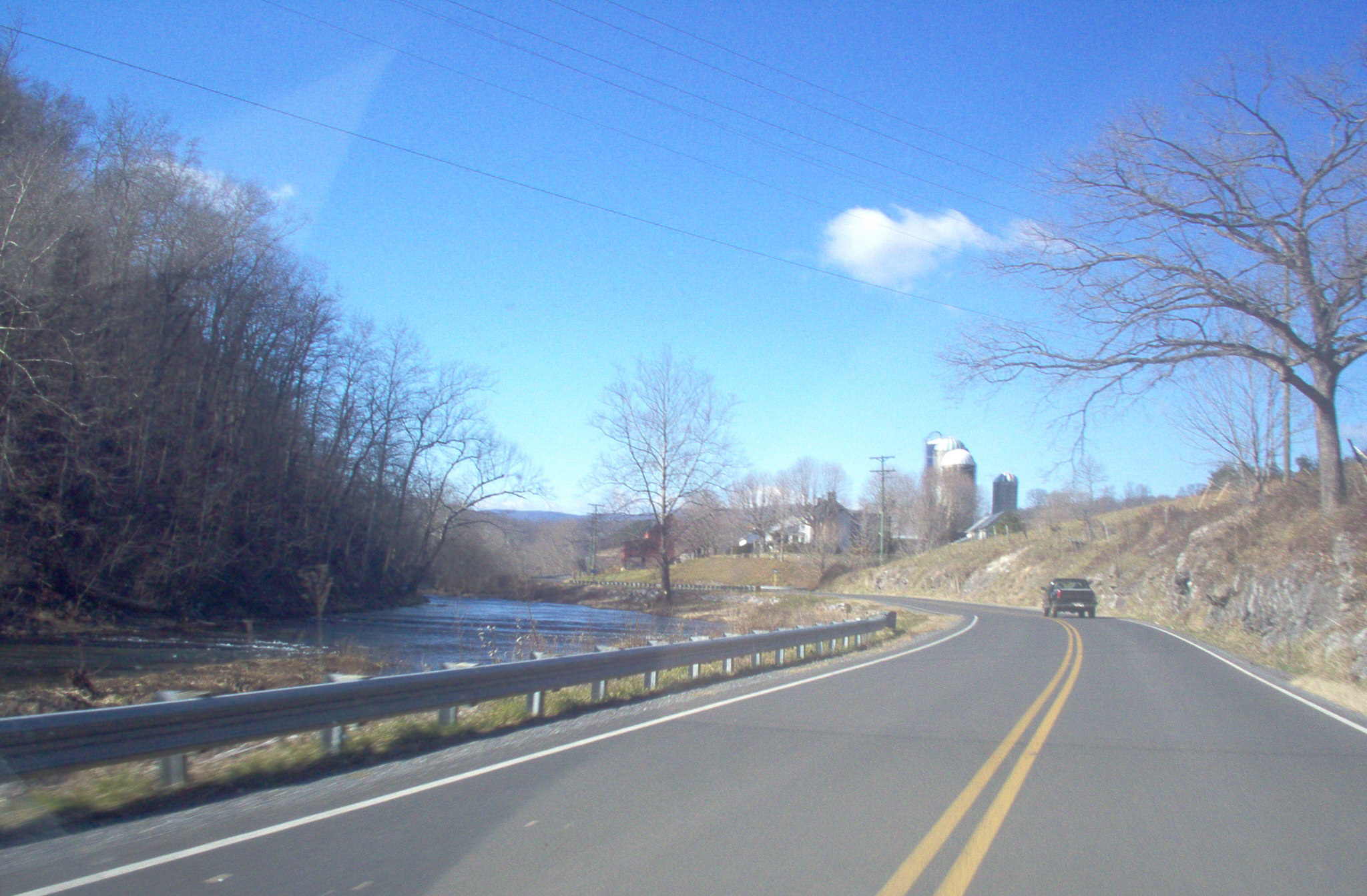
Photo: VA 251 is lovely following west along Colliers Creek (photo by Mapmikey 1/26/06)
| VA 241
to 260 < VA 221 to 240 | Home | VA 261 > |
Photo: VA 251 is lovely following west along Colliers Creek (photo by Mapmikey 1/26/06) |
| |||||
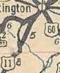
| ROUTE LOG US 1: 0 - 0 I-95 (exit 175), I-495: 1.28 - 1.28 Alexandria-Fairfax Line: 0 - 1.28 VA 236: 0.60 - 1.88 |
Creation: Appeared in July 1933 as a renumbering of VA 717. Ran essentially as it does today. This is the only VA 241.
Adjustments: The northern mile of VA 241 changed twice in the 1960s, first with construction of the D.C. Beltway (completed in 1964), then again with the construction of the trumpet interchange at VA 236 in 1969. Before the trumpet was built, VA 241 went underneath the railroad tracks in a pseudo-tunnel that was directly underneath where today's northbound bridge span is. A pedestrian tunnel remained at this location after the interchange was built, but was closed down in 2010 so that the bridge could be rebuilt and widened. Also in the late 1960s, VA 241 was changed to meet SR 611/Telegraph Rd where it does now instead of at Huntington Ave (former SR 629). 1964 aerial imagery does not show this but the 1971 USGS topographic map does. The south end of VA 241 was reconfigured to meet US 1 a couple blocks north of the complicated junction where US 1, VA 241 and SR 633 all used to meet. This is implied on official maps to have occurred in 1988, and 1988 aerial imagery shows the reconfiguration in place. Improvements: Paved upon inception on the Telegraph Rd segment. The Kings Hwy portion wasn't fully paved until at least 1937. Construction of the Beltway and the trumpet interchange at VA 236 completed multilaning on the Telegraph Rd segment by 1969. Multilaning of the Kings Hwy segment was completed in 1988. Posted: Not so good. Fully posted from US 1 NB and VA 236 WB. Not posted at all from US 1 SB or VA 236 EB. Prior to the reconstruction of the Beltway interchange, the SB 241 turn onto Kings Hwy was not posted. Now that the Beltway interchange reconstruction is complete, the ramp from the Inner Loop to SB 241 is not signed for VA 241, but instead is signed for SR 611. For several years (but now corrected), the BGS for VA 236 at the end of VA 241 was posted for Cameron Station after that facility was torn down. Multiplexes: None Legislative names: North Kings Highway, from US 1 to SR 1332 (since 6/25/47) Other names: Kings Highway N, Telegraph Rd Scenic Byway: No segments Comment: Serves at a cutoff between US 1 and either I-95/495 and VA 236 while avoiding downtown Alexandria. The 1944 Official shows this as US 241. The 1939 VDOT report on primary system development had recommended that VA 241 be decommissioned south of SR 611. |
1936 Fairfax County |
|||
| |||||
| ROUTE LOG US 1: 0 - 0 SR 600: 3.58 - 3.58 |
Creation: Appeared in March 1950 (CTB) as an upgrade to a portion of SR 600. Ran as it does today. This is the 2nd VA 242.
Adjustments: A little straightening out in the 1970s, but nothing else. Improvements: Paved upon inception; no multilane segments Posted: Fully posted; error oval 242 sign on SR 600 EB at US 1 since at least 1995. Multiplexes: NONE Legislative names: NONE Other names: Gunston Rd (entire route) Scenic Byway: entire route (April 1967) Comment: VA 242 exists to connect US 1 to Gunston Hall, per the 1950 CTB. First appears on the 1952 Official, incorrect shown as SR 242. |
 1952 Official |
|||
| Previous VA 242's:
1941 ROUTE LOG VA 29: 0 - 0 Rappahannock-Culpeper Line: 11.47 - 11.47 US 211: 9.22 - 20.69 US 522 SB: 3.90 - 24.59 US 522 NB: 0.19 - 24.78 Fauquier-Rappahannock Line: 4.96 - 29.74 BREAK IN ROUTE SR 724: 0 - 29.74 VA 17, VA 55: 3.59 - 33.33 |
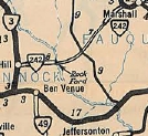
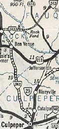
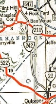
VA 242 #1: Appeared in July 1933 as renumbering of VA 718. Began in two pieces: 1. VA 55 (current F137) near Marshall southwest about 2 miles and 2. VA 3 (current US 522) Flint Hill northeast 4.75 to just short of the Rappahannock River.
In August 1933, Piece 1 was extended to SR 724 Ada. In September 1940, VA 242 piece 2 was extended south from Flint Hill through Ben Venue and down to end at VA 29 (current VA 229) near Culpeper. This was a renumbering of part of VA 49. In September 1942, Piece number 1 was downgraded to SR 647. Today, the northeastern end of this is cutoff by I-66. In April 1944, VA 242 north was truncated to US 522 Flint Hill. The stub over to the Rappahanock River became part of SR 647. In May 1948, VA 242 was decommissioned, leaving behind SR 729, which had a white border sign up until about 2002.
|
||||
| |||||
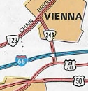
| ROUTE LOG US 29, VA 237: 0 - 0 I-66 (exit 62): 0.42 - 0.42 VA 123: 1.30 - 1.72 |
Creation: Appeared as an upgrade to SR 828 in December 1960 (CTB). Ran only from I-66 to VA 123. This is the 2nd VA 243.
Adjustments: In July 1965, VA 243 was extended south over SR 828 to US 29-211/VA 237. Improvements: Paved and multilaned at time of inception Posted: Fully posted. A cutout shield existed leaving VA 123 until about 2006. Multiplexes: NONE Legislative names: NONE Other names: Nutley St (Entire route) Scenic Byway: No segments Comment: VA 243 did not appear explicitly on official maps until 1975 when the Washington DC inset was expanded to cover Vienna. Nutley St between US 29 and US 50 was not in the state maintenance system until relatively recently and was assigned as SR 10230 which was the highest SR number known at that time (now the numbers are over 10700 in Fairfax County). |
 1975 Official |
|||
| Previous VA 243's:
1941 ROUTE LOG SR 607: 0 - 0 US 33 WB: 4 - 4 VA 230: 0.5 - 4.5 US 33 EB: 2.5 - 7 US 29: 4 - 11 |
VA 243 #1: Appeared in July 1933 as renumbering of VA 719.
Began near the SR 604-633 junction in Amicus and ran north to
Stanardsville, then east with VA 4 (now US 33 BUsiness and F991) before
branching off east to end at US 29 Burtonsville.
In September 1942, VA 243 was downgraded to SRs 604, 624 and 622 south of Stanardsville |
 1933 Official |
|||
| |||||
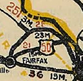
| ROUTE LOG VA 236: 0 - 0 VA 7: 4.06 - 4.06 Arlington-Fairfax Line: 0.52 - 4.58 |
Creation: Appeared in July 1933 as a renumbering of VA 720.
It ran from the Fairfax-Arlington line east of VA 7 Baileys Crossroads
over to US 1-50 in what is now Crystal City. This is the original VA 244.
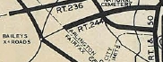
Adjustments: In October 1935, VA 244 was extended west as upgraded secondary routing to VA 236 Annandale. VA 244 east was truncated to what is now the western loop of VA 27 Washington Blvd when the Pentagon was completed in the early 1940s. This left behind some Columbia Pike. In December 1964 (CTB), VA 244 was re-extended east to its current endpoint. The west end of VA 244 has been altered twice in modern times...prior to 1995, VA 244 between VA 236 and SR 617 Backlick Rd was made one-way westbound. VA 244 east was signed to follow VA 236 to SR 617 north to Columbia Pike. Around 2006 or 2007, VA 244 east was signed to follow VA 236 further east, to John Marr Drive north to Columbia Pike. In Sept 2010 (CTB), VA 244 was truncated to the Fairfax-Arlington Line. Arlington County wants to put a trolley line down Columbia Pike and VDOT wouldn't allow that if they were resposible for its maintenance. VDOT retains control of Columbia Pike at the VA 120 and VA 27 intersections. Improvements: Paved upon inception VA 244 was first multilaned around Baileys Crossroads in 1955. In 1957, VA 244 was multilaned from VA 7 to VA 120. In 1960 or 1961, VA 244 was multilaned from VA 120 to Washington Blvd. In 1968, VA 244 was multilaned from VA 7 to Old Columbia Pike In 1971, VA 244 from Old Columbia Pike to VA 236 was multilaned. Posting: Fully posted; SR 244 shield posted WB leaving VA 7; SR 244 shield also existed several years on VA 236 EB but corrected now. A 60's white border shield exists on S. Highland St, left over from an old neighborhood clover with VA 120 NB. Dan F reported in 2005 VA 244 was not posted from VA 120 NB. Multiplexes: NONE Legislative names: Thurgood Marshall Memorial Highway, from VA 236 to Arlington County Line (since 10/21/93) Other names: Columbia Pike (entire route) Scenic Byway: No segments Comment: VA 244 provides direct access to Fort Myer and The Pentagon. The original east end point with then-US 1-50 still exists, on Old Jefferson Davis Highway in the vicinity of 6th St, slightly east of I-395/US 1.
| ||||
| ||||||
| ROUTE LOG US 17: 0 - 0 I-66 (exit 31): 2.05 - 2.05 VA 55: 1.22 - 3.27 |
Creation: Appeared in 1945 as a renumbering of part of VA 17. Ran from VA 55 The Plains to VA 17 Old Tavern. This is the 4th VA 245.
Adjustments: In 1975, VA 245 was extended south to its current US 17 endpoint from today's SR 845, when US 17 was rebuilt to avoid Old Tavern. Improvements: Paved upon inception; multilane only at the I-66 interchange. Posted: Fully posted Multiplexes: NONE Legislative names: James Madison Highway, entire route (designation 3/19/28 predates VA 245) Other names: Fauquier Ave (The Plains); Old Tavern Rd (rest of route) Scenic Byway: Entire Route (9/15/83) Comment: VA 245 has a secondary feel to it. This was part of US 15 until Sept. 1940. |
|||||
| Previous VA 245's:
1933 ROUTE LOG VA 7: 0 - 0 SR 734: 0.40 - 0.40 1941 ROUTE LOG VA 40: 0 - 0 SR 602: 4.54 - 4.54 1943 ROUTE LOG VA 17: 0 - 0 VA 55: 3.40 - 3.40 |
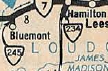
VA 245 #1: Appeared July 1933 as a renumbering of VA 726. Ran as a 0.4 mile stub from VA 7 to SR 734 Bluemont. In September 1940, VA 245 was renumbered as part of VA 234. Today it is SR 760.
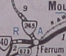
VA 245 #2: Appeared September 1940 as a renumbering of VA 120. It ran from VA 40 Ferrum north 4.5 miles towards Algoma. in September 1942, VA 245 was downgraded to SR 602. VA 245 #3: Appeared September 1942 as an upgrade to SR 710. Ran from VA 17 (now VA 245) Old Tavern north along today's SR 845, US 17, F1074 and US 17 Business to end at VA 55 Marshall.
|
|||||
| |||||
| ROUTE LOG US 460, VA 166: 0 - 0 VA 168: 0.76 - 0.76 |
Creation: VA 246 was created in 1943 or 1944 as an upgrade
to part of SR 642, running from US 460 along Liberty St then south on
Atlantic Av to the SCL of South Norfolk. This is the 2nd VA 246.
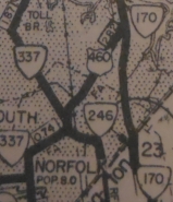
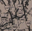
Adjustments: In May 1954 (CTB), VA 246 was rerouted to run as it does now. Improvements: Paved upon inception; no multilane segments Posted: Posted on its west end and is actually posted at the US 460-VA 166-337 junction west of its official end. The last report I have (July 2005) is that VA 246 is not posted at VA 168 anymore. Multiplexes: None Legislative names: NONE Other names: Liberty St (entire route) Scenic Byway: No segments Comment: Provides primary access from VA 168 over to South Norfolk
| ||||
| Previous VA 246's:
1941 ROUTE LOG VA 27: 0 - 0 US 522: 4.87 - 4.87 |
VA 246 #1: Appeared July 1933 as a renumbering of VA 723, running from VA 16 (now VA 231) near Hawlin east to VA 3 (now US 522) Woodville.
In September 1942 VA 246 was downgraded to SR 618. The western portion of this route is still unpaved. |
 1933 Official |
|||
| |||||
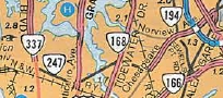
| ROUTE LOG VA 337: 0 - 0 US 460: 1.13 - 1.13 VA 168: 1.28 - 2.41 VA 194: 2.00 - 4.41 I-64 (exit 279): 0.29 - 4.70 VA 165: 0.61 - 5.31 |
Creation: VA 247 was created in January 1959 as new
primary routing along 26th/27th Sts, contingent on upgrades to these
streets which was officially finished until September 1962 (CTB). It
ran only from VA 337 to VA 168. This is the 2nd VA 247.
Adjustments: In January 1979 (CTB), VA 247 was extended east as upgraded routing to VA 165. Improvements: Paved upon inception VA 247 was multilane on the 26th/27th Ave one-way splits upon inception. The only other multilane portion shown on a map is the Chesapeake Blvd portion. However, VA 247 is all multilaned and has been for 20 years or more. Posted: Fully posted, except from I-64 although trailblazer shields exist at the end of the new off-ramp from EB 64. An oval 247 shield exists WB just east of I-64. Multiplexes: None Legislative names: NONE Other names: 26th St (EB)/27th St (WB); Lafayette Blvd; Chesapeake Blvd; Norview Blvd. Scenic Byway: No segments Comment: VA 247 provides direct access from I-64 to the airport, although the VA 247 designation stops 1/2mi short of the airport entrance. VA 247 doesn't appear on a VDOT Official map until 1963; The 1963 Esso map of Hampton Roads misidentifies the route as VA 242.
| ||||
| Previous VA 247's:
1940 ROUTE LOG VA 6: 0 - 0 SR 624: 0.60 - 0.60 |
VA 247 #1: Appeared July 1933 as a renumbering of VA 727,
running from VA 6 south 0.6 miles to SR 624 (original VA 19), halfway
between Dixie and Columbia. This route served absolutely no purpose.
In May 1943 (CTB), VA 247 was downgraded to SR 656. |
 1933 Official |
|||
| VA 248 not currently assigned | ||||
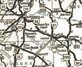
| Previous VA 248's: 1942 ROUTE LOG US 211: 0 - 0 SR 622: 1.00 - 1.00 1944 ROUTE LOG US 33: 0 - 0 SR 714: 2.5 - 6.24 |
VA 248 #1: Appeared in July 1933 as a renumbering of VA 728
running from US 211 (now US 211-522 BUs) Washington north a short piece
on today's SR 628, then northwest on today's SR 622 for a total of 1
mile. In May 1943 (CTB), VA 248 was downgraded to SR 628 and 622. VA 248 #2: Designated May 1943 (CTB Minutes) as an upgrade to SR 642, running 0.65 miles from US 33 Louisa southeast. In April 1944 (CTB), this primary corridor was extended southeast to US 33-522 near Cuckoo, then redesignated as US 33. VA 248 #3: Appears in the July 1980 CTB minutes as a proposed new road connecting US 17 north of Falmouth over to VA 3 near where it crosses what is now VA 212. This was never built. Eventually, VA 212 (now 218) was assigned in the same area, albeit over existing SR 664. Too bad this VA 248 wasn't built as the Falmouth area is choking to death from traffic today.
|
|||
| |||||
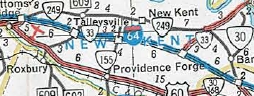
| ROUTE LOG US 60, VA 33 WB: 0 - 0 I-64 (exit 205), VA 33 EB: 0.22 - 0.22 VA 106: 6.61 - 6.83 VA 155: 3.78 - 10.61 VA 30, VA 33: 8.04 - 18.65 |
Creation: Appeared July 1970 (CTB) mostly as a renumbering of part of VA 33. Ran as it does today. This is the 2nd VA 249.
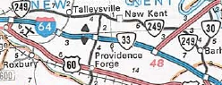
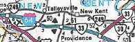
Adjustments: In 1980, VA 249 was extended east to VA 30 (now VA 273) Barhamsville. In 1986, VA 249 was restored to its current routing, replaced by a rerouted VA 30. Improvements: Paved upon inception; multilane only from I-64 to US 60. Posted: Fully posted. Multiplexes: VA 33 (0.22 mi) Legislative names: Martha Washington Highway, entire route (designation 10/23/58 predates VA 249) Washington-Rochambeau Highway, from SR 609 to VA 30-33 (2/20/75) Other names: NONE Scenic Byway: No segments Comment: VA 249 south of I-64 was probably new construction. One can see where VA 33 used to tie into US 60 a little west of this intersection today. VA 249 is the main street of New Kent County.
| ||||
| Previous VA 249's:
1952 ROUTE LOG US 11: 0 - 0 US 501: 6.37 - 6.37 |
| ||||
| US 250 | |||||
| VA 250 not currently assigned | |||
| Previous VA 250's: 1934 ROUTE LOG VA 259: 0 - 0 SR 642: 2.50 - 2.50 |
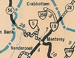
VA 250: Appeared in July 1933 as a renumbering of VA 802 running from VA 18 (now US 220) 2,5 miles west to Crabbottom. In 1935, VA 250 was renumbered as VA 284. Today it is SR 642.
|
 1933 Official |
|
| ||||||||||
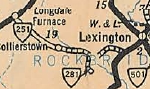
| ROUTE LOG US 11, US 11 Bus: 0 - 0 Rockbridge-Lexington Line: 0.62 - 0.62 SR 672-770: 9.33 - 9.95 |
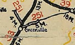
Creation: Appeared in July 1933 as a renumbering of VA 806. Originally ran from US 60 (now VA 269) Longdale Furnace to US 11 (now SR 764) west of Lexington. This is the 2nd VA 251.
Adjustments: About 1938, VA 251 was extended to Lexington over what had been part of US 11. VA 251 now ended at the corner of S. Main and Thornhill. In May 1945 (CTB), VA 251 was truncated to Collierstown, leaving behind SR 770. About 1972, VA 251 was rerouted to meet up with the US 11-US 11 Business junction as it does now, leaving behind Thornhill Rd.
Improvements: VA 251 was first paved in 1938, from SR 677 to Lexington. VA 251 was paved from SR 672 to SR 612 (old VA 281) in 1945 or 1946. VA 251 was finally fully paved in 1951. VA 251 has no multilane segments. Posted: Fully posted; cutout leaving US 11 was removed between 2018-21. An error US 251 shield has been up on US 11 Bus SB since at least 2008 A second US 251 shield replaced the cutout mentioned above Multiplexes: None Legislative names: Harry B. Wright Memorial Highway, from Collierstown to Lexington CL (10-19/78). Thomas S. Dixon Bridge over Buffalo Creek (3/21/85). Other names: Farmers Dr. (entire route) Scenic Byway: No segments Comment: Although VA 251 clearly runs east-west, it is posted as north-south in the field. VA 251 is a scenic ride over to Collierstown. SR 770 over North Mountain to VA 269 is largely unpaved and largely unused. I drove this in 2006 and I would not recommend doing this without an SUV. It was narrow and now well maintained. It does pass a couple tiny waterfalls and you can see on some turns on the mountain that the road was engineered way, way back when. There should be signs discouraging through travel on both ends...the Rand McNally atlases show this as paved and thus an enticing short cut. | |||||||||
| Previous VA 251's:
1928 ROUTE LOG BEGIN VA 251: 0 - 0 US 11 NB, VA 33 NB: 4.0 - 4.0 US 11 SB, VA 33 SB: 2.0 - 6.0 VA 39: 17 - 23 GAP IN ROUTE VA 17: 0 - 23 US 211, VA 21: 28 - 42 END VA 251: 9 - 51 GAP IN ROUTE BEGIN VA 251: 0 - 51 US 50 WB, VA 36 WB: 5 - 56 US 50 EB, BEGIN US 340, VA 36 EB: 1 - 57 VA 376: 6 - 63 VA 32: 26 - 89 END VA 251: 8 - 97 GAP IN ROUTE BEGIN VA 251: 0 - 97 VA 25: 4.5 - 101.5 |
VA 251 #1: Appeared March 1924 as new primary routing. Initially
ran from VA 25 (now VA 123) Chain Bridge south 9.4 miles to end at VA
31 (now US 1) near Alexandria. This is essentially Glebe Rd and S.
Glebe Rd.
In October 1926, VA 251 was greatly expanded:
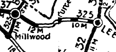
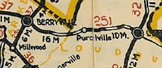
Replaced VA 325 from Leesburg to Berryville to Millwood
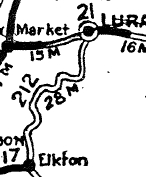
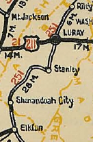
Replaced VA 212 from Luray to Elkton
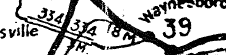
Replaced VA 396 in the Waynesboro area, which had not yet been put into the system Replaced VA 334 in the Greenville area.
In December 1926 (CTB), VA 251 was extended east 1 mile towards Waynesboro.
In August 1928, VA 251 was renumbered:
VA 251 is shown on the 1927 and 1928 Officials to have more routing than the CTB Minutes indicate actually existed. |
|||||||||
| ||||||
| ROUTE LOG VA 39: 0 - 0 Augusta-Rockbridge Line: 10.25 - 10.25 VA 262: 16.87 - 27.12 Staunton-Augusta Line: 0.15 - 27.27 VA 254 WB: 1.68 - 28.95 US 11 Bus, US 250, VA 254 EB: 0.11 - 29.06 |
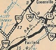
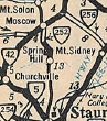
Creation: Appeared in July 1933 as a two-segment route: 1. VA 501 (now VA 39) northeast to VA 56 (current SR 620) Newport replacing VA 808 and 2. VA 42 Moscow south to Spring Hill, replacing VA 830 This has been the only VA 252.
Adjustments: About 1939, a third piece of VA 252 appeared, running from Staunton southwest to below Middlebrook, upgrading SR 620. In July 1940 (CTB), VA 252 piece 3 was extended south to meet piece 1. In August 1941 (CTB), VA 252 piece 3 was extended north into the City of Staunton on Middlebrook Ave and ending at US 11 Johnson St. Sometime between 1942-44, the gap between Pieces 1 and 3 were connected replacing more SR 620.
In April 1944, the 4.49 piece 2 well north of Staunton was downgraded to SR 607. In April 1960, VA 252 was rerouted in Staunton to use Middlebrook to Lewis to VA 254, then duplex with VA 254 east to US 11-250. I cannot locate a map to prove it, but the northern end was switched ad posted to use E. Hampton St US 11 (south of US 250 east) for a little while in the mid-to-late 90's, but today is back at downtown Staunton. Perhaps this was a temporary posting for a project involving the railroad overpass near the north end of VA 252. Improvements: When created in 1933, only the douthern half of piece 2 and the town of Brownsburg were paved on VA 252. VA 501 to Brownsburg was paved in 1938. All segments south of Staunton have been paved since 1939. VA 252 is multilane in a short segment near its north end. Posted: Fully posted; cutouts exist in Staunton and Brownsburg. At the junction of Middlebrook and Lewis there is a white interstate cutout shield that says "Rte 252 Ends Here". As far as I know VA 252 is not posted on Lewis St and is not posted on its VA 254 duplex. Multiplexes: VA 254 (0.11 mi) Legislative names: None Other names: Middlebrook and Lewis Aves (City of Staunton); Middlebrook Rd (Augusta County); Brownsburg Tpk (Rockbridge County) Scenic Byway: VA 39 to SR 606 (designated 9/20/01) Comment: VA 252 can be used as the back-back way to go from Staunton to Lexington. However, there is a large segment of narrow twisty (though flat) segment where it parallels Moffats Creek. | |||||
| |||||
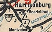
| ROUTE LOG US 11: 0 - 0 I-81 (exit 245): 0.48 - 0.48 Rockingham-Harrisonburg Line: 1.33 - 1.81 VA 276: 3.87 - 5.68 VA 331: 4.61 - 10.29 US 340: 1.89 - 12.18 |
Creation: Created 3/17/05 (CTB Minutes) as an upgrade to SR 659 running as it does today. This is the 3rd VA 253.
Adjustments: None Improvements: Paved upon inception; multilane in the US 11/I-81 area since inception. Posting: Fully posted in Rockingham County. In the City of Harrisonburg it is posted only on I-81 BGS's. There are no 253 signs on the I-81 ramps, however. Multiplexes: NONE Legislative names: NONE Other names: Port Republic Rd (entire route) Scenic Byway: No segments Comments: A nice pleasant route, but I am unsure why this particular corridor was in line for primary upgrade. Dan F was a student at JMU in the past and offers his take on the new VA 253: I think it's interesting that Rockingham SR 659 is being upgraded to VA 253. I went to JMU and took some drives on Port Republic Rd from time to time. In my opinion, the road was fine as it was and there are plenty of other primary routes that serve an east-west function (VA 256, US 33). However, there are a few reasons why I think Port Republic Road was upgraded. 1. Rockingham Memorial Hospital in Harrisonburg is moving to an area near the JCT of Port Republic Road and SR 710 (Reservoir St) in Rockingham County. JMU will convert the current Rockingham Memorial Hospital into academic buildings. 2. Harrisonburg has been interested in widening Port Republic Road. A couple of years ago the city widened the road from I-81 east to Lois Lane (which serves apartment complexes). I think the city eventually wanted to widen Port Republic further east to Neff Ave. Since this is now a primary route, Harrisonburg gets more money to maintain the road. 3. Development has really been sprawling eastward into Rockingham County. 4. The Howard Johnson at the JCT of I-81 and Port Republic Rd will be or is in the process of being torn down so a higher capacity interchange can be placed. I don't know if this is part of the I-81 statewide improvements or something else. There is currently a diamond interchange. Despite all this, maybe it would have been necessary only to extend VA 253 to VA 276 (which I think should be downgraded to an SR) and not further east to US 340 in the middle of nowhere. | ||||
| Previous VA 253's:
1940 ROUTE LOG US 33: 0 - 0 SR 620: 2.67 - 2.67 1998 ROUTE LOG US 1: 0 - 0 SR 1103: 1.93 - 1.93 |
VA 253 #1: Appeared July 1933 as a renumbering of VA 807 #2, running from VA 4 (now Country Club Rd) Harrisonburg east to SR 620 Keezletown.
In April 1944 (CTB), VA 253 was renumbered as part of today's VA 276. Today it is SR 925 Keezletown Rd. VA 253 #2: Appeared April 1967 (CTB) as a renumbering of a piece of VA 123, which was placed on the new Gordon Blvd in Woodbridge to provide an interchange with I-95. About 1972, VA 123 was rerouted again over a new Occoquan River bridge which bypassed Occoquan itself. VA 253 was not extended either across the old bridge and SR 722 (crossing not possible today) nor was it extended over SR 1203 over to the modern VA 123. It just remained where it was ending at Commerce St. VA 253 was downgraded to a well-posted SR 906 Occoquan Rd in May 1998. VA 253 was not labeled on official maps until 1969.
|
||||
| ||||||||
| ROUTE LOG VA 42: 0 - 0 VA 262: 7.03 - 7.03 Staunton-Augusta Line: 0 - 7.03 VA 252 SB: 2.39 - 9.42 US 11 Bus, US 250, VA 252 END: 0.11 - 9.53 US 11 SB, US 11 Bus, US 250: 0.38 - 9.91 US 11 NB: 0.68 - 10.59 VA 261: 0.3 - 10.89 Augusta-Staunton Line: 2.15 - 13.04 VA 262: 1.59 - 14.63 Waynesboro-Augusta Line: 8.30 - 22.93 US 250: 0.82 - 23.75 US 340: 0.07 - 23.82 |
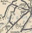
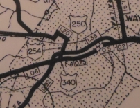
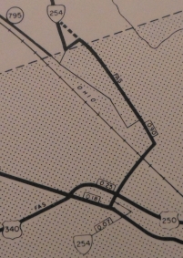
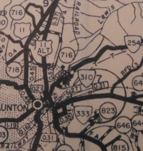
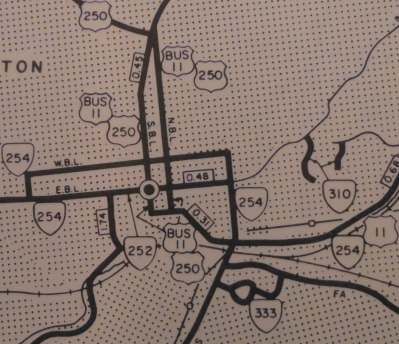
Creation: Appeared in July 1933 as a renumbering of VA 810 and VA 831. As today, VA 254 ran from Buffalo Gap through Staunton to end in Waynesboro. This has been the only VA 254.
Adjustments: In March 1962 (CTB), VA 254 was rerouted in Waynesboro. Originally it began at Main St and Wayne, proceeded up Wayne, then NW on Ohio St to New Hope Rd (today it appears there are gaps in Ohio and New Hope Rds) west out of town Now VA 254 began where it does now, and used Poplar Ave/King Ave to Ivy St NW to Edward Ave south to New Hope Road which VA 254 followed west out of town. In September 1963 (CTB), VA 254 was removed from Beverley St between Coalter Ave and US 11 which was through the Virginia School for the Deaf. VA 254 was given its current routing down Coalter St and the US 11 duplex. It is possible some piece of that VA 254 became part of VA 310 but this is not certain. In September 1969 (CTB), VA 254 was rerouted in Waynesboro to its current routing using Ivy St out of town, leaving behind Edward Ave and New Hope Rd (now includes today's SR 795 Hampton Dr).
By 1975, VA 254 was split into one-way streets in Staunton. The first VDOT Official to suggest it is the 1994 edition. Eastbound VA 254 uses the longtime VA 254 route on Beverley east to Coalter. Westbound uses Coalter north to Frederick St which it follows west to Jefferson St south back to Beverley.
In 1976, VA 254 was rebuilt in several places between Annex and Waynesboro, leaving behind several SR loops in places such as Barren Ridge and Hermitage. Improvements: Paved upon inception from Buffalo Gap to Staunton and a little paving towards Waynesboro In 1936, VA 254 was paved Staunton to Waynesboro except around Hermitage. The Hermitage segment was paved in 1940. VA 254 has no multilane sections except for the one-way splits in Staunton and its US 11 duplex. Posting: Fully posted; Waynesboro cutouts removed around 2000; numerous Staunton cutouts remain as mid-2021. Multiplexes: VA 252 (0.11 mi) US 11 (0.68 mi) Legislative names: NONE Other names: Parkersburg Tpk (VA 42 to Staunton); Beverley St, Coalter St, Commerce Rd, New Hope Rd (Staunton); Frederick St, Jefferson St (WB Staunton); Hermitage Rd (Staunton to Waynesboro); Ivy St, Broad St (Waynesboro) (everywhere else) Scenic Byway: No segments Truck Route: In 2008, a VA 254 TRUCK was posted in Staunton westbound. It follows the actual path of VA 254 from US 11-11 Bus-250 up and over to US 11 Bus-250. The point is to make sure trucks who want to get to VA 254 west leaving downtown Staunton will not use US 11 Bus-250 as a short cut which involves a tight left turn at VA 254. Comment: VA 254 is blown off by I-81. VA 254 makes a good alternative from I-81 to Waynesboro. VA 254 between US 11 east out to VA 262 is very curvy. The 1939 VDOT report on primary system development had recommended that VA 254 be decommissioned from Staunton to Waynesboro. |
 1933 Official |
||||||
| Previous VA 254's:
|
VA 254 ALT: Appeared in several CTB Minutes from 1965-68 as the new construction from US 11 east to VA 254 north of Staunton.
VA 254 ALT was signed as VA 275 when it opened. Today it is part of VA 262. |
|||||||
| ||||||
| ROUTE LOG US 17, US 50: 0 - 0 US 340: 3.84 - 3.84 |
Creation: Appeared in July 1933 as a renumbering of VA 811 and US 340. Originally ran from today's SR 723 (then US 50) Millwood north to SR 617 (then US 340). This has been the only VA 255.
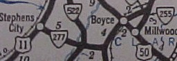
Adjustments: In May 1946 (CTB), VA 255 was extended south by heading east on SR 723 and then replacing part of SR 624 down to its current endpoint. For a couple years, VA 255 south had ended at SR 723 because US 50 was relocated a while before this VA 255 extension. In March 1953 (CTB), VA 255 was extended north slightly when VA 12 was moved off of SR 617 and onto the current US 340 routing. Improvements: Paved upon inception; no multilane segments. Posting: Fully posted; cutouts still up on SR 723 WB in July 2008; error US 255 sign at US 340 NB. Multiplexes: NONE Legislative names: Bishop Meade Highway (entire route), designated 4/16/98. Other names: NONE Scenic Byway: SR 723 to US 340 (designated 5/17/90) Comment: VA 255 gives the appearance of a secondary route for pretty much its whole length. It has a speed limit of 25 over a large portion of its routing. It is a pretty, albeit slow cutoff between US 17-50 and US 340.
|
 1933 Official |
||||
| |||||
| ROUTE LOG US 11: 0 - 0 I-81 (exit 235): 0.14 - 0.14 VA 276: 1.22 - 1.36 Rockingham-Augusta Line: 4.50 - 5.86 US 340: 0.92 - 6.78 |
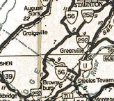
Creation: Appeared in July 1933 as a renumbering of VA 812 Originally ran from VA 42 Mossy Creek to US 11 Burketown. This has been the only VA 256.
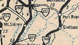
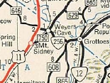
Adjustments: In Sept 1942 (CTB), VA 256 was extended east using a brief US 11 duplex, then east replacing SR 770 through Weyers Cave and ending at VA 12 (now SR 865) Mt. Meridian. In May 1945, VA 256 was extended east to Grottoes, replacing the alignment VA 12 had been using. VA 256 now ended at VA 12 (current US 340) In April 1951 (CTB), VA 256 west of US 11 was downgraded to SR 646. Around 1966, VA 256 was rerouted in Weyers Cave to its current routing, leaving behind SR 2002 Click/Houff Rds and SR 2003 Wayside Dr. Around 1967, VA 256 was put on new alignment from Weyers Cave to Mt Meridian to its current routing. This left behind SRs 847, 769 and a bit of 865. In May 2003 (CTB), VA 256 was rerouted in Grottoes to its current routing. Up to then, VA 256 turned north on Aspen Ave, then east on Cary St to meet US 340 at the SR 663 jct. The direct routing was new construction. Improvements: VA 256 was not paved anywhere until 1942-44, fully paved everywhere since; there are no multilane segments on VA 256. Posting: Fully posted; cutouts removed in the mid 90s. Multiplexes: NONE Legislative names: NONE Other names: Weyers Cave Rd (Augusta Co); 3rd Ave (Grottoes) Scenic Byway: No segments Comment: The original VA 256 crossing of Middle River was a 19th century bridge which is still standing, though no longer open to traffic. Pictures here - 1897 entry
| ||||
| ||||||
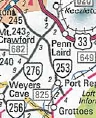
| ROUTE LOG SR 924: 0 - 0 VA 42 Bus NB: 11.84 - 11.84 VA 42 NB, VA 42 BUs END: 0.05 - 11.89 VA 42 SB: 2.73 - 14.62 US 11: 2.56 - 17.28 I-81 (exit 240): 0.86 - 18.14 |
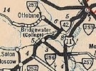
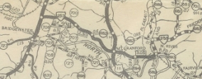
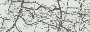
Adjustments: In August 1933 (CTB), VA 257 was extended west over SR 827 for a distance of 1.4 miles. In Sept 1937 (CTB), VA 257 was extended 0.6 miles west to SR 924 Hone Quarry. In April 1944 (CTB), VA 257 east was truncated to US 11 leaving behind SR 867, 689 and a little 682. In May 1945, VA 257 was rerouted at its new east end at US 11 to use its current US 11 junction north of Mt. Crawford, replcing a piece of SR 682 and leaving behind more SR 867 (now SR 679). Around 1952, VA 257 was rerouted in Bridgewater to its current routing through Bridgewater College, swapping routes with SR 700 (now SR 1316 Mt. Crawford Ave).
About 1967, VA 257 was extended east to the new I-81, using a brief US 11 duplex, then east over SR 682 (not the same part of 682 that was VA 257 years earlier). In 1993, VA 257 was rebuilt between US 11 and I-81 on mostly new alignment, eliminating the US 11 duplex and leaving behind an SR 682 stub, Old Friedens Church Rd. Improvements: Upon designation VA 257 was paved from SR 613 Ottobine to the railroad crossing east of US 11 Mt Crawford. VA 257 west of Ottobine was paved in 1938. The last bit of VA 257 at its historical eastern end was paved in 1940. VA 257 was first multilaned on the VA 42 duplex in 1970. The only other multilaned portion of VA 257 is the US 11 to I-81 segment, since 1993. Posting: Fully posted; Multiplexes: VA 42 (2.73 mi) VA 42 Bus (0.05 mi) Legislative names: NONE Other names: Briery Branch Rd (west of Ottobine); Ottobine Rd (Ottobine to Dayton); John Wayland Hwy (VA 42 duplex); Dinkel Ave (VA 42 to US 11); Friedens Church Rd (US 11 to I-81) Scenic Byway: No segments Comment: Passes through Bridgewater College. SR 924 beyond VA 257 looked very scenic when I drove to there recently. Dan F has recently explored SR 924 and beyond: Eventually 257 became SR 924 and became a 1-lane gravel road. At an unmarked intersection I had to turn left to go up the mountain. Since it wasn't marked, I turned left going home instead right, and the gravel road ended up in West Virginia. The road ended in Franklin County, WV at SR 10, I think. The road I was on was posted with a WV SR # and called Reddish Knob Road at its terminus. I turned left and luckily, the way to US 220 was well posted. There is no sign where the VA/WV border is, and there are no end-state maintanance signs either along SR 924 so I don't think it becomes a private road or a Park Service or Forest Service road (though other roads in the area are marked with Park Service Route Number signs). There are no 924 signs except right after 257 turns into 924 and no WV route signs until it ends at SR 10. The 1939 VDOT report on primary system development had recommended that VA 257 be decommissioned west of Ottobine. | |||||
| VA 258 not currently assigned | ||||||
| Previous VA 258's: 1940 ROUTE LOG VA 12: 0 - 0 VA 12: 6.65 - 6.65 1944 ROUTE LOG US 58 WB, US 258: 0 - 0 US 58 EB: 2 - 2 US 460: 13 - 15 VA 10 WB: 15 - 30 VA 10 EB, VA 32: 4 - 34 US 17 SB: 3 - 37 US 60: 7.8 - 44.8 US 17 NB, VA 168: 0.2 - 45 VA 134: 4.5 - 49.5 VA 167, VA 278: 1.8 - 51.3 VA 351: 1.7 - 53 VA 169: 0.8 - 53.8 US 60 WB: 0.6 - 54.4 US 60 EB, END VA 258: 0.9 - 55.3 |
| |||||
| |||||
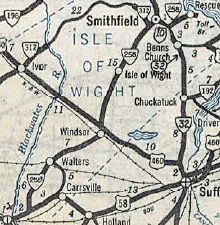
| ROUTE LOG US 258 Bus: 0 - 0 VA 10 Bus: 0.48 - 0.48 |
Creation: Appeared in May 1953 (CTB) as an upgrade to SR 1101, SR 1104 and new construction between these SRs to total 0.54 miles.
Adjustments: The current traffic log shows VA 258 ALT as only 0.48 miles. The 1958 VDOT County Atlas shows 0.54 miles. It is unclear when or how this lost about a block's worth of distance, unless it was meant to include a duplex with VA 10 initially. Improvements: Fully paved upon designation; no multilane segments Posting: Fully posted; Error US 258 ALT signs at its southern end. Multiplexes: NONE Legislative names: NONE Other names: Grace St (entire route) Scenic Byway: No segments Comment: This runs only 1 block west of US 258 Business, so I don't know what the point of this is now or for that matter when it was created. |
 1958 Isle of Wight County |
|||
| |||||
| ROUTE LOG I-81, US 11: 0 - 0 VA 259 ALT: 3.95 - 3.95 VA 42 NB: 0.45 - 4.40 VA 42 sB, VA 259 ALT: 0.62 - 5.02 WV LINE: 16.79 - 21.81 WV LINE (Frederick Co): 0 - 21.81 US 50: 4.99 - 26.80 |
Creation: Appeared in July 1933 as a renumbering of VA 817.
Originally ran SR 620 Althone west across US 11 to Broadway, then
northwest to the West Virginia Line near Dovesville. This has been the
only VA 259.
Adjustments: In October 1940 (CTB), VA 259 was reassigned to VA 275 from US 50 Gore south to the West Virginia Line. In conjunction with this, WV 58 and WV 23 were renumbered to WV 259.
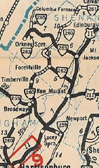
In May 1945 (CTB), VA 259 was truncated from SR 620 Althone to US 11 Lacey Spring, leaving behind SR 608. In August 1949 (CTB), VA 259 was rerouted in Broadway to its current routing which was an upgrade to SR 801 and a renumbering of a piece of VA 42. VA 259's old route through Broadway became VA 259 ALT. About 1965, VA 259's south end was moved southward to accommodate the I-81 interchange with US 11. Improvements: Upon designation VA 259 was paved everywhere except the northern 3 miles in Rockingham County and the last mile or so into Althone. VA 259 in northern Rockingham County was paved in 1935. VA 259 out to Althone was paved in 1941, making VA 259 paved everywhere. There are no mulitlane segments on VA 259 Posting: Fully posted; cutouts remain at VA 42 SB near Broadway (verified 4/11/10). Multiplexes: VA 42 (0.45 mi) Legislative names: NONE Other names: Mayland Rd (US 11 to VA 42); Timber Way (VA 42 duplex); Brooks Gap Rd (VA 42 to WV Line); Capers Pike (Frederick Co) Scenic Byway: No segments Comment: VA 259 provides a very quiet scenic backway alternative to I-81 from the Harrisonburg region to the Winchester region on an alignment that is easy to drive without mountain curviness. | ||||
| |||||
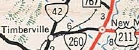
| ROUTE LOG VA 259: 0 - 0 VA 42 SB: 0.72 - 0.72 VA 42 NB, VA 259: 0.32 - 1.04 |
Creation: Appeared in August 1949 (CTB) as a renumbering of VA 259.
Adjustments: None Improvements: Fully paved upon designation; no multilane segments Posting: Fully posted; Multiplexes: VA 42 (0.32 mi) Legislative names: Harpine Highway (VA 42 duplex), designated 7/20/54. Other names: Broadway Av (VA 42 to VA 259); Timber Way (VA 42 duplex) Scenic Byway: No segments Comment: Not sure why this wasn't changed to VA 259 Business at some point.
| ||||
| VA 260 not currently assigned | |||||
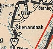
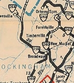
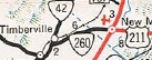
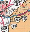
| Previous VA 260's: 1946 ROUTE LOG US 11: 0 - 0 VA 259 NB: 13 - 13 VA 259 SB: 1 - 14 VA 262: 8 - 22 VA 263 WB: 6 - 28 VA 263 EB: 0 - 28 VA 59: 10 - 38 1971 ROUTE LOG VA 42: 0 - 0 Shenandoah-Rockingham Line: 4.27 - 4.27 VA 305: 1.31 - 5.58 I-81, BEGIN US 211: 0.05 - 5.63 US 11, US 211 EB: 0.26 - 5.89 2003 ROUTE LOG US 58, VA 189: 0 - 0 Isle of Wight-Suffolk Line: 0.91 - 0.91 US 58 Bus, US 258: 2.81 - 3.72 |
VA 260 #1: Appeared in July 1933 as a renumbering of VA 818
running from US 11 Harrisonburg north to VA 261 (now SR 678-623 jct)
Columbia Furnace with a 3 mile gap in southern Shenandoah County.
In Sept 1934 (CTB) the 3-mile gap was closed. In November 1947 (CTB), VA 260 was renumbered as an extended VA 42. Today, it follows VA 42 except right in Harrisonburg it used Edom Rd; VA 260 also went through Edom; in Broadway, VA 260 used VA 259 ALT east to VA 259 north; in Columbia Furnace VA 260 used SR 767 and SR 623. VA 260 #2: Appeared May 1952 (CTB) as an upgrade to SRs 728, 795 and 618, running from VA 42 Timberville to US 11 New Market. VDOT Officials in 1953 and 1954 show VA 260 crossing the railroad near Timberville which would've been the route of today's SR 617. The 1955 Official shows that VA 260 was rerouted over SR 618 to run south of the N. Shenandoah River as it does today. The old way to VA 42 went back to being SR 617. In November 1964 (CTB), US 211 was placed on VA 260 as a duplex between I-81 and US 11. In March 1977 (CTB), VA 260 was renumbered as VA 211 west of I-81 and remained US 211 from I-81 to US 11. VA 260 #3: Appeared in Sept 1987 (CTB) running from US 58/VA 189 north to SR 656 in Isle of Wight County with the intent to be the US 258 bypass of Franklin upon completion of the "3.70 mile" route. It appears in 2003 VA 260 was officially extended to US 58 Bus/US 258 (2002 Traffic Logs show 260 ending at SR 656 and the 2003 log shows connecting to US 58/258). VA 260 was finally designated as US 258 in 2003. Froggie has a photo gallery of VA 260 before it was changed to US 258
|
||||
Previous: VA 221 - 240 |
Next: VA 261
Top | Virginia Hwy Index
Home
Page last modified 28 January 2022