< VA 12 | Home | VA 14 >
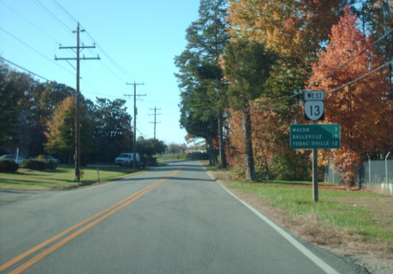
Photo: VA 13 leaving Powhatan CH (photo by Mapmikey 11/7/08)
|
|
|
| ROUTE LOG |
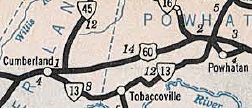
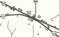
US 60, VA 45: 0 - 0 Powhatan-Cumberland Line: 7.19 - 7.19 VA 300: 14.52 - 21.71 US 60: 2.37 - 24.08
|
Creation: Appeared Oct 1934 as a renumbering of part of US 60. This is the 2nd of three VA 13 designations in Virginia.
|
VA 13 appears 1936 Official Adjustments: Sometime between 1947-58, VA 13 was rerouted west of Powhatan CH to no longer have a brief duplex with US 60.
Improvements: Fully paved upon designation; no multilane segments Posted: Fully posted; Multiplexes: None Legislative names: None Other names: Old Buckingham Rd Scenic Byway: No segments Comment: VA 13 has been a violation of the numbering system from the beginning. My speculation is that since the state routes were to remain posted for a while after the 1933 great renumbering, they just left the VA 13 postings up and took US 60 postings down. However, since 284 had been assigned to the projects for new construction bypassing current VA 13, I don't understand why today's VA 13 isn't VA 284. I believe VA 13 is the longest state route in Virginia without a stoplight. This should probably be renumbered to VA 300 and change 300 to 300Y. | Previous VA 13's:
1932 ROUTE LOG VA 14: 0 - 0 VA 313: 35 - 35 US 29 NB, VA 18 NB: 7 - 42 US 29 SB, VA 18 SB: 1 block - 42 VA 307: 16 - 58 VA 306 SB: 13 - 71 VA 306 NB: 2 - 73 US 15, VA 32: 7 - 80 VA 310: 13 - 93 VA 45: 4 - 97 VA 406: 8 - 105 VA 46: 12 - 117 VA 418: 21 - 138 VA 418Y: 0.25 - 138 US 1 SB, US 60 WB, VA 31 SB: 11 - 149 VA 19, VA 41: 1 - 150 US 1 NB, VA 31 NB, VA 39 WB: 1 - 151 US 60 EB, VA 39 EB: 1 - 152 VA 414: 7 - 159 VA 30 EB: 16 - 175 VA 30 WB: 1 - 176 VA 29: 5 - 181 VA 604: 7 - 188 US 17 SB, VA 38 EB: 6 - 194 US 17 NB, VA 38 WB: 3 - 197 VA 609: 4 - 201 VA 37 WB: 3 - 204 VA 37 EB: 1 - 205 VA 607: 11 - 216 1941 ROUTE LOG US 58: 0 - 0 US 17: 4.4 - 4.4 VA 170 SB: 3.4 - 7.8 US 460 WB: 2.5 - 10.3 VA 170 SB: 0.2 - 10.5 US 58: 2.5 - 13.0 VA 165: 3.6 - 16.6 US 460 EB: 1.7 - 18.3 US 60: 1.4 - 19.7 |
VA 13 #1: Began in January 1918 as an original state route defined by the general assembly:
Route 13: Tappahannock, Richmond, Midlothian, Powhatan, Cumberland, Farmville, Lynchburg, "then with routes 10 and 14" The route 10 duplex was Farmville to Lynchburg, while the route 14 duplex was defined: "...Lynchburg, Natural Bridge, Lexington, Clifton Forge, Covington, White Sulphur"
VA 13 Cumberland to Tappahannock via Richmond 1922 Auto Trails
VA 13 with VA 10 from Lynchburg 1922 Auto Trails In July 1921 (CTB), VA 13-14 was rerouted at Longdale Furnace to stop using today's SR 770/VA 251 to Lexington and instead use today's SR 850/US 60 via Kerrs Creek instead.
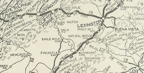
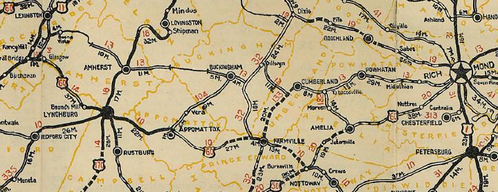
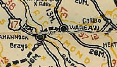
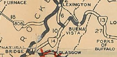
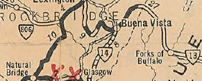
VA 13 with VA 14 from West Virginia to Lynchburg 1922 Auto Trails In 1923 (CTB), VA 13 west was truncated to end at VA 10 (now US 460 Bus) Farmville leaving behind VA 10 over to Lynchburg; VA 14 to Glasgow; VA 141 to Natural Bridge; VA 33 to Lexington; VA 14 to West Virginia via Covington. Today this is High St west out of Farmville; US 15-460 Bus; SR 695; US 460; SRs 608-628-655 in the Prospect area; US 460 Business through Pamplin City; Flood to Appomattox used a road paralleling the railroad, bits of today's SRs 627, 633, 630, then also SR 695 to SR 635 north back to today's US 460 Business through Appomattox (except used SR 1004 near SR 727); US 460; SR 689 in Spout Spring; US 460; SR 800 in Concord; US 460; SR 658/609 in Thomas Terrace; US 460; Old Richmond Hwy; Concord Tpk to Garnet St to Lynch St, then west (not possible now) to Pine St, then Main St into Central Lynchburg. VA 13 had used Rivermont Ave northwest, then US 501 Bus and US 501; Peakland Ln; Winding Creek Ln north of Boonsboro; US 501 into Rockbridge County; crossed the James River to SR 684 Glasgow; VA 130; SR 773 through Natural Bridge Station; VA 130; US 11; SR 743; SR 609; US 11; SR 764; VA 251; Thornhill Rd and US 11 Bus into Lexington; US 60; SR 850; VA 269; SR 632 towards Clifton Forge; US 60 Bus; SR 662 Chestnut St; Ingalls Dr south; Ridgeway Ave through Clifton Forge; SR 696 through Selma and Low Moor; SR 1104 on the other side of I-64 at the Jackson River crossing; US 60-220 into Covington; south on Chestnut, west on Lexington, east on Water St; US 60; SR 645 through Teaberry Flats; US 60; Humpback Bridge; SR 710; VA 159 although near Crows there are clearly abandoned alignments; VA 311 north to the West Virginia line.
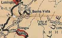
VA 13 extended west to Buena Vista 1926 Official In March 1927 (CTB), both the Buckingham and Amherst pieces were extended west 4 miles each.
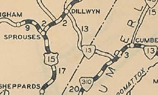
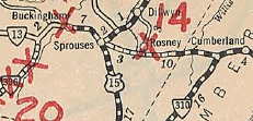
In 1930, VA 13 west was truncated to southern Buena Vista at what is now the intersection of US 501 and 10th St. The old route across Maury River to McCormicks gate became part of VA 14 (now SR 745/608). It is confusing what VA 13's status in Rockbridge County was - the 4.6 mile segment was never extended to Buena Vista in the CTB and is shown as CR 1 on the 1932 Rockbridge County map. This same map also shows VA 14 as discontinuous as the current US 60 bridge over Maury River hadn't been built yet. So VA 13 may or may not have run from 10th St north to central Buena Vista. Also in 1930, VA 13 was rerouted away from Dillwyn and instead went directly from Cumberland CH to Sprouse Corner. This left behind CR 106 (now SR 629) along with the US 15/VA 32 duplex south to Sprouses.
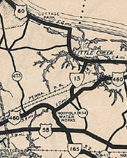
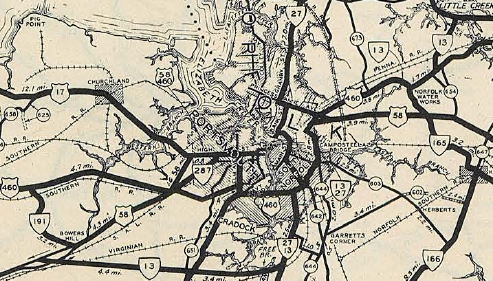
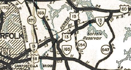
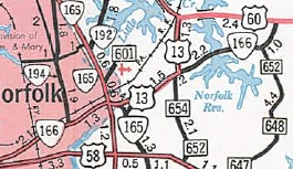
VA 13 #3: In 1938, a separate VA 13 was created as a US highway extension. It initially ran only from the Little Creek ferry landing south to US 460 (now US 13). This was a replacement of VA 165. In 1939, VA 13 was extended southwest with US 460 to Norfolk, then south with VA 27 through South Norfolk, then replaced VA 299 west along Military Hwy to end at US 58-460 Bowers Hill. In 1942 VA 13 may have become technically discontinuous - the June 1942 CTB has VA 13 on Military Hwy (not yet completed) and the 1942 Norfolk County Map shows VA 13Y on Princess Anne Rd (now VA 166) in Norfolk and no VA 13 multiplexes through Norfolk and South Norfolk (became part of US 460), but labels VA 13 on Military Hwy from Bainbridge Blvd westward. Note that Military Hwy from Bainbridge Blvd east to around Campostella Rd (then VA 226) was referred to in project documents as VA 336. Around 1943, VA 13 was eliminated when US 13 was extended over the Chesapeake Bay ferry and down Diamond Springs Rd (now VA 166) and today's Northampton Blvd, then (no longer connects to) today's VA 165Y and VA 165 northwest to today's US 13/VA 165-166 jct. then all the way around Military Hwy to Bowers Hill.
VA 13Y #1: Appears explicitly in the June 1942 CTB as the piece of Military Hwy in the project stage between Northampton Blvd and Little Creek Rd. This was added to the state highway system in March 1942 (CTB)
VA 13Y #1 being proposed to become VA 351Y 1943 Request to AASHO
VA 13 ALT: Appears in some CTB Minutes in 1931 and 1932 as the proposed new construction between Cumberland and Powhatan. When the projects were actually let for this corridor, they were assigned as VA 284. By the time this was completed, US 60 was placed on it. | ||||||||||||||||||||||||||

Previous: VA 12 |
Next: VA 14
Top | Virginia Hwy Index
Home
Page last modified 30 January 2022