< VA 13 | Home | VA 15 >
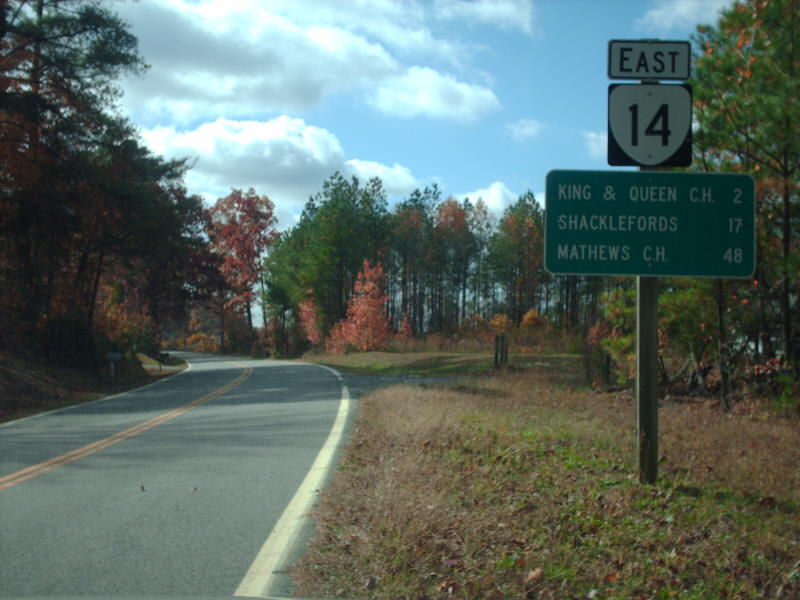
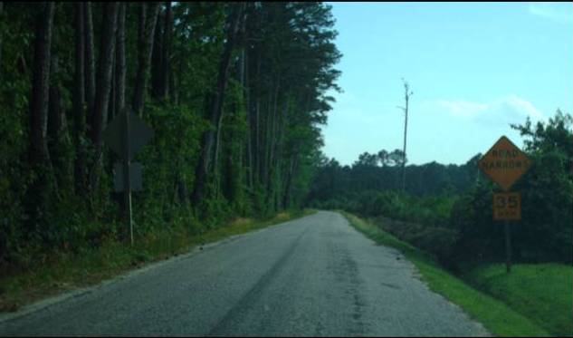
Photo: VA 14 nearing King and Queen CH (photo by Mapmikey 11/7/08)
|
|
|
| ROUTE LOG |
US 360: 0 - 0 VA 33 WB: 30.13 - 30.13 VA 33 EB: 1.66 - 31.79 Gloucester-King and Queen Line: 4.95 - 36.74 US 17 NB: 1.04 - 37.78 US 17 SB, US 17 Bus BEGIN: 7.83 - 45.61 US 17 Bus SB, VA 3 BEGIN: 1.27 - 46.88 Mathews-Gloucester Line: 6.25 - 53.13 VA 3 WB: 0.11 - 53.24 VA 198 WB: 7.28 - 60.52 VA 198 EB: 1.69 - 62.21 END VA 14: 8.89 - 71.20
|
Creation: Appeared July 1933 as a renumbering of VA 29 from VA 2 (now SR 627) De Jarrette to Gloucester; VA 600 from Gloucester to Mathews CH; VA 38 Mathews to Bayside. This is the 2nd VA 14.
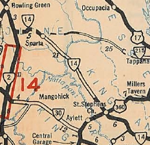
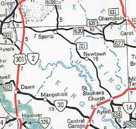
| Adjustments: In Aug 1933, VA 14 was extended further west replacing part of VA 2 which was moved to today's US 301/VA 2 alignment. In Oct 1940 (CTB), VA 14 was removed from SRs 644/678 south of Sparta. Also in Oct 1940 (CTB), VA 14 was removed from the SR 652 loop in northwestern King and Queen County west of Salvia. In Aug 1949 (CTB), VA 14 was removed from the SR 691 loop and the SR 623/690 loops east of Gloucester CH. In May 1954 (CTB), VA 14 west was truncated to US 360 (now SR 677) St Stephens Church leaving behind SR 721.
In April 1962 (CTB), VA 14-33 was removed from SR 678 between Shacklefords and Shacklefords Fork In Oct 1962 (CTB), VA 14 was removed from the SR 681 loop at King and Queen CH. In 1962, VA 14 west was extended slightly out to the new alignment of US 360. In July 1974, the CTB rejected a request from the Fredericksburg District to re-establish SR 721 as VA 14. Improvements: Fully paved upon designation from VA 2 to Sparta; 5 miles west of US 360 to Bayside In 1934, VA 14's pavement was extended west to Newtown In 1940, VA 14 was fully paved when the gap between Sparta and Newtown was paved. In 1973, VA 14 was widended from Gloucester to Adner In 1974, VA 14 was multilaned from Gloucester C.H. east 3 miles. In 1975, VA 14 was widened on its VA 33 duplex as well as the rest of its VA 3 duplex Posted: Fully posted; last known cutouts were removed in early 1990s. Multiplexes: VA 33 (1.66 mi) US 17 (7.83 mi) US 17 Bus (1.27 mi) VA 3 (6.36 mi) VA 198 (1.69 mi) Legislative names: None Other names: The Trail (US 360 to VA 33); Lewis Puller Memorial Hwy (VA 33 dup); Buena Vista Rd (King and Queen Co s of VA 33); Adner Rd (Gloucester Co n of US 17); George Washington Memorial Hwy (US 17 dup); Main St (Gloucester CH); John Clayton Mem Hwy (Gloucester CH to end); Main St (Mathews CH) Scenic Byway: US 360 to VA 33 (since 3/21/02); Mathews CH to SR 600 (4/20/2000)
| Previous VA 14's:
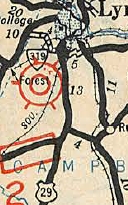
1932 ROUTE LOG NC STATE LINE: 0 - 0 VA 300: 2 - 2 VA 301 SB: 1 - 3 US 58 WB, VA 12 WB: 1 - 4 US 58 EB, VA 44: 0.5 - 4.5 VA 12 EB: 0.5 - 5 VA 301 NB: 1 - 6 VA 57 WB: 15 - 21 VA 57 EB: 2 blocks - 21 VA 20: 9 - 30 VA 320: 13 - 43 VA 43 WB: 13 - 56 VA 43 EB: 1 - 57 VA 319: 10 - 67 VA 10 WB: 1 - 68 VA 10 EB: 1 - 69 US 29 NB, US 60 EB, VA 18: 1 - 70 VA 204: 20 - 90 US 60 WB, VA 801: 12 - 102 VA 13: 8 - 110 US 11, US 60 EB, VA 33: 6 - 116 VA 805: 13 - 129 VA 806: 9 - 138 VA 17 NB: 6 - 144 VA 17 SB: 4 - 148 VA 800 SB: 10 - 158 VA 800 NB: 2 - 160 VA 22: 16 - 176 WV STATE LINE: 8 - 184 |
VA 14 #1: Began in January 1918 as an original state route defined by the general assembly:
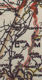
Route 14: North Carolina Line, Danville, Chatham, Alta Vista, Lynchburg, Natural Bridge, Lexington, Clifton Forge, Covington, White Sulphur
This is how VA 14 ran:
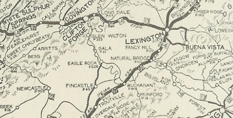
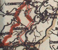
VA 14 (with VA 13) from West Virginia to Lynchburg 1922 Auto Trails In 1923, VA 13 was dropped from VA 14. Also by 1923, VA 14 was rerouted Alta Vista-Lynchburg to follow US 29 Bus, SR 712 Riverbend Rd, US 29; SR 912; US 29; SR 754 Anstey Rd, SR 738 Greenhouse Rd; SR 685, US 29, SR 738 English Tavern Rd, US 29 In April 1924 (CTB), VA 14 was rerouted off SR 684 at Glasgow and instead followed VA 130/SR 773 to Natural Bridge Station (replaced some of VA 141), and used SR 608 northeast from there.
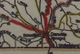
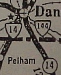
In May 1924 (CTB), VA 14 was rerouted from Danville to North Carolina over new primary routing using today's VA 293, US 29 Bus, and the Old US 29 alignment at the NC line just east of current US 29. The old route became VA 144.
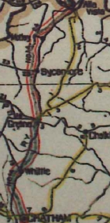
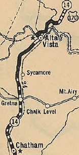
In late 1926, US 60 was assigned to VA 14 from West Virginia to Lexington and from Natural Bridge Station to Lynchburg. US 170 was assigned to VA 14 from Lynchburg south to North Carolina. In 1928, VA 14 was removed from the James River and Kanahwa Turnpike through Teaberry Flats, leaving behind CR 236 (today's SR 645). Also, based on bridge dates, VA 14 was straightened out on today's VA 159. About 1928, VA 14 was placed on today's US 29 between Sycamore and Motley; also VA 14 was placed on current US 29 in the Galveston area south of Gretna.
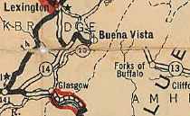
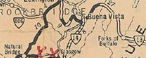
In 1929, VA 14 was removed from the Humpback Bridge. In 1930, VA 14 was rerouted at Glasgow to head to Buena Vista (new primary routing), then headed west at 10th St/current SR 745 to SR 608 south to McCormicks Gate, then northwest on SR 699 to Lexington as before. Buena Vista to McCormicks Gate was a renumbering of part of VA 13. Also in 1930, VA 14 was placed on current US 29 through Tightsqueeze. About 1931, VA 14 was placed on today's US 29 Bus/VA 163 in the vicinity of Lynchburg airport.
In 1932, VA 14 was removed from SR 699 (became CR 5) and instead sent east on SR 701 and US 60 to SR 608 outside BUena Vista. The 1932 Rockbridge County map shows a gap on SR 608 south to current SR 745 which is still shown as VA 14. In 1932, the US 170 designation was renumbered as US 29. By 1932, VA 14 was placed on the current US 501 near Boonsboro; Also, VA 14 was placed on modern US 29 Business through Blairs; removed from US 29 Bus/VA 41 and instead placed on VA 293. In 1933, VA 14 was removed from SR 745 and used US 60 across the Maury River, but then used Orchard St which curls around to the south before the railroad and no longer crosses the small stream. VA 14 continued south on Alleghany, then east on Factory to Beech which VA 14 used south heading out of Buena Vista towards Glasgow.
In July 1933, VA 14 was dropped from US 60 from West Virginia to Buena Vista; renumbered as US 501 from Buena Vista to Lynchburg; dropped from US 29 from Lynchburg to North Carolina.
| |||||||||||||||||||||||

Previous: VA 13 |
Next: VA 15
Top | Virginia Hwy Index
Home
Page last modified 22 January 2014