< US 11W | Home | US 13-A >
US 13 Business | US 13 ALT | US 13Y
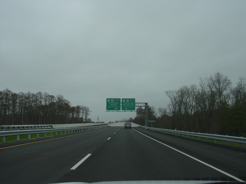
Photo: US 13 on the southbound portion of the new Suffolk Bypass freeway (photo by Adam Froehlig 3/19/03)
| US 13 < US 11W | Home | US 13-A > US 13 Business | US 13 ALT | US 13Y |
Photo: US 13 on the southbound portion of the new Suffolk Bypass freeway (photo by Adam Froehlig 3/19/03) |
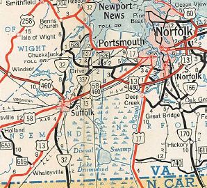
| ROUTE LOG NC STATE LINE: 0 - 0 VA 32 SB: 13.31 - 13.31 US 13 Bus, VA 32 Bus: 1.64 - 14.95 US 58 WB, US 58 Bus: 2.80 - 17.75 US 460 WB, US 460 Bus: 1.88 - 19.63 VA 10, VA 32 NB, VA 32 Bus: 0.93 - 20.56 US 13 BUs, US 58 Bus, US 460 Bus: 4.17 - 24.73 Chesapeake-Suffolk Line: 3.46 - 28.19 I-664 (exit 13): 2.41 - 30.60 US 58 EB, US 460 ALT, VA 191 NB: 0.64 - 31.24 END VA 191: 0.18 - 31.42 I-64 (exit 296): 2.89 - 34.31 US 17: 1.37 - 35.68 VA 196: 1.01 - 36.69 US 460 EB, VA 166: 2.20 - 38.89 I-464 (exit 2): 0.31 - 39.20 VA 168: 1.43 - 40.63 Virginia Beach-Chesapeake Line: 2.80 - 43.43 I-264 (exit 14): 0.85 - 44.28 US 58: 0.95 - 45.23 VA 165 NB, VA 166 SB: 1.23 - 45.46 VA 165 SB: 0.10 - 45.56 I-64 (exit 282): 0.78 - 46.34 Virginia Beach-Norfolk Line: 0.20 - 46.54 VA 166 NB: 0.95 - 47.49 VA 225: 2.14 - 49.63 US 60: 1.19 - 50.82 Northampton-Virginia Beach Line: 0.78 - 51.60 US 13 Bus, VA 184: 28.48 - 80.28 US 13 Bus: 1.71 - 81.99 US 13 Bus: 3.21 - 85.20 US 13 Bus: 2.33 - 87.53 US 13 Bus: 11.77 - 99.30 VA 183: 1.40 - 100.70 VA 178: 0.52 - 101.22 US 13 Bus: 0.35 - 101.57 Accomac-Northampton Line: 0.19 - 101.76 VA 181: 0.42 - 102.18 VA 182: 2.95 - 105.13 VA 180 WB: 2.68 - 107.81 VA 180 EB: 0.46 - 108.27 VA 389: 0.95 - 109.22 US 13 Bus: 3.62 - 112.84 VA 179: 1.00 - 113.84 US 13 Bus: 0.55 - 114.39 US 13 Bus: 1.25 - 115.64 US 13 Bus: 2.88 - 118.52 VA 176: 2.24 - 120.74 VA 187: 4.94 - 125.68 VA 175: 9.18 - 134.86 MD STATE LINE: 4.09 - 138.95 |
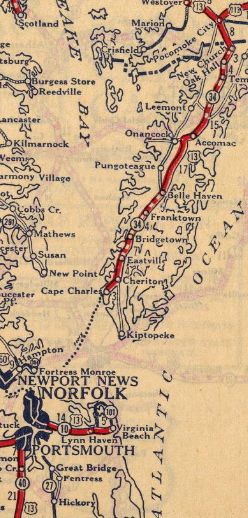
Creation: Appeared in late 1926 as an original US Highway, running from Cape Charles to Maryland as an addition to VA 34. US 13 had been originally designated in the 1925 plan to continue south to Wilmington but was truncated to Cape Charles on July 8, 1926 (AASHO). Norfolk to Wilmington became part of US 17 instead. It is unclear where US 13's south end was initially, although I surmise it was the ferry landing to Norfolk. The first map I have to sorta definitively show it is the 1935 Northampton County map which shows the south end looking to be at the west end of Mason Ave.
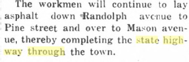
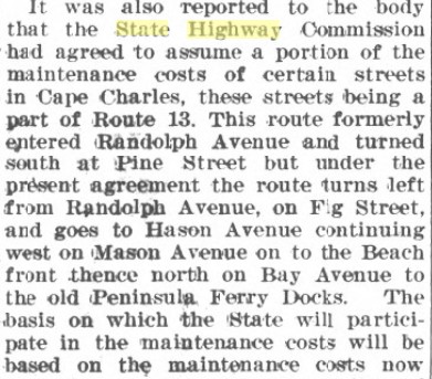
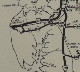
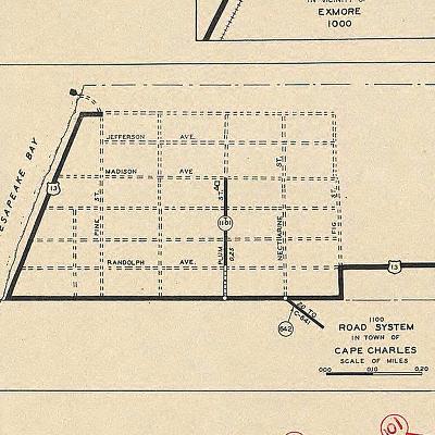
Adjustments: In April 1928 (CTB), VA 34 (and therefore US 13) was officially designated to follow today's US 13/13 Bus from Sunnyside to Exmore instead of the original routing using today's SR 618, SR 622 to Bridgertown, SR 619, then SR 618 to Franktown and Exmore. In 1930, VA 34 was rerouted to avoid Belle Haven by replacing VA 526 from Exmore to Belle Haven Station. The old route via Belle Haven became parts of VA 522 and a second VA 526 (now VA 178 and VA 181). In July 1933, VA 34 was dropped from US 13. In Sept 1934 (CTB), US 13 was extended north along Bayview Ave in Cape Charles, then curled around to end at the former terminal to Fort Monroe, which had just ceased operations right before. Unfortunately, 1936 was the first year the county map had a Cape Charles inset. Fortunately, I have discovered 2 newspaper articles that establish where US 13 ran prior to this 1934 adjustment: Randolph to Pine south to Mason, where the original ferry terminal to Little Creek was. The 1924 article shows it started out this way.
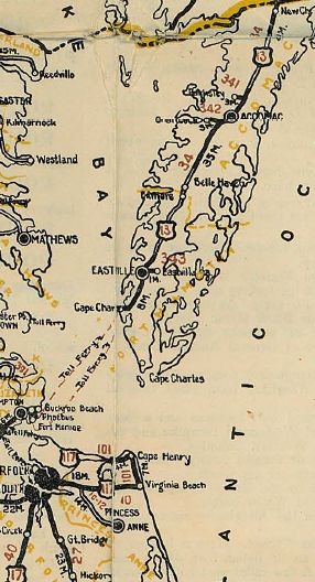
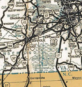
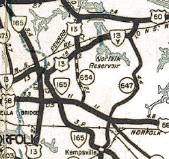
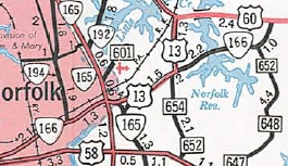
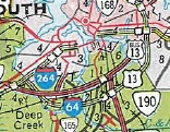
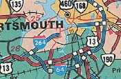
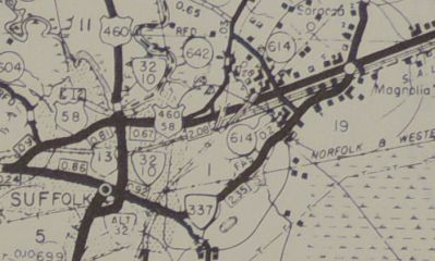
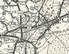
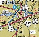
In July 1943 (AASHO), US 13 was continued across the Cape Charles ferry to Little Creek, then replaced VA 13 down Diamond Springs Road, Waterworks Rd, Princess Anne Rd, and Military Hwy around the Tidewater area to end at US 58 (now VA 191) Bowers Hill. Note that Virginia had been trying to get US 13 extended across the bay since 1926! In Sept 1945, the Interregional System of Highways was distributed to the CTB. They approved all the routes therein for Virginia (except wanted to change US 211 as a corridor to VA 55), plus added 2 more corridors. One was US 13 from Cape Charles to Maryland, "provided the Public Roads approves the addition within Delaware and Maryland." The next mention of the Interregional System of Highways occurs in the April 1958 CTB, which summarizes what happened in 1945 and notes that the Bureau of Public Roads only accepted one of the 2 additional corridors, US 301 from NC to Petersburg. Sometime in 1950 (per April 1951 CTB), US 13 was rerouted from Cape Charles to the Kiptopeke Ferry location. Some of this was a replacement of VA 186. The road to Cape Charles became US 13 ALT (now VA 184). See scan under US 13 ALT entry. In Oct 1950 (CTB), US 13 was removed from Waterworks Rd and Princess Anne Rd, leaving behind VA 165Y (east of I-64 is physically gone) and VA 165. US 13 was instead placed on Northampton Blvd in this area. In Oct 1951 (AASHO), US 13 was extended along US 58-460 to Magnolia, VA 337 into central Suffolk, then after a brief VA 32 duplex south, replaced VA 37 through Whaleyville and into North Carolina.
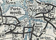
In Oct 1957 (CTB), US 13 was placed on Hall Ave between Saratoga Ave and Washington St in Suffolk, leaving behind VA 337. In Feb 1958 (AASHO), South Carolina tried to have US 13 from Norfolk to Maryland renumbered as part of a huge extension of US 5. It is unclear what was supposed to happen to US 13 from Norfolk to Goldsboro NC. No other state joined in, so this, of course, went nowhere. In May 1960, the CTB requested an interstate corridor on the Eastern Shore. it is unclear what happened to this other than it didn't happen. In Feb 1964 (CTB), US 13 was moved from Diamond Springs Rd to Northampton Blvd and over the new Chesapeake Bay Bridge-Tunnel as a route swap with VA 166. In Northampton County, US 13 was removed from Kiptopeke, leaving behind SR 704 which is still 4-lane concrete.
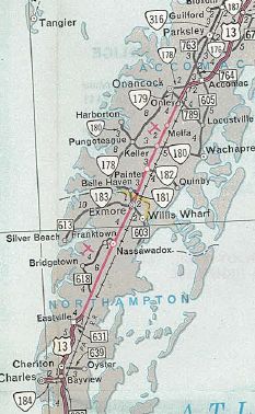
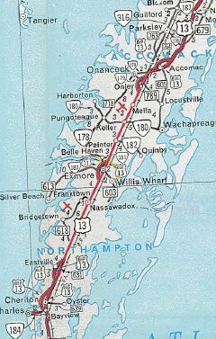
In Oct 1966 (CTB), US 13 received bypasses of Cheriton/Bayview, Eastville, Exmore, and Onley/Tasley/Accomac C.H. All old routings became US 13 Business segments.
In Aug 1970 (CTB), US 13 was placed on I-64 from Bowers Hill to Northampton Blvd, leaving behind US 13 Business. In June 1974 (CTB), US 13 was removed from Hall Ave and VA 337 and instead began using today's US 13 Business through Suffolk. Oddly, officials from 1975-80 and county maps through at least 1981 show US 13 on its old routing, when they never showed it when it was actually happening. In June 1980 (AASHTO), US 13 was returned to Military Hwy and Northampton Blvd, replacing US 13 Business.
On March 19, 2003, US 13 was rerouted to go around the west side of Suffolk as new constructed freeway, although posting of the original Suffolk Bypass with US 13 shields took a couple months longer.
In 2006, the General Assembly directed DOT to study the idea of an I-99 to run up the Eastern Shore. Go to the I-99 page for details. Improvements: Upon designation in 1926, US 13 was paved from Cape Charles to Sunny Side; Keller to Rue; Oak Hall to Maryland. In 1928, US 13 was paved from Rue to oak Hall In 1929, the rest of US 13 was paved The First segment of US 13 to be multilaned was when it was added to Military Hwy around 1943. In 1949, US 13 was multilaned from Accomac C.H. to VA 176 and from VA 175 to Maryland. In 1951, US 13 was multilaned on its Northampton Blvd and diamond Springs Rd routings; also from Temperanceville to Oak Hall. In 1952, US 13 was multilaned when it was added to US 58-460 from Bowers Hill to Magnolia. In 1953, US 13 was multilaned from VA 176 to Mappsville. In 1954, US 13 was multilaned from Mappsville to Temperanceville; erroneously shown as widened from onley to Tasley In 1958, US 13 was multilaned from SR 683 to the Kiptopeke Ferry Landing In 1959, US 13 was multilaned from SR 683 to SR 684. In 1964, US 13 was multialned from old US 13 (now SR 704) south to the Chesapeake Bay Bridge-Tunnel; also US 13 was multilaned when moved to its all-Northampton Blvd routing. The 1965 and 1966 Officials show US 13 widened from SR 684 to north of Eastville, although no bypasses are shown. This may be a premature showing on the map or US 13 was widened between bypass segments. In 1967, US 13 was multilaned on its bypasses of Cheriton, Eastville, Exmore and Onley/Tasley/Accomac In 1969, US 13 was multilaned from Eastville to Exmore; Exmore to Onley In 1974, US 13 was 4-laned from Magnolia to Suffolk when it was removed from VA 337 and Hall Avenue. In 1976, US 13 was widened from Suffolk south to the VA 32 split. In 1999, US 13 was multilaned on the bridge segments of the Chesapeake bay Bridge-Tunnel. In 2003, US 13 was multilaned around Suffolk when rerouted onto its Suffolk Bypass (full freeway). US 13 is 6-lanes from US 60 to VA 166; I-64 to Military Hwy; Indian River Rd to Auburn Dr; Allison Dr to VA 168; Bowers Hill to Suffolk Bypass US 13 is 8-lanes from Diamond Springs Rd to I-64; Lowery Rd to US 58; I-264 to Indian River Rd. US 13 is 10-lanes from US 58 to I-264. The remaining 2-lane segments are: NC to VA 32; Chesapeake Bay Tunnels Posted: Fully posted; mainline US 13 cutouts on the Eastern Shore gradually disappeared during the 2000s, the last known cutout at SR 642 below Cheriton still remained in April 2007 but was gone by 2013. The last Tidewater area cutout was at the former VA 32 ALT intersection in Suffolk which was still there in 1994, but long gone now. A series of "TO US 13" trailblazers exists on westbound VA 166 in Norfolk, including one just west of the US 13/VA 165/VA 166 intersection. Multiplexes: VA 32 (4.44 mi) US 58, VA 32 (1.88 mi) US 58, US 460, VA 32 (0.93 mi) US 58, US 460 (10.04 mi) US 460, VA 191 (0.18 mi) US 460 (7.47 mi) VA 165, VA 166 (0.10 mi) VA 166 (1.93 mi) VA 180 (0.46 mi) Legislative names: Ocean Highway, US 17 to Maryland Line except Business segments(since 3/23/46); Charles M. Lankford Jr memorial Highway, Northampton/Accomack Counties (since 1978) Dr. Martin Luther King, Jr Memorial Bridge, Lake Kilby (designation 12/18/01); Other names: Whaleyville Blvd/Carolina Rd (S Suffolk); Military hwy (E Suffolk/Chesapeake/Norfolk); Northampton Blvd (Norfolk/Va Beach). Scenic Byway: None Comments: US 13 now (since mid-2004) has mile markers from the north end of the Chesapeake Bay Bridge-Tunnel (MM 70) to the Maryland State Line (MM 138). Westbound along VA 166/Princess Anne Rd has TO US 13 trailblazers. This may not seem like much, except that it's moving away from US 13 at the Princess Anne Rd/Northampton Blvd/Military Hwy intersection (where US 13 meets with VA 166). Turns out they direct you to turn left on Azalea Garden Rd to reach US 58 where one can jog east back to US 13. I guess people didn't notice Military Hwy when coming down Northampton Blvd. L. Corsaro and E. Smith have a US 13 expressway site Froggie has a photo journey of the Suffolk Bypass of US 13 - here. From Dave: The main drag of the Delmarva Peninsula, which I became familiar with as a child on my family's biannual trips to my great aunt's home in Jarvisburg, NC. Highlights include: one of my favorite town names - Mappsville, Owl Restaurant in Accomac, and, of course, the famous Bridge-Tunnel. Mike would like to add Formy's Restaurant (BBQ) in Painter. Froggie's usual stop is at the Great Machipongo Clam Shack just north of Nassawaddox, well-known for fried seafood and soft-shell crab. | ||||||||||||||||||||
Previous: US 11W |
Next: US 13-A
Top | Virginia Hwy Index
Home
Page last modified 23 June 2026