<US 450 | Home | US 466 >
US 460 ALT | US 460 Bus | US 460 Byp | US 460 Temp | US 460-Y
US 60 | US 160 | US 260 | US 360 | US 560 | US 660
US 460 at US Ends.com
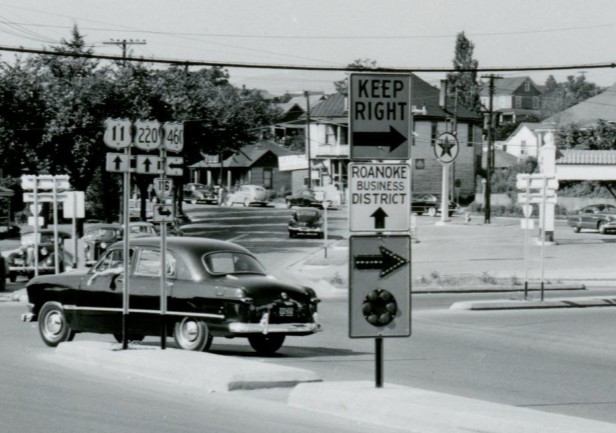
Photo: US 11-220 south at US 460/VA 116 in Roanoke VA (public domain photo by T W Kines, Aug 6, 1950)
|
|
|
| ROUTE LOG |
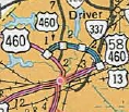
US 60, US 421: 0 - 0 US 460 Byp Georgetown: 13.6 - 13.6 US 25: 2.0 - 15.6 US 62, US 460 Byp: 1.2 - 16.8 I-75 (Exit 125): 0.3 - 17.1 US 27, US 68: 14.1 - 31.2 US 68 Bus SB: 1.5 - 32.7 US 68 Bus NB: 1.1 - 33.8 I-64 (Exit 110): 20.8 - 54.6 US 60 EB: 1.6 - 56.2 US 60 WB: 0.1 - 56.3 US 23 NB: 87.5 - 143.8 US 119 NB: 35.5 - 179.3 US 460 ALT: 7.5 - 186.8 US 23 SB, US 119 SB: 10.9 - 197.7 KY STATE LINE: 18.8 - 216.5 Begin US 121: 7.2 - 223.7 END US 121, END US 460: 4.3 - 228.0 GAP IN ROUTE US 460 ALT: 0 - 228.0 US 460 Bus Grundy: 2.2 - 230.2 US 460 Bus: 0.6 - 230.8 US 460 Bus Richlands: 28.0 - 258.8 US 460 Bus Cedar Bluff: 3.0 - 261.8 US 460 Bus: 1.2 - 263.0 US 19 SB: 1.3 - 264.3 US 19 Bus, US 460 Bus Tazewell: 12.1 - 276.4 US 19 Bus, US 460 Bus: 5.8 - 282.2 US 19 NB: 11.0 - 293.2 WV STATE LINE: 4.9 - 298.1 US 52 Bus NB: 3.1 - 301.2 US 52, US 52 Bus END: 1.6 - 302.8 US 19 SB: 0.7 - 303.5 US 19 NB: 5.2 - 308.7 I-77 (Exit 9): 4.9 - 313.6 VA STATE LINE: 11.4 - 325.0 US 219: 3.3 - 328.3 US 460 Bus Pearisburg: 8.3 - 336.6 US 460 Bus: 2.6 - 339.2 US 460 Bus Blacksburg: 17.5 - 356.7 US 460 Bus: 6.5 - 363.2 US 460 Bus Christiansburg: 3.0 - 366.2 US 11, US 460 Bus: 2.7 - 368.9 I-81 (Exit 118): 0.4 - 369.3 I-81 (Exit 118C), US 11 NB: 1.0 - 370.3 US 11 ALT, US 460 ALT: 21.2 - 391.5 US 11 NB: 0.9 - 392.4 US 11 ALT SB, US 460 ALT: 1.6 - 394.0 I-581 (Exit 4), US 220: 5.1 - 399.1 US 11, US 11 ALT END, US 221 SB: 0.3 - 399.4 US 221 NB, US 460 Bus Bedford: 25.9 - 425.4 US 460 Bus: 2.8 - 428.2 US 460 Bus Lynchburg: 14.0 - 442.2 US 29 SB, US 29 Bus: 4.7 - 446.9 US 501 NB: 2.1 - 449.0 US 460 Bus, US 501 SB, US 501 Bus: 2.2 - 451.2 US 29 NB: 2.3 - 453.4 US 460 Bus Appomattox: 15.3 - 468.7 US 460 Bus: 2.5 - 471.2 US 460 Bus Pamplin City: 8.5 - 479.7 US 460 Bus: 2.1 - 481.8 US 15 NB, US 460 Bus Farmville: 11.4 - 493.2 US 15 SB, US 15 Bus: 4.5 - 497.7 US 460 Bus: 3.0 - 500.7 US 360 WB, US 360 Bus, US 460 Bus Burkeville: 11.4 - 512.1 US 360 Bus, US 460 Bus: 1.4 - 513.5 US 360 EB: 0.4 - 513.7 US 460 Bus Blackstone: 7.5 - 521.2 US 460 Bus: 7.3 - 528.5 I-85 SB (Exit 61), US 460 Bus Petersburg: 27.8 - 556.3 US 1, US 460 Bus: 2.2 - 558.5 I-85 NB (Exit 68), I-95 NB (Exit 50): 4.6 - 563.1 US 301: 0.4 - 563.5 I-95 SB (Exit 48): 2.3 - 565.8 US 460 Bus: 1.6 - 567.4 I-295 (Exit 3): 0.6 - 568.0 US 13 SB, US 58 WB, US 460 Bus Suffolk: 50.3 - 618.0 US 13 Bus, US 58 Bus, US 460 Bus: 4.9 - 622.9 I-664 (Exit 13), US 58 EB, US 460 ALT: 6.1 - 629.0 I-64 (Exit 297), 3.4 - 632.4 US 17 Bus: 1.2 - 633.6 US 13 NB: 3.2 - 636.8 I-264 (Exit 11): 5.5 - 642.3 US 460 ALT: 1.2 - 643.5 US 58: 0.3 - 643.8 I-564 (Exit 3): 4.3 - 648.1 I-64 (Exit 276): 0.2 - 648.3 US 60: 2.6 - 650.9
|
Creation: Appeared in May 1933 (AASHO), running from Roanoke to Chesapeake Beach via Bedford,
Lynchburg, Appomattox, Farmville, Burkeville, Petersburg, Suffolk,
Portsmouth and Norfolk. This is the 4th attempt at US 460. In this routing, US 460 replaced:
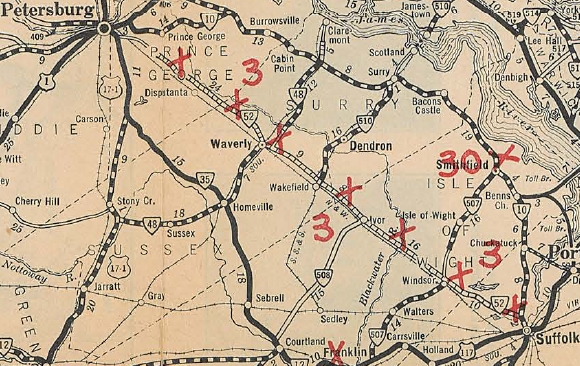
| VA 10 from Roanoke to Lynchburg; US 60 and VA 10 from Lynchburg to Burkeville; VA 10 from Burkeville to Petersburg; VA 52 from Petersburg to Suffolk; US 117 and VA 10 from Suffolk to Norfolk; VA 12 from Norfolk to Chesapeake Beach Note that Virginia actually requested this corridor be US 86, after first contemplating that Roanoke to Burkeville would become part of an extended US 221. Virginia reported this as 259 miles to AASHO.
Adjustments: Let's take a look at US 460's progression from a geographic point of view: Virginia/West Virginia
In October 1946 (AASHO), US 460 was extended west from Roanoke, effective 1/1/47 as follows: replacing VA 24 through northern Roanoke; replace VA 117 to Salem; follow US 11 to Christiansburg; replace VA 8 to Narrows; replace VA 100 to Rich Creek VA; follow US 219 to Princeton WV; follow US 19 to Claypool Hill VA; replace VA 4 to Kentucky.
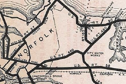
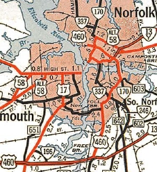
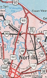
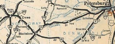
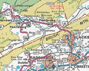
In 1948, US 11-460 was given a new alignment at Dixie Caverns, leaving behind SR 796. In 1950, US 460 was given its current Salem to Roanoke routing via Melrose and Orange Ave. Before it used Melrose/11th/Gilmer/US 11-220/Orange. Also in 1950, US 11-460 was placed on a bypass of Elliston leaving behind SR 745. Also in 1950, US 11-460 was built on new alignment bypassing Stones Keep Rd and Wayside Rd, SRs 813 and 821 (discontinuous now) near Roanoke Wayside Also in 1950, US 15-460 was removed from the lengthy SR 695 west of Farmville. In 1952, US 11-460 was given its bypass of Shawsville leaving behind SR 753. By 1954, US 460 was rerouted in Petersburg to used Washington St directly to Crater Rd south. In 1956, US 460 was placed on its current Thaxton Bypass leaving behind SR 831. In Oct 1957 (CTB), US 460 in Suffolk was moved onto Constance St east of Main, leaving behind Katherine and Pinner Sts (now also E Old Pinner). In 1958, US 460 was placed on a new bypass of Pembroke, leaving behind SR 1404. Also in 1958, US 460 was rerouted in Norfolk to its current routing to US 60 Ocean View, replacing VA 170 on Granby St.
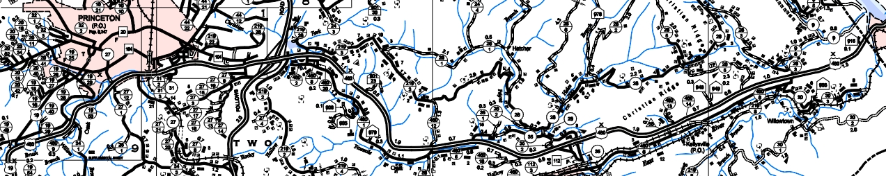
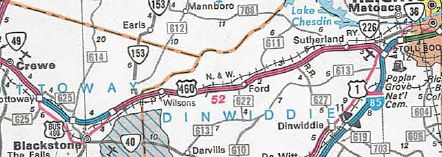
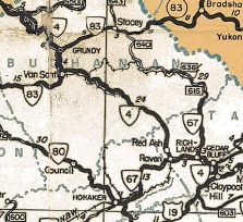
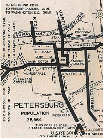
US 460 was removed from SR 1004 in Appomattox by 1958. By 1958, US 460 was given its current Concord routing, leaving behind SR 800. US 460 (or US 221) was removed from SR 646 in Norwood sometime after 1958. About 1960, US 19-460 was taken off SR 637 in the Pounding Mill area. In Feb 1961 (CTB), US 460 was split in Petersburg - EB US 460 had to follow US 301 south to I-95 and use what had been US 460 ALT to get back to Winfield Rd which US 460 WB continued to use. In 1961, US 460 was removed from SRs 777 and 778 in the Sinking Creek area. In the mid 1960s, US 460 was placed on one-way alignments at Grundy. WB used the original routing. EB was placed on the road that had been assigned as US 460 ALT in earlier CTB references, running behind the (now destroyed) town. This had been SR 1006 on the 1958 Buchanan County map. In 1965, US 460 was removed from Bonsack Rd at Bonsack. In March 1965 (CTB), US 460 was rerouted east of Sutherland to the new I-85 and US 1, which it followed north towards Petersburg. This left behind VA 226. In Nov 1966 (AASHO), US 460 was placed on a freeway bypass of Christiansburg, leaving behind US 460 Business. In Dec 1968 (AASHO), US 460 was placed on an expressway bypass around the west of Blacksburg, leaving behind US 460 Business. In Feb 1969 (CTB), US 460 was rerouted to follow Fort/12th past Campbell Ave to follow today's US 221 routing. Maps show a one-way split alignment between 12th and today's US 29 Bus, most like involving Buchanan St and either 14th or 15th. In June 1969 (AASHO), US 460 was given its expressway bypass of Pamplin City, leaving behind US 460 Business. In Nov 1969 (CTB), US 460 was placed on its Burkeville bypass, leaving behind some SR 714 and US 360-460 Business.
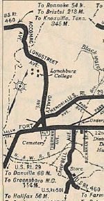
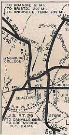
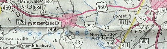
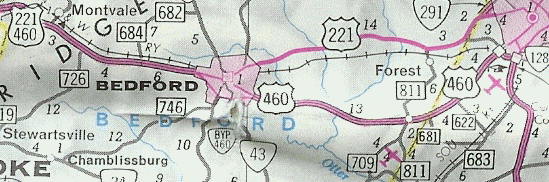
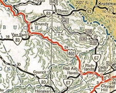
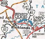
In 1969, US 460 was placed on its bypass of Newport, leaving behind SR 796, VA 42 and VA 797. In 1970, US 460 was placed on a new alignment bypassing Raven, leaving behind VA 67 and SR 806. In November 1970, AASHO denied Virginia's request to move US 460 onto VA 297 between Bedford and Lynchburg, with the old routing becoming US 460 ALT. In December 1970 (CTB), US 460 was rerouted at Bedford onto its current Bedford Bypass and its route over to the original Lynchburg Bypass (current US 29 Bus). This was a replacement of VA 297. The old route became an extended US 221.
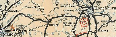 VA 10 Roanoke to Lynchburg 1932 Official
In 1972, US 460 was moved onto the new Corridor Q alignment from the I-77 area east as new alignments to WV 12 (now WV 112) Oakvale WV. This left behind CR 460/10 Oakvale Rd (no longer connects to); CR 460/2 and CR 460/1 Hilltop Dr; CR 460/5 Fountain Park Rd; CR 35 Goodwins Chapel Rd In June 1973 (AASHO), US 460 was placed on a freeway bypass of Richlands and Cedar Bluff, leaving behind US 460 Business.
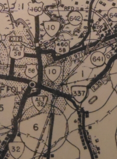
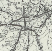
In Aug 1973 (CTB), US 460 was given its freeway bypass of Suffolk, leaving behind US 460 Business. AT first it was just US 460 as the freeway wasn't open west of there back to US 58.
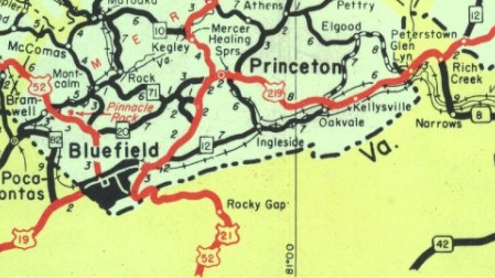
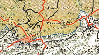
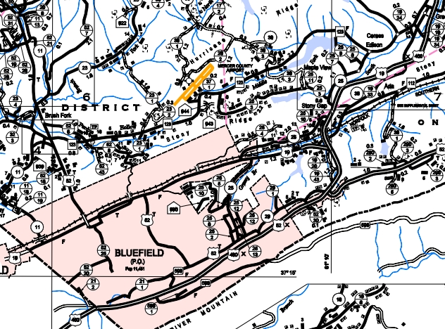
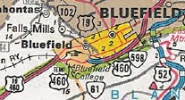
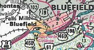
In 1973, US 460 was moved onto the new Corridor Q alignment leaving behind a bit of WV 12 (now WV 112), CR 460/6 Goodwins Chapel Rd. and the Ball Ave loop at the state line by Glen Lyn VA. Between 1962-75, US 460 was rerouted in Bluefield to a less direct route across Bluefield. It left Graham Ave at Walnut, then south to what is now Virginia Ave then east back out of town. Originally it had used Graham Ave all the way through. Also in 1973, US 460 was rerouted in the Rice area to its current routing, leaving behind SRs 735 and 736. The new alignment eclipsed a piece of VA 307. In 1974, US 460 was put on new alignment in central Dinwiddie County, leaving behind SR 751. In November 1974 (AASHO), US 460 was removed from central Princeton WV and instead send around to the south over what was CR 219/11. The route through central Princeton remained US 19 and WV 20.
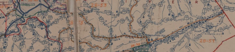
US 460 original route from Princeton east to Virginia 1949 Mercer County
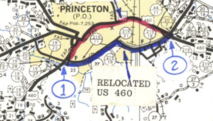
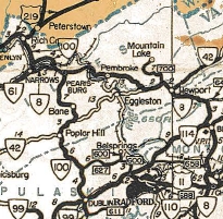
US 460 bypasses central Princeton early 1970s Mercer County (from 1974 AASHO application)
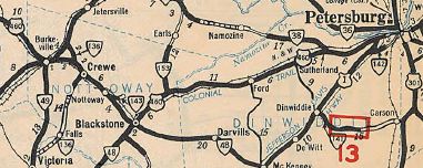
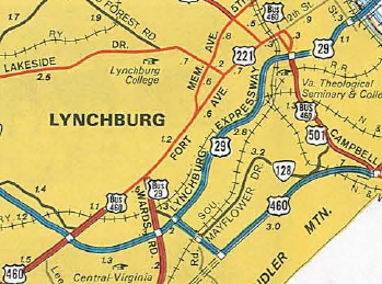
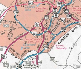
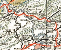
US 460 bypasses Princeton and on new alignment east to Virginia 2004 Mercer County In 1975, US 19-460 was placed on a freeway bypass north of Tazewell, leaving behind US 19-460 Business. This was approved by AASHO in May 1970. In Nov 1975 (AASHO), US 460 was placed on a new expressway from then-US 29 east to Candler Mtn, then northeast on more new freeway to meet back up with US 460-501. The old route remained parts of US 29 and US 501. In 1974, US 460 was placed on its freeway bypass of Ripplemead. This left behind SR 636 and probably SR 807. In Dec 1975 (CTB), US 460 was rerouted from Rich Creek to Glen Lyn, leaving behind SR 806, abandoned roadway, then SR 1308 in Glen Lyn. In 1976, US 460 was placed on its freeway bypass of Blackstone leaving behind US 460 Business. AASHO approved this in May 1970.
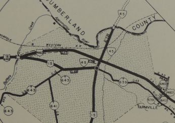
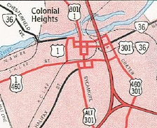
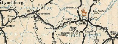
 US 460 bypasses Blackstone and diverts to I-85 1984 Official About 1976, US 1-460 was placed on one-way splits using Washington and Wythe Sts. In July 1977 (AASHTO), US 460 was placed on its southern bypass of Farmville, some of which was already open as US 15 Bypass. The old route became US 460 Business.
In 1978, US 460 received its final bypass of Princeton, leaving behind more US 19 and WV 104 on the first bypass. Note that West Virginia applied for the Corridor Q relocations from 1972-78 all at once in June 1979 (AASHTO)
In June 1979 (AASHTO), US 460 was removed from US 19 through Bluefield VA and WV. At that time, a new expressway was constructed from the eastern SR 720 jct east to the West Virginia line. SR 720 west to US 19-460 was signed as TEMP US 460. Also US 460 was placed on new alignment in the Green Valley WV area leaving behind CR 19/33 and a little WV 112. In June 1981 (AASHTO), US 460 was placed on its freeway bypass of Pearisburg. This left behind VA 100 and US 460 Business. In 1987, US 460 TEMP was removed from SR 720 as the rest of the expressway was opened.
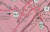
In December 1988 (AASHTO), US 460 was placed on its current Lynchburg Bypass routing, replacing VA 224. The old route remained part of US 29 (now 29 Bus) and US 501/VA 128.
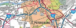
Also in December 1988 (AASHTO), US 460 was placed on I-85 at Exit 61 up to I-95 then it got off I-95 at the next exit. Here it replaced unsigned US 460 ALT back to US 460 near Ft. Lee. The old route became US 460 Business.
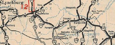
In October 1993 (AASHTO), US 460 was placed on its freeway bypass of Appomattox, leaving behind US 460 Business.
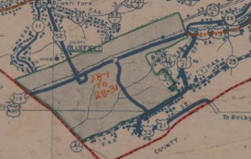
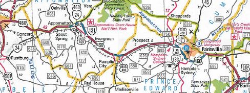 US 460 bypasses Appomattox, Pamplin City and Burkeville 2004 Official In 1997, US 11-460 was removed from today's discontinuous SR 603 east of Elliston. From the early 50s to 1997, US 11-460 was split into a wide alignment using SR 603 for the NB routing. About 2001, US 460 was extended south from the Christiansburg Bypass directly to I-81. Then US 460 was moved to the C/D lanes in each direction of I-81 at the Exit 118 complex. US 460 then continued to follow US 11 southeast of I-81. The old route along US 11 between these locations became more of US 460 Business. About 2003, US 460 was placed on new freeway connecting the Blacksburg and Christianburg bypasses, leaving behind a long US 460 Business.
Around 2007, US 460 was rerouted to stay on I-95 south to Wagner Rd, then put on Wagner Rd east to US 460/VA 106. This left behind an extended US 460 Business. In 2009, the split routing through Grundy was removed as the EB roadway was widened to 4 lanes. The old WB routing through what used to be downtown Grundy remains Main St and a bit of VA 83. In late 2013, US 460 was placed on a new bypass of the business district along Riverside Dr in the SR 615 Levisa Rd area between Van Sant and Grundy. The old route became US 460 Business. In fall 2020, US 460 was removed from a dogleg in South Norfolk at VA 246 using a bit of Liberty St and 22nd St to reach the bridge over the railroad. Now Poindexter connects directly to a new bridge which ties into the original rotuing halfway across the bridge. Kentucky
Before US 460 in eastern Kentucky 1944 RMcN Official
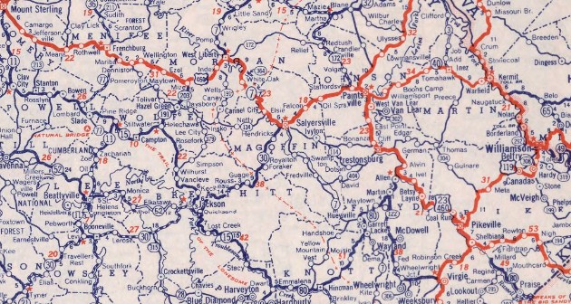
US 460 in eastern Kentucky 1949 RMcN Official US 460 also replaced KY 40 to Frankfort; followed US 60 to Louisville; followed US 31E to Indiana
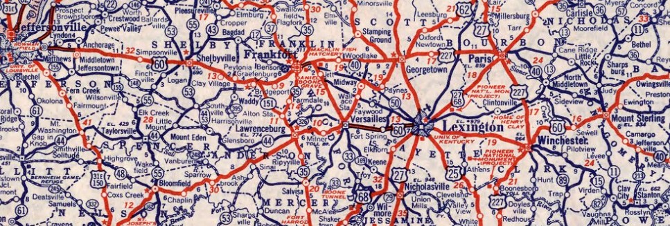
Before US 460 in central Kentucky 1944 RMcN Official
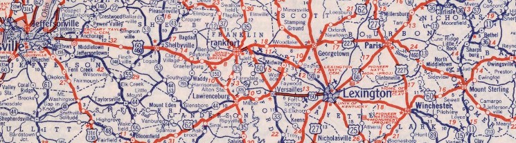
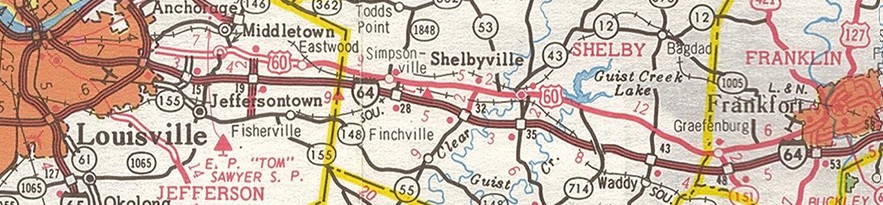
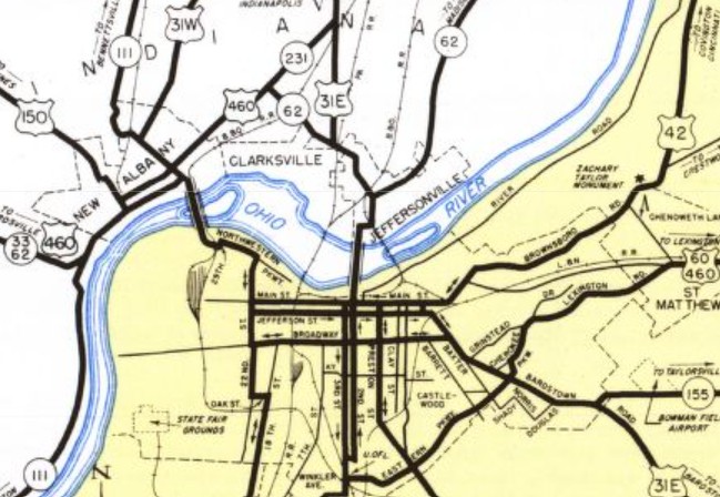
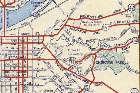
US 460 in central Kentucky 1949 RMcN Official About 1953, US 460 was removed from Old Paris Rd/abandoned at KY 3362 west of Mt Sterling KY. It is unclear if it was in place already when US 460 was extended west through Kentucky, but by 1955, US 460 was put on a one-way pair through Shelbyville KY. EB used the original route of Main St, while WB used 1st St/Washington St. Around 1955, US 460 was given a one-way pair through Paris KY. US 460 EB used the original Main St route; WB used Bank Row St/High St. Between 1952-56, US 460 was rerouted at St Matthews KY to use Frankfort Ave to US 42 Louisville, then follow US 42 to US 31E. The old route remained US 60 (now US 60 ALT), US 60 Bus (now Grinstead Dr), and US 31E-150.
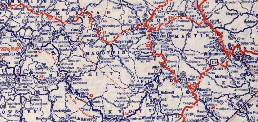
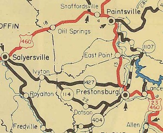
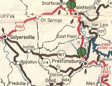
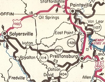
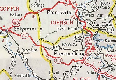
About 1961, US 460 was given its first bypass of Paintsville, leaving behind US 460 Business. Today this is KY 40 and KY 321 Business.
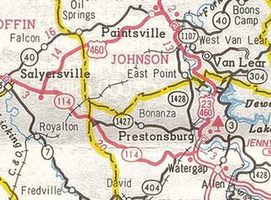
Between 1959-62, US 460 was given its original bypass around the east of Pikesville KY. The old route through town became US 460 Bus. Today this is KY 1384; Hambley Blvd; one way pair with EB using Hambley/S Auxier/3rd/Pike/2nd/Huffman/College, while WB used College/Huffman/Main/Scott/7th; College Ave; Hubbard St; abandoned former bridge next to KY 1426 Baird Ave. In July 1963 (AASHO), US 460 was placed on new routing between Prestonsburg KY and Paintsville KY, leaving behind KY 1428 and KY 2333 to Paintsville. Between Prestonsburg and Hagershill, KY 1428 is now again US 23-460 except: CR 1477; CR 1478; Ash Ln; Woodland Heights; KY 1100;
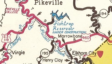
In June 1964 (AASHO), US 460 was rerouted at Millard KY to follow KY 80 to Belcher, then new construction to Mouthcard. This was needed to accommodate the Fishtrap Dam and expanded waterway. The old route is KY 1789 to the boatramp just past the dam; underwater around 3 humps of Fishtrap Lake and part of Grapevine Creek; Old Rd; KY 194; KY 1499 through Biggs to Mouthcard.
About 1973, US 460 was removed from Conn St near Tram KY; Main St through Stanville KY; Church Rd in Boldman KY; Pem Friend Ln, Blairtown Rd, and N Mayo Tr in Blairtown KY In June 1974 (AASHTO), US 460 was put on new alignment from Allen KY to Prestonsburg KY, leaving behind more KY 1428 plus Court St in New Allen. In July 1976 (AASHTO), US 460 west was truncated from the state line at Louisville to US 60-421 on the east side of Frankfort. This left behind US 31E and US 42 in downtown Louisville; US 60 Truck to St Matthews; US 60 Bus to I-264 (all of this is now just US 31 over the river and US 60 out to I-264); US 60 to the east side of Frankfort.
US 460 truncated to Frankfort 1983 Official In June 1978 (AASHTO), US 460 was rerouted between Salyersville KY and Paintsville KY by using a little KY 114 then new construction to Paintsville. The old route became KY 40 to Paintsville (US 460 used Trimble Ln/abandoned/Old Bridge Rd west of KY 172).
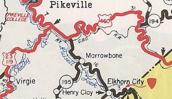
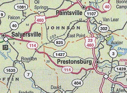
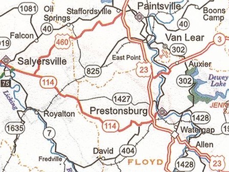
Around 1982, US 460 was removed from McClain Way near West Liberty KY. Between 1978-85, US 460 was removed from Old Georgetown Rd near Forks of Elkhorn KY. About 1985, US 460 was removed from abandoned/Jones Creek Rd at Cottle KY. About 1986, US 460 was removed from Rothwell Ridge Rd west of Frenchburg KY and Old US 460 east of town. In May 1987 (AASHTO), US 460 was given its current bypass of Pikeville KY leaving behind KY 3496, KY 1426, KY 1460 and KY 3495. Between 1986-89, US 460 was removed from Revis Rd at KY 205. About 1991, US 460 was removed from Grassy Hill Rd W and Grassy Hill Rd E near Grassy Creek KY. In 1993 or 1994, US 460 was rerouted at Prestonsburg KY on an upgraded KY 1428 (this had been US 460 until 1963) to Hagerhill. This left behind a little KY 114 and KY 321. About 1995, US 460 was removed from KY 1441/1789 at Millard KY. About 1997, US 460 was given its current bypass of Paintsville and Hagerhill KY, leaving behind a bit of KY 40; KY 321; KY 1428
Between 1987-98, US 460 was removed from part of Delissa Dr/abandoned in Georgetown KY. In December 2002 (AASHTO), US 460 was removed from Robinfield Rd east of Mariba KY plus some of Meyers Fork Rd. In January 2006 (KYTC), US 460 was removed from Chase Ln at Jeffersonville KY. In May 2009 (AASHTO), US 460 was removed from several abandoned alignments east of KY 946. In February 2016 (KYTC), US 460 was removed from Wynn Flat Rd and Pear TreeWay/Mariba Loop west of Mariba KY. About 2018, US 460 was removed from an unnamed fat loop west of Ezel KY. About 2020, US 460 was removed from abandoned/Science Ridge Rd east of Jeffersonville KY. About 2024, US 460 was removed from an unnamed fat loop outside Salyersville KY. In October 2025, the last section of the new Corridor Q route opened. Reports are it was signed as US 460 while the older Corridor Q segments on either side were still posted as KY 3174. A separate report is that the existing US 460 has at least one US 460 ALT posting already. HB Elkins reported on 4/3/26 that all of Corridor Q from US 23 to Virginia is now signed as US 460 and all of the former US 460 signed as US 460 ALT to Virginia. With a short segment still under construction in Virginia, these are premature signage changes, although AASHTO already approved the US 460 reroute and US 460 ALT designation in October 2025. Indiana
US 460 across southwestern Indiana 1947 Official
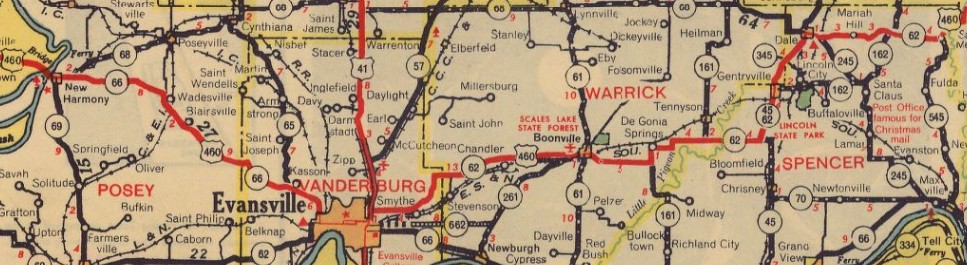
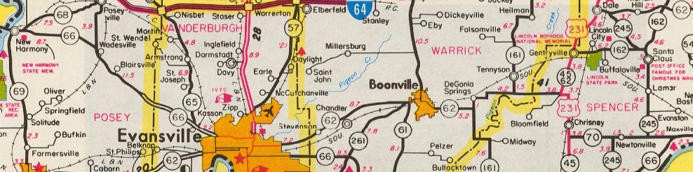
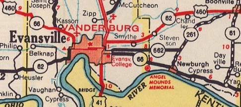
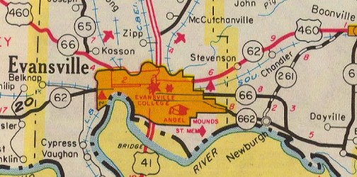
US 460 across southeastern Indiana 1947 Official In 1950, US 460 was removed from Old Boonville Hwy from Smythe IN; Gardner Rd/Fuquay Rd/Washington St/Old Plank Rd through Chandler IN to west of Chandler IN. About 1961, US 460 was removed from Providence Way, Lewis & Clark Pkwy, Eastern Blvd, Spring St, Indiana Ave, and Court St in Jeffersonville. Instead, US 460 joined I-65 where today's US 31 does and left I-65 on Browns Station Way to Spring St into New Albany. About 1966 (approved by AASHO June 1971), US 460 was rerouted around the north side of Evansville IN by following US 41 north briefly, then new construction west to Meeker Park Dr, then was also New Harmony Rd out to nearly Parkers Settlement. The old route through Evansville itself remained IN 66 (today this is St Joseph Ave, Franklin St (WB used Virginia/1st, EB used Franklin/Garvin on the downtown couplet), and Virginia St, then US 41 (now Fares Ave) back to Morgan.
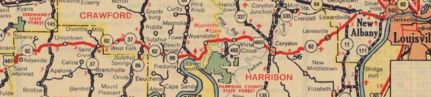
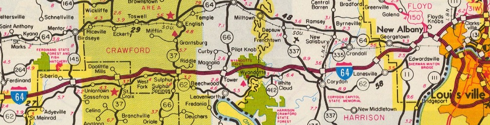
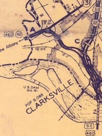
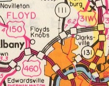
In June 1971 (AASHO), US 460 was placed on I-64 from Edwardsville IN to New Albany IN. The old route is Corydon Pike, then Main St back to I-64 New Albany.
In November 1975 (AASHTO), US 460 west was truncated to the Kentucky-Indiana State Line. In Indiana, US 460 remained IN 66 to Evansville, IN 62 to Jeffersonville (used IN 62 WB through Booneville; Spring St/Browns Station Way), and US 31E (now US 31) to Kentucky
IN 66/62 across southwestern Indiana 1977 Official
IN 62 across southeastern Indiana 1977 Official Illinois/Missouri
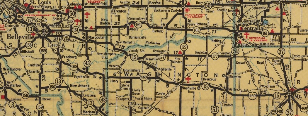
US 460 across western Illinois 1948 Official
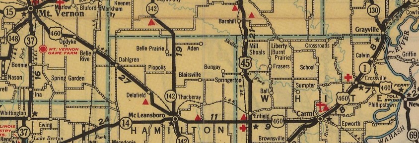
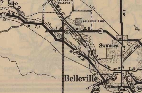
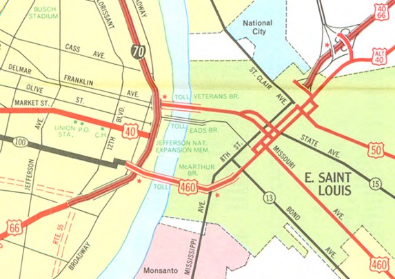
US 460 across eastern Illinois 1948 Official In July 1955 (AASHO), US 40-50 were removed from Macarthur Bridge. In 1959, US 460 was given a new bypass of Belleville IL. The old route remained IL 13.
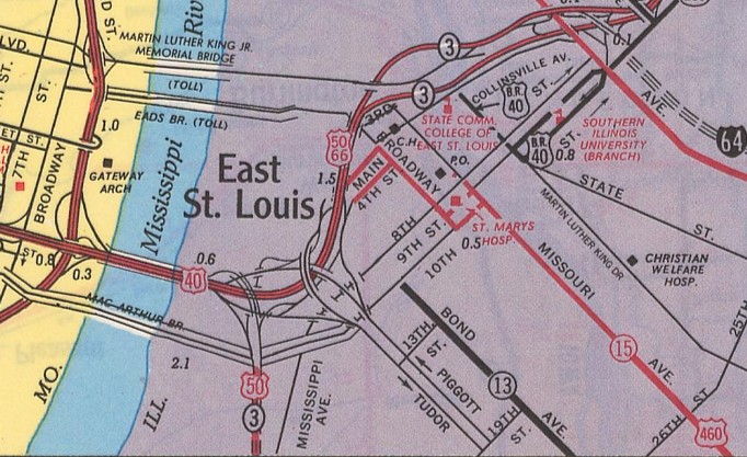
In July 1963 (AASHO), US 67 ALT was removed from 7th St and the Macarthur Bridge, which left US 460 no longer connected to a US route in St. Louis. Between 1960-73, US 460 was removed from Vermont Rd in Ashley IL. About 1973, US 460 was rerouted in E. St. Louis to leave the 9th/10th couplet at Broadway north to a couplet using Main/4th to meet I-55/70, US 40-50-66. Per Missouri's 1975 application to drop US 460, it notes that Illinois' US 460's postings ended here. The old route to the Macarthur Bridge became unnumbered 10th St.
Also about 1973, US 460 was rerouted in Mt Vernon IL to stay on IL 37 10th St south to IL 148, then headed east on Veterans Memorial Dr. The old route used Perkins Ave, Shawnee Ave, and Old Rt 142. In November 1975 (AASHTO), US 460 west was truncated to the Kentucky-Indiana State Line. Missouri noted that their only US 460 postings were at the foot of the Macarthur Bridge. Illinois noted that they would not remove US 460 postings until I-64 was fully finished in Illinois, projected to be in 1977. US 460 became just the unnumbered Macarthur Bridge in Missouri (since closed to auto traffic and demolished in the area of 7th St). In Illinois, US 460 became IL 15 from I-55/70 to Mt Vernon; IL 37 south; IL 142 to McLeansboro; IL 14 to Indiana (bridge over the Wabash River is permanently closed).
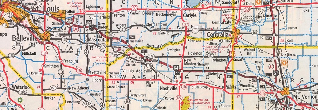
IL 15 across western Illinois 1977 Official
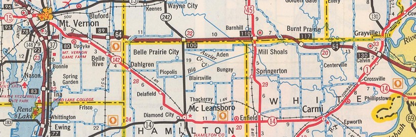
IL 142/14 across eastern Illinois 1977 Official Comments: US 460 is an important corridor from Petesburg VA west to Paintsville KY. I-64 was originally supposed to follow US 460's corridor from Roanoke to Farmville, and Princeton WV to Christiansburg was under study to be I-77's route north of I-81. It is theoretically the corridor for I-73 if it were ever to exist between Roanoke VA and Princeton WV. Previous US 460's:
|
LAST ROUTE LOG (460 #1) US 70: 0 - 0 US 60: 35 - 35 LAST ROUTE LOG (460 #2) US 70: 0 - 0 US 60: 41 - 41 LAST ROUTE LOG (460 #3) US 66, US 85: 0 - 0 US 60: 71 - 71
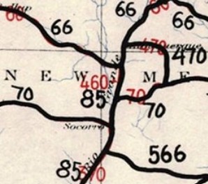
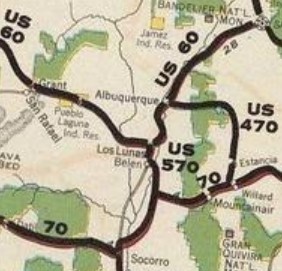
US 460 #1 and #2: The change of US 60 to US 66 while also adding several small US routes that were to be x60 or x66 numbers all at the same time in 1926 produced a bewildering trail of correspondence where letters are dated to take actions that had already been rearranged earlier. The 1925 original plan had US 460 assigned to run from US 60 (now NM 6) Los Lunas NM south to a point on US 70 (now an abandoned route south of present US 60).
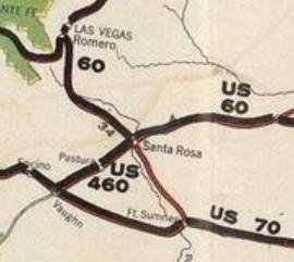
| In January 1926, AASHO approved another short route with no number assigned to run from US 70 (now abandoned alignment between US 285 and the railroad) Vaughn NM to US 66 (now I-40 Bus) Santa Rosa NM. In February 1926, several states requested this Vaughn-Santa Rosa route be a part of a much longer US 54. This was blocked by Cyrus Avery of Oklahoma. In July 1926, AASHO voted to make the Vaughn-Santa Rosa route US 460 and renumber the Los Lunas US 460 as US 570. Although the change from US 60 to US 66 was formally announced in August 1926, July ballots for renumbering the Los Lunas segment were changed to read renumbering US 466 as US 570. So somewhere US 460 #1 got redesignated as US 466 #1. Today this is US 85 from Los Lunas to Belen; NM 304 to Casa Coronado; headed southeast from NM 304 on Benavidez Rd and went straight 1.1 miles (Google maps shows Benavidez Rd wandering south before here). US 460 then bent to ESE for another 1.9 miles to what Google Maps labels as Escobar Pl. Here US 460 turned SSE in a straight line 2.6 miles to what Google Maps label as Verde Ave. US 460 then headed just slightly west of due south into Socorro County for a total of about a mile. US 460 headed SW to cross an arroyo for 0.3 miles to nearly what Google Maps labels as Pedro Place, then headed SSE in a straight line, crossing US 60 after 5 miles and after 0.4 more miles, then turns due south for 2.9 miles to where the road bends southwest again. Here is where it intersected then-US 70, which came from the northeast and continued southwest to Sorocco. After leaving Benavidez Rd, the only part of US 460 that appears truly drivable is the part south of US 60 (Luna Rd) which is gated off as private property. 95% of US 460's route southeast of Casa Colorado is still discernible on current satellite views.
In late August, AASHO notified New Mexico that the US 60-66 change necessitated renumbering x60 routes as x66. Therefore, the Vaughn-Santa Rosa segment was renumbered from US 460 #2 to US 466 #2. Today this is abandoned routing running 2800 ft northeast to the current US 54-60 junction; abandoned routing east of US 54 for 6.3 miles that bows eastward up to about a mile before joining US 54; followed US 54 for about 8.7 miles; abandoned alignment along the RR, using Aragon/1st St through Pastura; abandoned along the RR to where the RR turns north towards Arabella then abandoned northeast about 2.5 miles to cross US 54 and curl alongside the east to about Gavilan Rd; US 54 to Santa Rosa.
US 460 #3: When it became clear that US 60 was replacing the original routing of US 70 across New Mexico, the highway department asked AASHO in December 1930 if US 470 from Willard NM to Albuquerque was going to become US 460. However, in July 1931, AASHO renumbered it to US 366 instead. Today it is NM 41 through Estancia to about Alan Ayers Blvd; Salt Mission Tr/Old NM 41 east of the former RR to Moriarty; 4th St in Moriarty which no longer connects back to NM 41; NM 41 to I-40 Bus. Here is where it gets tricky, as the original routing was stair step routing and there are multiple possibiliies here. Best guess: I-40 Bus which does not connect to Green Rd north, Thomson Rd west, Martin Rd north, Dinkle Rd west. West of Barton, US 460 would have used Sedillo Rd until it meets NM 333 east of Zuzax, then used North Zamora Rd on the other side of I-40 for about 2.3 miles; South Zamora Rd below I-40 to its NM 333 junction; I-40 ROW to about NM 14; NM 333 to just past the NM 337 interchange; I-40 ROW to the next big curve; NM 333 to about Exit 170 (except Atanacio Rd); mostly I-40 ROW to Exit 167; Central Ave into Albuquerque. | ||||||||||||||||||||||||||||||||||||||||||||||||||||||||||||||||||||||||


Previous: US 450 | Next: US 466
US 460 ALT | US 460 Bus | US 460 Byp | US 460 Temp | US 460-Y
US 60 | US 160 | US 260 | US 360 | US 560 | US 660
US 460 at US Ends.com
Page last modified 3 April 2026