<US 350 | Home | US 366 >
US 360 ALT | US 360 Bus | US 360-Y
US 60 | US 160 | US 260 | US 460 | US 560 | US 660
US 360 at US Ends.com
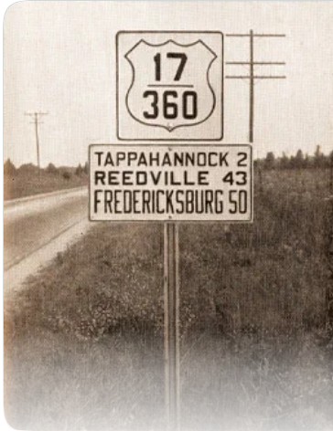
Photo: US 17-360 heading for Tappahannock VA (VDOT, 1946)
|
|
|
| ROUTE LOG |
US 58 Bus WB: 0 - 0 US 29, US 58 WB, US 58 Bus END: 1.7 - 1.7 US 501: 28.0 - 29.7 US 58 EB: 0.7 - 30.4 US 15 SB: 22.6 - 53.0 US 15 Bus, US 360 Bus Ontario: 10.5 - 63.5 US 15 Bus, US 360 Bus Keysville: 1.4 - 64.9 US 15 NB, US 360 Bus: 4.0 - 68.9 US 360 Bus Burkeville, US 460 WB, US 460 Bus: 17.2 - 86.1 US 360 Bus, US 460 Bus: 1.4 - 85.5 US 460 EB: 0.5 - 86.0 US 360 Bus Amelia: 15.6 - 101.6 US 360 Bus: 2.0 - 103.6 US 360 Bus: 0.8 - 104.4 US 1, US 301: 32.2 - 136.6 US 60 WB: 1.6 - 138.2 US 60 EB: 0.3 - 138.5 US 250: 0.3 - 138.8 I-64 (Exit 192): 2.0 - 140.8 US 360 Bus Mechanicsville: 3.5 - 144.3 US 360 Bus Grundy: 0.8 - 145.1 I-295 (Exit 37): 0.4 - 145.5 US 17 SB: 35.7 - 181.2 US 17 NB: 2.5 - 183.7 SR 644: 39.1 - 222.8
|
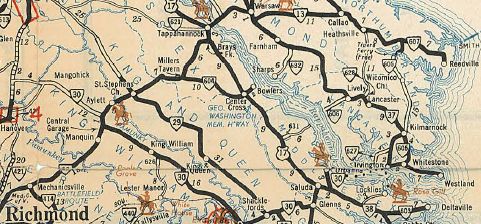
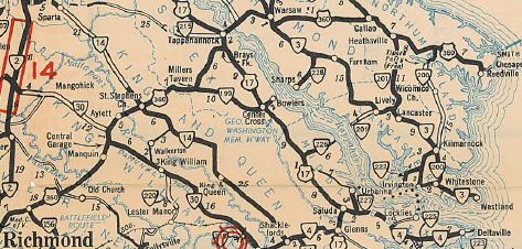
Creation: Appeared in May 1933 (AASHO), running from Danville to Reedville via Halifax, Burkeville,
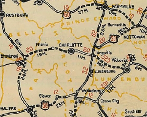
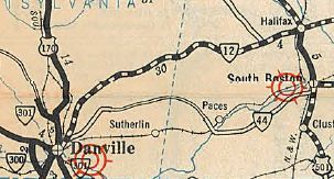
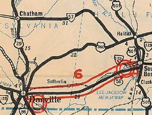
Richmond and Tappahannock. This is the 2nd attempt at US 360. In this routing, US 360 replaced: VA 12 from Danville to Halifax; US 501 from Halifax to Burkeville; US 60 from Burkeville to Richmond; VA 13 from Richmond to Callao; VA 607 from Callao to Reedville.
|
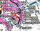
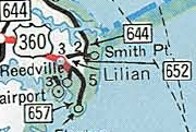
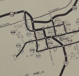
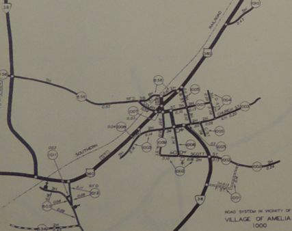
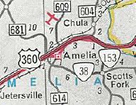
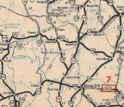
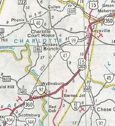
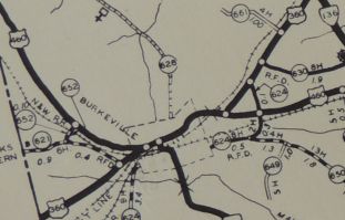
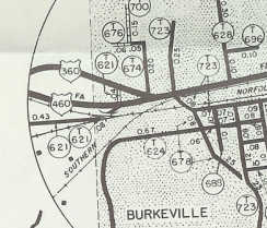
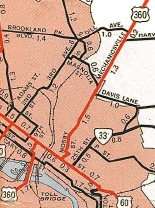
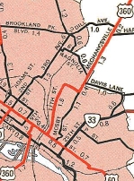
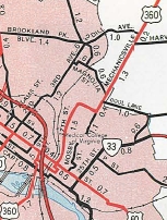
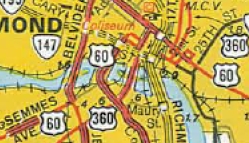
Note that Virginia had applied for this corridor as US 33 first, after originally in the 1933 draft log slating US 221 to cover the portion from Burkeville to Reedville and VA 40 from Burkeville to Danville. Adjustments: Not long after 1933, US 360 was removed from SR 713 in the VA 47 area. About 1936, US 360 was removed from SR 701 between Simplicity and Meherrin. In 1939, US 360 was routed fully on current US 360 Business through Amelia, leaving behind SR 656. In July 1939 (CTB), it appears US 360 was removed from SR 694 Avalon and SR 695 Blantons Corner east of Heathsville. In August 1941 (CTB), it appears US 360 was removed from SR 646/702 in Lilian and SR 652/703 in Beverleyville. In September 1948 (CTB), it appears US 360 was removed from SR 726 at the northern end of Reedville. In 1949, US 360 was rerouted in eastern Richmond to leave Broad St north on 17th St to Fairfield Ave east to Mechanicsville Tpk instead of using 21st and Mosby St. In 1951 (bridge date), US 360 was removed from SR 621 west of Burkeville. For a time, US 360 crossed over US 460 (on today's SR 716) without intersecting and they met at today's SR 716/US 360-460 Business split. In May 1954 (CTB), US 360 east was truncated 0.43 miles from the Reedville waterfront to its current end at SR 644 leaving behind an extended SR 644.
In March 1956 (CTB), US 360 was rerouted in Richmond on 14th to head -east- on Main St over to 18th, then north to Grace St for one block west, then north on 17th across Broad and so on. Before, it used Main St -west- to 13th St north to Broad St. In the late 1950s, US 360 was removed from SR 622 south of Ontario. It appears that in Nov 1957 (CTB), US 360 was removed from SR 661 through Manquin and SR 662 through Central Garage. Around that time US 360 was also removed from SR 649 in Warsaw. In August 1958 (CTB), US 360 was removed from SR 671 through Jetersville and SR 697 through Maplewood. About 1962, US 360 was removed from SR 728 and the SR 630 loop at Meherrin In October 1966 (CTB), US 15-360 was given its bypass of Ontario and Keysville, leaving behind US 15-360 Business. Also in October 1966 (CTB), US 360 was placed on its northern bypass of Amelia CH. leaving behind US 360 Business and Goodes Bridge Rd.
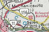
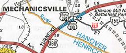
Also around 1966, US 360 was removed from Mt. Olive Ln and SR 698 through eastern Amelia County. In September 1968 (CTB), US 360 was placed on its southern Mechanicsville bypass, leaving behind US 360 Business.
In November 1968 (CTB), US 360 was placed on its current routing bypassing Clover and Barnes Corner, leaving behind an extended VA 92 and US 15.
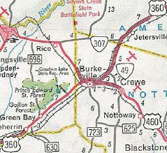
In Nov 1969 (CTB), US 360 was placed on its northern bypass of Burkeville leaving behind US 360-460 Business.
In 1975, US 360 was placed on one-way splits in eastern Richmond, using 17th WB and 18th EB between Grace St and near Fairfield St.
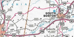
In November 1976 (CTB), US 360 was removed from SR 697 through Indian Field. In September 1982 (CTB), US 360 was rerouted to run to Danville via South Boston instead of Halifax. This was accomplished by replacing VA 304 and duplexing with US 58 west of South Boston. Virginia requested to AASHTO that the old path via Halifax be labeled as US 360 ALT but for unknown reasons was denied. The old route through Halifax became VA 360 instead.
Comments: US 360 is an important corridor from Danville to Richmond. US 360 should be extended southwest, replacing US 311 to Winston-Salem NC. Previous US 360's:
|
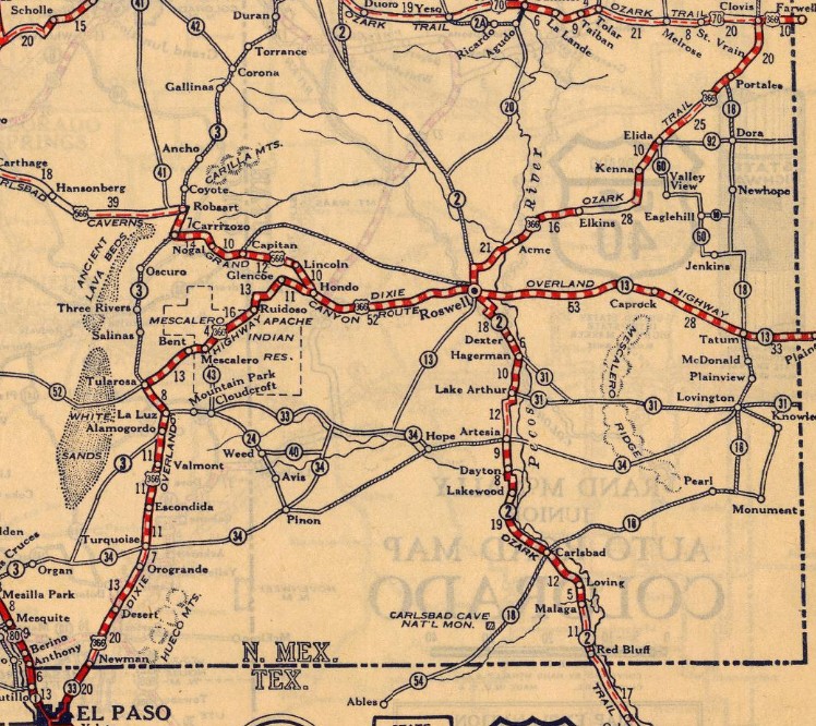
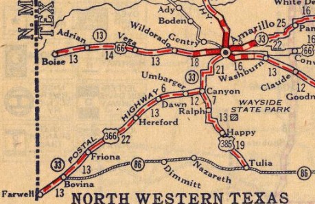
US 360 #1: Appeared in the 1925 plan for the US Highways, running from US 80 (now TX 20) El Paso TX to US 66 (now 6th Ave) Amarillo TX.
| In August 1926, as part of renumbering US 60 as US 66, US 360 was renumbered to US 366. Today the routing is Piedras St, Pershing Dr and Dyer St out of central El Paso (US 360 might have followed current TX 20 to Mesa Dr); US 54 Bus into New Mexico; US 54, then US 54 Bus into to Alamogordo NM; 10th St east, then Florida Ave/La Luz Rd through La Luz; Main St, Laborcita Canyon Rd, then Appler Rd 1.8 miles to its apparent end; abandoned northwest 4.7 miles along the same line as Appler Rd; US 54-70 into Tularosa US 360 used Higuera Ave/Old Mescalero Rd out of Tularosa; at the sharp curve left, US 360 continued east as abandoned for about 700 ft, then north abandoned just across US 70, then east abandoned 1200 ft back to US 70; 0.2 miles east of CR B014, abandoned flat loop north of US 70 for about 0.7 miles; at River Front Rd, abandoned northeast 0.6 miles/Bridal Falls Ln/Cottonwood Spring Rd to where it turns south; abandoned ENE 0.5 miles back to US 70; after 0.4 miles, abandoned loop north of US 70 through Tularosa Falls Campground to about Virden Rd; after 0.3 miles, two short abandoned loops in succession north of US 70; a bit past MM 236, abandoned northeast/Cabeza de Vasquez Tr/Santa Barbara Tr/abandoned/Round Mountain Rd to Bent; Mauer Dr, Kidd Dr, then from the horseshoe curve abandoned northeast back to US 70. US 360 used Old Rd west of Mescalero; Lipan Ave through Mescalero; abandoned loop west centered around Botello Rd; Service Ln at Ruidoso Downs; abandoned loop east centered around Allison Canyon Rd; abandoned loop north just east of the River Ranch RV Park that crosses back under US 70 and uses the parallel paved driveway; short abandoned secant at the next curve; lenghty Buckhorn Loop, then just before rejoining present US 70, US 366 used private/abandoned road across Ruidoso Rio, connecting to CR E004 Tully Ln; CR E005 Perry Spring Tr which becomes private road to Glencoe; Glencoe Loop/abandoned on north side of US 70 to just past CR E009, then dropping south as an abandoned rounded square root shape back to US 70 about a mile east of CR 009; Gomez Loop; Nosker Ln; Don Maricio Loop; Flores Canyon Tr; Calle de Cipriana which used to continue abandoned southeast to roughly Aristad/El Valle Loop intersection; El Valle Loop east back to US 70; abandoned/White Cat Rd/abandoned through San Patricio; Old Schoolhouse Rd west of Hondo; abandoned/Fritz Spring Rd, plus US 380 through Hondo. Starting 7.5 miles east of the Picacho Post Office, US 366 used abandoned south loop 0.5 miles, then 0.3 miles later, south abandonded loop 1 mile, then north abandoned loop for 0.9 miles, then south abandoned loop for 2.5 miles to meet 380 0.8 miles west of Borderhill Rd; abandoned south loop starting 0.5 miles east of the county line for 2 miles back to 380 at Mossman Rd; abandoned from the WB Weigh Station 3.3 miles to where it tied back in, now an abandoned alignment about 1.3 miles west of Larkspur Rd. US 366 used the abandoned S loop in the Blackwater Draw area west of Roswell NM Out of Roswell, US 360 used Barrendo Rd east to Railroad Rd northeast. At Pine Lodge Rd, Railroad Rd becomes a primitive dirt road. after 2.2 miles, abandoned north 0.1 mile, then abandoned northeast 1.2 miles, then Old Clovis Hwy until current US 70, then crosses over as abandoned alignment that closely parallels US 70 for 2.5 miles before melding back in with US 70; 0.8 miles later, abandoned south parallel to just past Magdalena Rd, then crosses over US 70 abandoned 0.9 miles, then abandoned 4.7 miles paralleling US 70, nearly meeting it again just past Ponderosa Rd before heading abandoned northeast 1.2 miles, the abandoned ENE 1.1 miles back to US 70 at Alcalda Rd. US 360 used Railroad Mountain Rd east and north through Kenna to 0.9 miles; abandoned northeast 0.8 miles; abandoned north 5.3 miles; CR 22 east to Elida; abandoned along east side of railroad out to US 70; US 360 used US 70 eastbound through central Portales; abandoned 2 miles northeast beginning 2.7 miles east of NM 202, then north abandoned a mile back to US 70. US 360 used Brady Rd/CR 9 east out of Clovis, then US 70-84 to Farwell TX, then FM 292; Railroad St/abandoned/Edwards Rd/abandoned along the east side of the railroad all the way to Bovina; North St; Railroad Rd out of Bovina/abandoned along east of railroad/CR 1 Railroad Rd/abandoned along east of railroad through Friona, continuing to Black/abandoned or unnamed dirt roads along the south of the railroad to nearly Hereford; De Los Santos St/abandoned; US 385 into Hereford; US 60 to Umbarger; FM 168 north; FM 1062 east; US 60 then the US 60 EB frontage road; TX 217 (11th St then 4th Ave) and US 87 (23rd St) through and north of Canyon. US 360 used the I-27 ROW up to just past S. Georgia St in southern Amarillo; NB frontage road to S. Van Buren St (except a wider arc centered around Parker St); 36th Ave; Fillmore St to then-US 66 (6th St).
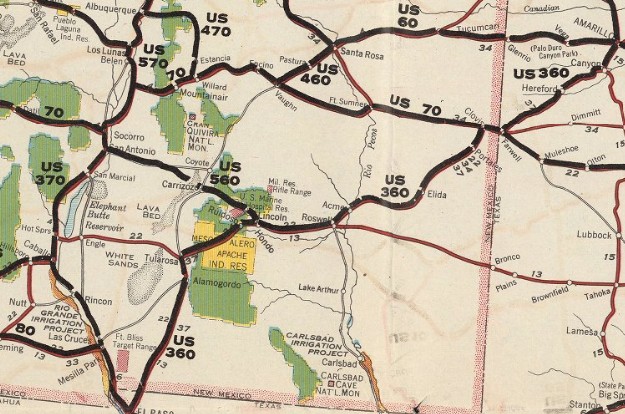 1926 AASHO
| ||||||||||||||||||||||||||||||


 Danville, VA
 Reedville, VA
Previous: US 350 | Next: US 366
US 360 ALT | US 360 Bus | US 360-Y
US 60 | US 160 | US 260 | US 460 | US 560 | US 660
US 360 at US Ends.com
Page last modified 21 August 2026