< VA 16 | Home | VA 18 >
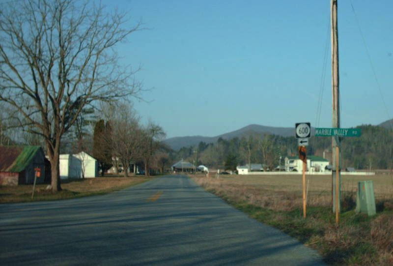
Photo: The oldest alignment of original VA 17 in Deerfield (photo by Mapmikey 3/14/08)
| U.S. 17 |
| VA 17 not currently assigned | |||||||||
| Previous VA 17's: 1932 ROUTE LOG US 11, VA 33: 0 - 0 VA 215: 21 - 21 US 60 WB, VA 14 WB: 16 - 37 US 60 EB, VA 14 EB: 4 - 41 VA 804Y: 19 - 60 VA 805Y: 8 - 68 VA 810: 22 - 90 VA 39 EB: 5 - 95 VA 39 WB: 1 - 96 VA 840: 3 - 99 VA 830: 4 - 103 VA 812: 3 - 106 VA 838: 5 - 111 VA 813: 4 - 115 VA 814: 5 - 120 US 11, VA 33: 3 blocks - 120 VA 807: 1 - 121 VA 809: 9 - 130 VA 815: 9 - 139 VA 704 WB: 14 - 153 VA 704 EB: 2 - 155 VA 719: 1 - 156 US 29 SB, VA 28 SB: 5 - 161 US 29 NB, VA 28 NB: 1 - 162 US 15, VA 32, VA 701: 12 - 173
|
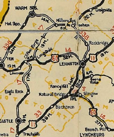
VA 17 #1: Began in January 1918 as an original state route defined by the general assembly: Route 17: Gordonsville, Standardsville [sic], Elkton, Harrisonburg, Moscow, Deerfield, Warm Springs, Hot Springs, Covington
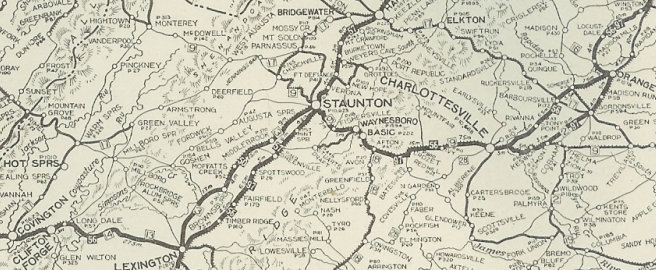
VA 17 #1 from Covington to Gordonsville via Deerfield 1922 Auto Trails In Dec 1921 (CTB), VA 17 was rerouted at Parnassus to instead follow VA 42 through Churchville and BUffalo Gap to Goshen except: SR 811 in the Augusta Springs Area; SR 687 through Craigsville; Jeff Gordon's Lane; Lebanon Circle; SR 616 Hunter Crossing Rd; abandoned RR crossing to SR 746 Paxton Ln; VA 39; and VA 39 ALT. VA 17 then followed SR 1001 to VA 39 west to Bath Alum to pick back up the original VA 17 routing. The old route became: CR 27 from Parnassus to Jennings Gap; VA 9 remained from Jennings Gap to West Augusta; CRs 5 and 12 south to VA 39 (some of this was VA 272 for a time later). In Dec 1921 (CTB), VA 17 was rerouted away from Deerfield and instead was routed via Craigsville and Goshen. Churchville to West August remained part of VA 9 while south through Deerfield became secondary, though later was part of VA 272.
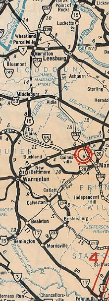
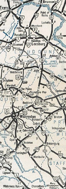
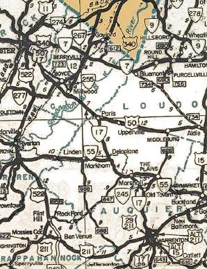
In March 1927 (CTB), the gap in VA 17 at the Alleghany/Bath line was put into the state highway system. It appears that by 1928, VA 17 was removed from SR 687 through Craigsville. About 1931, VA 17 was placed on modern US 33 in Quinque. In July 1932 (CTB), VA 17 was placed on modern VA 42 through the Goshen area and also removed off of SR 616. Around the time of the 1933 renumbering, VA 17 was put on a new James River Bridge into Eagle Rock (SR 870 location) and onto modern VA 43 north out of town. In July 1933, VA 17 was renumbered as VA 12 from Troutville to Clifton Forge; US 60 remained from Clifton Forge to Longdale; VA 42 from Longdale to Harrisonburg; VA 4 from Harrisonburg to Gordonsville. VA 17 #2: Appeared in July 1933 as a renumbering of VA 38 from US 1 (now SR 607) Falmouth to US 15-29 Opal. In Oct 1940 (CTB), VA 17 was extended north with US 15-29 to Warrenton, then followed US 15 to The Plains. A second segment of VA 17 was created running from MD 17 at Brunswick, MD south to Purcellville, then after a brief duplex with VA 7, south another mile along current SR 690. This separated piece was a renumbering of the northern piece of VA 234. In Jan 1943 (CTB), VA 17 was removed from SR 607 (now SR 1001) in Falmouth and placed on today's US 17 Business. In April 1944 (CTB), the northern disconnected piece of VA 17 was renumbered as VA 287 from Purcellville to Brunswick MD (this is now SR 722 in Purcellville) and downgraded to SR 690 south of Purcellville. Also in April 1944, the remaining VA 17 was rerouted at Old Tavern to instead replace VA 245 to Marshall, duplex west with VA 55 to nearly Delaplane, then replace SR 710 north to Paris, then follow US 50 to end at US 11 Winchester. The old route from Old Tavern to The Plains became current VA 245. In March 1946 (CTB), VA 17 was removed from SR 656/805 through Bealeton and placed on current US 17. In April 1951 (CTB), VA 17 was removed from SR 700 McWhirt Loop, SR 750 Fleet Rd, and SR 746 Peach Lawn Rd (all 3 were SR 700 at that time) in the Berea area of Stafford County; also VA 17 was removed from SR 704 Burton Loop, SR 705 Hartwood Church Rd, and SR 706 Marsh Rd in the Hartwood area. In all cases VA 17 was moved to today's US 17. In March 1953 (CTB), VA 17 was removed from SR 813 in Goldvein and placed on current US 17. In Jan 1957 (CTB), VA 17 was moved from SR 701 to today's US 17 at Paris. In Jan 1959 (CTB), VA 17 was removed from Delaplane Grade Rd/Rokeby Rd horseshoe at Delaplane, plus nearby Crooked Run Rd, and place on current US 17. In Sept 1963 (CTB), VA 17 was removed from SR 835 Morrisville Rd and SR 836 Harpers Run Rd north of Morrisville and placed on current US 17. In March 1964 (CTB), VA 17 was removed from SR 837/663 Bowers Run Rd/Old Marsh Rd north of Bealeton and placed on current US 17. In Oct 1964 (CTB), VA 17 was removed from SR 840 Baines Corner Rd and SR 841 Elk Marsh Rd near Bealesville and placed on today's US 17. In 1965, VA 17 became part of US 17. Note that VA 17 used SR VA 245/SR 845 in Old Tavern and F185 north of Marshall.
| ||||||||
Previous: VA 16 |
Next: VA 18
Top | Virginia Hwy Index
Home
Page last modified 15 June 2013