< VA 15 | Home | VA 17 >
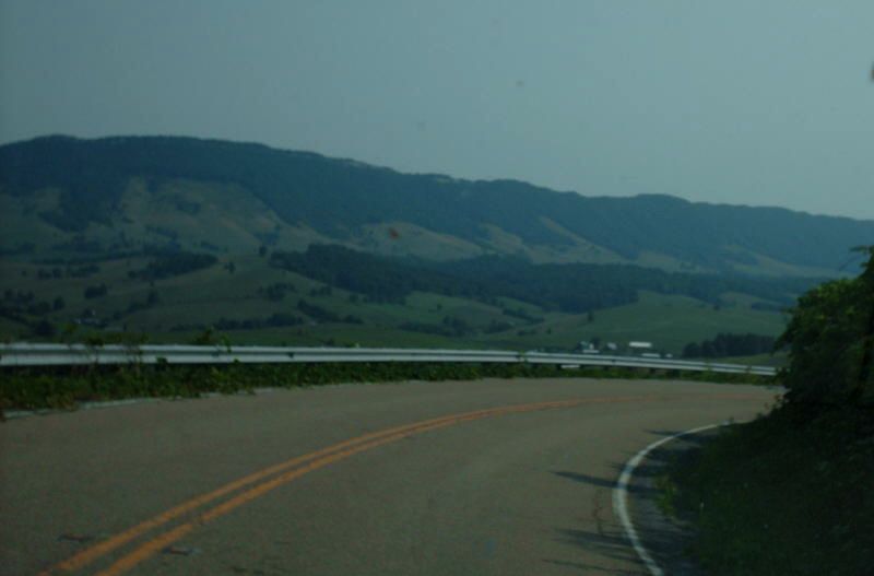
Photo: VA 16 descending into Thompson Valley near Tazewell (photo by Mapmikey 8/18/07)
|
|
|
|
| ROUTE LOG |
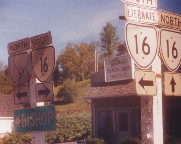
NC STATE LINE: 0 - 0 US 58 EB: 4.06 - 4.06 US 58 WB: 3.99 - 8.05 Smyth-Grayson Line: 8.79 - 16.84 I-81 (exit 45): 15.36 - 32.20 VA 217: 0.05 - 32.25 US 11 SB: 0.68 - 32.93 US 11 NB: 1.19 - 34.09 VA 348: 3.79 - 37.88 VA 42 SB: 9.43 - 47.31 VA 42 NB: 0.32 - 47.63 Tazewell-Smyth Line: 2.96 - 50.59 US 19 Bus SB, US 460 Bus WB: 13.06 - 63.65 VA 16 ALT: 1.75 - 65.40 US 19 Bus NB, US 460 Bus EB: 1.25 - 66.65 US 19, US 460: 0.83 - 67.48 VA 61: 0.44 - 67.92 VA 16 ALT: 1.30 - 68.22 WV STATE LINE: 8.38 - 74.60
|
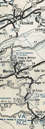
Creation: Appeared Oct 1940 as a renumbering of VA 92 from the NC Line to Mouth of Wilson; and addition to US 58 from Mouth of Wilson to Volney; VA 88 from Volney through Marion to a point 2.15 miles into Tazewell County. A second piece replaced more of VA 88 from the WV Line south through Tazewell to end at SR 601 Criggers. This is the 2nd VA 16.
| Adjustments: In April 1944 (CTB), VA 16 was removed from today's SR 700 north out of Marion and placed on its present routing to the east which supplanted parts of SR 617 and SR 618. In March 1946 (CTB), VA 16 was removed from the SR 711 and SR 712 loops southeast of Marion. In 1949, the two pieces of VA 16 were connected in southern Tazewell County. In Aug 1958 (CTB), VA 16 was removed from SRs 603/837 in Troutdale. Also about 1958, VA 16 was removed from SR 858 at the North Carolina line. In the mid-1970s, VA 16 was removed from Carline Ave in Tazewell to provide access to the new US 19-460 bypass of Tazewell.
Improvements: Fully paved upon designation from NC to VA 348; entire northern piece except small section at southern end. In 1951, VA 16 was paved from VA 42 to Tazewell SR 601. In 1953, VA 16 became fully paved. No VDOT maps show this, but VA 16 has been multilaned from I-81 north to its split with US 11 NB back to at least 1991. Posted: Fully posted; VA 16 was full of cutouts throughout in the early 90s. Cutouts remained in Tazewell and North Tazewell as of fall 2012; A couple Marion cutouts were still present as of fall 2008 Error US 16 shields have existed in Marion back to at least 1991. Cutout US 16 shield with US 11 back then and a US 16 shield in modern times. Multiplexes: US 58 (3.99 mi) US 11 (1.19 mi) VA 42 (0.32 mi) US 19 Bus, US 460 Bus (3.00 mi) Legislative names: BF Buchanan Highway (3-29-34 designation predates VA 16), from US 58 to US 19-460 Bus Other names: Jefferson Hwy (NC Line to US 58); Troutdale Hwy (Mouth of Wilson to Smyth Line); Sugar Grove Hwy (Smyth Co s of Marion); Commerce St/Main St (Marion); Park Blvd (US 11 to VA 42); Main St/Fincastle Tpk/Tazewell Ave (Tazewell); Riverside Dr (North Tazewell); Stoney Ridge Rd (VA 16 ALT to WV). Scenic Byway: SR 601 Sugar Grove to US 19 Tazewell (since 1/20/00); Mathews CH to SR 600 (4/20/2000) Comment: VA 16 is an epic three-state highway which very nearly goes through 5 states. It begins in St. Marys, WV near a bridge which Ohio has unfortunately chosen to number OH 807. From there it goes to the bottom of West Virginia, nipping the western part of Virginia, before entering North Carolina. It heads down through Charlotte before ending a couple miles from the SC line. None of the 3 states had this road numbered 16 at the state lines in 1940 (WV 12, VA 81, VA 92, NC 681), so some coordination took place to get this thing numbered as one route. One thought that occurred to me is that MSR 16 would be a natural extension for US 521, not that I really want 3-state 16 to disappear... VA 16 north of Hungry Mother State Park into Tazewell County is one of the most harrowing drives in Virginia. I have driven this northbound. There are numerous blind curves around rock outcroppings with little or no railing on the outside edge of the road. It is the only road I've ever driven where I was scared to take pictures while driving. Trucks are prohibited north of VA 348 and with good reason. It is not possible for a semi to stay in the correct travel lane and would be a nasty surprise for an oncoming driver around a blind curve. On the other hand, most of VA 16 is quite scenic. | Previous VA 16's:
1940 ROUTE LOG US 60: 0 - 0 VA 45 NB: 13 - 13 VA 45 SB: 1 - 14 VA 6: 12 - 26 END VA 16: 12 - 38 GAP IN ROUTE US 250: 0 - 38 US 33: 10 - 48 Orange-Louisa Line: 11 - 59 GAP IN ROUTE US 15: 0 - 59 VA 231 SB: 9 - 68 US 29 SB, VA 230 WB: 2 - 70 VA 230 EB: 0.5 - 70.5 US 29 NB: 0.5 - 71 VA 231 NB: 5 - 76 VA 232: 8 - 84 VA 246: 3 - 87 VA 3: 5 - 92 |
VA 16 #1: Began in January 1918 as an original state route defined by the general assembly:
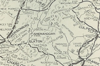
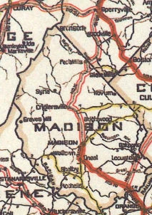
Route 16: Orange, Madison, Stanley, Luray, New Market
This is how VA 16 ran:
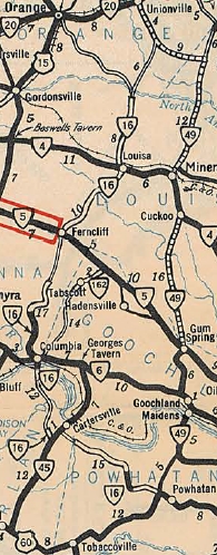
In Oct 1934 (CTB), VA 16 Piece 1 south was truncated to US 60 west of Powhatan, leaving behind SR 601.
| ||||||||||
|
|
|
| ROUTE LOG |
US 19 Bus, US 460 Bus, VA 16: 0 - 0 US 19, US 460: 0.88 - 0.88 VA 16: 0.73 - 1.61
|
|
| |||||||

Previous: VA 15 |
Next: VA 17
Top | Virginia Hwy Index
Home
Page last modified 3 June 2013