< VA 33 | Home | VA 35 >
VA 34Y
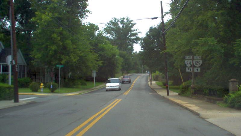
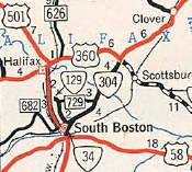
Photo: Approaching VA 34 from VA 129 (photo by Mapmikey 7/22/06)
|
|
|
| ROUTE LOG |
VA 129: 0 - 0 US 360: 0.54 - 0.54
|
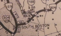
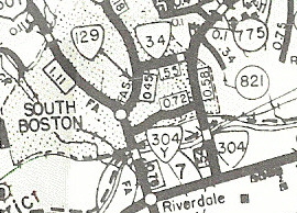
| Creation: Appeared in May 1952 (CTB) as a renumbering of a piece of VA 304 running as it does now. This is the 4th VA 34. Adjustments: None Improvements: Paved upon its inception; no multilane segments Posted: Fully posted; Multiplexes: None Legislative names: None Other names: Hodges St Scenic Byway: No segments Comment: VA 34 is a simple connector from US 360 to central South Boston, but when this was VA 304 this was how you headed to Richmond from South Boston. VA 34 did not appear on Official maps until 1986 but it was shown in the county atlases all along.
| Previous VA 34's:
1932 ROUTE LOG BEGIN US 13, BEGIN VA 34: 0 - 0 VA 525: 4 - 4 VA 524: 5 - 9 VA 527: 8 - 17 VA 537 EB: 5.5 - 22.5 VA 522, VA 537 WB: 0.5 - 23 VA 526: 1 - 24 VA 530: 4 - 28 VA 523: 2 - 30 VA 540: 5 - 35 VA 522: 1 - 36 VA 548: 2 - 38 VA 521: 4 - 42 VA 531: 5 - 47 VA 520: 10 - 57 MD STATE LINE: 5 - 62 1940 ROUTE LOG VA 40: 0 - 0 VA 136: 4 - 4 VA 137 NB: 8 - 12 VA 137 SB: 4 - 16 US 1 NB: 1.5 - 17.5 US 1 SB: 0.5 - 18 US 58 EB: 7 - 25 US 58 WB: 1 - 26 NC STATE LINE: 19 - 45 1952 ROUTE LOG US 58: 0 - 0 VA 34Y: 0.54 - 0.54 VA 304: 0.58 - 1.12 |
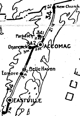
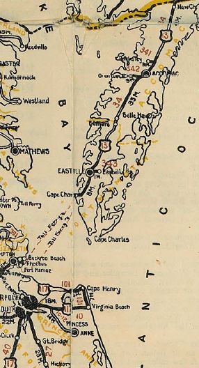
VA 34 #1: Appeared in 1923 as a renumbering of VA 4, running from Cape Charles up the Eastern Shore to the Maryland State Line above New Church.
If VA 34 ever used SR 710 just south of the Maryland Line, it stopped doing so by 1926. In late 1926, US 13 was added to the entirety of VA 34. In April 1928 (CTB), VA 34 was officially designated to follow today's US 13/13 Bus from Sunnyside to Exmore instead of the original routing using today's SR 618, SR 622 to Bridgertown, SR 619, then SR 618 to Franktown and Exmore. In 1930, VA 34 was rerouted to avoid Belle Haven by replacing VA 526 from Exmore to Belle Haven Station. The old route via Belle Haven became parts of VA 522 and a second VA 526 (now VA 178 and VA 181). In July 1933, VA 34 was dropped from US 13.
No map I have including the 1932 Northampton County map clearly shows where VA 34 ended in Cape Charles or if the ending moved. However, I have discovered 2 newspaper articles that establish where US 13/VA 34 ran: Randolph to Pine south to Mason, where the original ferry terminal to Little Creek was. The 1924 article shows it started out this way.
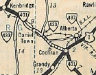
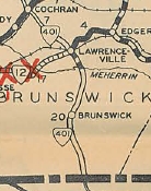
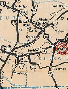
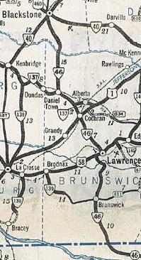
VA 34 #2: Appeared in July 1933 as a renumbering of VA 401, running from VA 48 (now VA 40) Kenbridge southeast through Dundas and Brunswick before entering North Carolina below Valentines. VA 34 initially followed today's VA 46 from the NC Line north, using SR 768 loop near the state line and the SR 767 and SR 766 loops above Brunswick. VA 401 then cut east on SR 715 over the Gholson Bridge over the Meherrin River, back around to VA 46. The route followed VA 46 to Cochran, then US 1 north, then SR 758 which is cutoff by I-85. The route picks up VA 46 again. Just north of SR 652, VA 401 crossed the RR and stayed north of it (no longer public road) all the way to SR 644, then went north to SR 643 then west to SR 729 over to Danieltown. VA 401 then crossed VA 46 to stay on SR 729 which no longer connects to VA 137. VA 401 picked up VA 137 through Dundas, then used SR 616 south across the RR, then northwest on what is not a public road back to VA 137. VA 401 then followed VA 137 to VA 40 in Kenbridge. About 1935, VA 34 was rebuilt to eliminate one of the RR crossings west of Dundas, making VA 34 follow today's VA 137 throughout. Also around 1935, VA 34 was rerouted to cross the railroad at Danieltown via today's SR 729 and used today's VA 46 southeast instead. In Oct 1940 (CTB), VA 34 was renumbered as VA 137 from Kenbridge to Danieltown and VA 46 from Danieltown to North Carolina.
VA 34 #3: The March 1942 (CTB) approved a bypass of South Boston involving Bank St east to today's US 360 then north to today's VA 34 (then-VA 304). It is possible this was designated as VA 34 VA 34 appeared explicitly in Sept 1948 (CTB) as the designation for a new Dan River Bridge east of South Boston. VA 34 would therefore run from US 58 to VA 304 (now today's VA 34) Hodges Street. I presume at this time Bank Street then became VA 34Y. The bridge opened about 1952 and in May 1952 (CTB), VA 34 was renumbered as VA 304. Today it is part of US 360. This VA 34 appeared explicitly on the 1952 Official.
|
|||||||||||||||||
Previous: VA 33 |
Next: VA 35
VA 34Y
Top | Virginia Hwy Index
Home
Page last modified 23 June 2026