VA 341 to 360
< VA 321 to 340 | Home | VA 361 to 380 >
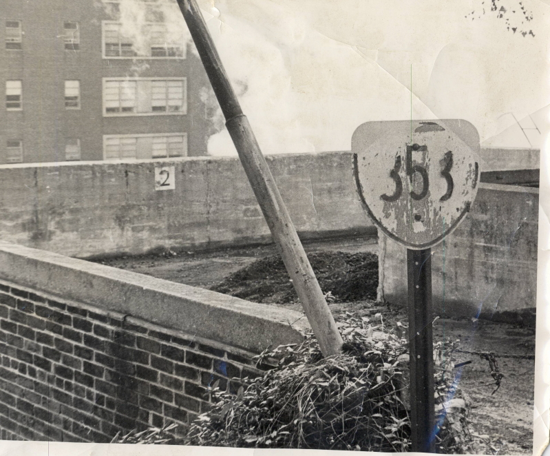
Virginia State Police Radio Station, Appomattox (Appomattox County)
Total Length:  0.20 mile  

Creation:  Appeared in 1941 (see scan below). This is the 2nd VA 341.
Adjustments:  None
Posting:  One shield in each direction on SR 613. If you are very observant you can see one from US 460.
Comments:  3 driveways off SR 613 west of Appomattox; VA 341 appears on VDOT Official State maps from 1941 to at least 1953 or 1954.
VA 341 #2
Previous VA 341's: VA 341 #1: Appeared in 1923. Ran from VA 34 (curr US 13) west to Parksley. In 1929 this was renumbered as VA 521. Today it is VA 176.
Virginia State Police Radio Station, Brandy Station (Culpeper County)
Total length:  0.16 mile  
ROUTE LOG
SR 762: 0 - 0
END VA 342: 0.16 - 0.16
Creation:  Appeared in 1941. This is the 3rd VA 342.
Adjustments:  None
Posting:  White rectangle at SR 762
Comment:  Used to connect to US 15-29 (curr SR 762); Is on 1941 VDOT official map but no others.
VA 342 #3
Previous VA 342's: VA 342 #1:  Appeared in 1923. Ran from VA 34 (curr SR 718) Onancock west to Cashville. This was denumbered by 1927. Today this is SR 638. If this is not a misprint on the 1923 map, this is the first state route to be permanently downgraded.
VA 342 #2:  Shown on 1927-28 maps - ran from US 13-VA 34 Onley west to Onancock, then south to Pungoteague. This replaced what had been the original VA 34 routing. In 1929 this was renumbered as VA 522. Today it is part of VA 179 and SR 718.
VA 342 #2 (1928)
Seashore (First Landing) State Park, City of Virginia Beach
Total Length:  6.99 miles

Creation:  Implied to have appeared in 1941 (shown as a state route, but not numbered). Consisted of only the southern (64th St) part of the park. This is the 2nd VA 343.
Adjustments:  By 1944, the sections by the park's current main entrance and campground existed.
Posting:  The northern part is posted with circles at US 60. 64th street is not posted in any way.
Comment:  Rand Mcnally's of late show VA 343's 2 main sections connected. They are in reality, as a bike path. I don't think the VDOT County atlas shows this as VA 343, though.
Previous VA 343's: VA 343 #1: Shown on my 1928 Rand McNally. Ran from VA 34 (curr US 13 Bus) Eastville east for a mile. This was renumbered as VA 524 in 1929. Today it is part of SR 631. VA 343 #1 (1928)
From:  Halifax County
To:  Staunton River State Park, Dryburg (Halifax County)
Total Length:  12.28 miles  
ROUTE LOG
US 360, VA 360: 0 - 0
END VA 344: 12.28 - 12.28
Creation:  Appeared in 1941. Originally ran only within the boundaries of Staunton River State Park (shown in scan below). This has been the only VA 344.
Adjustments:  In 1952, VA 344 was extended west over SR 725 to its current west end.
Posting:  Fully posted; At its west end is a sign saying that VA 344 ends in 12 miles and that there is no crossing of the Staunton River - I find this odd because I don't have any maps that show there was ever a crossing.
Comment:  I believe this is the only state facility 3xx-series route that was promoted to a real state highway. Note that some of the state park roads are SR 782.
VA 344 - 1941/42
From:  near Petersburg (Dinwiddie County)
To:  Richard Bland College (Prince George County)
Total Length:  0.49 mile  
ROUTE LOG
SR 608-677: 0 - 0
PG-DW LINE: 0.08 - 0.08
END VA 345: 0.41 - 0.49
Creation:  This William and Mary affiliated college was opened in 1962. This is the 2nd VA 345.
Adjustments:  None
Posting:  I finally got a chance to go to this location in April 2005. There is a 345 rectangle sign at SR 608-677.
Comment:  On the county line, giving VA 345 the odd distinction of being a college route in two counties.
Previous VA 345's: VA 345 #1:  Appeared in 1941 as the road in Douthat State Park. It looks like this was downgraded to SR 629 by 1944. The scan is from the 1941-42 Official Map VA 345 #1
From:  Patrick County
To:  Fairy Stone State Park (Patrick County)
Total Length:  3.86 miles  
ROUTE LOG
VA 57: 0 - 0
END VA 346: 3.86 - 3.86
Creation:  Appeared in 1941 as a newly numbered route. Began at VA 57's end in Stone Store and entered Fairy Stone Park from the east side. This has been the only VA 346.
Adjustments:  In 1958, VA 346 assumed its current configuration, leaving behind part of SR 822 and an extended VA 57. VA 346 on the west side of Fairy Stone had been part of SR 623.
Posting:  Fully posted at VA 57; unknown elsewhere
Comment:  The VDOT atlas shows that a sizable portion of this road is barricaded and not open to the public. VA 346 was the end of VA 57 for a number of years. Shown on all official maps since 1941.
 
VA 346 - 1941/42
From:  Baynesville (Westmoreland County)
To:  Westmoreland State Park (Westmoreland County)
Total Length:  2.98 miles  

Creation:  Appeared in 1941, possibly using the alignment of still-unpaved SR 667 (Old Park Rd.) This has been the only VA 347.
Adjustments:  The current paved entrance to the park was built in 1951.
Posting:  Shields at VA 3; no internal postings in the park that I recall.
Comment:  VA 347's descent to the Potomac River is as twisty as a mountain descent. Shown on all official maps since 1941.
From:  north of Marion (Smyth County)
To:  Hungry Mother State Park (Smyth County)
Total Length:  0.6 miles  
ROUTE LOG
VA 16: 0 - 0
SR 703: 0.6 - 0.6
Creation: Appeared in 1941. This has been the only VA 348.
Adjustments: None
Posting: Last time I was there (1992), it was fully posted at VA 16 in cutouts, plus there was a cutout within the park at SR 703.
Comments: Hungry Mother is the prettiest state park I have been to in Virginia. Shown on all official maps since 1941.
From:  Halifax (Halifax County)
To:  Halifax (Halifax County)
Total Length:  0.12 miles  
ROUTE LOG
US 501: 0 - 0
VA 360: 0.12 - 0.12
Creation:  Appeared in 1941 in its current form. This has been the only VA 349.
Adjustments:  None
Posting:  Reassurance shields at each end only
Comment:  Edmunds Blvd (named by state assembly in 1942). This is the shortest non-Y route that connects two other primary routes. As short as this is, it actually appears on the 1941 official map. This route has zero purpose, it just runs behind the municipal building in Halifax.
Nick Britton reports in Dec. 2004 that the route has been blocked off on both ends the last 2 times he drove past. I know for sure that in 2002 one could still drive this route.
VA 349
Tidewater Community College, City of Virginia Beach
Total Length:  0.78 mile  
ROUTE LOG
VA 165: 0 - 0
END VA 350: 0.78 - 0.78
Creation:  Appeared in 1971. This is the 2nd VA 350.
Adjustments:  None
Posting:  None
Comment:  Located off VA 165 east of Lynnhaven Pkwy.
Previous VA 350's: VA 350 #1:  The Shirley Highway is shown as dotted line on 1944 official map.
The 1947 map shows VA 350 running from US 1 at the Pentagon (curr I-395 - US 1/VA 110 jct) to VA 7 Arlington.
The 1950 map shows a 2-lane VA 350 running south as new construction to US 1 Woodbridge about 1952.
The 1952 map is the first to show it as a divided highway, although I'm certain the 1950 and 1951 covers for the state maps show VA 350 where it crosses today's Lorton Rd. SR 642.
The 1965 Official map is the first one to cosign I-95 with VA 350 (although my 1961 Rand McNally does this with the part of VA 350 inside the beltway). VA 350 was eliminated in 1966. Today it is I-95 from Exit 161 (US 1) to 170 (I-495) and I-395 from the beltway to the Pentagon.
From:  EB ( does not intersect WB, only bridges over it) City of Newport News
To:  1 block east of Buckroe Beach (City of Hampton)
Total Length:  8 miles  
ROUTE LOG
US 60: 0 - 0
VA 143: 0.25 - 0.25
HAM-NNS LINE: 1 - 1
VA 415: 3 - 4.25
VA 134: 1 - 5.25
US 258: 0.75 - 6
VA 169 NB: 1.25 - 7.25
VA 169 SB: 0.5 - 7.75
END VA 351: 0.25 - 8
Creation:  Appeared between 1945-47 in its present form, as a renumbering of part of VA 168. This is the 3rd VA 351.
Adjustments:  None
Posting:  Fully posted.  Even has an END shield at Buckroe Beach.
Comment:  Pembroke Ave. in Hampton, 39th St. in Newport News; Blown off by US 60 WB (though there are trailblazers to get around the block from WB 60), I-64 and I-664.  Also serves as I-664's frontage road for a couple miles.
A VA 351 TRUCK used to be signed in Hampton, following King St, Settlers Landing Rd, and Woodland Rd, presumably to keep trucks off the Pembroke Ave bridge over Hampton Creek.  As of July 2005, only the trailblazer on US 258 SB remains of this TRUCK route.
Previous VA 351's: VA 351 #1:  Appears in my 1928 Rand McNally. Ran from Sussex north to VA 35, and from VA 35 Homerville to Waverly. In 1929, the Homerville to Waverly piece became part of VA 48. The other piece was not a numbered route. Because of this, that piece may have been labeled in error (possibly VA 351 was continuous from Sussex east to Waverly). Today this is all part of VA 40.
VA 351 #2:  Appeared between 1942-44 as an upgrade to Little Creek Rd. Ran from VA 337 Hampton Blvd. east to US 60 Little Creek. Between 1945-47 this was renumbered as VA 165 from Hampton Blvd. to Military Hwy and VA 168 from Military Hwy to US 60. Today it is still VA 165 to Military Hwy, but now is VA 170 from there to US 60.
From:  Stone Creek
To:  St. Charles
Total Length:  2.4 miles  
ROUTE LOG
US 421: 0 - 0
SR 634-636: 2.4 - 2.4
Creation:  Appeared between 1942-44 in its current form. This has been the only VA 352.
Adjustments:  None
Posting:  Fully posted; error US 352 signs have existed
Comment:  Mapmikey has never laid eyes on this one...
Virginia Commonwealth University, City of Richmond
Total Length: 0.38 mile  
ROUTE LOG
8th Street: 0 - 0
END VA 353: 0.38 - 0.38
Creation: Unknown - I know of no other modern VA 353. VCU has existed in various forms for many decades. My guestimate would be created between 1942-44. This has been the only VA 353.
Adjustments: Unknown
Posting: Never noticed any; D. McGrann reports that VA 353 was posted in 1972!
Comment: Shown on VDOT's current route log; I don't recall this in the county or city atlas books.
From:  Litwalton (Lancaster County)
To:  Bertrand (Lancaster County)
Total Length:  13 miles  
ROUTE LOG
VA 3: 0 - 0
VA 201: 6 - 6
END VA 354: 7 - 13
Creation:  Appeared as an upgrade to SR 622 between 1942-44. This has been the only VA 354.
Adjustments:  None
Posting:  Fully posted
Comment:  From Dave: Just off VA 354 is one of the two free VDOT-run ferries in the Northern Neck.  It carries two cars at a time, and if there's room the operator will actually go back to pick you up if you just miss the launch - at least he did for me.
The south end of VA 354 ends almost literally in a hole.
From:  near Warrenton (Fauquier County)
To:  Lord Fairfax Community College, Fauquier Campus (Fauquier County)
Total Length:  <1 mile  

Creation:  Appeared as a new routing between 2001-03 in its current form. This is likely the 2nd VA 355.
Adjustments:  None
Posting:  I found white rectangles at both ends in May 2005.
Comment:  VA 355 is the entrance road off SR 880, which ends at a parking lot.
Previous VA 355's: VA 355 #1?:  The August 1949 CTB minutes references a route 355, and implies it is at or near the intersection of US 11 and VA 102 Tyler Ave in Radford. Was VA 355 a state route designation for Radford University?
The end date for this is unknown but probably at least 25 years ago.
From:  Greendale (Henrico County)
To:  Lakeside (Henrico County)
Total Length:  1.43 miles  
ROUTE LOG
US 33: 0 - 0
VA 161: 1.43 - 1.43
Creation:  Appeared as a new routing between 1942-44 in its current form. This has been the only VA 356.
Adjustments:  None
Posting:  Fully posted
Comment:  Glenside Dr. from VA 161/Lakeside Ave. to US 33/Staples Mill Rd. Rand McNally shows VA 356 running west to US 250, but this has never been the case.
From:  Petersburg (City of Petersburg)
To:  Southside Virginia Training Center, Petersburg
Total Length:  0.93 mile  

Creation:  SVTC opened at this location in 1960. This is the 3rd VA 357.
Adjustments:  None?
Posting:  I drove by this on June 16, 2002. It is not posted on US 1, but I saw 2 VA 357 cutouts very close to US 1, where VA 357 splits into 2 branches - each has a reassurance cutout.
I drove back here in mid-April 2005 to take pics of the cutouts, but they were replaced by two new shields. There are a couple 357 rectangles within the facility, as well.
Comment:  Off US 460 Bus-US 1 west of Petersburg. Directly across from VA 319. The training center had been at the site of current Richard Bland College from 1943-52. Was this numbered as something else during that timeframe (VA 357? how about VA 355?)
Previous VA 355's: VA 357 #1:  The 1949 VDOT Route Log shows VA 357 as being for the Woodrow Wilson Center in Fishersville, which opened in 1947. This was the highest 3xx number at the time, so 358 is listed as NOT ASSIGNED. By 1957 (VDOT Route Log) this had been renumbered as VA 358.
VA 357 #2:  The 1957 VDOT Route Log shows VA 357 as being for the proposed Veterans Facility at Kecoughtan in the city of Hampton. I have found no CTB references to this so I don't know how long this was the case.
From:  Fishersville (Augusta County)
To:  Woodrow Wilson Rehabilitation Center (Augusta County)
Total Length:  1.12 miles  

Creation:  Appeared between 1950-57 as a renumbering for VA 357 assigned to the WWRC which opened in 1947. This has been the only VA 358.
Adjustments:  None
Posting:  Fully posted at US 250
Comment:  Does not appear on VDOT official maps

 
From:  Colonial Parkway, Jamestown (James City County)
To:  Jamestown (James City County)
Total Length:  0.27 mile  
ROUTE LOG
COLONIAL PKWY: 0 - 0
VA 31: 0.27 - 0.27
Creation:  The first map to label VA 359 is the 1962 issue (The 1961 map shows a road but it is not numbered). This has been the only VA 359.
Adjustments:  In 2004 a slight realignment occurred at the VA 31 end as part of an intersection improvement.
Posting:  Fully posted; error US 359 signs existed in the late 80's - probably fixed by now.
Comment:  Very short connector from VA 31 to Colonial Parkway.
US 360
From:  City of Danville
To:  Halifax County
Total Length:  41 miles  
ROUTE LOG
US 58 Bus, US 360, VA 293 SB: 0 - 0
VA 293 NB: 0.5 - 0.5
US 29: 1.25 - 1.75
PT-DAN LINE: 0 - 1.75
HX-PT LINE: 18 - 19.75
VA 57: 12 - 31.75
VA 349: 4 - 35.75
US 501 SB: 0.25 - 36
US 501 NB: 0.25 - 36.25
US 360, VA 344: 5 - 41.25
Creation:  Appeared as a renumbering of US 360 in 1984.  Ran as it does today.  This has been the only VA 360.
Adjustments:  None
Posting:  Fully posted, except from US 360 WB in Halifax County
Comment:  VA 360 is a two-lane road which was part of US 360 until 1984.  At that time US 360 was routed along the more direct route of VA 304 to join with US 58 to Danville.  Some genius at VDOT apparently thought it would a good idea to have parallel roads with the same number less than 10 miles apart.
Here's how VDOT handles the signage, according to Evan Jones:
    Anyway, about the mysterious route 360 in the southside... I've traveled to Danville quite often from my home in Manassas and took this route as an alternate to all the traffic lights in C-Ville and Lynchburg on U.S. 29. The first time I took this route, I was kind of curious about the signage for VA 360 from U.S. 360 when I approached South Boston. Guess what? If you're traveling west on U.S. 360, there's absolutly no sign for VA 360! About 8 miles from South Boston, there's a traffic light with an Exxon which according to maps is the eastern end of VA 360.  There's only a directional sign for Halifax and that's it. If you're from out of state and don't really know the routes, VDOT prevents any confusion by pretending the road doesn't exist! U.S. 360 then moves along, joining up with U.S. 58 into Danville. U.S. 360 appears to end at traffic light intersection with VA 293, which used to be U.S. 29 business. (This is also the western end of VA 360, but no signs there, too!)

In Mapmikey's (and Froggie agrees) opinion, VA 360 would be better numbered as any of the following: VA 344 ext, VA 92 ext, VA 41 ext, VA 86 ext, VA 413 ext, VA 51 ext, or even VA 12 (which it once was).
I got to drive VA 360 myself in late March 2003. The western third is one 35 mph curve after another, and the eastern reach of Danville creeps out quite a ways. Around Halifax, though, is much better driving.
Previous VA 360's: VA 360Y:  Appears on the 1961 Essex County Map. At the US 17-360 split at Brays Fork the sw triangle leg is shown as VA 360Y. I cannot say when this was created except it was after 1934. It likely lasted until all approaches to the intersection were 4-laned, which occurred around 1994.

Previous: VA 321 - 340  |  Next: VA 361 - 380
Top  |  Virginia Hwy Index Home

Page last modified 17 September, 2006