< VA 349 | Home | VA 351 >
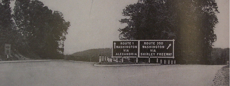
Photo: VA 350 leaving US 1 (1950s advertising photo courtesy J.N. Winkler)
|
|
|
| ROUTE LOG |
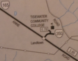
VA 165: 0 - 0 END VA 350: 0.78 - 0.78
|
|
| Previous VA 350's:
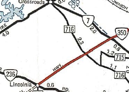
1959 ROUTE LOG US 1 SB: 0 - 0 US 1 NB: 0.81 - 0.81 VA 236: 11.77 - 12.58 VA 7: 2.75 - 15.33 VA 120: 1.18 - 16.51 US 1: 2.62 - 19.13 |
VA 350: The earliest CTB reference I can find is Sept 1941, where they vote to confirm authority to secure options on ROW for the planned route from Occoquan Bridge to Arlington Heights. This means of course by then the route had been planned out. There is no mention of this route in the 1941 route log.
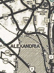
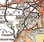
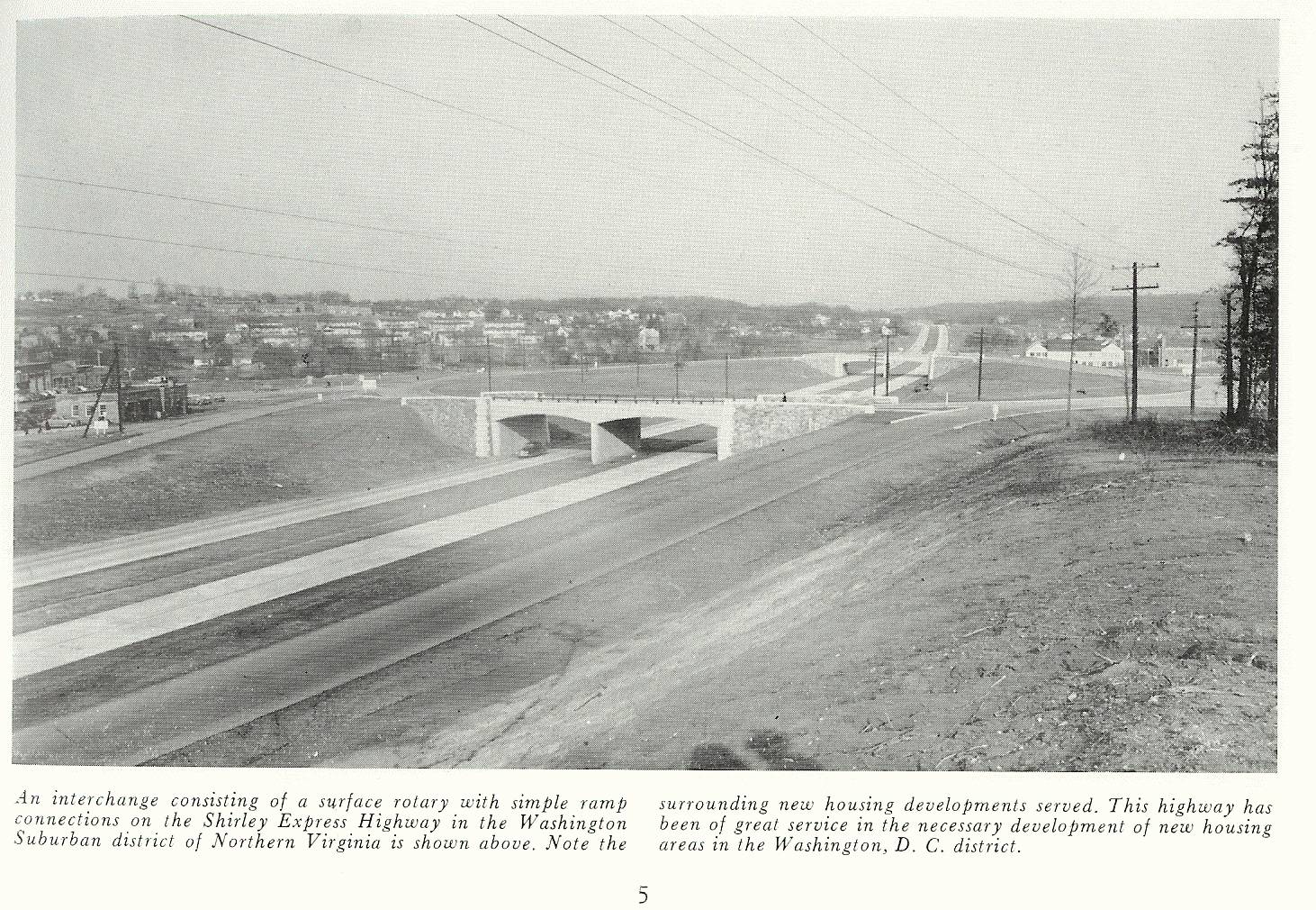
Per Scott Kozel's detailed history of the Shirley Highway, separately from anything Virginia was doing, the construction of the Pentagon in 1941 brought about the need for an improved road network near the Potomac River around Washington DC. Thus, the US Public Roads Administration was in charge of building the network of roadways. This included the Fort Belvoir Bypass from VA 7 to US 1, as well as US 1 to the 14th St bridge. In March 1942 (CTB) the 17-mile multilane Ft. Belvoir Bypass is confirmed that it will be constructed and named for the recently deceased Highway Commissioner, Henry G. Shirley. In Oct 1943 (Kozel), Shirley Highway was opened as a 2-lane route from VA 7 to the 14th St Bridge. In Aug 1944 (CTB), the Shirley Highway was designated as limited access. The earliest explicit reference I can find calling the highway VA 350 is in the Oct 1944 CTB in a discussion about whether to allow filling stations along the route. It also appears on the 1945 Arlington County Map south of VA 7. In Oct 1944 (Kozel), VA 350 was widened to a 4-lane expressway from VA 7 to the 14th St Bridge. In March 1946 (CTB), the southern end of VA 350 is specifically defined to be the north end of the US 1 Occoquan Creek (sic) bridge. Since VDOH did not build or maintain the portion of Shirley Hwy north of VA 7, it is reasonable to wonder if that portion was part of VA 350. The answer is yes - the 1949 and 1957 Route Logs both define the north end of VA 350 to be "on US Route 1, 0.56 miles south of the south end of the 14th St Bridge..." The 1946 Official is the first to label VA 350 anywhere and does do so between VA 120 and VA 244. VA 350 may have opened to VA 236 Lincolnia in 1948 before opening all the way to US 1 at the Occoquan Bridge in Sept 1949 (Kozel). Per Kozel, trucks were banned south of SR 644 Springfield, which was initially a 2-lane road.
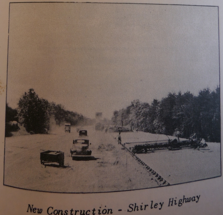
In Feb 1951 the CTB rejected requests to continue to restrict trucks from using VA 350 once the road was 4-laned to US 1. In Aug 1951 (CTB), VA 350 in its entirety was placed in the 50,000 pound system, opening the way for trucks to use the road which was 4-laned in May 1952 (Kozel).
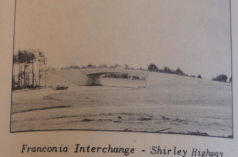
In Oct 1953 the CTB voted to have the policy not to permit the construction by individuals, companies, or private corporations, of service drives within the ROW of the Shirley Memorial Highway. In March 1955 the CTB voted to accept a proposal from the Bureau of Public Roads to transfer maintenance of the Pentagon Road Network, to include the northern 5 miles of VA 350, to VDOH. The BPR obligated itself to make certain improvements prior to the transfer. In Aug 1958 (CTB), 13.2 miles of VA 350 was officially made part of the Interstate System from 1.47 miles north of US 1 Occoquan Bridge to the NCL of Alexandria which was at VA 7. In Sept 1959 the CTB rescinded its March 1955 action to accept the BPR offer to relinquish responsibility of the Pentagon Road Network, as the BPR was unable to secure congressional funding to do the improvements that were part of the agreement. VDOH and BPR had no agreement in place over interstate system financing for VA 350 and VDOH was unwilling to accept the additional cost of this without further study. In Sept 1961 (CTB), a congressional bill was enacted that would fund VA 350 north of VA 7 as part of the interstate system with the federal government paying 95% and the state 5%. It was also agreed to widen VA 350 to 8-lanes on this northern stretch and the bill contained money to do the improvements around the Pentagon that the BPR was supposed to do in the 1950s. VDOH would then accept maintenance responsibility once the improvements were made. In Dec 1964 (CTB), the improvements were completed and VDOH received responsibility for the Pentagon Road Network. The CTB then placed VA 350 from VA 7 northward into the interstate system specifically as I-95. The last CTB reference to VA 350 being present was Jan 1966, describing it as "being converted to I-95". The last Official map to show a VA 350 shield was the 1965 issue and it is not shown anywhere on the 1967 Fairfax County map. VA 350 was widened to 6-lanes as part of its conversion to I-95 from Woodbridge to Springfield. Work to widen I-95 further north was largely done after VA 350 was decommissioned. VA 350 had the same interchanges that I-95 and I-395 have now, only most were simple folded diamonds or parclos. Only VA 236 (full clover) had a more advanced interchange south of the Pentagon Road Network. Today, only the SR 642 interchange at Lorton and the Shirlington Circle interchange (ignoring the HOV ramp) are essentially in the same configurations as originally built.
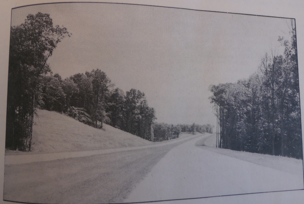
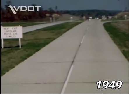
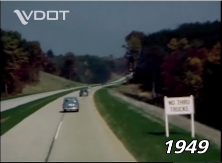
A terrific VDOT video comparing part of VA 350 in 1949 to I-395 today is available - here. Two still shots are below...
|
|||||||||||||||||||
Previous: VA 349 |
Next: VA 351
Top | Virginia Hwy Index
Home
Page last modified 5 March 2015