ROUTE LOG
VA 57: 0 - 0
END VA 346: 3.86 - 3.86
|
|
Creation: Created in July 1940 (CTB) when Park route R-1 in Fairy Stone State Park (opened in 1936) were taken into the primary system, a total of 3.83 miles. Initially the route began near the Henry County line and headed northwest from VA 57 (whose west endpoint was at this new VA 346) to Fairy Stone State Park and ending at SR 623. This is the only VA 346.
Adjustments: In Feb 1964 (CTB), VA 346 west was extended to meet VA 57 (now SR 838) west of the park (replacing SR 623). The original east end was truncated to SR 822 with the old route to VA 57 becoming more SR 822.
In Oct 1964 (CTB), VA 346's west end was shifted to its current endpoint, leaving behind SR 839.
It is unclear when VA 346 through the east side of the park was closed to vehicle traffic. VA 346 is shown as the western piece only beginning with the 1966 Official.
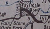
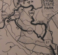
VA 346 initial routing
1941-42 Official |
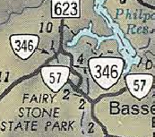
VA 346 extended to west of park
1965 Official |
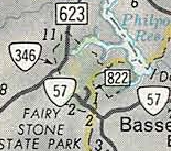
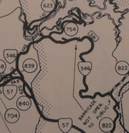
VA 346 no longer through park
1966 Official |
In Oct 1974 (CTB), VA 346 was removed from an old loop just north of SR 623.
Improvements: Paved upon inception; no multilane segments
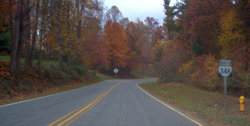
Posted: Fully posted at VA 57; white rectangle at SR 623.
Multiplexes: None
Legislative names: None
Other names: Fairystone Lake Dr
Scenic Byway: No segments
Comment: The official mileage of VA 346 still includes the closed section east to SR 822. Some roads within the park are SR 754.
VA 346 appears on officials since July 1940.
VA 346 initial routing more detailed
1946 Patrick County |
VA 346 closed on eastern end
1975 Patrick County |
|