<US 711 | Home | US 777 >
US 30 | US 130 | US 230 | US 330 | US 430 | US 530 | US 630 | US 830
US 730 at US Ends.com
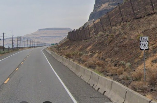
Photo: US 730 just inside Washington (GMSV Sept 2023)
|
|
|
| ROUTE LOG |
I-84 (Exit 168), US 30: 0 - 0 I-82 (Exit 1), US 395 NB: 16.1 - 16.1 US 395 SB: 0.7 - 16.8 WA STATE LINE: 18.4 - 35.2 US 730 SPUR: 5.8 - 41.0 US 12: 0.2 - 41.2
|
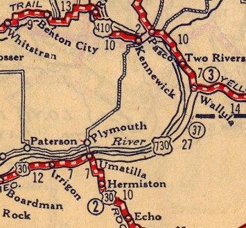
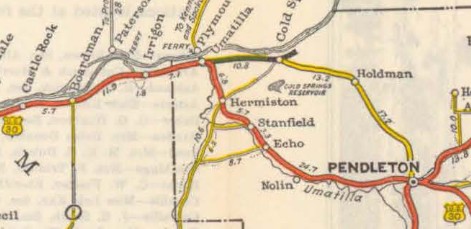
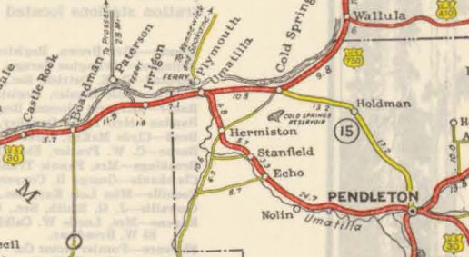
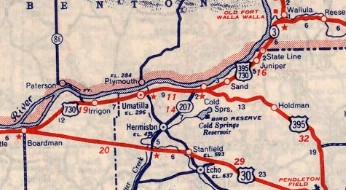
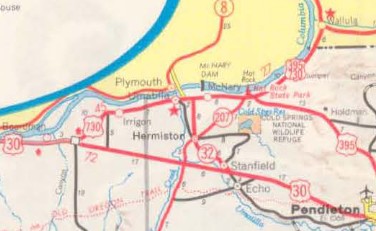
Creation: Created in January 1926 (AASHO) in the period between the original 1925 preliminary list and the final list in December 1926. This was a renumbering of US 420. It originally ran from US 30 (now just River Rd) Umatilla OR to US 410 (now US 12) Wallula Jct WA. US 730 was an addition to OR 37 and to a spur of WA 3. The original length reported to AASHO was 26 miles.
| Note that Oregon state officials up through 1932 showed no through road where US 730 was. The 1933 Official was the first to show a road and the first to indicate US 730 existed. Commercial maps, however, did show it.
Adjustments: In 1942, US 730 was extended west to Boardman, replacing US 30 which was rerouted to avoid Umatilla and Hermiston entirely. US 730 ended at the intersection of what is now Columbia Blvd/Laurel Ln. Laurel Ln didn't exist until after 1970, but there was an Y interchange between Columbia Blvd and US 30's routing from the east, as US 30 still went through Boardman. About 1951 (bridge date), US 730 was relocated uphill to make room for Wallula Lake that was to be formed by the new McNary Dam. The relocation began at Sand Station east of OR 37 and continued to at least the Washington State Line. It was after this that US 730 reached its longest reach at 47 miles. In 1953 (bridge date), US 730 east was truncated slightly to the new Wakulla Junction due to the new bridge over the Walla Walla River. The bit that was truncated became part of US 410 (now US 12). In 1962 (bridge date), to accomodate the additional water created by the John Day Dam, US 730 west was rerouted at Irrigon to head directly southwest to its current endpoint at I-84 Exit 168 Boardman Junction. The old route is: Columbia Blvd for about 4 miles; Heritage Hiking Trail through McCormach Slough; Columbia Ln from Patterson Junction to Irrigon. This realignment also had the benefit of being a few miles shorter to reach then-I-80N/US 30. In a December 1972 memo approving the relocation of US 395 to Pendleton-Hermiston-Cold Spring, AASHTO requested Oregon and Washington consider whether US 730 should continue as a US route. Oregon replied that US 730 was still a vital connector between I-80N and US 12 and beyond. So US 730 remains.
Comments: Per reports to Dale Sanderson, US 730 was not posted in Washington during the period up to when US 395 was still with it (early 1980s). Note that the county map with the 1984 request to AASHTO to move US 395 to I-82/182 did explicitly show US 395-730. Given that at one point US 730 was only 10 miles long on its solo routing 1934-42, it is surprising it didn't get the axe. | ||||||||||
Previous: US 711 | Next: US 777
US 30 | US 130 | US 230 | US 330 | US 430 | US 530 | US 630 | US 830
US 730 at US Ends.com
Page last modified 13 December 2025