<US 401 | Home | US 421 >
US 11 | US 211 | US 311 | US 511
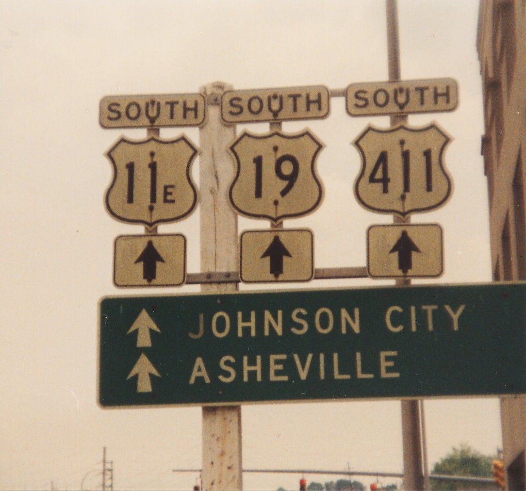
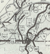
Photo: US 411 posting at the VA/TN line in Bristol, long after official decommissioning (photo by Michael Summa, 1992)
| US 411 not currently assigned | ||||||||
| Previous US 411's: 1932 ROUTE LOG US 25E, VA 10 WB, VA 100: 0 - 0 VA 101: 16 - 16 VA 102: 15 - 31 VA 103Y: 6 - 37 VA 104: 8 - 45 VA 11: 4 - 49 VA 103: 2 - 51 VA 142: 10 - 61 US 23 NB, VA 106: 9 - 70 VA 107 NB: 12 - 82 US 23 SB, VA 107 SB: 2 - 84 US 11W SB: 27 - 111 US 11, US 11E, US 19, US 321, VA 10 EB: 1 - 112 |
US 411 #1: Appeared in late 1926 as an original US Highway. US 411 was added to VA 10. It ran from US 25E Cumberland Gap to US 11 Bristol. The 1925 preliminary list had US 411 continue northwest from Cumberland Gap to Corbin KY, whcih was changed to US 25E by the time the official US route system was rolled out:
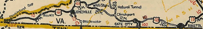
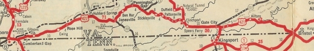
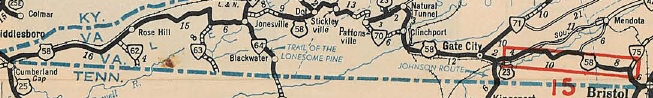
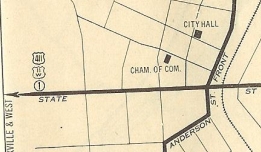
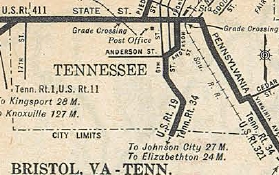
US 411 began in what is now 0.20 miles west of the parking lot for the Cumberland Gap area, then an unnumbered road (National Park Rd) that parallels the modern US 58 to the north eastward. The route used the SR 912 loop, then maybe modern US 58 but there is what looks like an old alignment on satellite photo that is not a road today. US 411 used SR 732 through the old Gibson Station area, then the piece of SR 692 that is north of US 58. THe route may have followed modern US 58 over to Wheeler, then SR 729. The route then seems to have followed modern US 58 to Kesterson Mill. US 411 followed SR 684 routing south of US 58, but not north of it unless it was before 1927. The route followed US 58 BUsiness through Ewing. The route likely used SR 697 and SR 672 to go to Rose Hill. US 411 followed modern US 58 until SR 670, then used the SR 813 loop to Henegartown. The route used a small bit of SR 621 and all of SR 814 in the Russels Store area. Continuing east the route used SR 946 (except used the SR 815 loop), then SR SR 899 and SR 880 down to Cony Hollow. US 411 followed modern US 58 from here to Jonesville except used the SR 836 and SR 745 loops. Then the route followed US 58 ALT north of Jonesville to Ben Hur except it likely used SR 715, 716, and 760, plus it looks like some alignments have been destroyed. In Ben Hur the route likely used some SR 645 and SR 644 then modern 58 ALT to Sulphur Springs, where the route probably used Combs Rd to Pennington Gap. The route in Pennington Gap seems to have been modern 58 ALT, then US 421 south of town. The route then seems to have used a bit of SR 630 plus a dead end alignment back to US 421. The route used SR 785 into Woodway. US 411 used SR 785 back to US 421, then followed that to US 58, US 411 used SR 915 up Wallen Ridge and US 58-421 off Wallen Ridge, then SR 702 to Stickleyville. Then US 411 used US 58-421 over Powell Mountain, then headed south on SR 638 through Pattonsville and down to SR 600. US 411 picked up SR 600 east to Clinchport, using SR 882, abandoned routing, SR 883 and VA 65 west. US 411 then followed US 23-58-421 past Speers Ferry, then used SR 870 to Gate City. US 411 followed Bus 23-58-421 through Gate City, then picked up mainline US 23-58-421. Before Weber City, US 411 veered off at today's SR 619. This road used to be continuous over to today's US 58-421 east of VA 224 but it is now a VDOT maintenance yard. US 411 likely used SR 701 and SR 614 over to Hiltons, then SR 709, 689 and 692 instead of US 58-421 southeast of Hiltons. The 1932 county atlas shows 58-421 routing, but it is not paved, so I have no date to say for sure it stopped using 614 if it ever used it. It appears US 411 followed US 58-421 east of Hiltons to Bristol, where it ended either at today's US 11W-421 split west of downtown or as the 1929 Auto Trails Map suggests, at US 11-19 Front St at State St.
US 411 #1 appears in 1926 1926 Official
US 421 replaces US 411 1932 Texaco (Rand McN)
US 58 quickly replaces US 421 1933 Official
|
|||||||
Previous: US 401 |
Next: US 421
US 11 | US 211 | US 311 | US 511 |
Top | Virginia Hwy Index
Home
Page last modified 12 March 2022