<US 560 | Home | US 570 >
US 66 | US 166 | US 266 | US 366 | US 466 | US 666
US 566 at US Ends.com
| US 566 renumbered | |||
| Previous US 566's: Final ROUTE LOG US 85: 0 - 0 US 366: 114 - 114 |
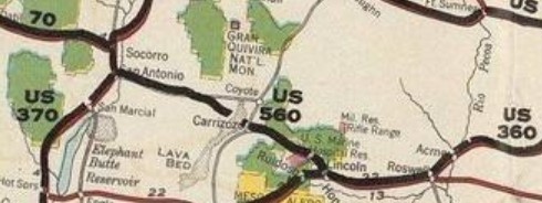
US 566: An original US Highway that was created in late 1926 as a renumbering of US 560. It ran from US 370 (now NM 1) San Antonio NM to US 360 (now US 70) Hondo NM. This was a replacement for NM 13. The mileage repored to AASHO on the initial 1927 route list was 117 miles.
 1926 NWA
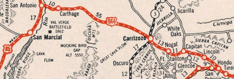
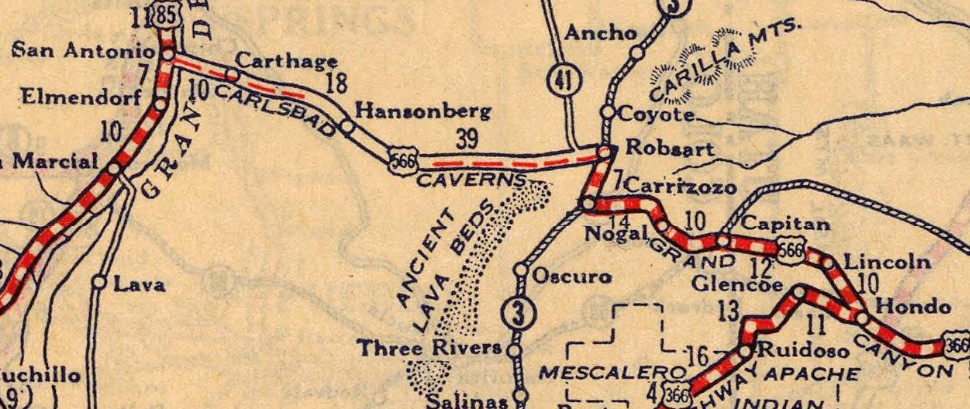 1927 RMcN In August 1930, AASHO suggested US 566 be replaced by a relocated US 70 as part of resolving New Mexico's request to extend US 60 from Springfield MO to Los Angeles. About 1930, US 566 was rerouted between Bingham and Carrizozo. It originially continued east from the Bingham area along Wsmr P Rte 41, then followed Wsmr P Rte 3506, then Iron Mine Rd around the lava field to Lincoln County. Then it went southeast on CR A012 until Coyote Canyon Wash. Here US 566 turned south on abandoned routing about 3 miles before curling southeast 3.3 miles to the abandoned US 54 alignment at Robsart. US 566 then followed the abandoned route along the railroad and US 54 to Carrizozo. This old routing became parts of NM 41, NM 144 and NM 161 for a time.
 1930 Clasons In July 1931 (AASHO), after numerous correspondences where AASHO was going to renumber it as US 280, US 566 was renumbered as part of US 380 while US 280 was assigned to the current route in Georgia.
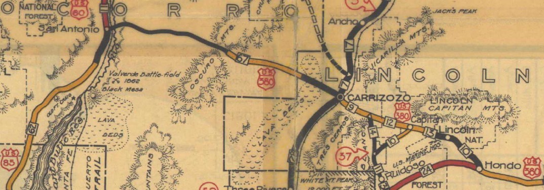 1933 Official Today the route is Santa Fe RR St and 6th St leaving San Antonio; abandoned routing across the Rio Grande to connect with US 380, 1.7 miles east of its current Rio Grande crossing; a mix of US 380 and abandoned loops for 7.5 miles; 2.25 mile ENE of abandoned routing; 18 miles along San Pedro Arroyo and Wsmr P Rte 41 to the Mockingbird Archaelogical Site in the Bingham area; CR 263 southeast for 3 miles; US 380 through Carrizozo; NM 37 through Nogal; CR C017 Cora Dutton Rd for 3.4 miles; abandoned routing for about a mile to about Aspen Dr; a bit of NM 48; Mt Captain Rd, then NM 48 to Captain; US 380 to Hondo except US 566 used Los Chozas Trail near Hondo. US 566's jct wih US 366 was at a Y junction 500 ft short of the current US 70-380 split. | ||
Previous: US 560 | Next: US 570
US 66 | US 166 | US 266 | US 366 | US 466 | US 666
US 566 at US Ends.com
Page last modified 7 February 2026