<US 383 | Home | US 393 >
US 85 | US 185 | US 285 | US 485
US 385 at US Ends.com
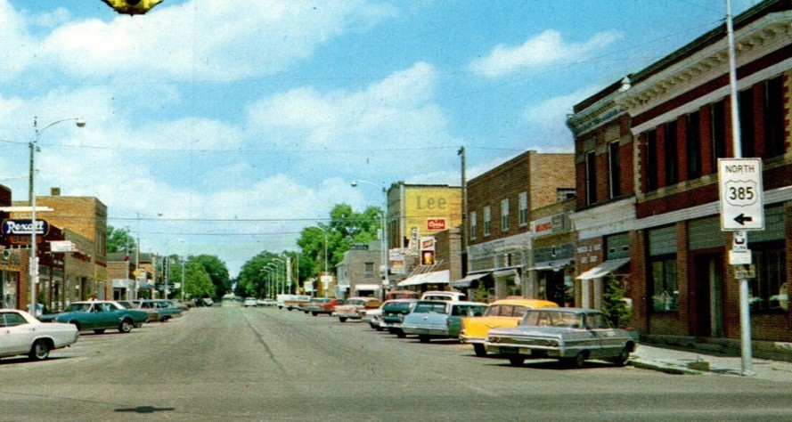
Photo: US 385 (now Cedar St) at US 138 Julesburg CO (circa 1960 postcard)
|
|
|
| ROUTE LOG |
US 385 Begin: 0 - 0 US 90 WB: 39.7 - 39.7 US 90 EB: 1.1 - 40.8 I-10 Bus WB, US 285 NB: 56.7 - 97.5 US 285 SB: 0.5 - 98.0 I-10 WB (Exit 261), I-10 Bus END, US 67 SB: 1.5 - 99.5 I-10 EB (Exit 273): 12.0 - 111.5 US 67 NB: 31.5 - 143.0 I-20 (Exit 116): 51.6 - 194.6 I-20 Bus: 1.4 - 196.0 US 62 WB, US 180: 62.9 - 258.9 US 380 WB: 40.8 - 299.7 US 380 EB: 0.1 - 299.8 US 62 EB: 0.9 - 300.7 US 84: 51.5 - 352.2 US 70: 22.9 - 375.1 US 60: 42.4 - 417.5 I-40 (Exit 36): 29.7 - 447.2 I-40 Bus: 0.4 - 447.6 US 87 SB: 50.0 - 497.6 US 54: 15.0 - 512.6 US 87 NB: 0.2 - 512.8 OK STATE LINE: 30.6 - 543.4 US 56 WB, US 412 WB: 14.1 - 557.5 US 56 EB, US 412 EB: 3.3 - 560.8 US 287 SB: 1.0 - 561.8 CO STATE LINE: 17.6 - 579.4 US 160: 28.9 - 608.3 US 50 WB, US 287 NB: 48.9 - 657.2 US 50 EB, US 400: 17.5 - 674.7 US 40 EB: 54.7 - 729.4 US 40 WB: 0.6 - 730.0 I-70 (Exit 437): 37.1 - 767.1 I-70 Bus WB, US 24 WB: 0.5 - 767.6 I-70 Bus EB, US 24 EB: 1.0 - 768.6 US 36 WB: 27.8 - 796.4 US 36 EB: 3.0 - 799.4 US 34: 23.9 - 823.3 US 6: 36.2 - 859.5 I-76 (Exit 180): 29.8 - 889.3 US 138 EB: 1.9 - 891.2 US 138 WB: 3.8 - 895.0 NE STATE LINE: 4.0 - 899.0 US 30 EB: 8.3- 907.3 US 30 WB: 25.7 - 933.0 US 26 WB: 39.9 - 972.9 US 26 EB: 1.0 - 973.9 US 20 EB: 85.8 - 1059.7 US 20 WB: 2.5 - 1062.2 SD STATE LINE: 16.3 - 1078.5 US 18 EB: 13.1 - 1091.6 US 18 WB: 21.7 - 1113.3 US 16 WB: 31.7 - 1145.0 US 16 ALT: 0.5 - 1145.5 US 16 EB: 17.6 - 1163.1 US 85: 36.5 - 1199.6
|
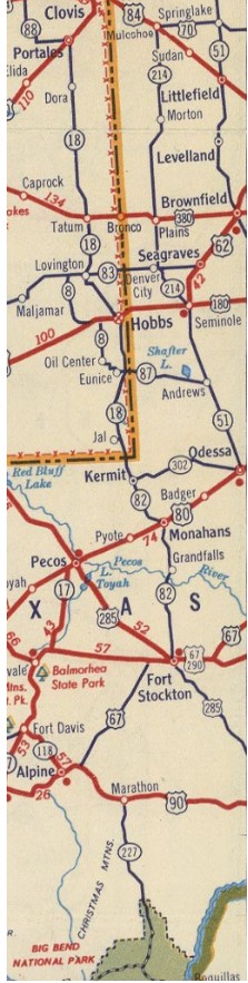
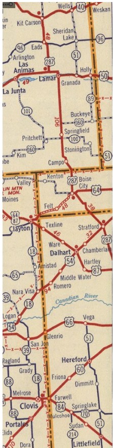
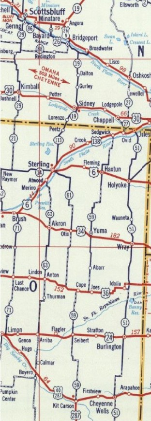
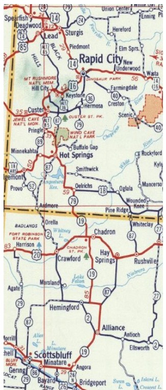
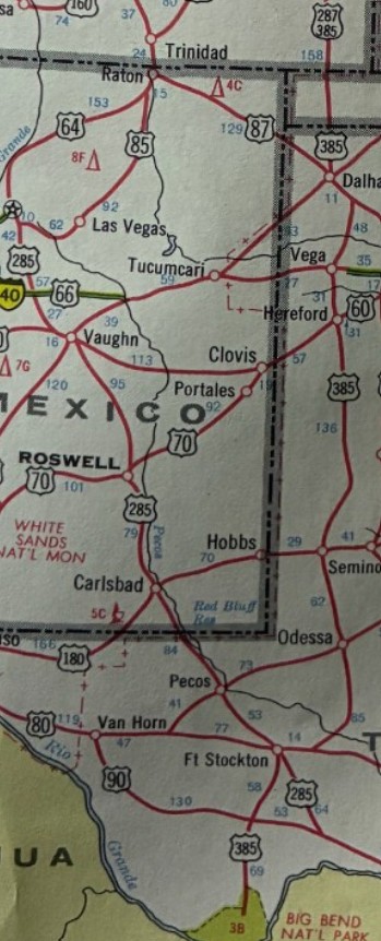
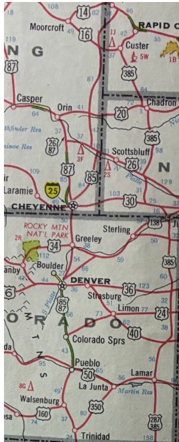
Creation: Appeared in November 1958 (AASHO) as the 4th US 385, running from Big Bend National Park in Texas to US 85 Pluma SD. Oddly, TX, OK, and CO said the route would end in Belle Fourche SD and the NE application said Rapid City. The SD application did have Pluma as the endpoint. This was a replacement for TX 51 from Big Bend to Oklahoma; replaced OK 134, followed US 56 to Boise City, followed US 287 to Kit Carson, Colorado; followed US 40 to Cheyenne Wells, replaced CO 51 to Julesburg, followed US 138 west briefly, replaced CO 166 to Nebraska; replaced NE 27 to Chappell, followed US 30 to Sidney, replaced NE 19 to South Dakota; followed SD 79 to Oelrichs, followed US 18 to Hot Spings, and replaced US 85 ALT to Pluma.
|
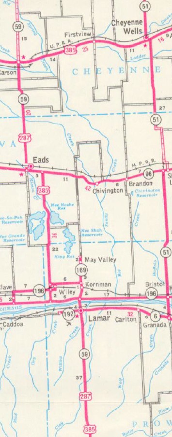
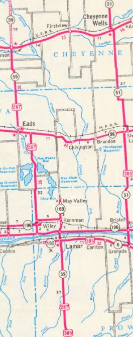
Adjustments: Between 1958-61, US 385 was removed from Old Seagraves Rd just south of Brownfield TX. In December 1962, AASHTO turned down a request to extend US 385 north as an overlay with US 85 to the Canadian Border above Fortuna ND. About 1964, US 385 was rerouted between Lamar CO and Cheyenne Wells CO. US 385 now headed east with US 50 to Granada, then replaced CO 51 north back to Cheyenne Wells. Lamar to Kit Carson remained US 287 (Except used CR 20/Young St into Kit Carson) and Kit Carson to Cheyenne Wells remained US 40.
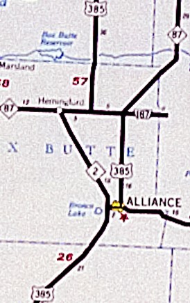
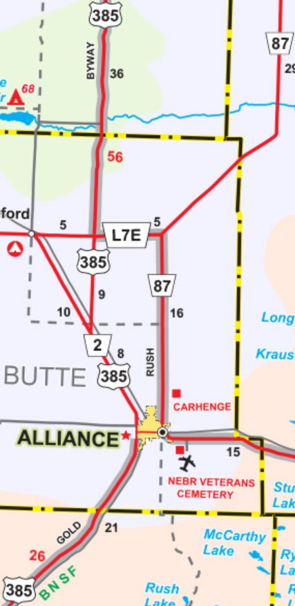
In December 1964 (AASHO), US 385 was given a straight alignment over Beaver Creek south of Boise City OK. The old route bowed out to the east. In November 1966, AASHTO turned down a request to extend US 385 north as an overlay with US 85 to the Canadian Border above Fortuna ND. Between 1962-67, US 385 was removed from Old Seagraves Rd between Seagraves TX and Wellman TX. In 1966 or 1967, US 385 was removed from Wind Cave Rd through the National Park in South Dakota; this likely is when it was also removed from about a mile of SD 87 plus abandoned alignment north of the park.. In June 1973, AASHTO turned down a request to extend US 385 north, replacing US 85 to the Canadian Border above Fortuna ND. In November 1973, AASHTO turned down a request to extend US 385 north, replacing US 85 to the Canadian Border above Fortuna ND. This extension would've utilized some I-90 routing. In April 1974, at AASHTO's suggestion, North Dakota contacted the 8 relative states to see if they would support replacing the entirety of US 385 from Pluma SD to Big Bend NP with US 85. They pointed out that US 85 loses its identity to I-25 for much of its route. New Mexico opposed this idea. Oklahoma was amenble to it. Nebraska was also amenable but suggested waiting until I-25 was finished in CO/NM and surely they would request eliminating US 85 then. Colorado said they wouldn't object but they would see great opposition to dropping US 85 where it would not be on I-25 north of Denver, but would support extending US 385 north over US 85 instead of duplexing the routes. Texas said they could not justify the effort but would support extending US 385 north over US 85 instead of duplexing the routes. In June 1974, AASHTO turned down a request to extend US 385 north, replacing US 85 to the Canadian Border above Fortuna ND. This extension would again have utilized some I-90 routing. About 1975, US 385 was placed onto its I-10 overlay out of Fort Stockton TX. The old routing is the WB Service Road. About 1976, US 385 was removed from a little Elm St, plus Rd 11E and abandoned segment northeast of Kimbal NE. The newest Kit Carson county map I can find (mid-1950s) shows the highway using 14th St to Webster Ave to reach 8th St in Burlington CO. State Officials appear to show this up through the 1976 issue, so about 1977 is when US 385 was changed to use Rose Ave directly to 8th St. In the late 1970s, US 385 was completely rebuilt from Adams Rd in northern Dawes County NE to north of Cottonwood School Rd, the 7 mile abandoned route is just west of the modern highway. By 1982, US 385 was removed from Northern St in Pringle SD. It appears that 1985 was about when US 385 was removed from Museum Dr in Hill City SD, plus the frontage road further east, plus straightened out a couple places further east. About 1988, US 385 was removed from Cedar St south of US 138 in Julesburg CO and rerouted northeast to meet US 138. About 1994, US 385 was removed from Road 99B north of Bridgeport NE. In April 2000 (AASHTO), US 385 was rerouted north out of Alliance NE to follow NE 2 for several miles, then north as new routing to the western intersection with NE 87 (now Link 7E). The old routing became a reroute NE 87, then Link 7E.
Between 1992-2004, US 385 was removed from part of Darcy Dr and abandoned segments north of Hot Springs SD; also straightened out in several places between SD 87 and Pringle SD. In 2012 (AASHTO), US 385 was removed from Oklahoma 287 Frontage Rd north of Boise City OK. Comments: US 385 is a pretty sparse route. Although Big Bend NP and several National Park sites are at the endpoints, US 385 only passes through one city with more than 15,000 people...Odessa TX. Previous US 385's:
|
LAST ROUTE LOG (385 #1) US 60: 0 - 0 US 85: 120 - 120 LAST ROUTE LOG (385 #2) US 70: 0 - 0 US 60: 41 - 41
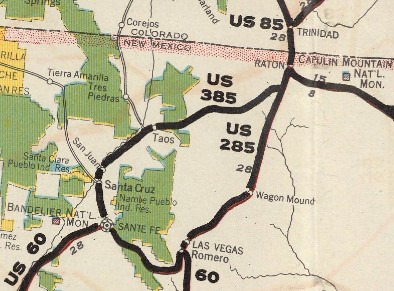
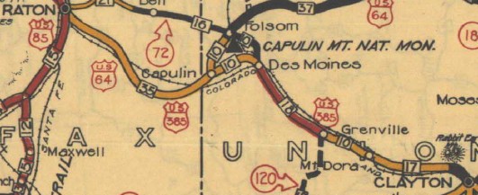
US 385 #1: Created in August 1926 as a renumbering of US 285, running from US 60 (now Camino Romeroville at Romeroville Frontage Rd) Romeroville NM to US 85 (now 2nd St at Clayton Rd) Raton NM. This was about 120 miles.
| In September 1926, US 385 became part of US 85. Today it is Romeroville Frontage Rd/abandoned/Bibb Industrial Rd/abandoned/I-25 Bus/South Pacific St into Las Vegas NM; National Ave, I-25 Bus out of Las Vegas (except abandoned alignment on west side from above Mills Rd to past Mountain View Rd; Airport Rd/abandoned/NM 250/abandoned along the west of RR to I-25 Exit 361; Circle Ranch Rd/abandoned along the west of RR to I-25 Exit 364; NM 161 through Watrous; NM 97 for 7.4 miles/abandoned along east side of RR/CR 35 across the RR/abandoned along west side of RR until it sidles up to Old US 85 into Wagon Mound; NM 120 east; CR 27 north 2 miles, then abandoned north almost 9 miles back to Old US 85 for 2 miles, then abandoned routing along RR through Colmor back to Old US 85; Old US 85 until it becomes the I-25 frontage road; I-25 ROW for 2.5 miles; Airport Rd; NM 21 into Springer; I-25 Bus to I-25 Exit 414; I-25 ROW for 5.3 miles; Old French Rd east 1 mile, then northeast about a mile to the former village of French; along the west of RR for ~2000 ft; due north (with squiggle R-L at the Vermejo River) past I-25 to become CR C-24; Maxwell Ave to Maxwell; NM 445 to US 64 except last mile was on abandoned alignment a little east; 3.5 miles abandoned alignment immediately to the east of US 64; 3.4 miles abandoned alignment that bows out to the west (passed through NRA Whittington Center) and joins US 64 just east of the Canadian River bridge; US 64, then Ranchway Rd, then I-25 ROW about 3/4 mile; Frontage Rd along I-25 SB; I-25 Bus (2nd St) into Raton. This US 385 does not appear on any map I can find. The one map that could have had it shows it as US 285 and places US 385 erroneously where US 485 had been assigned.
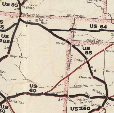
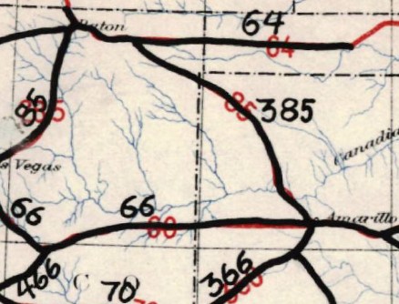
US 385 #2: Created in September 1926, running from US 290 (now Green Cedar Rd at Waring Welfare Rd) Nelson City TX to US 85 (now I-25 Bus) Raton NM. Raton to Amarillo TX was a renumbering of US 85; Amarillo to Canyon was an overlay with US 366
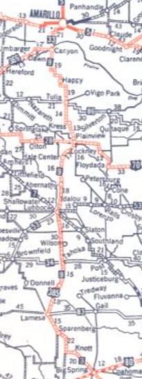
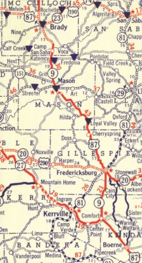
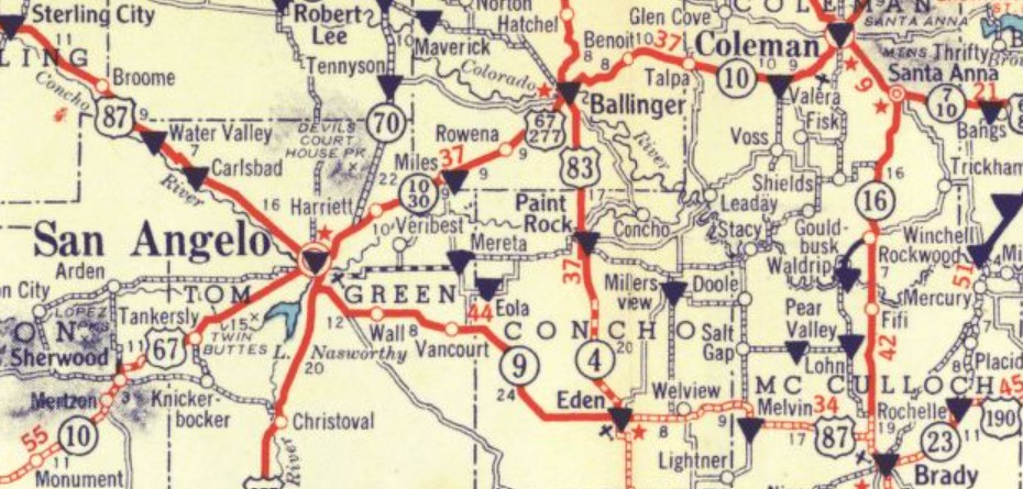
Canyon to Comfort via Lubbock, Big Spring, San Angelo and Fredericksburg (then-TX 9) was a new US Route corridor that had been floated by AASHO to Texas as a rerouted US 85 in August after AASHO had assigned it US 181 shrtly before. All AASHO correspondence/documents listed Comfort TX as the endpoint but US 385 didn't go through there. Nelson City was not much more than a crossroads then, so perhaps they kept listing Comfort because it was a real place nearby.
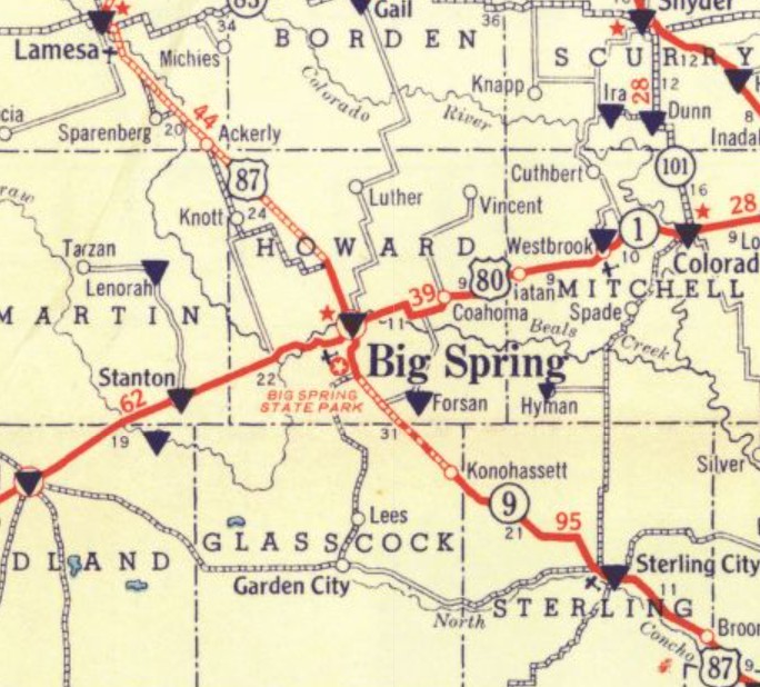
In 1929 (bridge date), US 385 was removed from an abandoned routing that began about 2 miles nortwest of Water Valley TX, includes the portion of Michaelwicz Rd parallel to US 87, and rejoins US 87 about 0.6 miles northwest of the Walnut Creek bridge. Also in 1929 (bridge date), US 385 was removed from abandoned routing that begins at 3rd at Robert Lee St on the east edge of Sterling City TX and proceeds southeast over 2 miles back to US 87. A 1928 map of Sterling City suggests US 385 used 3rd into town but it is unclear how it got through Sterling City. In 1930 (bridge date), US 385 was removed from a handful of abandoned segments on the west side between Sterling City and Big Spring TX. Also in 1930 (bridge date), US 385 was removed from N. Avenue H (some of this was destroyed by I-27). Past Kemper St the old route is abandoned in an arc that passes through the steel plant and tied into Ash St just below Loop 289. Also in 1930 (bridge date), US 385 was given a direct routing from Happy to Canyon TX, and was removed from Main St and N. Western Ave in Happy; County Line Rd; Western St; FM 1705; Coulter Rd In 1931 (bridge date), US 385 was removed from Emory Ave east of the RR from Ash Ave to Manchester Rd in New Deal. This appears to also be when US 385 was removed from Ash Ave/Railroad Ave and Main St in Abernathy TX. Also around 1931, the highway was given a direct routing from McCormick Rd to Amarillo. The original routing used Coulter St; Loop 335 ROW; Bell St; 34th Ave (with dogleg on S. Western St) to Fillmore which the new routing picked up from 36th Ave. About 1932, US 385 was given a direct routing between Grenville NM and Des Moines NM. The old route: Main St and 5th St through Grenville; driveway into Hays Ranch; abandoned west 0.6 miles; abandoned north to just across US 64-87 and the RR; abandoned along RR 3.1 miles; CR B015; CR A015 west 4.9 miles; unnamed road north 3 miles; Weatherly Rd to just short of the RR; abandoned along east side of RR for about 1.2 miles then cross RR back to US 64-87.
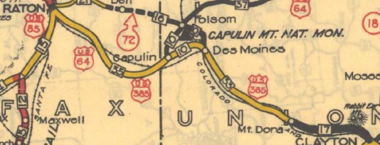
About 1934, US 385 was given a direct routing between Clayton NM and Mt Dora NM. The old route: NM 370 about 0.7 miles; abandoned east side of the RR to Rockledge Rd; Rockledge Rd to its drivable end; abandoned west about 1.5 miles; abandoned northwest about 1.5 miles; abandoned NNW about 0.3 miles; abandoned west to Royce Rd; Royce Rd north; Hindes Rd west to end; abandoned west about a mile; abandoned southwest about 2 miles; abandoned SSW about 0.7 miles; abandoned WSW about 0.5 mile; abandoned along north side RR about 1.8 miles, then across RR to Mt. Dora; current US 64-87 through Mt. Dora (new 1934 route used Loop Rd around Mt. Dora).
Around the time of the renumbering, the highway was given its modern routing to Big Spring. The old routing used abandoned/0.2 miles Hunt Rd/abandoned, then US 87, then abandoned loop west at Chalk Creek, then US 87, then longer abandoned west routing in the Killebrew Ln area, then US 87 to about Private Road 210; abandoned routing west about a mile; US 87 about 3 miles; abandoned loop east at Gardener Draw; US 87 about 3 miles; abandoned west loop at big curve (these last two abandoned loops were still US 87 for many years); small bit of US 87; abandoned alignment on east side, crossing over 87 at the Glasscock County line as a west side right angle loop, back across 87 for an east side right angle loop back to 87 at McDonald Rd; McDonald Rd north 3.1 miles; McDonald Rd west 3.6 miles/abandoned west of 87 about 1/3 mile; abandoned north 1/2 mile; abandoned west 1 mile, abandoned north 0.5 mile to 87 at Overton Rd; Overton Rd; Wildfire Rd west; Longshore Rd north to Wasson Rd. US 385 used Wasson Rd, Marcy Dr, abandoned diagonal from Gregg St to 24th St, Scurry St into Big Spring. US 385 used 3rd St, then US 87 Business (Gregg St) out of Big Spring. US 385 used FM 2230; CR 21; CR 36; CR 19; FM 846 through Knott; CR 9; FM 2212 through Ackerly; County Rd U; CR 34; County Rd T/FM 178; CR 31; County Rd S; CR 30/FM 828 to Sparenberg; FM 26; CR 25; County Rd N; CR 24; County Rd M (doglegs CR 23); 8th St then US 87 Business through Lamesa.
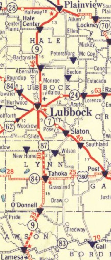
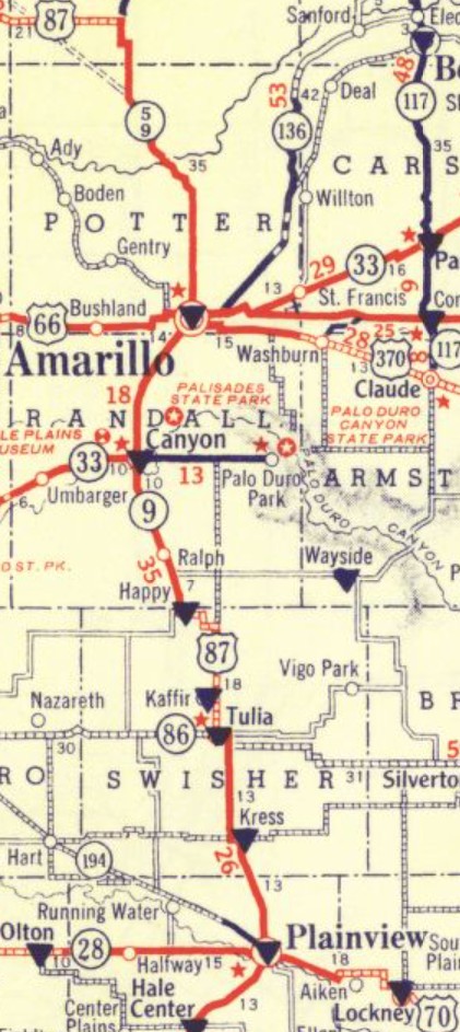
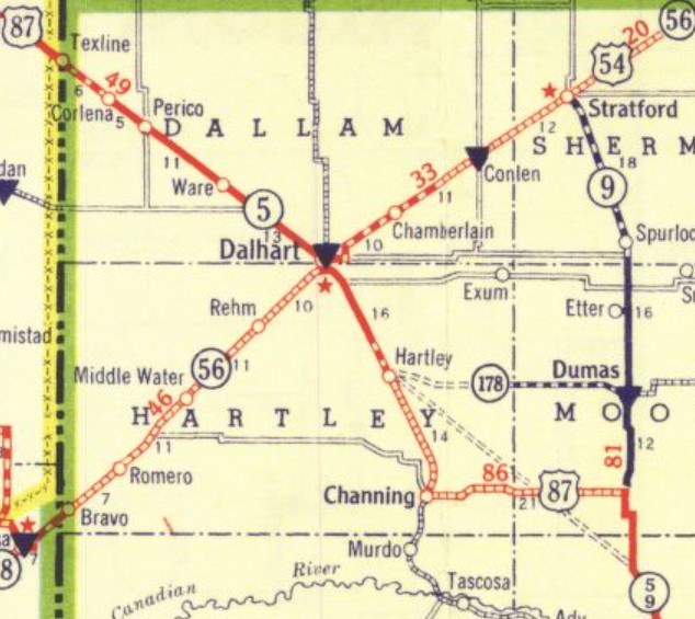
Around the time of the renumbering, the highway was given its modern routing from Lamesa to Tahoka. The old route was immediately adjacent to the east of the railroad. It is not clear how US 385 got over to Eglin/Stenholm Blvd in Lamesa. Essentially none of the route is still driveable until O'Donnell where it picks up Loop 76 through town. It appears the route has always followed US 87 to below Tahoka (except it skirted around the east of the pond just above Skeen Lake for a number of years). US 385 then stayed north on now-abandoned route to the B Ave/11th St intersection, then used 11th east to Loop 472 through central Tahoka; US 385 used US 87 to Lubbock except: Loop 493 through Woodrow; NB frontage road between FR 1585 and 91st St; SB frontage road between Rhodes Cir and 79th St; NB frontage road between 58th St and 27th St; Buddy Holly Ave/Municipal Dr/Ash Ave. US 385 used the SB frontage road from Ash Ave to Owen St; NB frontage road from Bluefield St to just past the airport exit; Ash Ave/SB frontage road/Loop 461 through New Deal/NB frontage road to N. CR 2400; I-27 ROW; Ave D/Loop 389; I-27 ROW to past Cemetery Rd; NB frontage road to FM 1424; I-27 ROW; I-27 Bus through Hale Center. US 385 used the NB frontage road to CR 135; I-27 ROW a short bit; NB frontage road; I-27 Bus towards Plainview. Around the time US 385 became US 87, it appears TX 9 was moved from Broadway St/11th St to use today's I-27 Bus through Plainview. US 385 used the NB frontage road to Exit 591; US 87 to Kress; Old Hwy 87, Skipworth Ave and FM 145 through Kress; CR 14 back to US 87 for 2.5 miles; CR 14A on the east side of RR to Tulia; Broadway through Tulia; US 87, then Airport Rd/CR 13 out of Tulia; FM 1881; CR 12; County Road B; I-27 SB frontage road at Happy; Main St, then US 87 through Canyon. US 385 used the I-27 ROW up to just past S. Georgia St in southern Amarillo; NB frontage road to S. Van Buren St (except a wider arc centered around Parker St); 36th Ave; Fillmore St; I-27 then US 87 ROW; Fillmore St through downtown; US 87 ROW to Loop 434; Loop 434 US 385 used US 87 to about 2 miles above Masterson; abandoned west about 0.3 miles then north about a mile back to US 87; US 87 to Fourway; TX 354 for 13 miles/abandoned due west/TX 354 for 1.8 miles; abandoned west about 0.3 miles; abandoned south across TX 354 for a total of about 0.8 miles; abandoned WSW back to TX 354; TX 354 for 3 miles; abandoned loop north side; TX 354 into Channing; Main St north which used to cross the RR to connect with current US 385 where it starts paralleling the adjacent RR; current US 385 to Dalhart; 7th St and Denrock Ave through central Dalhart; US 87 to Texline
US 385 followed US 87 through Des Moines NM except: Loop Rd around Mt Dora; abandoned loop along RR just west of the Santa Fe Trail marker well east of Grenville; abandoned south loop between Saavedra Ave and CR B080; abandoned north loop between CR B080 and CR B010; abandoned west about 2 miles; abandoned south across US 64-87/southern wavy loop to past CR A045; abandoned south dip back around to the Capulin Volcano roadside marker; US 64-87 to NM 325 Capulin NM; south on Commercial Ave, then 4th St and Kiowa Rd; CR B002/CR A-18/CR A-41; NM 193 to 1.4 miles short of US 64-87; abandoned 2.6 miles northwest, then more northerly across Una de Gato Creek for about a mile, then abandoned north to US 64-87; US 64-87 for 1.3 miles; abandoned west 1.25 miles; abandoned northwest 0.75 miles; abandoned west 0.7 miles; abandoned NNW for a mile; abandoned northwest 0.7 miles; abandoned NNW about 2 miles; CR 22; short abandoned loop north of US 64-87; US 64 to I-25 Bus Raton NM.
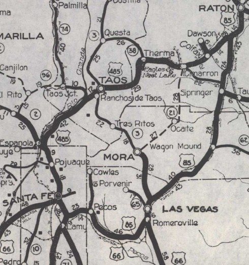
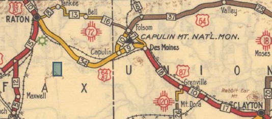 1935 Official US 385 #3: In July 1953, AASHO turned down a request for a US route running from US 160 Fort Garland CO south to US 85 Santa Fe NM. This would have replaced CO 159 to NM; NM 3 (now NM 522) to Taos; duplexed with US 64 (now NM 68) to Espanola; duplexed with US 84-285 to Santa Fe. Although neither Colorado nor New Mexico requested a specific designation, the AASHO package had handwritten on it: end at Taos? 164 385? Because there was a July 1952 letter from US Senator Chavez (NM) that requested an alternate US 85 routin from Santa Fe to Fort Garland to Walsenburg CO, I am inclined to believe this would've been US 385 had AASHO approved it. | ||||||||||||||||||||||||||||||||
 Pluma, SD

Previous: US 383 | Next: US 393
US 85 | US 185 | US 285 | US 485
US 385 at US Ends.com
Page last modified 21 June 2026