< TN 69 | Home | TN 71 >
|
|
|
|
| ROUTE LOG |
NC STATE LINE: 0 - 0 TN 107 WB: 6.1 - 6.1 TN 351: 0.8 - 6.9 US 321, TN 35, TN 107 EB: 8.2 - 15.1 US 11E Bus NB, TN 350: 1.0 - 16.1 US 11E SB, US 11E Bus END, TN 34 WB: 0.3 - 16.4 US 11E NB, TN 34 EB: 0.5 - 16.9 I-81 (exit 30): 10.2 - 27.1 Hawkins-Greene Line: 5.3 - 32.4 TN 66 SB: 6.7 - 39.1 US 11W SB, TN 1 WB, TN 66 NB: 3.8 - 42.9 US 11W NB, TN 1 EB: 2.9 - 45.8 TN 347: 0.5 - 46.3 US 11W, TN 1: 0.2 - 46.5 TN 94: 5.3 - 51.8 Hancock-Hawkins Line: 9.5 - 61.3 TN 33 NB: 1.7 - 63.0 TN 33 SB: 0.1 - 63.1 VA STATE LINE: 2.5 - 65.6
|
Creation: An original state highway that in 1924 ran generally as it does today.
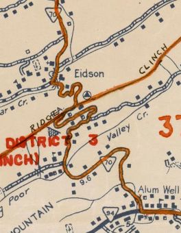
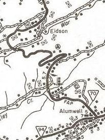
| Adjustments: In 1933, Tennessee tried to have US 33W assigned to the entirety of TN 70. About 1934, TN 70 was removed from today's TN 351/Old Asheville Hwy into Greenville. In 1934, Kentucky and Virginia tried to have US 33 assigned to the entirety of TN 70. In 1937, Tennessee tried to have US 33 assigned to the entirety of TN 70. In 1952, TN 70 was removed Rogers Rd and Klepper Church Rd just north of TN 94; also removed from Lee Valley Rd which no longer connects to TN 70 on its south end beyond Eidson (believe it or not TN 70's routing was even more winding than now through here).
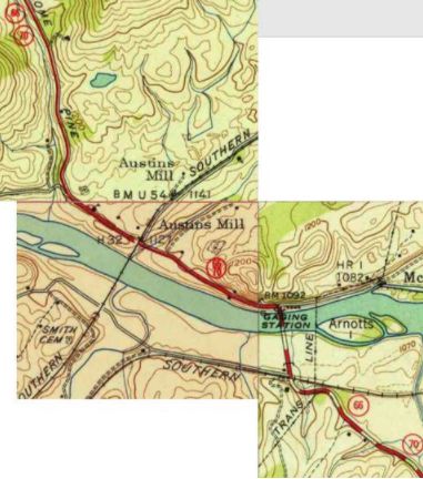
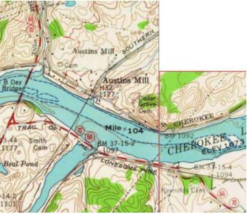
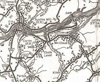
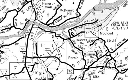
In 1958, TN 70 was rerouted west of McCloud to its current crossing of the Holston River as new construction. The old crossing was directly north of where today's Old Hwy 70 crosses the railroad about a mile east of current TN 66-70. TN 70 was also removed from a mile of McKinney Chapel Rd on the north side of the river as well as Big Springs Rd through Henardtown.
About 1966, TN 70 was given its bypass of Rogersville leaving behind Broadway/Depot/Main St. Between 1966-71, TN 70 was routed out of Greenville. The old route used W. Main St, W. Summer St, N. Cutler St, W. Depot St, W. Church St and La Sambra Ln. In 1967, TN 70 was removed Old State Hwy 70 west McCloud and instead replaced TN 66 through Persia to the new TN 66 just north of TN 113. Sometime after 1985, TN 70 was removed from Irish St and Myers St just north of US 321 (really).
In 1986, TN 70 was removed from Thacker Ln and Old State Hwy 70 through Strahl and McCloud as well as Old Persia Rd and Squirrel Hill Rd through Chalk Hill which no longer connects to Old Hwy 70 at its Dodson Cr bridge.
Posting: posted as a primary route everywhere except north of TN 33 Its overlays with US 11E Bus, US 11E, TN 66 and US 11W are all posted Secret US Route Overlay: None Comment: TN 70 is one of the few truly north-south routes in northeastern Tennessee and has numerous mountain crossings as a result. | |||||||||||||