< TN 10 | Home | TN 11 Byp | TN 12 >
|
|
|
|
| ROUTE LOG |
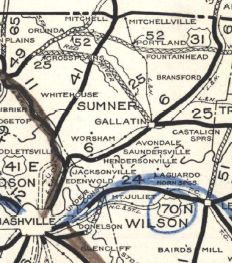
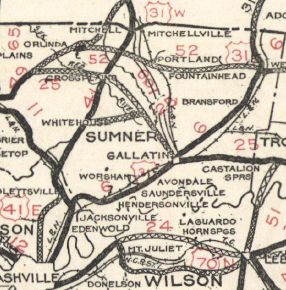
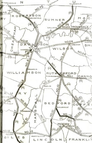
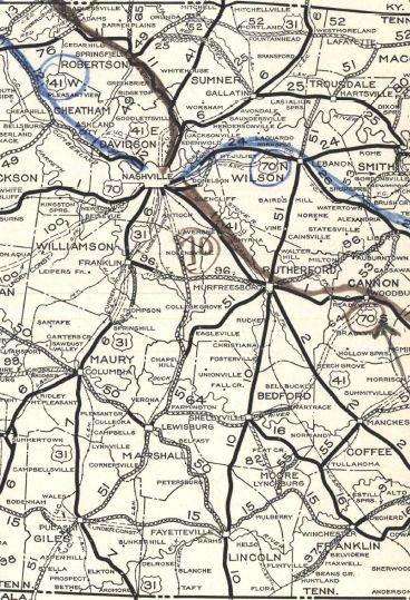
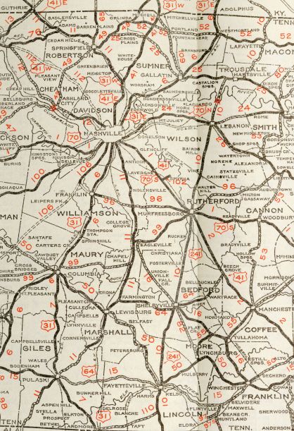
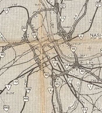
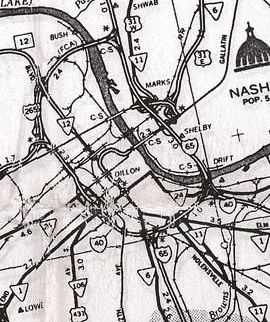
AL STATE LINE: 0 - 0 US 64, TN 15, TN 166 NB: 16.0 - 16.0 TN 166 SB: 0.3 - 16.3 US 31 SB, TN 7 SB: 2.8 - 19.1 US 31 NB, US 31 ALT Begin, TN 7 NB: 0.3 - 19.4 I-65 (exit 22): 11.3 - 30.7 Marshall-Giles Line: 0 - 30.7 TN 129 EB: 2.3 - 33.0 TN 129 WB: 2.3 - 35.3 US 31 ALT NB, US 31 ALT Bus Begin, TN 106: 5.3 - 40.6 US 431 Bus SB, TN 50 EB, TN 373: 1.7 - 42.3 US 31 ALT SB, US 31 ALT Bus END, US 431, US 431 Bus END, TN 50 WB, TN 106, TN 272 SB: 1.1 - 43.4 TN 272 NB: 0.2 - 43.6 TN 271: 4.95 - 48.55 TN 64: 0.05 - 49.6 TN 99 WB: 6.7 - 56.3 TN 270: 0.2 - 56.5 TN 99 EB: 3.0 - 59.5 Williamson-Marshall Line: 4.3 - 63.8 Rutherford-Williamson Line: 0.7 - 64.5 TN 269: 2.0 - 66.5 Williamson-Rutherford Line: 0.6 - 67.1 US 41 ALT SB, TN 16: 4.1 - 71.2 I-840 (exit 42): 2.7 - 73.9 TN 96: 0.6 - 74.5 Davidson-Williamson Line: 10.3 - 84.8 TN 253: 0.7 - 85.5 TN 254: 3.8 - 89.3 TN 255: 2.4 - 91.7 TN 155: 2.4 - 94.1 I-440 (exit 6): 0.9 - 95.0 I-40 (exit 210C), US 41 SB, US 70S EB, TN 1 EB: 2.2 - 97.2 US 31 SB, US 31 ALT END, TN 6 SB: 0.6 - 97.8 US 70, US 70S WB, US 431 SB, TN 1 WB, TN 24: 0.3 - 98.1 US 41 ALT NB, TN 12: 0.7 - 98.8 I-24 (exit 48): 1.2 - 100.0 US 31 END, US 31E, US 31W Begin, TN 6 NB: 0.1 - 100.1 US 31E, TN 6: 0.3 - 100.4 I-24 (exit 47): 0.2 - 100.6 US 431 NB, TN 65: 2.1 - 102.7 I-65 (exit 90): 2.3 - 105.0 TN 155: 0.2 - 105.2 TN 45: 2.2 - 107.4 TN 174: 4.6 - 112.0 Sumner-Davidson Line: 1.2 - 113.2 US 31W NB, TN 41: 0.3 - 113.5 Davidson-Sumner Line: 1.0 - 114.5 Robertson-Davidson Line: 3.5 - 118.0 TN 257: 0.5 - 118.5 US 431 SB, TN 65 SB: 8.8 - 127.3 TN 49, TN 76 EB: 1.3 - 128.6 US 431 NB, TN 65 NB: 1.5 - 130.1 TN 76 WB: 11.0 - 141.1 Montgomery-Robertson Line: 3.8 - 144.9 KY STATE LINE: 3.0 - 147.9
|
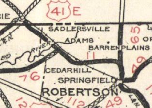
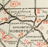
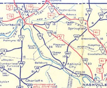
Creation: Appeared in 1923 as an original state highway, running from TN 6 (1st at Main) Nashville through Springfield and Adams into Kentucky.
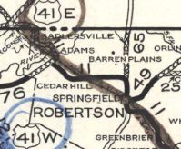
| Adjustments: In late 1926, By late 1927, US 241 was changed to US 41E. In 1927 or 1928, TN 11 was extended into Nashville on Deadrick, then 8th/Union/4th, then south as new state highway to end at TN 51 (now TN 99) Chapel Hill. In 1930, TN 11 was removed from Pineywoods Rd/Mint Springs Rd/Keysburg Rd between Adams and the Kentucky line Also in 1930, TN 11 was removed from Rivergate Pkwy and Two Mile Pike north of Nashville and instead placed on Dickerson Pike
Also in 1930, TN 11 was removed from Fuller Rd/Riggs Rd in southeastern Williamson County In 1931 or 1932, TN 11 was extended south, replacing TN 51 through Lewisburg and Pulaski and southwest into Alabama.
Also in 1931 or 1932, TN 11 was removed from TN 76, TN 256, Mud Cat Rd and Main St from Adams to Cedar Hill. In 1932, TN 11 was removed from Old Springfield Pike between Goodlettsville and Ridgetop; Old Springfield Hwy just inside Robertson County. Also in 1932, TN 11 was removed from Old Horton Hwy north of TN 96. About 1935, TN 11 was removed from abandoned routing/bit of Avery Word Rd plus Sam Davis Cir in Minor Hill; Bevels Spring Rd below Anthony Hill In 1935 or 1936, TN 11 was rerouted in Nashville to follow 4th/Broadway/1st/Deadrick
About 1938, TN 11 was removed from Ragsdale Ln (no longer connects to)/Beechwood Farm Rd (no longer connects to)/Tabitha Ln out of Pulaski; Sumac Rd through Powell Chapel and Sumac; Hopkins Rd/Blackburn Hollow Rd loop at Brick Church Between 1944-46, TN 11 was removed from the lengthy Old Greenbrier Pike between TN 257 and Springfield.
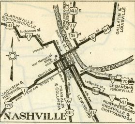
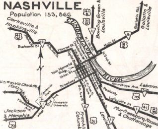
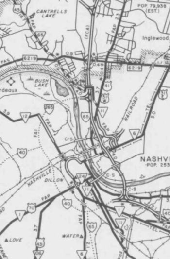
In 1947, US 31A was added to TN 11 from Pulaski to Nashville. In 1950, TN 11 was removed from Overpass Rd out of Cornersville Between 1939-51, TN 11 was rerouted in Pulaski to use 2nd St from College instead of 3rd St. I am guessing that in the early 1950s, TN 11 was removed from Yell St/Yell Rd loop in Lewisburg. About 1956, TN 11 was placed on Memorial Blvd through Springfield. The old route used routing abandoned to the east adjacent to the quarry and N Main St Between 1960-64, TN 11 was removed from US 431/TN 161/Old 41N/S Garrett Rd/N Garrett Rd north of Springfield; also Dunn Rd at Cedar Hill. In 1965, TN 11 was removed from Deaderick St and N. 1st St and placed on the current viaduct over Cumberland River to nearly I-24, then placed on 5th St/Spring St/Dickerson Pike. By 1966, TN 11 was placed on one-way splits in southern Nashville, with NB using Ensley Blvd/2nd Ave/Hart/3rd and SB using the original routing on 4th Ave. By 1975, TN 11 NB in southern Nashville was rerouted to just Ensley/2nd. In 1976, TN 11 was removed from the discontinuous Old State Hwy 11 and Old Hwy 41 loops northwest of Adams. Betweeen 1976-78, TN 11 was rerouted in South Nashville to follow US 41 entirely. 2nd/4th Ave north of Lafayette St was removed from the state highway system; while Broadway remained part of US 70; 1st Ave between Broadway and Robertson Pkwy was also removed from the state highway system.
About 1983, TN 11 was removed from Mill St in Pulaski Posting: TN 11 is primary throughout except 2nd St in Pulaski and from I-440 north to Goodlettsville, which are secondary. TN 11 is not posted north of the US 31 split in Pulaski Secret US Route Overlay: US 31 ALT I (21.2 mi) US 31 ALT Bus (2.8 mi) US 31 ALT II (54.4 mi) US 41 (47.8 mi) Comment: TN 11 provides a backdoor way from Pulaski to Nashville | |||||||||||||||||
Previous: TN 10 |
Next: TN 11 Byp | TN 12
Top | Tennessee Hwy Index
Home
Page last modified 5 July 2021