< VA 18 | Home | VA 20 >
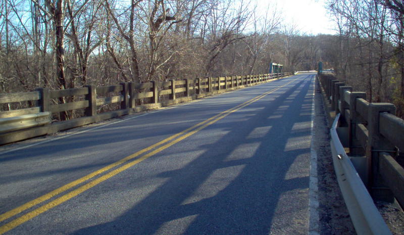
Photo: VA 19's bridge over the Rivanna River near Columbia from 1930-33. (photo by Mapmikey 1/26/06)
| U.S. 19 |
| VA 19 not currently assigned | ||||||
| Previous VA 19's: 1932 ROUTE LOG US 29, VA 28: 0 - 0 VA 19Y: 6 - 6 VA 316: 15 - 21 US 15 SB, VA 32 SB: 16 - 37 US 15 NB, VA 32 NB: 2 - 39 VA 727: 2 - 41 VA 46: 3 - 44 VA 45: 7 - 51 VA 49: 10 - 61 VA 419: 1 - 62 VA 427: 6 - 68 VA 418: 17 - 85 VA 441: 2 - 87 VA 432: 2 - 89 |
VA 19: Began in January 1918 as an original state route defined by the general assembly: Route 19: Richmond, Rio Vista, Goochland to Dixie, point on Route 2 main line
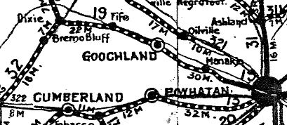
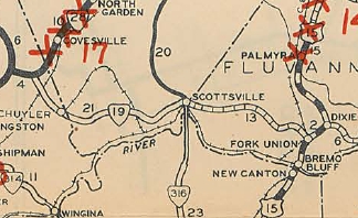
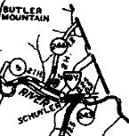
VA 19 original route: Dixie to Richmond via Fife 1924 Official In May 1926 (CTB), VA 19 was extended west with then-VA 32 to Fork Union, then west 2 miles as new routing. In March 1927 (CTB), VA 19 was extended west 2 more miles. About 1927, VA 19 was removed from SR 667 Old Columbia Rd through Fife to Georges Tavern. In Aug 1928 (CTB), VA 19 was extended west through Scottsville and ending just inside Nelson County at Schuyler. There was a 2-mile gap from the Nelson-Fluvanna line eastward. Apparently in this timeframe, VA 19 was further extended to VA 28 (now US 29) via Rockfish. This is shown on the Aug 1928 Official Map but I can find no CTB reference. In June 1930 (CTB), the two mile gap in Fluvanna County was put into the system. In Sept 1930 (CTB), VA 19 was rerouted north of Schuyler to head to VA 28 (now US 29) via Faber. This was described as being the temporary routing of VA 19 (no previous CTB reference) now being made permanent. The small piece into Schuyler later became VA 19Y and is now SR 800. Schuyler to VA 28 via Rockfish became CR 5 (now SR 617).
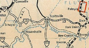
In 1930 (bridge dates), VA 19 was placed on current VA 6 from Dixie to Columbia, leaving behind a lengthy CR 223 (now SR 624). In Oct 1931 (CTB), VA 19 was removed from SR 650 River Rd from the Manakin area into Richmond and placed on today's VA 6, then south on Three Chopt Rd back to Cary St. Cary St between River Rd and Three Chopt bcame an extended VA 418. One 1932 Gen Draft Map shows VA 19 turning north on Boulevard from Cary but I am skeptical of this. About 1932, VA 19 was removed from a lengthy abandoned loop through Dogtown west of Goochland CH. In July 1933, VA 19 was renumbered as VA 6 to Three Chopt Rd; VA 197 along Three Chopt Rd; VA 147 along Westhampton/Cary. From Columbia to Richmond it is still VA 6 except it used VA 310. West of Fork Union it is VA 6 except: SR 670/620 Church Ln/Rock Spring Rd; SR 632 Shiloh Loop in Faber; abandoned routing at SR 630 to pick up Havenwood Ln then SR 800 northward; Esmont/Paces Store Rd in Esmont; Precinct Rd in Porters; SR 737 west of Scottsville; Temperance Ln at the Hardware River; SR 697/640 Cunningham Rd; SR 649/704 loop Central Plains; SR 705 Cohassett Cir; SR 612/671 loop at Cohassett
| |||||
Previous: VA 18 |
Next: VA 20
Top | Virginia Hwy Index
Home
Page last modified 10 February 2015