< US 250 | Home | US 301 >
US 258 Bus
US 58 | US 158
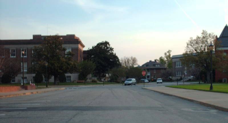
Photo: US 258's view leaving Old Point Comfort (photo by Mapmikey 4/19/08)
|
|
|
| ROUTE LOG |
NC STATE LINE: 0 - 0 VA 189: 5.28 - 5.28 US 58 WB, US 258 Bus: 3.72 - 9.00 Suffolk-Southampton Line: 3.02 - 12.02 US 58 EB, VA 189: 1.20 - 13.22 Isle of Wight-Suffolk Line: 0.91 - 14.13 US 58 Bus, US 258 Bus: 1.81 - 15.94 US 460: 12.83 - 28.77 US 258 Bus, VA 10 WB: 14.45 - 43.22 US 258 Bus, VA 10 Bus: 2.30 - 45.52 VA 10 EB: 1.96 - 47.48 VA 32 SB: 0.20 - 47.68 US 17 SB: 2.65 - 50.33 Newport News-Isle of Wight Line: 6.81 - 57.14 US 60, VA 32 END: 0.22 - 57.34 US 17 NB, VA 143: 0.56 - 57.90 Hampton-Newport News Line: 0.29 - 58.19 VA 415: 2.49 - 60.63 I-64 (exit 263), VA 134 NB: 0.34 - 60.97 VA 152: 0.83 - 61.80 VA 134 SB: 0.24 - 62.04 VA 278: 1.52 - 63.56 VA 169: 0.25 - 63.81 VA 351: 1.42 - 65.23 VA 169: 0.94 - 66.17 VA 143: 0.80 - 66.97
|
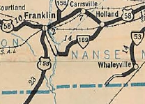
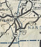
Creation: Appeared in Oct 1940 as a renumbering of US 158, running from US 58 Franklin south to the North Carolina line.
|
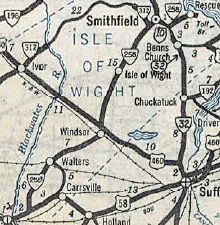
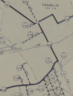
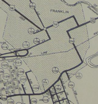
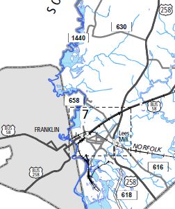
In Oct 1945 (CTB), US 258 was removed from High St in Franklin and instead used Main St to go from South St to 2nd Ave. High St is still posted as US 258, along with the current US 258 Bus routing. In Nov 1973 (CTB), US 258 was placed on its southern bypass of Smithfield, leaving behind US 258 Business. In May 2004 (AASHTO), US 258 was placed on its bypass of Franklin by duplexing with US 58 and replacing all of VA 260. The old route through Franklin became US 258 Business.
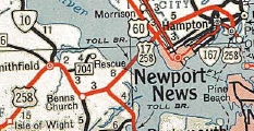
When The Hampton Roads Bridge Tunnel was built in 1957, the '58 VDOT County atlas continued to show US 258 going to Old Point Comfort even though the ferry was discontinued. Virtually all maps still show US 258 ending at Old Point Comfort on the Ft. Monroe Post. However, as early as 1991 it was not posted past VA 143 and from Sept 11, 2001 until around 2007 Ft. Monroe was not an open base. So for all practical purposes US 258 does end at VA 143. Improvements: The entirety of US 258 was paved upon its designation. The first multilaning of US 258 occurred by 1947, from Phoebus to Old Point Comfort. In 1949 the 4-laning was extended west to VA 351. In 1958, US 258 was multilaned from Armistead Ave west to about Newport News CL. In 1960 or 1961, US 258 was 4-laned US 60 to Hampton CL and also from VA 134 to VA 351. In 1970, US 258 was 4-laned from US 17 south to the James River. In 1977, US 258 was multilaned from Benns Church to the south end of the Smithfield Bypass In 1980, US 258 was multilaned from VA 10 to US 17; also it was widened on the James River Bridge98 In 2003, US 258 was multilaned on its new US 58 duplex. US 258 is 8 or more lanes from US 17/VA 143 all the way to VA 278. Posted: Fully posted, though there are no longer any postings east of the Mallory St area; error VA 258 shield at US 60 has existed in the past. Both US 258 Bypasses are posted as US 258 TRUCK in places. Multiplexes: US 58 (4.22 mi) VA 10 (4.26 mi) VA 32 (2.85 mi) US 17, VA 32 (7.03 mi) US 17 (0.56 mi) VA 134 (1.07 mi) Legislative names: Pocahontas Trail, from Old Point Comfort to VA 143 (3-21-24 designation predates US 258); James River Bridge (since 1-15-87); General C C Vaughan Jr Bridge over Nottoway River (no date given) Other names: Smith Ferry Rd (NC to US 58); Franklin Bypass (US 58 duplex); General Mill Hwy/Camp Family Hwy (US 258 Byp); Walters Hwy (US 58 Bus to Windsor); Prince Blvd (Windsor); Courthouse Hwy (Windsor to Smithfield); Main St/Benns Church Blvd (Smithfield); Brewers Neck Rd (VA 10 to US 17); Carrolton Blvd (US 17 to James River); Mercury Blvd (Newport News and Hampton) Scenic Byway: no segments Comment: US 258 is a major artery in Hampton and not so special south of the James River. If US 258 really still exists on Fort Monroe it is a true dead-end US highway. | ||||||||||||
Previous: US 250 |
Next: US 301
US 58 | US 158
Top | Virginia Hwy Index
Home
Page last modified 9 March 2022