< WV 70 | Home | WV 71 SPUR | WV 72 >
|
|
|
| ROUTE LOG |
US 52: 0 - 0 WV 10: 11.2 - 11.2
|
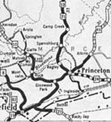
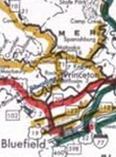
Creation: WV 71 was designated about 1935 as a renumbering of an unnumbered primary route which had been part of original WV 67. It ran from Matoaka to Rock, then southeast to end at US 19-21 (now CR 19/29 jct with CR 19/33) Glenwood. This is the 2nd WV 71.
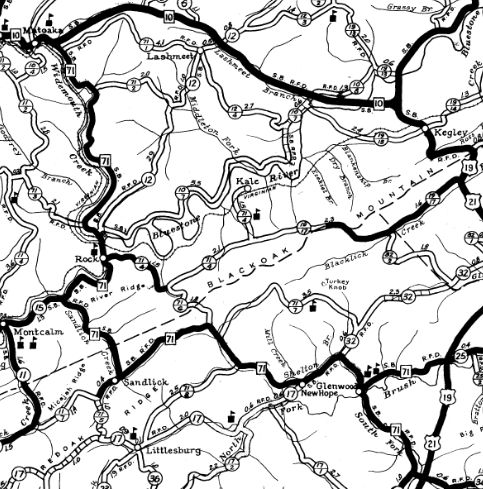
| Adjustments: In 1933, WV 71 was extended at Glenwood in 2 directions, replacing US 19-21 east to the new US 19-21 below Princeton and replacing US 19-21 south to the new US 19-21 in Green Valley. County maps that I have seen 1933-49 label both legs as WV 71 instead of 71N and 71S. WVDOT annual reports also suggest no split routing names and that both legs were 71. By 1964 (per WVDOT e-mail), the northern leg was officially WV 71 Spur (now CR 19/29). On 12/23/77 (WVDOT CO), WV 71 was rerouted south of Rock to instead continue southwest replacing CR 15 to Montcalm and CR 11 south to US 52 Bluewell. The old route to Sandlick and Newhope became CR 71/13; WV 20 remains on its former overlay; WV 20 to US 19 became CR 19/33. Improvements: Paved upon inception; no multilane segments Comment: The two legs of WV 71 baffle me. Other routes did have a split routing explicitly labeled.
| Previous WV 71's:
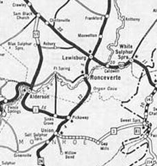
1930 ROUTE LOG WV 21: 0 - 0 WV 24: 15 - 15 |
WV 71 #1: Appeared 1923 as new primary routing running from WV 21 (now WV 12) Alderson to WV 24 (now US 219) Pickaway.
In 1931, WV 71 was renumbered as part of WV 3.
|
|||||||||||

Previous: WV 70 | Next: WV 71 SPUR | WV 72 |
Top | West Virginia Hwy Index
Home
Page last modified 1 April 2022