< WV 13 | Home | WV 14 ALT | WV 14 SPUR | WV 15 >
|
|
|
| ROUTE LOG |
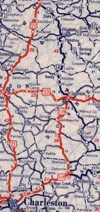
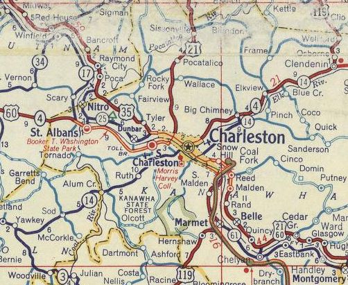
US 33: 0 - 0 Wirt-Roane Line: 11.7 - 11.7 WV 5: 13.8 - 25.5 Wood-Wirt Line: 6.9 - 32.4 I-77 (exit 170): 7.6 - 40.0 WV 14 ALT: 3.7 - 43.7 WV 95 WB: 1.1 - 44.8 WV 95 EB: 0.5 - 45.3 US 50: 0.2 - 45.5 WV 68 SB, WV 618 WB: 0.7 - 46.2 WV 618 EB: 0.2 - 46.4 WV 68 NB: 1.2 - 47.6 WV 31 NB: 11.6 - 59.2 WV 31 SB: 1.3 - 60.5 I-77 (exit 185): 0.1 - 60.6
|
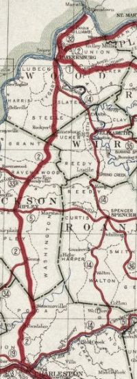
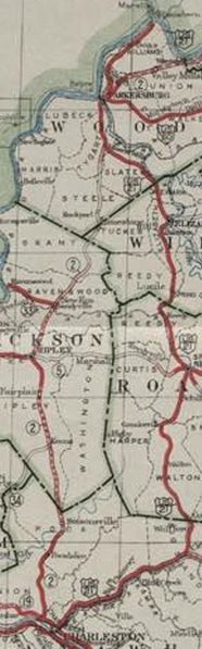
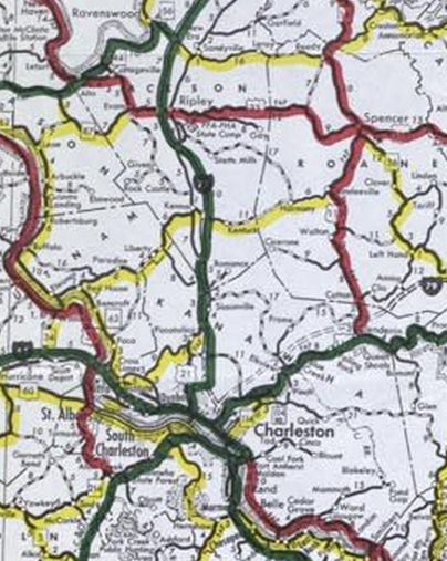
Creation: Created in 1922 as new primary routing, running from WV 2-3 (now Virginia St) Charleston to WV 2 (now abandoned route near CR 21) Mineral Wells. This is the only WV 14.
| Adjustments: About 1928, US 21 was temporarily added to the entirety of WV 14. It is unclear if WV 14 was de-posted. By 1931, US 21 was moved back to its original Charleston-Ripley-Parkersburg routing. Between 1926-29, WV 14's Charleston routing changed. Originally it used Capitol to State (now Lee) to Truslow (no longer exists) to Lovell (now Washington) to Crescent Rd. Now WV 14 ended at Lovell (became US 21/WV 2) at Bigley as WV 14 was removed from Crescent entirely. In 1930, the north end of WV 14 was moved northwest to the newly constructed US 21 alignment, replacing a bit of US 21. Between 1929-31, WV 14 south was truncated to WV 13 (now WV 4) Clendenin with the route to Charleston becooming WV 13 (now US 119). In 1935, WV 14 south was truncated to Spencer with the route to Clendenin becoming US 119.
In 1938, WVDOH studied requesting replacing all of WV 14 with an unspecified US route number. It is unclear if they formally requested this or not but it obviously did not happen. In 1946, WV 14 south was re-extended along US 119 to Big Chimney, then replaced CR 51 to Charleston, then followed US 60 west across the Kanawha River, then replaced WV 13 to end at WV 3 Yawkey. The 1946 official only shows the extension to Clendenin but the 1946 Kanawha County map shows it all the way through, while the 1946 Lincoln County map still showed WV 13 to Yawkey. Between 1950-55, WV 14's north end was rerouted to be further south along US 21, replacing CR 14/8 (which had been US 21 until the 1930 rearrangement). The old WV 14 piece was abandoned and is no longer a road today. Between 1950-57, US 119/WV 14 was removed from Market St in Spencer. Between 1950-56, WV 14 was rerouted in Charleston to follow then-US 119 south to the 35th St bridge across the Kanawha River, then northwest along WV 61 back to where WV 14 split off headed for Yawkey. The old route remained US 60 across the Kanawha River and WV 61 on McCorkle.
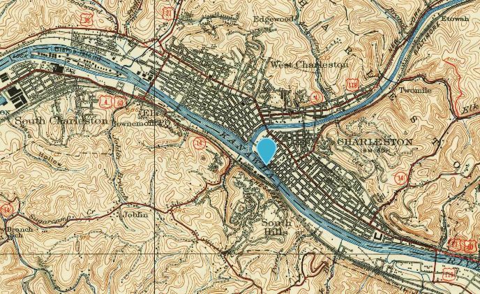
WV 14 through downtown Charleston crossing the river with US 60 around to the west 1935 topo rev 1949
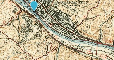
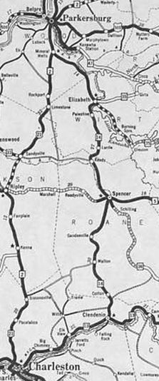
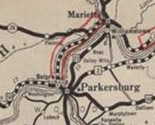
WV 14 rerouted to cross the river southeast of Charleston 1935 topo rev 1956 Between 1965-72, WV 14 was given one-way splits at Big Chimney, using today's CR 119/61 Chimney Dr (SB 14 - the original routing) and CR 119/62 Chimney Dr (NB 14) Around 1971, WV 14 was extended north replacing US 21 through Parkersburg to Williamstown, then headed southeast with WV 31 before meeting I-77 as it does today.
In 1971 or 1972, WV 14 south was truncated back to US 33 Spencer leaving behind WV 214 from Yawkey to Charleston (WV 214 was also rebuilt in the area where it crosses US 119 at Terry Rd, with old WV 214 using a bit of RHL Blvd; also slightly rebuilt where it crosses US 119 at Ruth; WV 14 used US 119 from WV 601 to Lawndale, then Oakhurst Ln, then Oakwood Rd to Cantly Dr then destroyed routing east across Corridor G to the railroad tracks then Ferry St and Thayer St between the railroad and WV 61); WV 61 along McCorkle; US 119 on the 35th St bridge and Washington St (no longer primary); WV 114 from Charleston to Big Chimney (except WV 14 used CR 49 Indian Creek Rd; CR 49/6 Trinity Way; removed bridge over Elk River; and CR 119/61 Chimney Dr (SB 14) and CR 119/62 Chimney Dr (NB 14); US 119 Big Chimney to Spencer
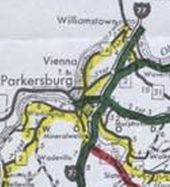
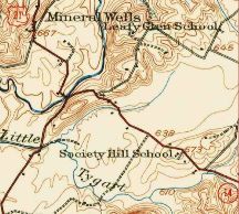
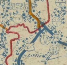
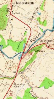
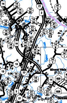
Between 1990-96, WV 14 was removed from CR 14/23 north of Elizabeth. Between 1997-2003, WV 14 was removed from CR 14/24 north of Elizabeth. Between 2003-07, WV 14 was placed on new construction leaving behind CR 14/44 Pike St and a little Alpine St south of Parkersburg. In 2012, WV 14 was placed on newly constructed route in the Mineral Wells area, leaving behind and CR 21 and CR 14/49.
Improvements: By 1923, WV 14 was paved from Clendenin to the Roane line and from Gandeeville to Spencer In 1924, WV 14 was paved from Elizabeth to Mineral Wells; also a couple miles towards each other on the 1923 sections By 1927, WV 14 was paved everywhere. WV 14 was multilaned through downtown Parkersburg and downtown Vienna upon its 1971 extension. By 1996, WV 14 was multilaned between Parkersburg and Vienna. The new routings in the I-77 area were multilaned upon completion. Comment: The I-77 welcome center entering from Ohio is actually on WV 14. WV 14 is on one-way splits through downtown Parkersburg: NB uses 5th/Julian/8th/Murdoch while SB uses Ohio/Garfield/4th/Green There is also a WV 14 TRUCK in Parkersburg that uses Green St and WV 618. |
|||||||||||||||||