|
|
|
|
ROUTE LOG
US 60: 0 - 0
WV 527: 0.5 - 0.5
|
|
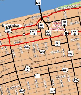
Creation: Appears to have been created in 1994 as a renumbering of US 60 WB after the WV 527 Ohio River Bridge configuration was changed with a new bridge. This is the 4th US 60 ALTs.
Adjustments: None
Improvements: Fully paved upon designation; undivided mulitlane throughout.
Comment: This is signed as US 60 West from both directions of WV 527 which must use 4th Ave to get to US 60 since the current bridge passes over the actual US 60 WB routing.
|
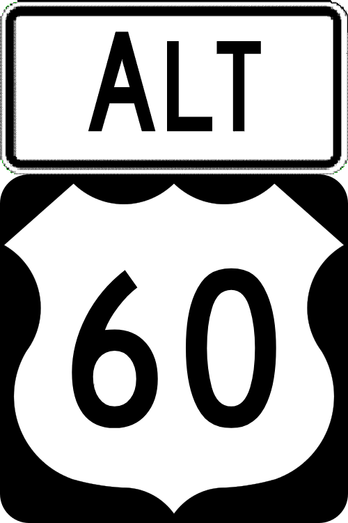
US 60 ALT Huntington
2017 Cabell County
|
|
| Previous US 60 ALT's:
1947 ROUTE LOG
US 60: 0 - 0
Virginia State Line: 0.7 - 0.7
1950 ROUTE LOG
US 60, WV 4: 0 - 0
WV 34 NB: 1.7 - 1.7
US 60, WV 4, WV 34 SB: 1.3 - 3.0
1983 ROUTE LOG
US 60: 0 - 0
I-64, US 119: 1.5 - 1.5
WV 114: 2.2 - 3.7
US 60: 0.7 - 4.4
|
|
US 60 ALT #1: Appeared in 1941 as new primary routing from US 60 (now WV 311) east of White Sulphur Springs across the nearby Virginia State Line.
In 1947, US 60 ALT became part of US 60. Today it is also I-64.
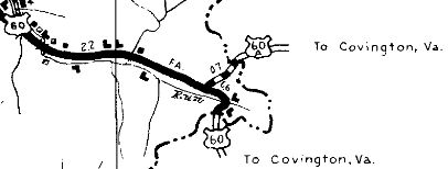
US 60 ALT east into Virginia
1946 Greenbrier County
|
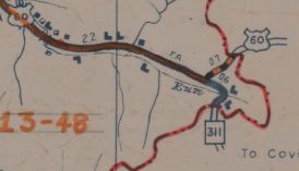
US 60 ALT becomes US 60
1949 Greenbrier County
|
US 60 ALT #2: Appeared about 1943 (bridge date) as a renumbering of US 60/WV 4 through Hurricane.
Between 1950-56, US 60 ALT was renumbered as WV 34 ALT on the western leg and remained WV 34 on its eastern leg.
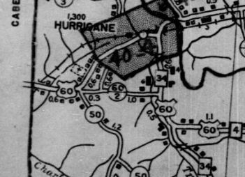
US 60/WV 4 through Hurricane
1937 Putnam County
|
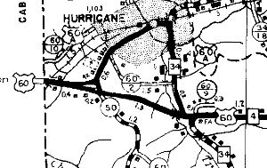
US 60 ALT through Hurricane
1946 Putnam County
|
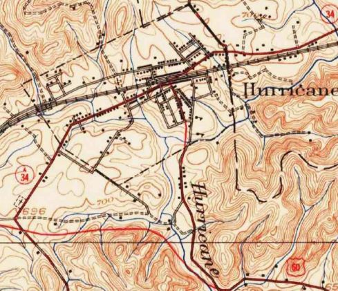
WV 34 ALT in Hurricane (earliest explicit reference I can find)
1963 Topo
|
US 60 ALT #3: Appeared as early as 1946 as new routing through Charleston using Kanawha Blvd and Pennsylvania Ave between Patrick and Chesapeake Aves in Charleston.
US 60 ALT is explicitly shown through at least 1983 and implied through at least 1989 on state officials. The 1992 official clearly shows it gone, with the part east of Greenbrier becoming part of US 60 but the rest west to Patrick St being downgraded to secondary. Today the secondary part is HARP 1054.
|
US 60 ALT in Charleston
1975 Official
|
|