< US 31E | Home | US 33 >
| |||||||||
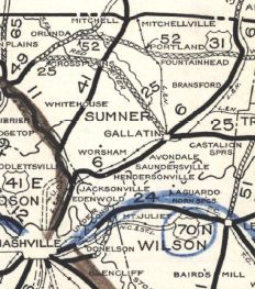
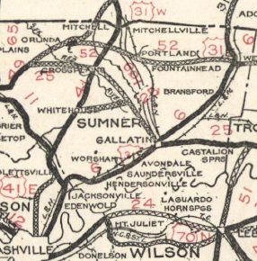
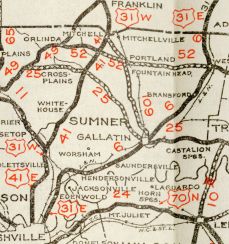
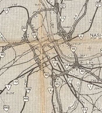
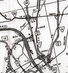
| ROUTE LOG US 31, US 31E, US 41 SB, US 431, TN 6, TN 11 SB: 0 - 0 US 31E, TN 6: 0.3 - 0.3 I-24 (exit 47): 0.2 - 0.5 US 431 NB, TN 65: 2.1 - 2.6 I-65 (exit 90): 2.3 - 4.9 TN 155: 0.2 - 5.1 TN 45: 2.2 - 7.3 TN 174: 4.6 - 11.9 Sumner-Davidson Line: 1.2 - 13.1 US 41 NB, TN 11 NB, TN 41 Begin: 0.3 - 13.4 I-65 (exit 98): 0.3 - 13.7 TN 257: 4.8 - 18.5 TN 258: 4.5 - 23.0 TN 76 WB: 0.7 - 23.7 TN 76 EB: 0.2 - 23.9 TN 25: 4.0 - 27.9 TN 52: 5.0 - 32.9 TN 109: 2.9 - 35.8 TN 259: 0.5 - 36.3 KY STATE LINE: 0 - 36.3 |
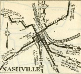
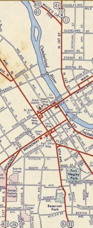
Creation: US 31W was requested by Tennessee in July 1929 at the request of Kentucky and approved shortly after. It initially began at US 31-70 (Union at 6th) Nashville and was co-signed with US 31W to near Edenwold and followed US 41E (now Rivergate Pkwy and Two Mile Pike) away from US 31E. It left US 41E at today's Old Stone Bridge Rd jct heading northeast on and following TN 41 Old Louisville Pike on its way to Kentucky.
Adjustments: In 1932, US 41E was placed on new routing out of Nashville. US 31W was removed from Rivergate Pkwy and Two Mile Pike and placed on this new routing, changing its south endpoint to 1st and Main in Nashville. US 31W was removed from Old Louisville Pike at this time.
In 1937, as part of a proposal to extend US 42 from Cincinnati to Memphis, AASHO tried to eliminate US 31W in its entirety. In 1939, US 31W was removed from C Smith Rd in Millersville; New Radar Rd (no longer connects to)/Woody Ln Jarrett Rd, Denson Ln and Florence Ln into White Hill In 1941, US 31W was removed from "Old Hwy 31" and Meadowlark Rd near Rolling Acres In 1947, US 31W was removed from "Old Hwy 31W" (no longer connects to) and South Rd in the TN 25 area; "Old Hwy 31W" at the Red River area; lengthy visible abandoned segment to the west from Old TN 52 EB to north of Byrum Chapel Rd; Old Hwy 31W in the Summers Branch area Between 1952-56, US 31W was rerouted in Nashville, to follow Deadrick to 8th then south to US 31-70 Broadway. Between 1959-67, US 31W was truncated to US 31-31E, which would be 1st at Main if by 1964, otherwise Spring at Main About 1978, US 31W south was extended west on Main to the current US 31E freeway south end.
Posting: Fully posted though not that great at its southern end. Secret TN Route Overlay: TN 11 (13.4 mi) TN 41 (22.9 mi) Comment: With I-65 so close by, US 31W is strictly local traffic these days. | ||||||||