< TN 71 | Home | TN 73 >
|
|
|
| ROUTE LOG |
TN 58: 0 - 0 TN 322: 5.4 - 5.4 Loudon-Roane Line: 2.2 - 7.6 I-75 (exit 72): 6.3 - 13.9 US 11, TN 2: 2.3 - 16.2 TN 444: 7.1 - 23.3 Monroe-Loudon Line: 1.3 - 24.6 Loudon-Monroe Line: 0.1 - 24.7 Monroe-Loudon Line: 0.6 - 25.3 TN 322: 1.8 - 27.1 US 411 SB, TN 33 SB: 2.2 - 29.3 TN 360: 2.4 - 31.7 US 411 NB, TN 33 NB: 2.7 - 34.4 Blount-Monroe Line: 5.5 - 39.9 Monroe-Blount Line: 1.5 - 41.4 US 129, TN 115: 2.0 - 43.4
|
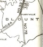
Creation: An original state highway that in 1924 ran from the North Carolina Line at Deal Gap to TN 33 Maryville.
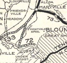
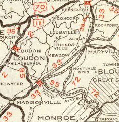
| Adjustments: In 1927 or 1928, TN 72 was rerouted to end at TN 33 (now Old Niles Ferry Pike) southwest of Maryville. The original route used Happy Valley Rd and Montvale Rd to Maryville. In 1930, TN 72 was extended north on Old Niles Ferry Pike to the new TN 33 (current US 411) in Maryville. In 1934, TN 72 was rerouted near Tallassee to instead replace TN 95 northwest to Loudon, then extended west as new routing to end at TN 58 (now Walnut Grove Rd) near today's TN 58-304 jct. 4 miles below Kingston. The old route to Maryville became TN 115 (which connected to US 411 where it does now) and Old Niles Ferry Pike was removed from the state highway system.
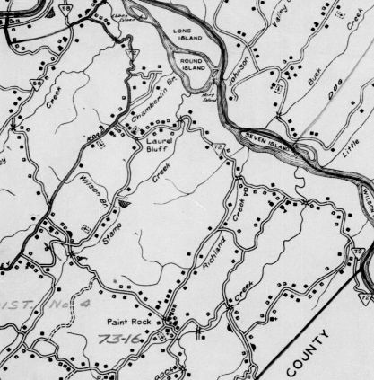
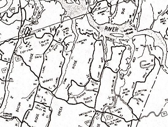
In 1935, US 129 was added to TN 72 from North Carolina to US 411 near Vonore. In 1942, TN 72 was rerouted west of I-75 to its current path. Only the part between Myrtle Ward Rd and Pattie Gap Rd in eastern Roane County was actual new construction. The old route used to run much closer to the Tennessee River which was expanding into Watts Bar Lake at this time. Surviving parts of original TN 72: Marney Cove Rd; Manley Dr/Chamberlair Cove Rd/Laurel Bluff Rd/Broken Arrow Point; Hickey Rd/Paint Rock Rd to about 1/2 mile after it turns south; N. Tennessee Chapel Cir/Tennessee Chapel Ln; Huffine Rd/Marble Bluff Rd; a bit of Corporate Blvd
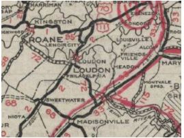
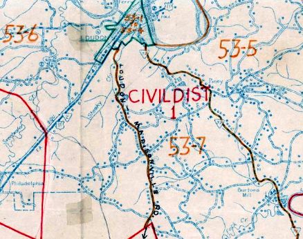
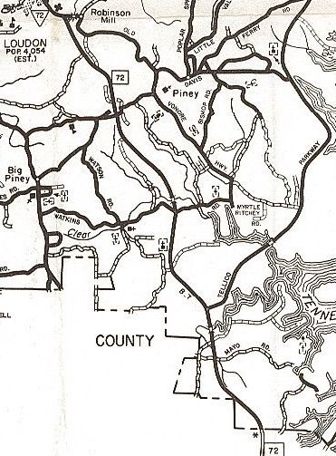
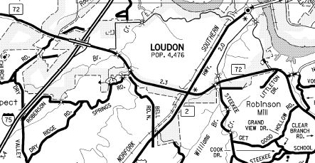
In 1956, TN 72 was built on new alignment slightly north of the original from just west of Chilhowie Dam to the Tabcat Creek bridge, about 6 miles worth. The old alignment is now underwater though is visible during dryer times, especially the old Abrams Creek Bridge. By 1974, TN 72 was removed from River Rd West and River Rd west out of Loudon, creating a longer US 11 overlay.
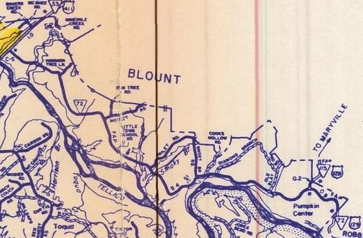
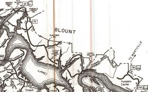
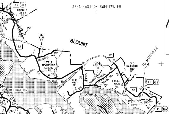
In 1981, TN 72 was moved to its modern routing east of Loudon to Vonore to accommodate Tellico Lake north of US 411. The former route used Vonore and Old Vonore Hwys and a litle bit of Chop Way; the old route is underwater to Monroe County except a tiny Old Vonore Hwy near current TN 72; pieces of Rarity Bay Pkwy; underwater some more; Church St in Vonore About 1982, TN 72 east was truncated to just east of the Nine Mile Creek Br east of US 411. TN 72 was removed from Clearview Dr and Marina Harbor Dr on each side of the creek. The rest of the route to US 129 near Tallassee was removed from the state highway system, and the route to NC with US 129 becoming more TN 115. The old route used current 72 to about where it turns away from the lake at Smoky Branch; "Old Hwy 72" that is accessible via Smoky Rd or Diamond Branch Rd; abandoned Old Hwy 72 that is not drivable just west of US 129. In 1988, TN 72 was removed from US 11 and Grove St est out of Loudon.
In 1990, TN 72 was re-extended east to US 129 near Tallassee as partial new construction mostly in Blount County.
 TN 72 east re-extended as new construction back to US 129 2007 Monroe County Posting: Posted as primary routing throughout. The US 411 overlay is posted Secret US Route Overlay: None Comment: TN 72 has almost no routing that follows an of its pre-1940 alignments as it has had to avoid 3 lakes. TN 72 was the original designation for the Tail of the Dragon. | |||||||||||||||||