< VA 304 | Home | VA 306 >
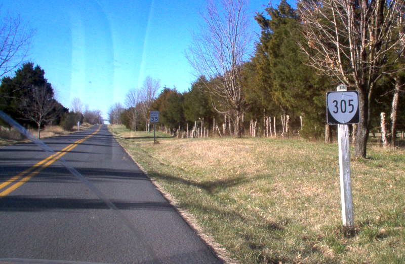
Photo: VA 305 leaving its northern end (photo by Mapmikey May 2006)
| ||||||||||||
| ROUTE LOG VA 211: 0 - 0 VA 305 END: 1.79 - 1.79 |
Creation: First designated in CTB Minutes in June 1968;
First appeared on the main official map in 1971 (was shown on the 1970
historical picture map on reverse of main map) as an upgrade to an I-81
frontage road. Ran as it does today. This is the 4th VA 305.
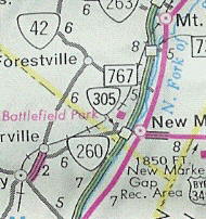
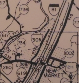
Adjustments: The original length of VA 305 was 0.8 miles. I cannot find any CTB documentation showing when it was lengthened, perhaps it was a typo of 1.8 which is the distance shown on the 1975 Shenandoah County map. Improvements: Paved upon inception; no multilane segments Posting: Fully posted; cutouts removed around 2000. Multiplexes: NONE Legislative names: George R Collins Memorial Pkwy (since 10/9/69) - entire route Other names: Miller Ln. Scenic Byway: No segments Comment: VA 305 is shown on the historical maps on the reverse of VDOT maps in the 70's.
| |||||||||||
| Previous VA 305's: 1931 ROUTE LOG US 60, VA 10: 0 - 0 US 15, VA 32: 14.6 - 14.6 1940 ROUTE LOG US 58: 0 - 0 Washington-Grayson Line: 19 - 19 VA 34: 0.58 - 1.12 US 360, VA 344: 7.20 - 8.32 1960 ROUTE LOG US 60: 0 - 0 END VA 305: 0.5 - 0.5 GAP END VA 305: 0 - 0.5 US 60; 1 - 1.5 |
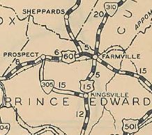
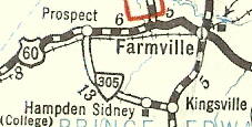
VA 305 #1: Appeared in August 1928 as a newly numbered
route. Ran from US 15/VA 32 Kingsville 13.26 miles west toward US 60/VA
10 (curr US 460) Prospect.
In August 1929 (CTB Minutes), VA 305 was extended the 1.34 miles to US 60/VA 10. VA 305 was renumbered as VA 133 in July 1933. Today it is mostly SR 658 and a tiny part of VA 133.
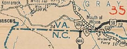
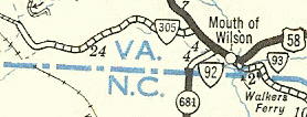
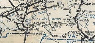
VA 305 #2: Appeared Aug 1936 (CTB), as an upgrade to SR 735 and a bit of SR 740, although before ca.1928 this had been part of original VA 12. Ran from US 58 (curr VA 16) Volney west 4.26 miles to end at SR 743 near Rugby. In Sept 1937 (CTB), VA 305 was extended west 12.4 miles replacing SR 740 and SR 725 to end at SR 754 near White Top Mtn. In May 1938 (CTB), VA 305 was extended west over more SR 725 then SR 726 to 1.07 miles inside Washington County. In July 1940 (CTB), VA 305 was extended west over more SR 726, then SR 603 the 16 miles to VA 78 (now SR 1212) near Damascus. In Oct 1940 (CTB), VA 305 was renumbered as US 58.
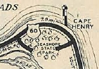
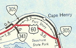
VA 305 #3: Appeared Aug 1941 (CTB) as a renumbering of two pieces of US 60. Each piece was a stub off US 60 to Fort Story - one near Seashore State Park and one where US 60 turned parallel to the ocean. These 2 pieces were never connected as one route. In Dec 1960 (CTB). VA 305 was decommissioned to SR 1246 Atlantic Ave. VA 305 remained on official maps through the 1963 issue. Virginia Beach didn't get the memo, as both segments were posted from US 60 into the 1990s and the western segment was posted until about 2014.
|
|||||||||||

Previous: VA 304 |
Next: VA 306
Top | Virginia Hwy Index
Home
Page last modified 24 January 2020