< VA 56 | Home | VA 58 >
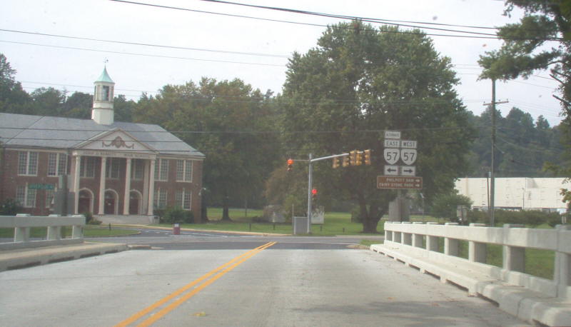
Photo: VA 57 westbound at VA 57 ALT at the Smith River bridge (photo by Mapmikey 9/23/06)
|
|
|
| ROUTE LOG |
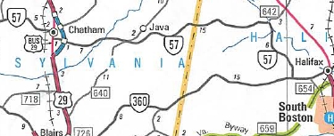
VA 8: 0 - 0 VA 346: 7.88 - 7.88 Henry-Patrick Line: 2.98 - 10.86 VA 57 ALT: 5.86 - 16.72 US 220 NB, US 220 Bus: 3.84 - 20.56 US 220 SB: 0.77 - 21.33 Martinsville-Henry Line: 3.68 - 25.01 US 220 Bus NB, VA 457: 1.68 - 26.69 US 58 Bus WB, US 220 Bus SB: 1.10 - 27.79 Henry-Martinsville Line: 2.54 - 30.33 US 58 Bus EB: 0.54 - 30.87 VA 457: 2.50 - 33.37 Pittsylvania-Henry Line: 10.30 - 43.67 VA 41: 4.95 - 48.62 US 29 Bus NB: 11.77 - 60.39 US 29 Bus SB: 0.19 - 60.58 US 29: 0.81 - 61.39 Halifax-Pittsylvania Line: 14.46 - 75.85 VA 360: 12.85 - 88.70
|
Creation: Appeared Dec 1930 (CTB) as a renumbering of VA 302, running from VA 12 (now VA 360) west to 5 miles past US 170/VA 14 (now US 29 Bus) Chatham. A second piece of VA 57 was created as new primary routing from VA 12 (now US 58 Bus) Martinsville east 8.27 miles towards Callands. This is the only VA 57.
| 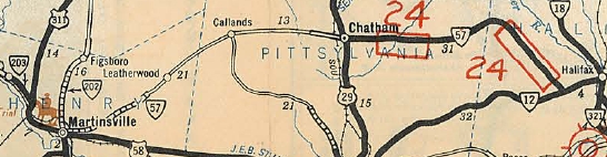
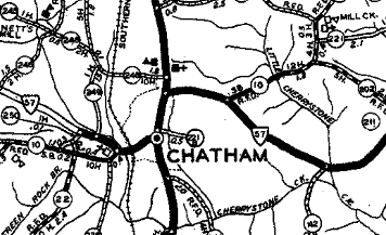
VA 57 appears in two pieces 1932 Official Adjustments: In June 1931 (CTB), the Martinsville piece of VA 57 was extended east 1.66 miles. In July 1932 (CTB), the Martinsville piece was extended east 5.92 miles to the Pittsylvania line and the Chatham piece was extended 1 mile west. In July 1933, VA 57 was extended west with US 58 into Martinsville, then north with US 311 out to Bassett Forks, then replaced VA 203 west through Bassett to end at the Patrick County line. In March 1934 (CTB), VA 57 was rerouted in Chatham to use its current alignment east of US 29 Bus. Originally it had followed 29 Bus north to SR 685 east, then SR 703 southeast back to current 57.
In Sept 1934 (CTB), the Chatham piece of VA 57 was extended west 6.99 miles. In Oct 1935 (CTB), VA 57 was made continuous when the remaining 5.84 mile gap was closed in western Pittsylvania County. 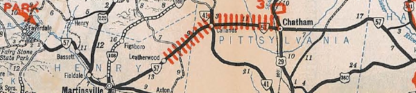
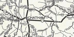
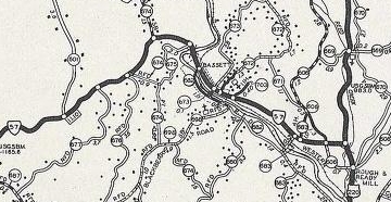
VA 57 extended west to Patrick County and made continuous 1936 Official In May 1943 (CTB), VA 57 was removed from SR 918 (now SR 1428) Moses Mill Rd in Chatham. In April 1944 (CTB), VA 57 was removed from SR 754 Edgewood Dr in the Bassett Forks area and instead replaced a bit of VA 57-Y to Bassett Forks before cutting west as new routing. In Dec 1947 (CTB), VA 57 was removed from SR 755 Woody Circle and SR 756 Reed Stone St in Bassett. In May 1948, the CTB turned down a request to extend VA 57 west to VA 8. In May 1952 (CTB), VA 57 east was truncated to US 29 (now 29 Bus) Chatham, leaving behind SR 832. 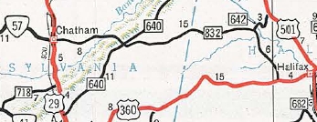
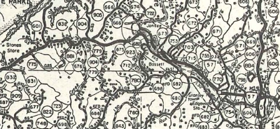
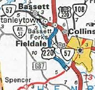
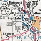
VA 57 east truncated to Chatham 1953 Official In March 1953 (CTB), VA 57 was rerouted west of Bassett to its current Smith River crossing, leaving behind a longer, looping SR 682 and SR 666 (now also partly SR 674).
In May 1957 (CTB), VA 57 was extended west over SR 625 to VA 8. 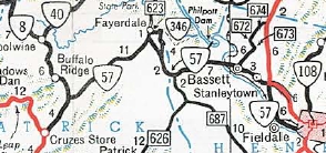
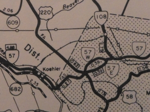
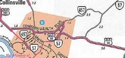
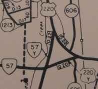
VA 57 west extended to VA 8 1959 Official In Oct 1960 (CTB), VA 57 was removed from SR 833 Clarence Martin Rd; SR 668 Holly Hill Rd; SR 653 Mt Hermon Church Rd; part of SR 904 Krontz Rd In Sept 1961 (CTB), VA 57 was removed from SR 912/687 in western Henry County. In Oct 1964 (CTB), VA 57 was removed from SR 840 Ida Loop; SR 838 Shelton Circle; SR 731 Clark Loop near Fairy Stone State Park. In July 1965 (CTB), VA 57 was rerouted in Marinsville off of Church St and instead onto current VA 457's routing in eastern Martinsville. In Aug 1966 (CTB), VA 57 was removed from SR 1154 loop and SR 1155 Hudson Circle west of Chatham. In Oct 1966 (CTB), VA 57 was removed from SR 842 Piano Rd; SR 843 Meadow Brook Loop; SR 844 Fairystone Church Loop Rd in western Patrick County. In July 1967 (CTB), VA 57 was removed from SR 1170 Glory Rd and SR 1171 Cedar Gates Loop east of Callands In March 1969 (CTB), VA 57 was rebuilt leaving behind several abandoned alignments from VA 41 west to Henry County. In Jan 1970 (CTB), VA 57 was removed from SR 979 Breckenridge Cir in northeastern Henry County. In June 1973 (CTB), VA 57 was given one-way alignments with EB using Church St and WB using Fayette St In Jan 1978 (CTB), VA 57 was removed from more of today's SR 754 when the current US 220-220 Bus-VA 57 interchange was completed. In June 1983 (CTB), VA 57 was removed from SR 973 Inge Dr east of Martinsville. In Jan 1992 (CTB), VA 57 was rerouted in Martinsville to its current routing via US 58 Bus and US 220 Bus. The old routing became VA 457. In Dec 2001 (CTB), VA 57 was re-extended east over SR 832 back to VA 360.
Improvements: Paved upon designation from Chatham to VA 12 In 1933 VA 57 was paved from Bassett to well east of Martinsville In 1934, VA 57 was paved from Bassett west to Patrick County In 1937 the remainder of VA 57 was paved. VA 57 was first multilaned on its Martinsville duplexes in 1960 or 1961. In 1964, VA 57 was multilaned between VA 57 ALT (now SR 903) and US 220. In 1976, VA 57 was multilaned on the newly built US 220 Bypass Posted: Fully posted; cutouts in the Bassett area remained until the late 90s. Multiplexes: US 220 (0.77 mi) US 220 Bus (1.10 mi) US 58 Bus (3.08 mi) US 29 Bus (0.19 mi) Legislative names: Fairy Stone Park Highway in Patrick and Henry Counties, since 3-26-46. Other names: William F Stone Hwy (US 220 duplex); Appalachian Dr (US 220 east to Martinsville line); Fayette St/Memorial Blvd/Starling Ave/Church St (Martinsville); A.L. Philpott Hwy (US 58 BUs duplex in Henry Co); Chatham Rd (Henry Co east of 58 Bus); Callands Rd (Pittsylvania Co west of Chatham); Depot St/Main St (Chatham); Halifax Rd (Pittsylvania Co east of Chatham); Chatham Rd (Halifax Co) Scenic Byway: No segments Comment: VA 57 is much easier to drive to VA 8 than parallel VA 40 to the north. | Previous VA 57's: |
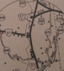
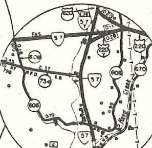
VA 57-Y: The earliest explicit reference to VA 57-Y in the CTB is March 1949, but I am pretty certain this was created in 1940 as a renumbering of a piece of US 220 in the Bassett Forks area when US 220 was placed on current US 220 Business north of Martinsville. It ran from VA 57 (now SR 734 Edgewood Dr) north to US 220, probably at the location of the end of the NB ramp from 220 Business to 220. In April 1944 (CTB), VA 57-Y south was truncated when VA 57 was removed from the E-W segment of SR 754 and put on its current route west of US 220 at Bassett Forks. VA 57-Y may have instead cut east on newly constructed road to meet US 220-Y. See the scan at right.
In Jan 1978 (CTB), VA 57-Y was decommissioned (destroyed) when the current interchange at US 220/220 Business/VA 57 was built.
|
|||||||||||||||||
Page last modified 9 March 2013