< VA 55 | Home | VA 57 >
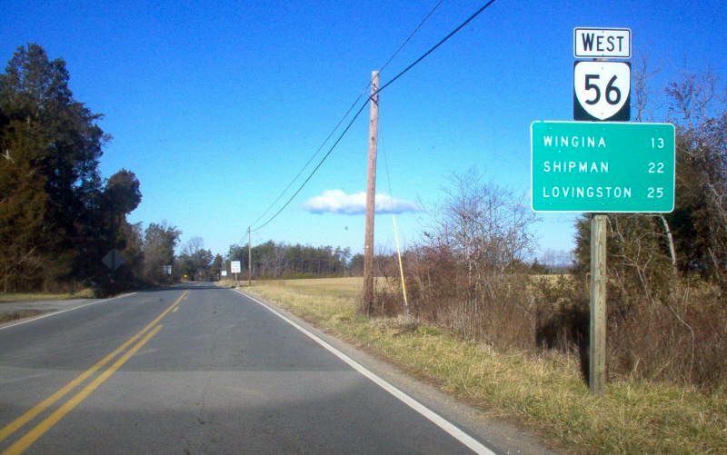
Photo: VA 56 westbound leaving US 60 (photo by Mapmikey 1/26/06)
|
|
|
| ROUTE LOG |
US 11: 0 - 0 Rockbridge-Augusta Line: 0.17 - 0.17 Blue Ridge Pkwy: 5.26 - 5.43 Nelson-Rockbridge Line: 0 - 5.43 VA 151 NB: 18.26 - 23.69 VA 151 SB: 2.56 - 26.25 VA 151Y: 0.20 - 26.45 US 29 SB: 4.83 - 31.28 US 29 NB, US 29 Bus BEGIN: 4.28 - 35.56 US 29 Bus NB: 0.30 - 35.86 Buckingham-Nelson Line: 14.54 - 50.40 US 60: 10.47 - 60.87
|
Creation: Appeared Dec 1930 (CTB) as new primary routing:
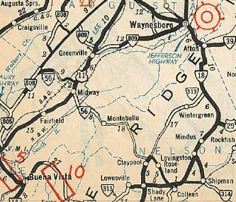
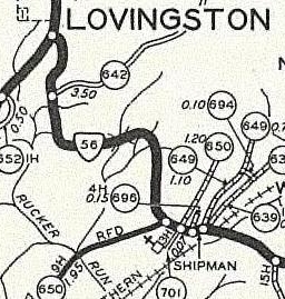
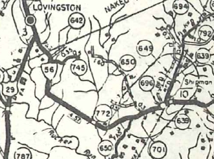
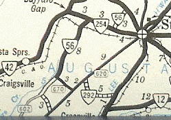
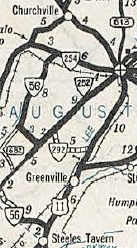
| 1.VA 808 (now VA 252) east 3 miles towards Spottswood 2.US 11/VA 33 Steeles Tavern east to today's SR 603 near Montebello. This is the only VA 56. Adjustments: In July 1933, two more pieces of VA 56 were created: 3. SR 602/677 jct near Sumerdean north to VA 254 above Swoope, then east with VA 254 and then north to end at VA 5 (now US 250) west of Staunton. This was a renumbering of VA 808. 4. US 29 Lovingston southeast to US 60 Dentons Corner. This was a renumbering of VA 314 and a bit of VA 306.
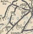
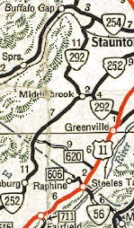
The July 1940 Official shows VA 56 between Middlebrook and VA 254 renumbered as VA 278 and the piece between VA 254 and US 250 downgraded to SR 612. These actions were apparently legislative as mentioned in the Oct 1940 CTB minutes. The Oct 1940 (CTB) defines VA 56's route: The west end was VA 254 near Swoope and was routed at Sumerdean southeast to VA 252 Middlebrook, replacing the short-lived VA 278. Because VA 252 was made continuous south to Rockbridge County in July 1940 (CTB), this made VA 56 continuous from VA 254 to VA 151. In May 1946 (CTB), VA 56 between VA 252 and US 11 was downgraded to SR 620. This stranded VA 56 north of Middlebrook, so it was renumbered as part of VA 292 (now SR 876).
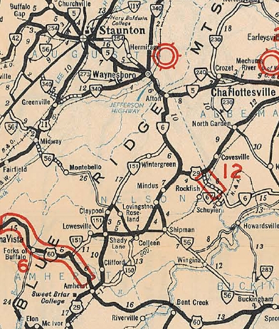
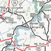
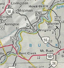
In Oct 1954 (CTB), VA 56 east was truncated to SR 647 Shipman, leaving behind SR 777. In Aug 1959 (CTB), VA 56 east was re-extended to US 60.
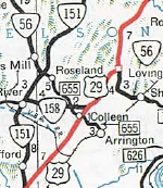
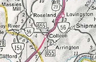
In Oct 1970 (CTB), VA 56 was finally made continuous by following VA 151 south, replacing VA 151-Y and VA 158 east to US 29 at Colleen, then following US 29 north to Lovingston.
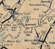
Improvements: Paved upon designation from Sumerdean to the VA 254 east split; Lovingston to Shipman In 1934, VA 56 was paved from VA 252 east a couple miles; Shipman to US 60 In 1936, VA 56 was paved from VA 151 west to Massies Mill. The Aug 1936 extension of piece 3 was paved. In 1937, VA 56 was paved from US 11 to Spottswood. In 1940, VA 56 was fully paved north of Middlebrook and from US 11 east to the South River. In 1948, VA 56 was paved from the Blue Ridge Pkwy east to the Massies Mill pavement. The last segment of VA 56 from the South River to the Blue Ridge Pkwy was paved in 1950. VA 56 is multilaned on its US 29 duplex - the north half upon designation in 1970 and the south half in 1972. Posted: Fully posted; last known cutouts were in the area west of the Blue Ridge Pkwy in the late 1990s. Multiplexes: VA 151 (2.56 mi) US 29 (4.83 mi) US 29 Bus (0.30 mi) Legislative names: None Other names: Tye River Tpk (w of BRP); Crabtree Falls Hwy (BRP to VA 151); Patrick Henry Hwy (VA 151 duplex); Ty Branch Hwy (VA 151 to US 29); Thomas Nelson Hwy (US 29 duplex); James River Hwy (Buckingham Co) Scenic Byway: Blue Ridge Pkwy to VA 151 (8-19-76); US 11 to Blue Ridge Pkwy (12-18-97); Comment: Through trucks are prohibited on VA 56 from US 11 to VA 151 and with good reason. The mountain crossing is extremely gnarly and difficult to drive. It is so difficult that there is actually a TO VA 56 shield on the unpaved SR 814 Campbell Mountain Rd leaving the Blue Ridge Pkwy. The unsuitability for through traffic over the mountain may be the reason why VA 56 was never extended west to I-81. The route log has always described VA 56 as continuous between Lovingston and Massies Mill, so it was puzzling that when US 29 was moved to its current route between Amherst and Colleen that the piece east of VA 151 was numbered VA 158 instead of VA 56. This implies another route for VA 56 was being envisioned at some point. Was it today's SR 655 between Colleen and Roseland (once part of original VA 18)? The 1939 VDOT report on primary system development had recommended that VA 56 be decommissioned from US 11 to VA 151. | |||||||||||||||||||
Previous: VA 55 |
Next: VA 57
Top | Virginia Hwy Index
Home
Page last modified 28 February 2015