< VA 52 | Home | VA 54 >
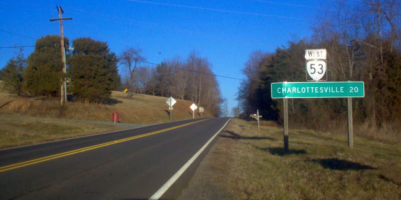
Photo: VA 53 leaving US 15 (photo by Mapmikey 1/22/06)
|
|
|
| ROUTE LOG |
VA 20: 0 - 0 Fluvanna-Albemarle Line: 9.51 - 9.51 US 15: 8.81 - 18.36
|
Creation: Appeared July 1947 (CTB) as a renumbering of VA 20 from Charlottesville to Simeon (SR 795) and an upgrade to SR 642 from Simeon east to US 15 Palmyra. This is the 3rd VA 53.
|
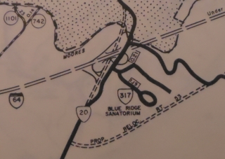
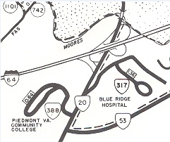
Adjustments: In Sept 1959 (CTB), VA 53 was straightened out at its eastern end. In Jan 1971 (CTB), VA 53 was rerouted from Michie Tavern westward to its current configuration (new construction) to accommodate the I-64 interchange with VA 20. This left behind SR 1102 Michie Tavern Ln. The I-64 WB ramp to VA 20 uses VA 53's original approach to VA 20.
Improvements: Paved upon designation; no multilane segments Posted: Fully posted; Multiplexes: None Legislative names: None Other names: Thomas Jefferson Pkwy (entire route) Scenic Byway: No segments Comment: VA 53 serves Michie Tavern, Monticello, and Ash Lawn. Otherwise it is a sleepy state route. | Previous VA 53's: |
VA 53 #1: Appeared Aug 1928 as new primary routing, running from US 60/VA 39 Andersons Corner north 3.5 miles. A second piece ran from VA 415 (now VA 30-33) south 5 miles to about Barnhamsville.
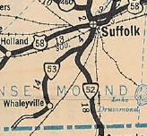
In Aug 1929 (CTB), the northern piece was extended south 0.8 miles to the James City line. In Dec 1930 (CTB), the 0.7 gap in James City county was placed in the primary system. In July 1933, VA 53 was became part of VA 30 . Today this is VA 30 from US 60 to Barnhamsville except it used SR 746 Old Stage Rd; SR 633; VA 273. Oddly, VA 53 should have continued across the Pamunkey River to West Point because this was a VDOT district dividing line and 3-digit routes didn't cross these. However, the 1931 route log says VA 415 crossed the river to West Point. VA 53 #2: Appeared in July 1933 as a renumbering of VA 506, running from VA 52 (now VA 32) near Suffolk southwest to Little Fork Rd (old SR 672) Whaleyville. In Aug 1933 (CTB), VA 53 was extended southwest 2.8 miles. In Sept 1934 (CTB), VA 53 was extended 1.6 miles to the North Carolina Line. In Sept 1940 (CTB), VA 53 was renumbered as VA 37. Today it is part of US 13 except VA 53 used Arthur Dr/Boonetown Rd.
|
|||||||||||||
Previous: VA 52 |
Next: VA 54
Top | Virginia Hwy Index
Home
Page last modified 9 March 2013