< WV 52 | Home | WV 54 >
|
|
|
| ROUTE LOG |
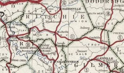
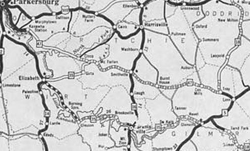
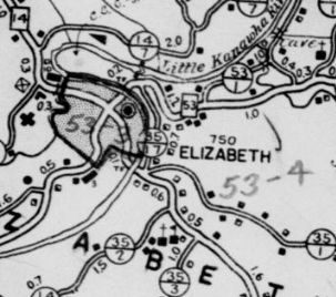
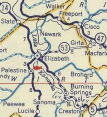
WV 5: 0 - 0 Ritchie-Wirt Line: 8.3 - 8.3 WV 47: 1.5 - 9.8
|
Creation: Appeared between 1929-31 running generally as it does now as a renumbering of WV 11. This is the 2nd WV 53.
|
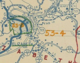
Adjustments: Between 1940-46, WV 53 was rerouted from WV 14 Elizabeth to instead meet WV 5 as it does now. The old route is partly CR 35/17 and also HARP 917 Court St (river crossing was a ferry). Between 1947-49, WV 53 may have been downgraded to CR 53 but by 1956 it was returned to being WV 53. Improvements: Was not paved until after 1956; no multilane segments Comment: A truly minor route
| Previous WV 53's:
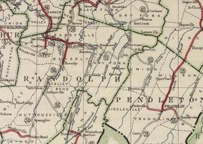
1930 ROUTE LOG WV 56: 0 - 0 WV 40: 22 - 22 VA 28 NB: 37 - 59 VA 28 SB: 1 - 60 Virginia State Line: 20 - 80 |
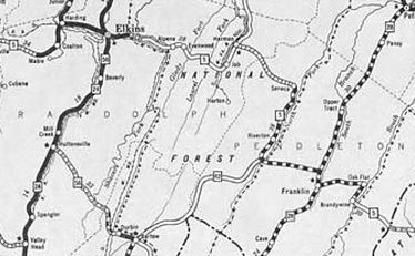
WV 53 #1: Appeared 1922 as new primary routing running from WV 56 (now US 219-250, WV 92) Elkins east and southeast to the Virginia line east of Franklin.
About 1931, WV 53 was renumbered as part of WV 5. Today it is approximated by: US 33 and CR 33/8 east of Elkins, then US 33 to Virginia except: CR 5/18 and 5/19 in the Wymer area; CR 31/CR 28 loop down through Job; CR 9/6 in Riverton; CR 33/8 at Judy Gap which no longer crosses the S. Potomac River; CR 3/7 and CR 3/8 at Oak Flat
|
|||||||||||||