< WV 17 | Home | WV 18 ALT | WV 18 Spur | WV 19 >
|
|
|
| ROUTE LOG |
WV 47: 0 - 0 Doddridge-Gilmer Line: 6.8 - 6.8 US 50: 18.8 - 25.6 Tyler-Doddridge Line: 12.2 - 37.8 WV 74: 5.2 - 43.0 WV 23: 5.2 - 48.2 WV 180: 12.5 - 60.7 WV 2 SB: 7.0 - 67.7 WV 2 NB: 0.9 - 68.6 Ferry: 0.3 - 68.9
|
Creation: Appeared in 1922 as new primary routing running generally as it does now. This is the only WV 18.
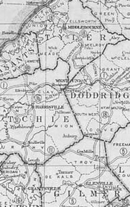
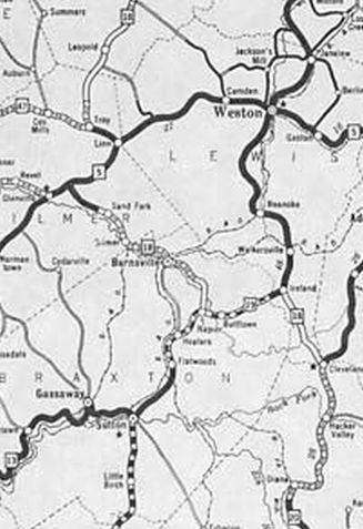
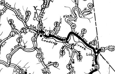
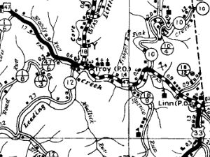
| Adjustments: Between 1929-31, WV 18 was extended south replacing WV 11 to Linn, then followed WV 5 (now US 33-119) southwest to nearly Glenville, then replaced WV 68 throguh Burnsville to Napier, then followed US 19 east to Ireland, then replaced WV 38 to end at WV 20 Cleveland. In 1932, WV 18 south was truncated to WV 5 Linn. Linn to Glenville remained WV 5 (now US 33-119); Glenville to Cleveland became WV 35 (now WV 5 from Glenville to Napier except: CR 5/10 at Burnsville; CR 5/11 and abandoned routing covered by Burnsville Lake. Some of old WV 35 from US 19 Napier northwestward still exists as an access road); Napier to Ireland remains US 19 except between Bullstown and Falls Mill the old route followed the Little Kanawha River much more closely. Surviving pieces are the access road to the Picnic Area at Bulltown and the old road from the Falls Mill side to the south dip in the river; Ireland to Cleveland is now CR 50, CR 50/6, and CR 20/21.
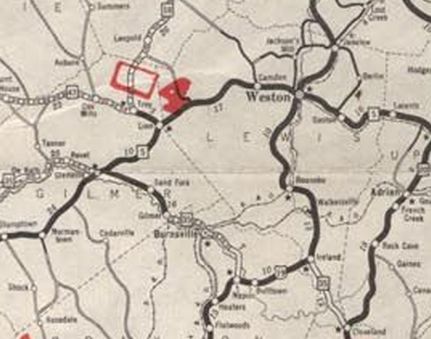
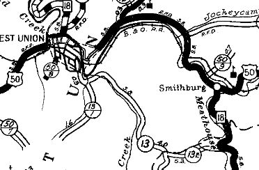
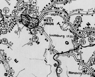
In 1936 or 1937, WV 18 was removed from CR 50/16 into Smithburg and US 50 (now CR 50/30) over to West Union to instead replace CR 13 and CR 13E directly to West Union. Between 1938-46, WV 18 south was truncated to Troy, replaced to Linn by WV 47.
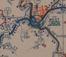
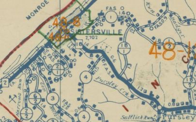
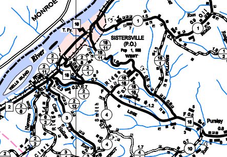
Also in this timeframe, it appears WV 18 was extended across WV 2 to the Sistersville ferry which has been in use roughly 200 years. In the late 1940s, there was a TEMP WV 18 through West Union...
In 1971 or 1972, WV 18 was placed on newly constructed routing from about Pursley to WV 2 south of downtown Sistersville. The old route to WV 2 is now CR 18/11.
Improvements: By 1923, WV 18 was paved in the vicinity of Middlebourne In 1926 or 1927, WV 18 was paved from Tyler to Sistersville By 1931, WV 18 was paved from Sand Fork to Troy By 1938, WV 18 was paved from Troy to Leopold and from West Union to Tyler County By 1942, WV 18 was paved from Leopold to West Union Between 1951-56, WV 18 was paved from WV 74 to Tyler. WV 18 was paved from WV 74 south to Doddridge County sometime after 1956. WV 18 was no multilane segments Comment: WV 18's duplex with WV 2 and over to the Ohio River Ferry is not signed as WV 18 anywhere, and there is an END WV 18 posting where it runs into WV 2 south of Sistersville. |
|||||||||||||||