< US 45E | Home | US 45W Bus | US 51 >
| |||||||
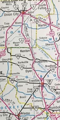
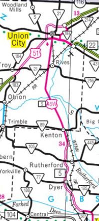
| ROUTE LOG US 45, US 45E, TN 5 SB, TN 43, TN 186: 0 - 0 Gibson-Madison Line: 3.1 - 3.1 US 45W Bus, TN 5 NB, TN 366 Begin: 1.9 - 5.0 TN 152: 0.8 - 5.8 US 70 ALT EB, US 70 ALT Bus, US 79 NB, US 79 Bus, TN 76: 1.5 - 7.3 US 45W Bus, US 70 ALT WB, US 79 SB, TN 5 SB, TN 366 WB: 1.1 - 8.4 TN 420: 3.6 - 12.0 US 45W Bus, TN 367, TN 457: 3.6 - 15.6 TN 54 WB: 1.9 - 17.5 TN 186: 0.4 - 17.9 TN 77 EB, TN 104: 0.7 - 18.6 TN 54 EB: 1.4 - 20.0 US 45W Bus, TN 367: 1.3 - 21.3 TN 77 WB, TN 185: 6.1 - 27.4 TN 105: 3.7 - 31.1 Obion-Gibson Line: 5.5 - 36.6 TN 89 EB: 0 - 36.6 TN 89 WB: 0.1 - 36.7 TN 21 SB: 10.5 - 47.2 TN 216: 1.1 - 48.3 TN 5 NB, TN 21 NB, TN 431 NB: 3.9 - 52.2 TN 184 Begin, TN 431 SB: 0.9 - 53.1 TN 214 SB: 0.9 - 54.0 TN 22 SB, TN 184 END, TN 214 NB: 1.8 - 55.8 US 51 SB, TN 3 SB, TN 22 NB: 0.3 - 56.1 TN 214: 7.2 - 63.3 US 45, US 45E, US 51, TN 3 NB, TN 215: 0.3 - 63.6 |
Creation: Officially approved as a new US route in June 1929 (after calling out Tennessee for unilaterally enacting its existence) as an addition to TN 5 from Three Way to union City and US 51 to end at the Kentucky State line at Fulton KY. Literally feet inside Kentucky US 45W met back up with US 45 and US 45E.
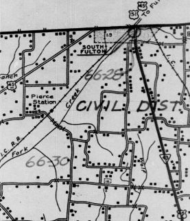
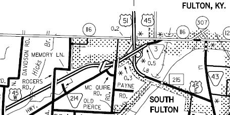
Adjustments: Also around 1929, TN 5/US 45W was removed from Markham Ln/abandoned routing/Old Dyer-Trenton Rd and Poplar St/Old Dyer-Rutherford Rd/Gravette Crosing E. It is unclear how TN 5/US 45W went between those roads It is unclear when US 45W was given its route jogging around the east of Union City, but the original TN 3 Bypass that went that way appeared between 1955-60. US 45W originally had used TN 21 and TN 214 in and out of downtown. About 1963, US 45W was given its bypass around the east of Trenton, leaving behind US 45W Bus. Around 1979, US 45W was removed from today's TN 214 between Union City and South Fulton. In 1982 (AASHO), US 45W was placed on the Humboldt Bypass, leaving behind US 45W Bus. In 1989 (AASHO), US 45W was truncated in South Fulton to the bypass. The old surface route into Kentucky became US 45.
In 1992, US 45W was removed from Three Way Lane at the US 45E-W split in Three Way and put on the new interchange alignments in the area, changing the location of the south endpoint. About 2000, US 45W was given its bypasses around the west of Dyer and Rutherford, leaving behind Trenton Hwy, Main St in Dyer (some of this is still TN 185), and Trenton St in Rutherford.
Posting: Fully posted Secret TN Route Overlay: TN 5 I (5.0 mi) TN 366 (3.4 mi) TN 5 II (43.8 mi) TN 431 (0.9 mi) TN 184 (2.7 mi) TN 22 (0.3 mi) TN 3 (7.5 mi) Comment: US 45W is several miles longer and has way more two-lane than US 45E, but is the best route from I-40 Jackson to the northwest corner of the state. | ||||||