< US 25 | Home | US 25W >
|
|
|
| ROUTE LOG |
US 25, US 25W, US 70 WB, TN 9 NB, TN 32 SB: 0 - 0 Jefferson-Cocke Line: 6.1 - 6.1 TN 341: 3.3 - 9.4 TN 113 SB: 1.6 - 11.0 Hamblen-Jefferson Line: 1.6 - 12.6 I-81 (exit 8): 0.3 - 12.9 TN 343: 1.8 - 14.7 TN 113 NB: 0.7 - 15.4 TN 160: 1.5 - 16.9 US 11E SB, TN 34 WB: 2.5 - 19.4 US 11E NB, TN 34 EB: 0.2 - 19.6 TN 343: 2.5 - 22.1 Grainger-Hamblen Line: 0.4 - 22.5 TN 375: 3.4 - 25.9 US 11W NB, TN 1 EB: 2.3 - 28.2 US 11W SB, TN 1 WB: 2.8 - 31.0 TN 131 SB: 7.5 - 38.5 TN 131 NB: 0.1 - 38.6 Claiborne-Grainger Line: 3.7 - 42.3 TN 33 NB: 3.1 - 45.4 TN 33 WB: 5.8 - 51.2 TN 345: 0.2 - 51.4 TN 63 EB: 9.0 - 60.4 TN 63 WB: 0.3 - 60.7 US 58, TN 383: 2.0 - 62.7 KY STATE LINE: 0.8 - 63.5
|
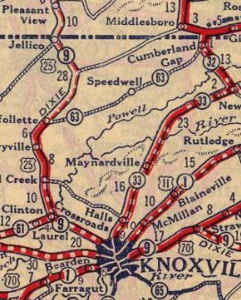
Creation: First mapped by Tennessee in November 1927 as an addition to TN 33 from Knoxville (Western at Broadway) to Tazewell and TN 32 from Tazewell to Virginia at Cumberland Gap. AASHO eventually noticed US 25E on Tennessee maps and accepted their belated request to make this change in mid-1929
| Adjustments: If US 25E ever used Walker Dr near today's I-640, it stopped doing so by 1930. In 1931, US 25E south was rerouted at Tazewell to continue southeast through Morristown to rejoin US 25 in Newport. The old route from Tazewell to Knoxville remained TN 33. Today this is still TN 33 except: Old Broadway in the I-640 and TN 331 interchange area; abandoned alignment/Old Maynardsville Pike at the north edge of Knoxville; several Old Maynardsville Pike segments north of TN 131; Jogging St and Raceway Dr south of Paulette; Old Maynardsville Hwy, Butler Ln and Karen Ln near Paulette; John Deere Dr through Raccoon Valley; Main St through Maynardsville; Old SR 33 Cupp Mill; New Hope Rd in Sandlick; Seals Rd sw of New Tazewell; Old State Hwy 33 leading into New Tazewell; Old Knoxville Hwy within New Tazewell; Old Knoxville Rd/Tazewell Rd between New Tazewell and Tazewell; Old Knoxville Rd in Tazewell
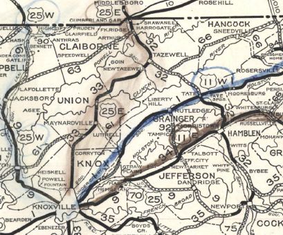
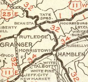
In 1931 or 1932, US 25E was removed from US 11E (now 1st St/Daisy St/Main St) and Liberty Hill Rd out of Morristown.
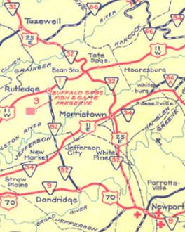
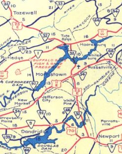
In 1934, US 25E south was rerouted below Morristown to head through White Pine to US 70 west of Newport. The original routing used Old White Pine Rd, Leepers Ferry Rd (no longer crosses Nolichucky River), Solomon Ferry Rd, Point Pleasant Rd, Holt Town Rd, Waxwing Rd, TN 160, US 321 into Newport. Also in 1934, US 25E was removed from Old Witt Rd below Morristown. Also in 1934, US 25E was removed from Old SR 32 in Raven Hill If US 25E used Nettleton Rd between Cleveland Ave Harrogate and the US 58 interchange it stopped doing so by 1935. By 1936, US 25E was removed from Old Kentucky Rd from the Springdale area to Tazewell Around 1942, US 25E was rerouted around the east and north of the new Cherokee Lake north of Morristown. The old route veers northwest at Needmore (TN 343 north end area) and manages to be underwater continuously (including going under the TN 375 bridge) until US 11W near Rock Haven; US 25E was also removed from Old Hwy 25E through Rock Haven up to the rerouted TN 32 on Clinch Mtn (using Ridgeview Rd)
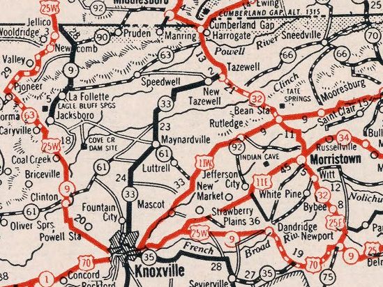
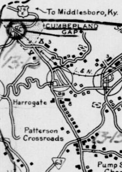
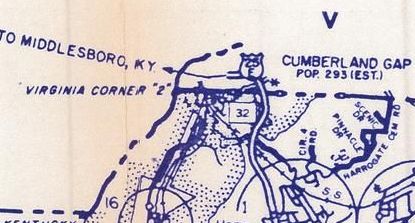
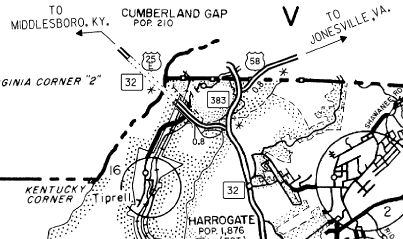
In 1956, US 25E was removed from Dry Valley Rd/Old Dry Valley Ln and Larry Keaton Rd at the Clinch River Between 1952-58, US 25E was removed from Dogwood Heights Dr through Bacchus and Blairs Creek Rd In 1959, US 25E was removed from Old US 25E in northern Tazewell Between 1965-70, US 25E was removed from Patterson Rd, Catalapa Ave and some Nettleton Rd in Harrogate Around 1970, US 25E was placed on a bypass using current US 58 and Cumberland Dr around the east of Cumberland Gap TN, leaving behind S. Cumberland Dr, Brooklyn St, Colwyn St and N Cumberland Dr northeast into Virginia. In 1975, US 25E was placed on a bypass around the east of Morristown. The old route through town remained TN 32 (now TN 343). In 1979, Tennessee proposed changing US 25E to US 25. It appears Kentucky did not wish to follow suit. In 1981, US 25E was removed from Ridgeview Rd on Clinch Mountain and "Old Hwy 25E" through Thorn Hill. In 1996, US 25E was routed through the new tunnel directly to Kentucky, leaving behind an extended US 58 and unnumbered Cumberland Dr northwest into Virginia.
In 1998, US 25E was removed from Broadway Dr to Bean Station and Main St leaving Bean Station. In 2001, US 25E was rerouted to bypass Tazewell. This removed US 25E from Maples Ln, Youngstown Rd and a rerouted TN 33 on Broad St About 2010, US 25E was removed from Old SR 32 between Tazewell and Springdale Posting: Fully posted Secret TN Route Overlay: TN 32 (entire route) Comment: US 25E major corridor north of interstate 81 and is a viable mostly 4-lane route to get to I-75 in Kentucky while avoiding Knoxville. Given that US 25W is so close to I-75, it would make sense to get rid of that and make US 25E become US 25. | |||||||||||||||
Previous: US 25 |
Next: US 25W
Top | Tennessee Hwy Index
Home
Page last modified 6 February 2021