< US 58 | Home | US 63 >
| ROUTE LOG MS STATE LINE: 0 - 0 TN 175 WB: 2.1 - 2.1 TN 175 EB: 0.8 - 2.9 I-55 (exit 7): 4.5 - 7.4 US 64 EB, US 70 EB, US 78 EB, US 79 NB, TN 1 EB, TN 14 NB: 3.1 - 10.5 I-55 SB (exit 12): 0.7 - 11.2 AR STATE LINE: 0.7 - 11.9 |
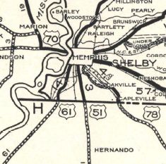
Creation: US 61 was an original US route, running generally as it does now, following TN 14 from Mississippi to Memphis, then TN 1 west to the Mississippi River Bridge to Arkansas.
Adjustments: About 1929, US 61 was placed on completely new routing, using 3rd St the entire way to Mississippi. The old route used Florida St, Old Horn Lake Rd, Mitchell Rd, Horn Lake Rd, Western Park Dr, 3rd St, Westview Rd, Shelby Dr and Weaver Rd In 1949, US 61 was moved onto what is now the I-55 Mississippi River Bridge, leaving behind the still standing Harahan Bridge. Posting: Fully posted Secret TN Route Overlay: TN 14 (10.5 mi) TN 1 (0.7 mi) Comment: US 61 just clips the southwest corner of Tennessee on its path that closely parallels the Mississippi River from Louisiana to Minnesota. |
 US 61 1929 Official | ||||