< SC 45 | Home | SC 46 ALT | SC 46-Y | SC 47 >
|
|
|
| ROUTE LOG |
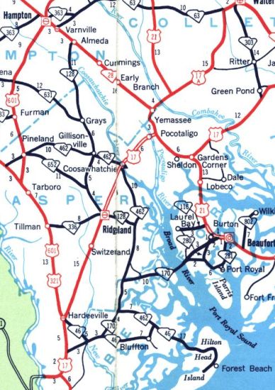
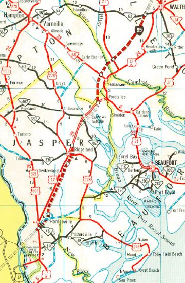
US 321: 0 - 0 US 17: 0.4 - 0.4 SC 170 WB: 5.2 - 5.6 Beaufort-Jasper Line: 0.6 - 6.2 SC 170 EB: 2.0 - 8.2 US 278: 9.2 - 17.4
|
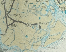
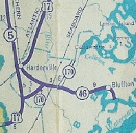
Creation: Appeared in 1939 as a renumbering of SC 33 from Hardeeville through Bluffton to Brighton Beach. This is the 2nd SC 46.
|
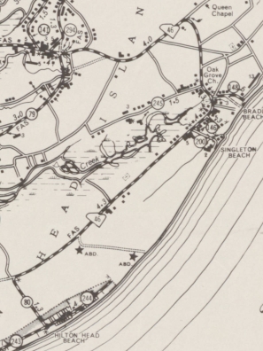
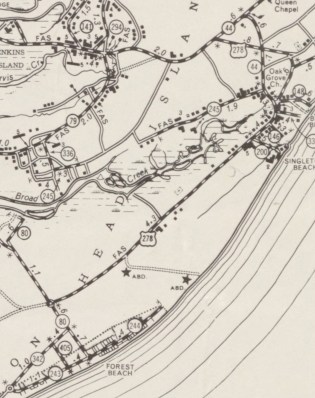
Adjustments: In 1947, SC 46 was extended west replacing SC 5 ALT from US 17 to SC 5 (now US 321). In 1956, SC 46 was rerouted at Bluffton to replace SC 462 north 2 miles, then replaced S-7-39 east to the Hilton Head Ferry, then replaced S-7-44 on Hilton Head Island to end at S-7-80 Forest Beach. The old route to Brighton became S-7-11 (now S-7-66) and S-7-13. In 1957, SC 46 was moved to the new bridge to Hilton Head Island, leaving behind S-7-242 Fording Island Rd and S-7-298 Jenkins Rd. In 1965, SC 46 east was truncated to its current end, with US 278 heading to Hilton Head and Forest Beach instead.
Note that between 1963-66 the primary highway on Hilton Head Island was removed from today's S-7-44. It is not clear it the route was SC 46 or US 278 at that time.
Improvements: SC 46 was paved upon designation; no multilane segments. Comment: SC 46 serves as a back way to get to Hilton Head Island, although prior to the new US 278 routing east of Hardeeville SC 46 was part of the primary way to reach the resort from the south. SC 46 is blown off by I-95, although a frontage road was built between US 17-321 and SC 46. Note SC 46 did not go to oceanfront at Forest Beach per all county maps, despite the state officials suggesting it did. | Previous SC 46's:
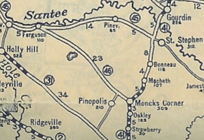
1938 ROUTE LOG SC 45: 0 - 0 SC 311: 18 - 18 SC 64: 8 - 26 US 52: 1 - 27 |
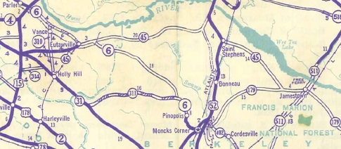
SC 46 #1: Appeared about 1923 as new primary routing, running from SC 45 (now S-38-137/138 jct) near Eutawville southeast to SC 41 (now US 52) Moncks Corner.
Between 1927-29, SC 46 was removed from today's S-38-138 and placed on current SC 6 from the Berkeley line westward. In 1939, SC 46 was renumbered as part of SC 6. Today, Lake Moultrie occupies a large part of old SC 46. The surviving segments are: easternmost 2 miles of SC 6; S-8-5 into Pinopolis; SC 6 west of S-8-132 in the Cross area.
|
||||||||||||||
Previous: SC 45 |
Next: SC 46 ALT | SC 46-Y | SC 47
Top | South Carolina Hwy Index
Home
Page last modified 20 January 2016