< SC 2 | Home | SC 3 ALT | SC 3 Bus | SC 4 >
|
|
|
| ROUTE LOG |
US 278: 0 - 0 Hampton-Jasper Line: 4.4 - 4.4 US 601: 7.4 - 11.8 US 321: 3.1 - 14.9 Allendale-Hampton Line: 6.4 - 21.3 US 301: 15.3 - 36.6 SC 125: 7.1 - 43.7 Barnwell-Allendale Line: 3.9 - 47.6 US 278 EB: 7.0 - 54.6 US 278 WB: 1.3 - 55.9 SC 64: 1.0 - 56.9 SC 70: 0.7 - 57.6 US 78: 9.2 - 66.8 US 78 Bus: 0.1 - 66.9 Orangeburg-Barnwell Line: 7.7 - 74.6 SC 3 Bus: 1.2 - 75.8 SC 4: 1.0 - 76.8 SC 3 Bus: 1.0 - 77.8 SC 389: 5.9 - 83.7 SC 394: 0.8 - 84.5 Lexington-Orangeburg Line: 4.6 - 89.1 US 178: 0.4 - 89.5 US 321: 6.8 - 96.3
|
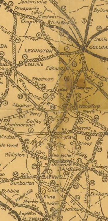
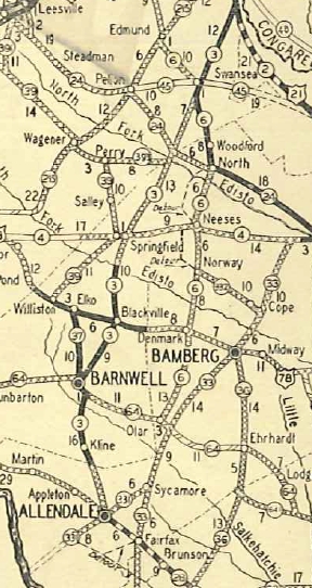
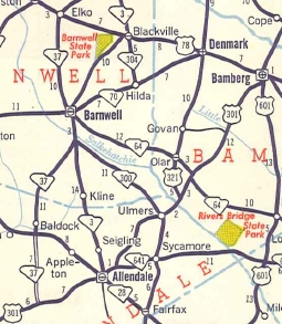
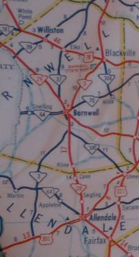
Creation: Appeared in 1928 as a renumbering of of SC 1 running from SC 331 (now US 301) Allendale north via Blackville and Springfield (already bypassed!) to end at US 21/SC 2 Dixiana. This is the 2nd SC 3.
|
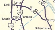
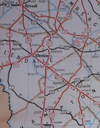
Adjustments: If SC 3 ever used S-6-150 to reach Blackville it stopped dong so by 1930. In 1933, SC 3 was extended north with US 21 to end at SC 215 (now SC 302) West Columbia. In 1939, SC 3 north was truncated to SC 5 (now US 321) below Swansea. The route from Swansea to West Columbia became SC 5. Today it is US 321 and the US 1-21 CONN. Note that state officials 1940-42 show SC 3 re-extended back to at least Dixiana but the 1940 and 1942 Lexington County maps do not show this. Also in 1939, SC 3 was extended south as new primary routing 5 miles towards Barton. In 1940, SC 3 was extended to SC 361 (now S-3-23) Barton. In 1947, SC 3 south was truncated back to Allendale, leaving behind S-3-19 and S-3-20 (all S-3-19 today).
In 1963, SC 3 was rerouted at Barnwell to instead replace SC 37 southwest to US 301. The old route to Allendale became part of SC 28 (now US 278).
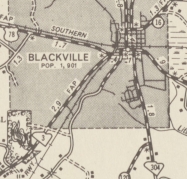
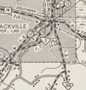
Also in 1963, SC 3 was placed onto new construction into Blackville, leaving behind S-6-10 and a little bit of US 78.
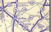
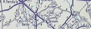
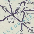
County maps from at least 1967-80 and state officials from 1962-70 show SC 3 re-extended north with US 321 to US 21-176 Dixiana. It is unclear if it extended north to I-26. In 1972, SC 3 was extended south as an upgrade to S-3-26, S-25-19, and S-25-39 to Estill (had been SC 631 decades earlier) and replaced SC 631 east to US 278 Grays.
Improvements: In 1929, SC 3 was paved from Dixiana to Swansea and also from the Edisto River to Kline. The rest of SC 3 was paved in 1932; however the short-lived extension to Barton was not paved while SC 3. No multilane segments. Comment: SC 3 provides access from the Columbia area to Barnwell. South of Barnwell SC 3 crosses through a lot of empty parts of southern South Carolina. | Previous SC 3's:
1927 ROUTE LOG US 1, US 76 WB, SC 50: 0 - 0 SC 52: 24.2 - 24.2 SC 26 NB: 20.8 - 45.0 SC 414: 2.2 - 45.2 SC 26 SB: 0.3 - 45.5 SC 30: 0.2 - 45.7 SC 54: 0.7 - 46.4 SC 341: 19.2 - 65.6 SC 53: 8.5 - 74.1 US 17 SB, US 76 END, US 601, SC 41: 13.2 - 87.3 US 217, SC 23: 18.0 - 105.3 SC 38: 8.7 - 114.0 SC 9 WB: 16.9 - 130.9 SC 9 EB: 2.0 - 132.9 NC STATE LINE: 7.0 - 139.9 |
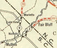
SC 3 #1: An original state route. Ran from SC 50 (now US 1) Columbia east through Sumter, Florence, and Marion before exiting to North Carolina east of Nichols.
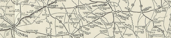
SC 3 #1 1922 Auto Trails If SC 3 ever used S-21-31 Evans St from Cashua east to downtown Florence it stopped doing so by 1925. About 1926, SC 3 was removed from Old Marion Hwy east out of Florence and placed on today's US 76. The old route today is US 52 Irby St to Cheves St east to S-21-12 Church St up to the railroad bridge; unnumbered stub of N. Church St that dead ends at the railroad; S-21-24 on Oakland Ave and Old Marion Hwy. If SC 3 ever used S-34-331 (used to loop back to US 76) and any part of S-34-41 between Marion and Mullins it stopped doing so by 1926. If SC 3 ever used Poston Rd/Springville Rd west of Marion or S-34-331 (used to loop back to US 76) it stopped doing so by 1927. In 1928, SC 3 was eliminated in favor of US 76 from Columbia to Florence and US 17 from Florence to North Carolina.
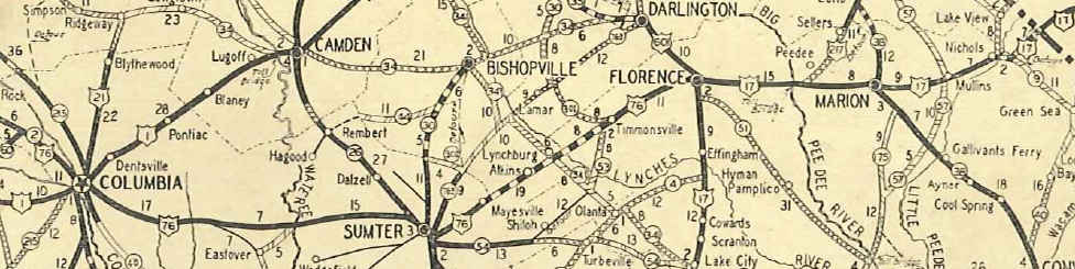
US 76 and US 17 replace SC 3 1930 Official
|
|||||||||||||||||||
Previous: SC 2 |
Next: SC 3 ALT | SC 3 Bus | SC 4
Top | South Carolina Hwy Index
Home
Page last modified 23 July 2016