< SC 27 | Home | SC 28 ALT | SC 28 Bus | SC 28-Y | SC 29 >
|
|
|
|
| ROUTE LOG |
US 278, SC 125: 0 - 0 GA STATE LINE: 1.5 - 1.5 GA STATE LINE: 0 - 1.5 McCormick Line: 0 - 0 US 221 SB: 7.1 - 8.6 SC 23: 4.7 - 13.3 SC 283: 9.5 - 22.8 US 221 NB, US 378: 4.8 - 27.6 SC 10: 1.7 - 29.6 SC 81: 5.4 - 35.0 Abbeville-McCormick Line: 7.5 - 42.5 SC 72: 6.9 - 49.4 SC 71: 2.9 - 52.3 SC 20: 0.5 - 52.8 SC 184 EB: 10.5 - 63.3 SC 284 WB: 0.4 - 63.7 SC 184 WB: 0.6 - 64.3 SC 284 EB: 1.2 - 65.5 Anderson-Abbeville Line: 1.3 - 66.8 SC 413: 2.8 - 69.6 SC 185: 5.2 - 74.8 SC 28 Bus: 4.2 - 79.0 US 29, SC 81: 0.1 - 79.1 US 29 Bus: 0.7 - 79.8 SC 24: 1.9 - 81.7 US 76 EB, SC 28 Bus: 4.3 - 86.0 I-85 (exit 19): 1.8 - 87.8 SC 187 SB: 5.7 - 93.5 SC 187 NB: 0.7 - 94.2 Pickens-Anderson Line: 2.3 - 96.5 SC 88: 1.8 - 98.3 SC 93: 0.5 - 98.8 US 123 NB: 0.7 - 99.5 SC 133: 0.3 - 99.8 Oconee-Pickens Line: 1.0 - 100.8 SC 130: 5.2 - 106.0 US 76 WB, US 123 SB, SC 59: 2.4 - 108.4 SC 188: 1.2 - 109.6 SC 11: 4.6 - 114.2 SC 183 EB: 1.2 - 115.4 SC 183 WB: 0.1 - 115.5 SC 107: 8.2 - 123.7 GA STATE LINE: 8.4 - 132.1
|
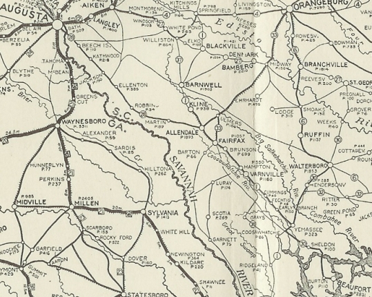
Creation: An original state route running from SC 1 (now US 278-301) Allendale to the Georgia State line west of Beech Island. This is the only SC 28.
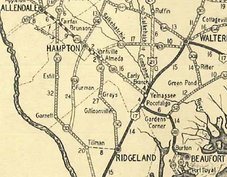
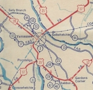
| Adjustments: In 1928, SC 28 was extended southeast through Fairfax and Hampton to Yemassee (replacing SC 1, then replaced SC 30 to end in Beaufort.
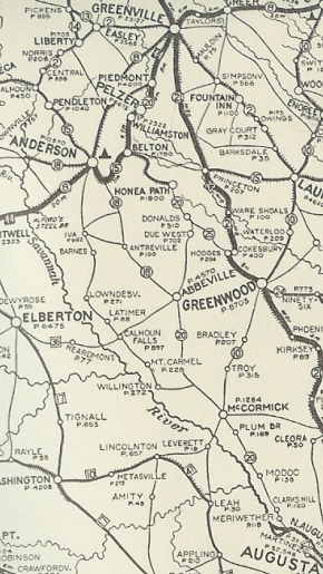
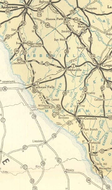
In 1935, SC 28 east was truncated to US 17-21 (now US 17 ALT) Yemassee. The route to Beaufort became US 21 (some of this is S-7-3). In 1938, GA 52 through Augusta was renumbered as GA 28, and at the SC Line in McCormick County, SC 28 came back into the Palmetto state, replacing SC 20 through McCormick to Abbeville; replaced SC 18 throguh Antreville to Anderson; replaced SC 24 through Pendleton, Clemson, Seneca, and Walhalla before re-entering Georgia above Mtn. Rest.
Also in 1938, SC 28 was rerouted at its Yemassee endpoint to cut southeast slightly to the new alignment of US 17-21. In 1940, SC 28 was extended southeast as new primary routing to end at US 21 Gardens Corner. In Yemassee the part of SC 28 connecting directly became SC 28-Y (now part of SC 68). In 1947, SC 28 east was truncated back to US 17-21 (now US 17 ALT) Yemassee leaving behind S-27-1, a bit of S-7-3, and all of S-7-21.
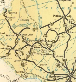
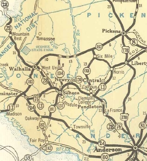
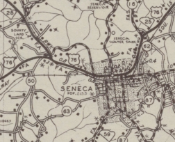
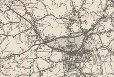
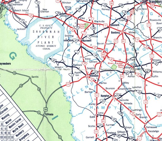
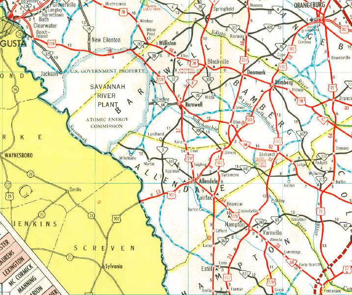
Between 1942-53, SC 28 was removed from SC 184/S-1-167 in Antreville. In 1953, SC 28 was rerouted at Beech Island to avoid the new Savannah River site, replacing SC 781 east, then headed southeast as new construction past SC 39, then replaced S-6-68 southeast to SC 37 Barnwell. SC 28 then followed a new bypass around the west of Barnwell, then replaced SC 3 south back to Allendale to pick up the original SC 28. The old route southeast to Jackson became S-2-5 and a bit of SC 125; closed altogether through SRS (now SC 125); SC 641 southeast to Allendale (now also SC 125). Between 1953-57, SC 28 was removed from Old Abbeville Hwy just south of S-4-141 near Anderson. In 1957, SC 28 received a new north bypass of Seneca. The old route through town became SC 28 Business. Today it is SC 130 and SC 59.
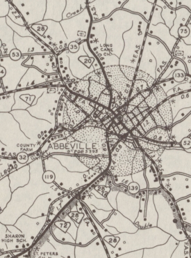
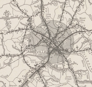
Also in 1957, SC 28 received its western bypass of Abbeville, leaving behind SC 28 Business. Today this is part of SC 72, S-1-1, SC 20, and SC 71, plus SC 20-71 CONN.
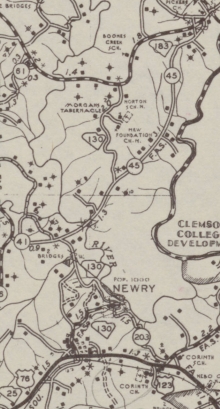
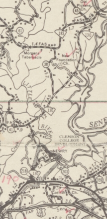
In 1959, SC 28 was straightened out from Seneca eastward, avoiding the Newry area. A small piece became part of SC 130, but mostly it became S-37-1.
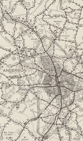
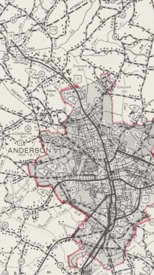
In 1960, SC 28 was given its western bypass of Anderson. South of SC 24 was new construction and north of SC 24 was an upgrade to S-4-62 and S-4-256. The old route through Anderson became SC 28 Business.
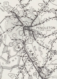
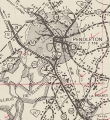
In 1962, SC 28 was placed on a western bypass of Pendleton, leaving behind SC 28 Business.
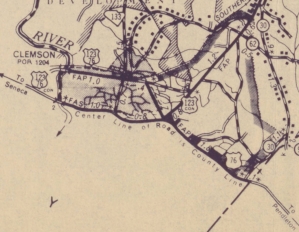
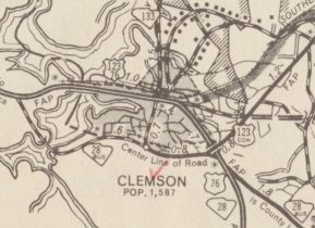
Also in 1962, SC 28 was rerouted around the east and north of Clemson as new routing. This left behind SC 28 Business (now S-37-4 and S-39-4).
In 1965, SC 28 east was truncated to Beech Island replaced by US 278 from Beech Island to Alameda, and all of today's SC 68.
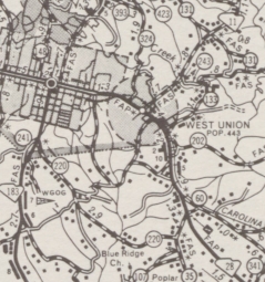
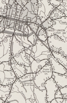
In 1973, SC 28 was given a bypass of West Union, leaving P-3701 (now S-37-3).
Between 1987-94, SC 28 was removed from S-33-464 near Clarks Hill. Improvements: SC 28 was paved from Yemasee to Gardens Corner in 1929 or 1930. In 1931, SC 28 was paved from Gardens Corner to Beaufort and from Alameda to Fairfax. In 1932, SC 28 became fully paved from Augusta to Beaufort. All parts of SC 28 north of Augusta were paved upon designation as SC 28. The brief extension of SC 28 from Yemassee to Gardens Corner was not paved while part of SC 28. SC 28's first multilane segment was between Seneca and Clemson, in 1959. In 1963, SC 28 was 4-laned from Clemson to I-85. In 1965, SC 28 was 4-laned from I-85 to the Anderson bypass. In 1973, SC 28 was 4-laned on the Seneca Bypass, and from Seneca to Walhalla. In 1974, SC 28 was 4-laned on the Anderson Bypass from old SC 80 to Camellia Dr. In 1975, SC 28 was 4-laned from Camellia Dr. north to the railroad overpass. In 1997, SC 28 was 4-laned from old SC 80 (Market St.) south to the end of the Anderson Bypass; also from Beech Island to Georgia Comment: SC 28 serves as the main route up the western side of South Carolina, connecting Augusta to McCormick, Abbeville, Anderson, Clemson, Seneca, and Walhalla. SC 28 passes through a large piece of Sumter National Forest and south of SC 81 is also part of the Savannah River National Scenic Highway. SC 28 enters SC twice and Georgia twice. It also comes within a mile of entering Tennessee. | |||||||||||||||||||||||||||

Previous: SC 27 |
Next: SC 28 ALT | SC 28 Bus | SC 28-Y | SC 29
Top | South Carolina Hwy Index
Home
Page last modified 22 March 2016