< VA 315 | Home | VA 317 >
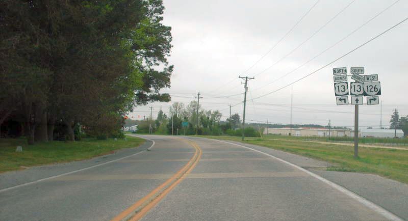
Photo: VA 316 and its concrete coming to its end in Tasley. Today this is a roundabout. (photo by Mapmikey, April 2007)
| |||||||
| ROUTE LOG US 13 Bus, VA 126: 0 - 0 VA 176: 5.81 - 5.81 VA 187: 3.68 - 9.49 |
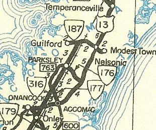
Creation: Appeared in July 1938 (CTB Minutes) as a newly constructed route that first appeared on the 1940 Official. Ran from US 13/VA 178 Tasley to VA 176-177 Parksley. This is the 3rd VA 316.
| ||||||
| Previous VA 316's: 1928 ROUTE LOG US 1, VA 31: 0 - 0 END VA 316: 2 - 2 1932 ROUTE LOG US 15, VA 32: 0 - 0 Albermarle-Buckingham Line: 23.15 - 23.15 VA 19: 0.25 - 23.40 |
VA 316 #1: Mentioned in 1928 CTB Minutes, running from US 1/VA 31 Chester east to 4.5 miles short of Hopewell Bridge.
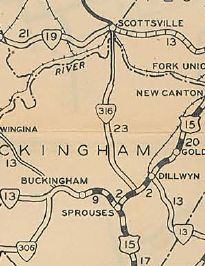
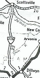
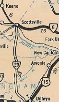
VA 316 was renumbered as part of VA 407 in August 1928. Today it is part of VA 10. I have never seen a map showing this. VA 316 #2: Appeared in August 1928 as a newly numbered route. Ran from US 15/VA 32 Dillwyn north 14.75 miles near Centenary. In Dec. 1930 (CTB Minutes), VA 316 was extended north 8.4 miles to VA 19 (curr VA 6) Scottsville. This makes VA 316 one of just a couple 3-digit routes to cross a district line. VA 316 was renumbered as part of VA 20 in July 1933. VA 20 has been straightened out considerably. VA 316 used SRs 699 and SR 631/700 north of Dillwyn; SR 722/622 and SR 655/704 south of Centenary; SR 695 north of Centenary; SR 783 approaching the James River and Ferry St in Scottsville.
|
||||||
Previous: VA 315 |
Next: VA 317
Top | Virginia Hwy Index
Home
Page last modified 3 May 2020