< VA 301 | Home | VA 303 >
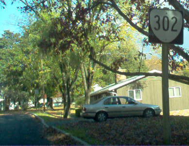
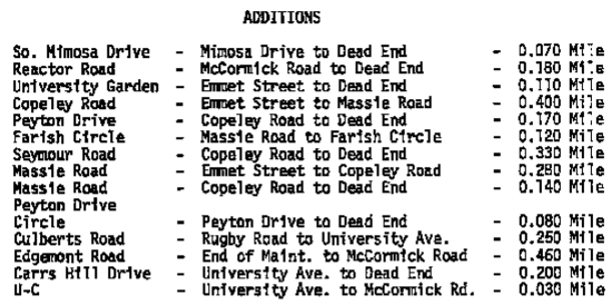
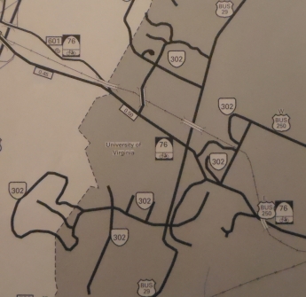
Photo: VA 302 was once posted at UVA (photo by Mapmikey)
| ||||||||
|
Creation: CTB minutes imply this went back to July 1933,
but the earliest explicit use of the 302 designation was in 1936.
Official maps did not start identifying VA 302 until 1988.
The July 1932 CTB Minutes assigns this as 3.042 miles. This is the 3rd VA 302.
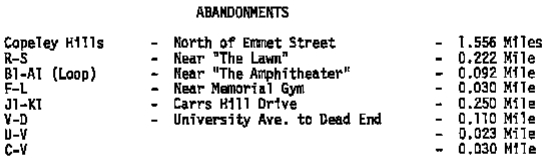
Adjustments: In April 1940 (CTB), 430 feet of road leading up to hospital and the circle at the hospital entrance were removed from VA 302 while the 490 feet that encompass the University President's driveway to his garage, plus the connecting link between US 29 and Old Lynchburg Rd southeast of the Engineering Building were added to VA 302. In March 1948 (CTB), the following roads were added to VA 302 totalling 0.44 miles: Chemical Building to Shop (0.13 mi); Road to back of Amphitheater (0.19 mi); road connecting Rugby Rd to Lambeth Field Rd (0.06 mi); raod to the nurses' home (0.07 mi). 0.45 miles consisting of narrow roads not meeting some minimum standard were refused as additions to VA 302. In Oct 1953 (CTB), a new road from McCormick Rd west around Cabell Hall and back around to McIntire Amphitheater (0.377 miles) was added to VA 302 while 4 short roads around Cabell Hall and 6 short roads at the medical school (0.676 miles en total) were removed from VA 302. In Aug 1955 (CTB), Carrs HIll Dr from Rugby Rd to US 250 (0.25 mi) was added to VA 302. In Aug 1956 (CTB), 0.244 miles worth of driveways in the Piedmont Housing area were added to VA 302. In May 1957 (CTB), the road leading from US 250 to the Childrens Rehabilitation Center (0.101 mi) was added to VA 302. In March 1959 (CTB), the road to Newcomb Hall (0.09 mi) was added to VA 302 while 0.16 miles of roads to parking areas was removed from VA 302. In Dec 1964 (CTB), the road leading from McCormick Rd at the Observatory 0.35 miles to the Research Laboratory for Engineering Science was added to VA 302. In Apr 1968 (CTB), Carrs Hill Rd from US 250 to Rugby Dr (0.25 miles) was removed from VA 302. In Oct 1972 (CTB), there were numerous additions totaling 3.020 miles and deletions totaling 2.313 miles from VA 302:
Posting: I have driven maybe half the roads on campus and seen no signs. However, I received word from Amy Barden 6/21/04 that there is a VA 302 sign (narrow square sign) off US 29 Bus at the southwest portion of UVA, at the Piedmont housing area. This sign was removed by 2008. Comments: First of the many college routes in the state highway systems. Like many of the other college routes, VA 302 consists not of a single road, but rather much (and perhaps all) of the state-maintained blacktop on the UVA campus. VDOT apparently has a thing about assigning a number to any drivable surface maintained by the state. Apparently a few other states do the same thing, including Utah, which even assigns state highway numbers to driving test tracks. |
||||||||
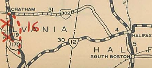
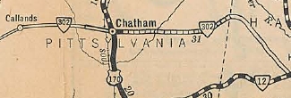
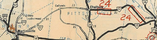
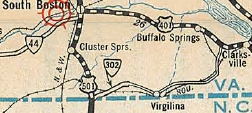
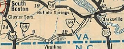
| Previous VA 302's: 1931 ROUTE LOG BEGIN VA 302: 0 - 0 US 170, VA 14: 5 - 5 Halifax-Pittsylvania Line: 17.1 - 22.1 VA 12: 10.7 - 32.8 GAP IN ROUTE US 501, VA 18: 0 - 32.8 END VA 302: 3 - 35.8 |
VA 302 #1: Appeared in August 1928 as a newly numbered
route. Ran from US 170/VA 14 (curr US 29 Bus) Chatham through Lucks and
Meadville, ending at VA 12 (curr VA 360) west of Halifax.
In Aug 1929 (CTB Minutes), VA 302 was extended west 5 miles. In December 1930, the original segment VA 302 was renumbered as current VA 57. Thanks to NE2 for sorting this out. VA 302 is still approximated by VA 57 except: SR 1154 loop and SR 1155 Hudson Circle west of Chatham; SR 1428 Moses Mill Rd in Chatham; a bit of US 29 Bus; SR 685 east out of Chatham, then SR 703 southeast.
| |||||||