< VA 58 | Home | VA 61 to 70 >
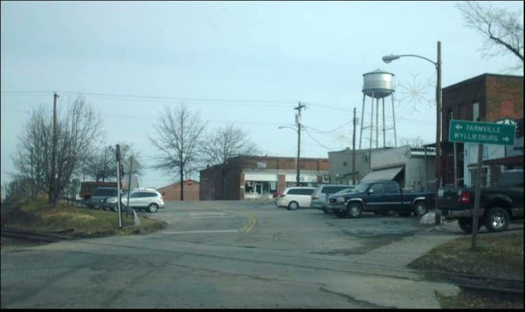
Photo: VA 59's original approach to Keysville (photo by Mapmikey 1/16/10)
|
|
|
| ROUTE LOG |
VA 47: 0 - 0 VA 40: 7.90 - 7.90
|
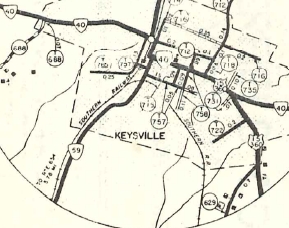
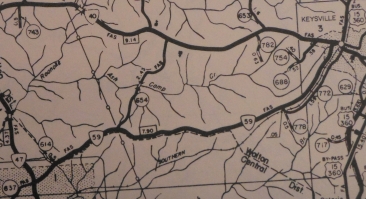
Creation: Appeared in May 1957 (CTB) as an upgrade to SR 657, running from VA 47 east to US 15-360, VA 40 in Keysville. This is the 4th VA 59.
| Adjustments: In Sept 1965 (CTB), VA 59 was rerouted to end at VA 40 just west of US 15-360 Business, leaving behind SR 772 and Hill Ave in Keysville. Improvements: Paved upon designations; no multilane sections Posted: Fully posted; Multiplexes: None Legislative names: None Other names: Merry Oaks Dr Scenic Byway: No segments Comment: VA 59 is strictly a local route connecting Keysville to the Drakes Branch area. Even though it largely runs east-west, it is posted north-south.
| Previous VA 59's:
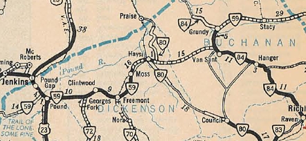
1932 ROUTE LOG US 501, VA 18: 0 - 0 Mecklenburg-Halifax Line: 9 - 9 GAP IN ROUTE CR 18: 0 - 9 US 58, VA 44: 2 - 11 1940 ROUTE LOG SR 671: 0 - 0 US 23 NB: 5 - 5 US 23 SB: 1 - 6 VA 72: 10 - 16 VA 70: 9 - 25 VA 80 SB: 16 - 41 VA 80 NB: 1 - 42 VA 84 EB: 16 - 58 VA 84 WB: 5 - 63 WV STATE LINE: 16 - 79 1941 ROUTE LOG WV LINE: 0 - 0 VA 260: 12.10 - 12.10 US 11 SB: 5.35 - 17.45 US 11 NB: 0.85 - 18.30 Forest Rd 108: 4.90 - 23.2 |
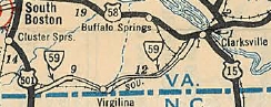
VA 59 #1: Appeared in June 1931 (CTB) as a renumbering of VA 302 from US 501/VA 18 near Denniston east 3 miles towards Virgilina. A second new primary piece was created running from VA 44 (now US 58/VA 49) near Clarksville southwest 2 miles to a little past Buffalo Junction.
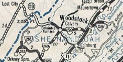
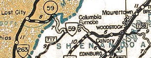
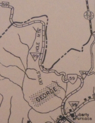
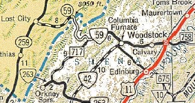
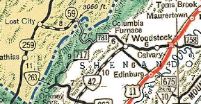
VA 59 #3: Appeared Sept 1940 (CTB) to match then-WV 59. This was a renumbering of VA 261 and it ran from West Virginia to Columbia Furnace and Woodstock before ending at Forest Rd 108 in Woodstock Gap. In Sept 1942 (CTB), VA 59 east was truncated to US 11 Woodstock, leaving behind SR 758.
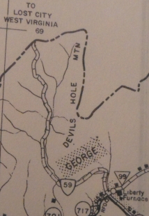
Between 1940-46, VA 59 was rerouted at the West Virginia border to use the current SR 691 gravel road east and then south to Liberty Furnace. The old route became a 4WD trail and Forest Road 252 which runs into SR 691 near Liberty Furnace.
In Oct 1947 (CTB), VA 59 east was truncated to Columbia Furnace, replaced by VA 42. In April 1949 (CTB), the remaining VA 59 was decommissioned to SRs 691/717-675, plus Forest Road 99.
Today, the route used by VA 59 is from west to east: SR 691 from WV to Liberty Furnace; SR 717 east to SR 675; SR 675 east to Columbia Furnace; SR 623 and SR 768 over to VA 42; VA 42 east to the I-81 area; Fairground Rd to US 11; US 11 Main St to Court St; Court St east to Water St; Water St north to Cemetery Rd; Cemetery Rd east out of Woodstock, becomes SR 758 which VA 261 followed up the mountain to its endpoint at forest road 108. The part west of SR 717 and the SR 758 ascent up the mountain are both still unpaved. The SR 758 section has several steep, sharp switchbacks. WV 59 is still shown on maps, including the WV Official. However, it is has been posted in the field as CR 59 back to at least the early 2000s. The West Virginia side is still only paved on the western half. |
||||||||||||||||
Previous: VA 58 |
Next: VA 61 - 70
Top | Virginia Hwy Index
Home
Page last modified 9 March 2013