<US 221 | Home | US 250 >
| US 240 not currently assigned | |||
| Previous US 240's: 1940 ROUTE LOG US 1: 0 - 0 DC LINE: 0.25 - 0.25 |
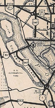
US 240: Commercial maps from at least two sources (Gen Drafting and Gousha) from at least 1934-42 show US 240 crossing the Potomac River via the Memorial Bridge onto Columbia Island, then heading southeast along today's George Washington Memorial Pkwy to US 1, whose "Highway Bridge" crossing was at today's 14th St bridge area. This means that 0.25 miles of US 240 from US 1 to the Boundary Channel bridge would've been in Virginia.
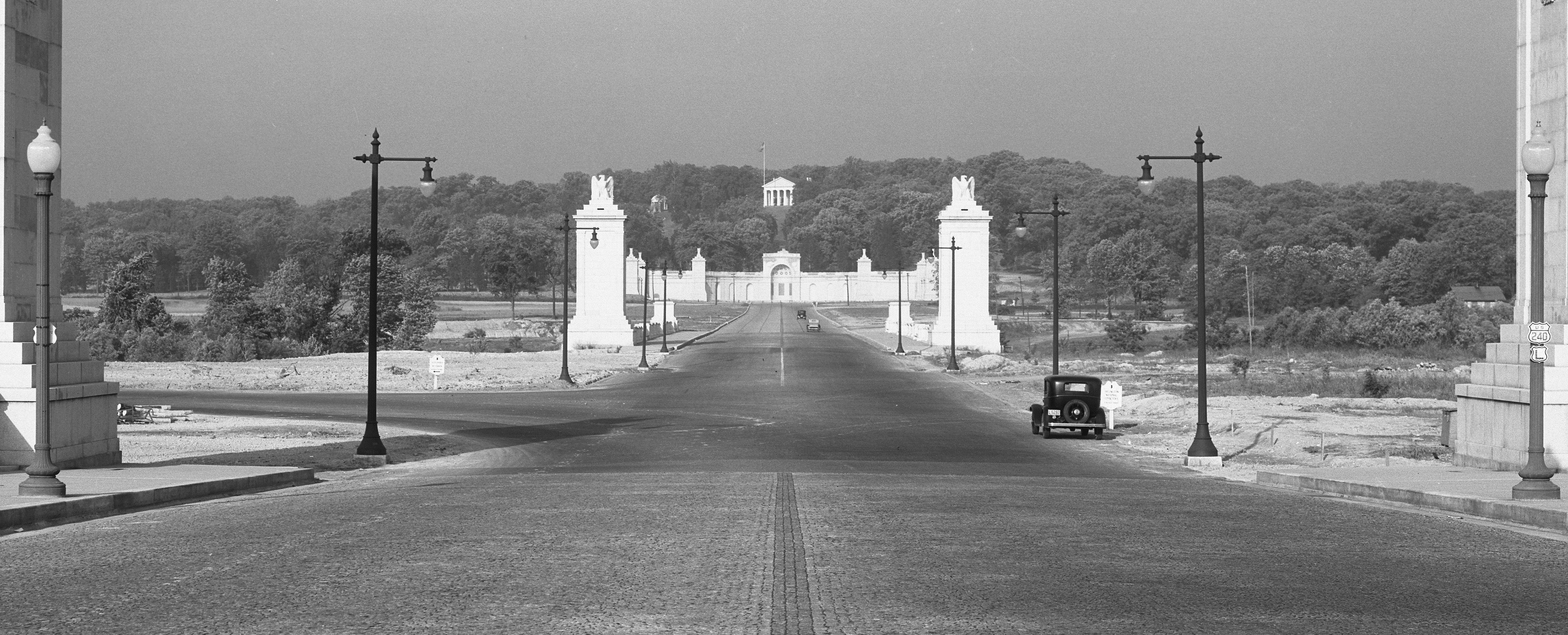
Although the Parkway (called Mt. Vernon Memorial Blvd back then) was never in the primary system, there is one Virginia Official State Map that also showed this: 1937. Maps from 1932-36 implied it could've been there. US 240 does not appear on any Arlington County map I can find - earliest one done by VDOT I have is 1945. This photo demonstrates it is all but certain that US 240 was posted in Virginia, as it shows US 240 turning left onto what is now George Washington Memorial Parkway from Columbia Island (Arlington National Cemetery is straight ahead), heading for US 1.
For a full size photo, go here.
|
US 240 shown west of the Potomac River 1937 Official | |
Previous: US 221 |
Next: US 250
Top | Virginia Hwy Index
Home
Page last modified 15 September 2017