< I-99 | Home | I-66 >
I-164 | I-264 | I-364 | I-464 | I-564 | I-664 | I-864
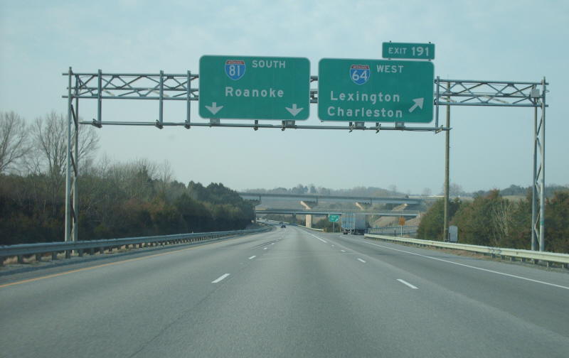
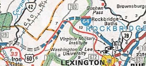
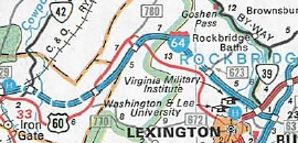
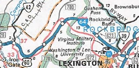
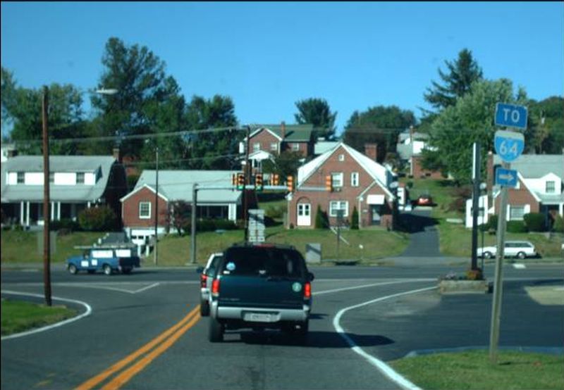
Photo: I-64 splitting off of I-81 at Lexington (Mapmikey 1-26-07)
|
|
|
| ROUTE LOG |
WV STATE LINE: 0 - 0 EXIT 1 - F-198: 1.83 - 1.83 [EB only] EXIT 7 (old 2) - SR 661: 5.33 - 7.16 EXIT 10 (old 3) - US 60 EB, VA 159: 2.85 - 10.01 Covington-Alleghany Line: 4.62 - 14.63 EXIT 14 (old 4) - VA 154: 0.21 - 14.84 Alleghany-Covington Line: 1.19 - 16.03 EXIT 16 (old 5) - US 60 WB, US 220 NB: 0.65 - 16.68 EXIT 21 (old 6) - SR 696: 4.81 - 21.49 EXIT 24 (old 7) - US 60 Bus, US 220 Bus, VA 384: 2.37 - 23.86 EXIT 27 (old 8) - US 60 Bus, US 220 SB: 3.63 - 27.49 EXIT 29 (old 9) - VA 42, VA 269: 1.78 - 29.27 EXIT 35 (old 10) - VA 269: 6.38 - 35.65 Rockbridge-Alleghany Line: 5.34 - 40.99 EXIT 43 (old 11) - SR 780: 1.92 - 42.91 EXIT 50 (old 12) - US 60 EB: 7.38 - 50.29 EXIT 55 (old 13) - US 11: 5.39 - 55.68 EXIT 56 (old 14) - I-81 SB (exit 191): 1.55 - 57.23 EXIT 195 (old 53) - US 11: 3.30 - 60.53 EXIT 200 (old 53A) - SR 710: 5.57 - 66.10 EXIT 205 (old 54) - SR 606: 4.49 - 70.59 Augusta-Rockbridge Line: 0.59 - 71.18 EXIT 213 (old 55) - US 11: 7.44 - 78.62 EXIT 217 (old 55A) - SR 654: 4.74 - 83.36 EXIT 220 (old 55B) - VA 262: 2.47 - 85.83 EXIT 87 (old 15) - I-81 NB (exit 221): 1.62 - 87.45 EXIT 91 (old 16) - VA 285: 3.83 - 91.28 Waynesboro-Augusta Line: 3.11 - 94.39 EXIT 94 (old 17) - US 340: 0.23 - 94.62 EXIT 96 (old 18) - Delphine Ave: 1.95 - 96.57 Augusta-Waynesboro Line: 0.70 - 97.27 EXIT 99 (old 19) - US 250: 2.31 - 99.58 Nelson-Augusta Line: 0.38 - 99.96 Albemarle-Nelson Line: 1.36 - 101.32 EXIT 107 (old 20) - US 250: 5.90 - 107.22 EXIT 114 (old 21) - SR 637: 6.91 - 114.13 EXIT 118 (old 22) - US 29: 4.25 - 118.38 EXIT 120 (old 23) - SR 631: 1.49 - 119.87 EXIT 121 (old 24) - VA 20: 1.73 - 121.60 Charlottesville-Albemarle Line: 0.55 - 122.15 Albemarle-Charlottesville Line: 0.17 - 122.32 EXIT 124 (old 25) - US 250: 2.00 - 124.32 EXIT 129 (old 26) - SR 616: 5.42 - 129.74 Fluvanna-Albemarle Line: 1.42 - 131.16 Louisa-Fluvanna Line: 1.51 - 132.67 EXIT 136 (old 27) - US 15: 4.06 - 136.73 EXIT 143 (old 28) - VA 208: 6.32 - 143.05 Goochland-Louisa Line: 4.66 - 147.71 EXIT 148 (old 29) - SR 605: 1.11 - 148.82 EXIT 152 (old 30) - SR 629: 3.92 - 152.74 Louisa-Goochland Line: 5.20 - 157.94 EXIT 159 (old 31) - US 522: 1.49 - 159.43 Goochland-Louisa Line: 3.07 - 162.50 EXIT 167 (old 32) - SR 617: 4.81 - 167.31 EXIT 173 (old 33) - SR 623: 6.56 - 173.87 EXIT 175 - VA 288: 1.19 - 175.06 Henrico-Goochland Line: 0.64 - 175.70 EXIT 177 (old 34) - I-295 (exit 53): 2.28 - 177.98 EXIT 178 (old 35) - US 250: 0.67 - 178.65 EXIT 180 (old 36) - Gaskins Rd: 1.43 - 180.08 EXIT 181 (old 37) - Parham Rd: 1.39 - 181.47 EXIT 183 (old 38) - US 250: 2.03 - 183.50 EXIT 185 (old 39) - US 33: 2.03 - 185.53 Richmond-Henrico Line: 1.19 - 186.72 EXIT 186 (old 40) - I-195 SB: 0.15 - 186.87 EXIT 187 (old 41) - I-95 NB (exit 79), I-195 END: 0.59 - 187.46 EXIT 78 (old 14) - VA 161: 0.48 - 187.94 EXIT 76 (old 13) - US 1, US 301: 2.19 - 190.13 EXIT 190 (old 43) - I-95 SB (exit 75): 0.53 - 190.66 [EB only] NO EXIT # - 3rd St: 0.15 - 190.81 EXIT 192 (old 44) - US 360: 1.52 - 192.33 Henrico-Richmond Line: 0.25 - 192.56 Richmond-Henrico Line: 0.77 - 193.33 Henrico-Richmond Line: 0.24 - 193.57 EXIT 193 (old 45) - VA 33: 0.10 - 193.67 EXIT 195 (old 46) - Laburnum Ave: 2.14 - 195.81 EXIT 197 (old 47) - VA 156: 1.88 - 197.39 EXIT 200 (old 48) - I-295 (exit 28): 4.07 - 201.46 New Kent-Henrico Line: 2.84 - 204.30 EXIT 205 (old 49) - VA 33 WB, VA 249: 1.30 - 205.60 EXIT 211 (old 50) - VA 106: 5.32 - 210.92 EXIT 214 (old 51) - VA 155: 3.47 - 214.39 EXIT 220 (old 52) - VA 33 EB: 5.69 - 220.08 James City-New Kent Line: 4.29 - 224.37 EXIT 227 (old 53) - VA 30: 2.45 - 226.82 EXIT 231 (old 54) - SR 607: 4.28 - 231.10 York-James City Line: 1.97 - 233.07 EXIT 234 (old 55) - VA 199: 0.87 - 233.94 EXIT 238 (old 56) - VA 143: 4.71 - 238.65 EXIT 242 (old 57) - VA 199: 3.44 - 242.09 EXIT 243 (old 58) - US 60, VA 143: 1.62 - 243.71 James City-York Line: 0.59 - 244.30 [EB only] EXIT 247 (old 59) - VA 143: 2.04 - 246.34 Newport News-James City Line: 0.30 - 246.64 [WB only] EXIT 247 (old 59) - VA 238: 1.32 - 247.96 EXIT 250 (old 60) - VA 105: 2.04 - 250.00 EXIT 255 (old 61) - VA 143: 5.03 - 255.03 EXIT 256 (old 61A) - VA 171: 1.41 - 256.44 EXIT 258 (old 62, old 9) - US 17: 1.81 - 258.25 Hampton-Newport News Line: 1.06 - 259.31 EXIT 261 (old 62AB) - Hampton Rds Ctr. Pkwy: 1.97 - 261.28 [WB only] EXIT 262 (old 63, old 8C) - VA 134 NB: 1.33 - 262.61 EXIT 263 (old 64, old 8) - US 258, VA 134 SB: 0.52 - 263.13 EXIT 264 (old 65, old 7) - I-664 (exit 1): 1.19 - 264.32 EXIT 265A (old 66, old 6) - La Salle Blvd: 0.77 - 265.09 EXIT 265B (old 67) - VA 134: 0.68 - 265.77 EXIT 267 (old 68, old 5) - US 60 WB, VA 143: 1.83 - 267.60 EXIT 268 (old 69, old 4) - VA 169: 0.33 - 267.93 Norfolk-Hampton Line: 4.00 - 271.93 EXIT 272 (old 70) - Ocean View Dr: 0.09 - 272.02 EXIT 273 (old 71) - US 60 EB: 1.74 - 273.76 [WB only] EXIT 274 (old 72) - Bay Ave: 1.30 - 275.06 EXIT 276 (old 73) - I-564, US 460: 1.40 - 276.46 [WB only] EXIT 276C (old 74) - VA 165: 0.69 - 277.15 EXIT 277 (old 75) - VA 168: 0.69 - 277.84 EXIT 278 (old 76) - VA 194: 1.04 - 278.88 EXIT 279 (old 77) - VA 247: 1.00 - 279.88 EXIT 281 (old 78) - VA 165: 1.26 - 281.14 EXIT 282 (old 79) - US 13, VA 166: 1.19 - 282.33 EXIT 284 (old 80) - I-264 (exit 14): 1.74 - 284.07 Virginia Beach-Norfolk Line: 1.34 - 285.41 EXIT 286 (old 81) - Indian River Rd: 1.35 - 286.76 Chesapeake-Virginia Beach Line: 1.57 - 288.33 EXIT 289 (old 82) - Greenbrier Pkwy: 0.98 - 289.31 EXIT 290 (old 83) - VA 168 NB, VA 168 Bus: 2.13 - 291.44 EXIT 291 (old 84) - I-464 (exit 1), US 17 SB, VA 168 SB: 0.58 - 292.02 [WB only] EXIT 292 (old 85) - VA 190: 0.70 - 292.72 EXIT 296 (old 86) - US 17 NB, US 17 Bus: 3.61 - 296.33 EXIT 297 (old 87) - US 13, US 460: 1.46 - 297.79 EXIT 299 (old 88) - I-264 (exit 1), I-664 (exit 15): 2.31 - 300.10
|
Creation: The first piece of I-64 to exist was the Richmond-Petersburg Turnpike in central Richmond, completed in 1958. However, this wasn't explicilty shown as part of I-64 until 1968 (9 years after it was labeled as I-95). Note that there are CTB references to I-64 from in the Covington area as being VA 403 and in the Hampton area as being VA 404, which is odd because this was already VA 168.
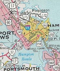
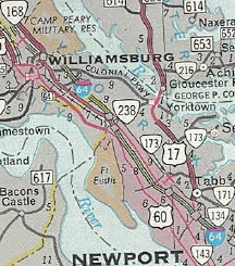
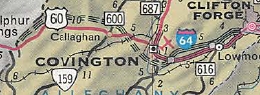
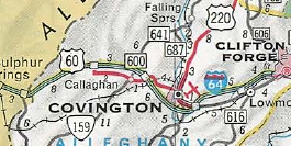
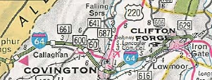
| Adjustments: Many of the following completion dates come from Scott Kozel's website. In April 1958 the CTB voted to officially consider a southern route for I-64 that would follow US 360, VA 307, and US 460 to Roanoke via Lynchburg, then north following US 220 to Clifton Forge in lieu of the original approved (affirmed in Oct 1957 CTB) routing along US 250 to Charlottesville and Staunton, then along I-81 south to Lexington before heading west along US 60 to West Virginia. In Feb 1959 (CTB), I-64 was assigned to the existing VA 168 between US 258 and the HRBT. In June 1959 the CTB voted 5-3 to adopt the southern route for I-64. A map of the southern route can be seen on Kozel's website. In 1960, I-64 was opened from US 258 west to VA 143 Jefferson Ave In Dec 1960 (CTB), the southern corridor was changed to have I-64 leave Richmond south of the James River along I-95 and that consideration should be given to having I-64 run with I-81 north from Roanoke to Lexington, then west to Clifton Forge. In March 1961 (CTB) it was noted that the Bureau of Public Roads rejected Virginia's request to adopt the southern route for I-64. The CTB then voted to vigorously investigate the disapproval, using the governor and attorney general as necessary. In April 1961, the CTB voted 5-2 against a motion to adopt the northern route of I-64, even given the reaffirmation by the Bureau of Public Roads that I-64 is to use the northern route. The defeated motion noted that delays in building I-64 were becoming noticeable by the public and that the issue had been under study since Oct 1957. Despite again rejecting the northern route, there are no other CTB references I can find to this and projects for I-64 along the northern route started appearing in 1962, so I guess sometime in late 1961 the Bureau of Public Roads said a final no. In 1964, I-64 was opened between east Covington and west Clifton Forge, directly on top of US 60-220's original bypass of Selma and Low Moor. In 1965 (Kozel), I-64 opened from VA 168 (now VA 143) Camp Peary to VA 143 Jefferson Ave.
By 1966 (Kozel), I-64 was open from Covington to the West virginia line. In 1966, I-64 was open from US 360 east to now-VA 249 Bottoms Bridge. In 1967, I-64 was opened from US 360 west to US 250 Short Pump, which also utilized existing I-95 in central Richmond. Also it opened from VA 168 Tidewater Dr around to I-464/VA 104. In Sept 1967 (Kozel), I-64/81 was opened from US 11 north of Natural Bridge to US 11 exit 213 near Stuarts Draft. In 1968 (Kozel), I-64 was opened from US 522 Gum Spring to US 250 Short Pump. Also it opened from I-464/VA 104 to Bowers Hill.
By August 1969 (Kozel), I-64/81 was open from US 11 exit 213 to VA 256. In 1969 (Kozel), I-64 was opened from US 460 Wards Corner to VA 168 Tidewater Dr.
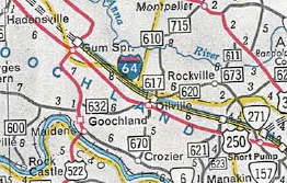
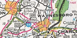
In Sept 1970 (Kozel), I-64 opened from US 250 near Crozet east to US 522 Gum Spring.
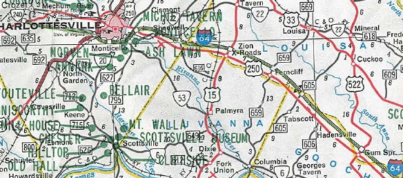
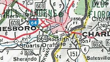
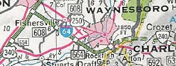
I-64 open from US 250 Crozet to US 522 Gum Spring 1971 Official In 1970, I-64 was opened from I-81 to US 340 Waynesboro. In Sept 1971 (Kozel), I-64 opened from US 340 Waynesboro to US 250 Afton Mtn. In Dec 1971 (Kozel), I-64 was opened around Clifton Forge.
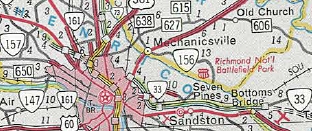
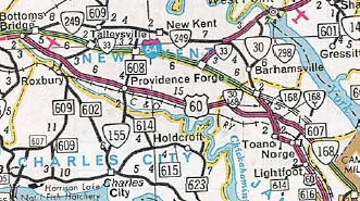
In Dec 1972 (Kozel), I-64 opened from US 250 Afton Mtn to US 250 Crozet; also from VA 249 Bottoms Bridge to VA 30.
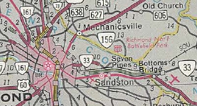
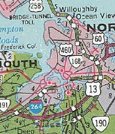
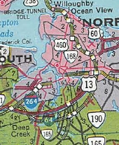
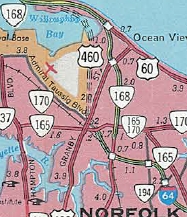
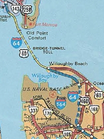
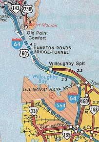
In 1973, I-64 was opened across Willoughby Bay. In Nov 1974 (Kozel), I-64 opened from VA 30 to VA 168 (now VA 30) Norge. In 1975, I-64 opened from 4th View to US 460. In 1976, the EB span of the HRBT opened, completing I-64 from Norfolk to Hampton.
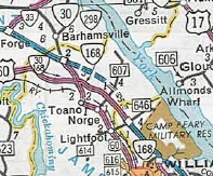
In Oct 1976 (Kozel), I-64 opened from US 60 Kerrs Creek to I-81 Lexington. In Aug 1978 (Kozel), I-64 opened from VA 168 Norge to VA 143 Camp Peary.
In Oct 1978 (Kozel), I-64 opened from VA 269 Longdale Furnace to US 60 Kerrs Creek. In June 1979 (Kozel), I-64 opened from Clifton Forge to VA 269 Longdale Furnace.
In May 1996 (CTB), VDOT presented 4 options to renumber the interstates in the Hampton Roads area: 1. Extend I-664 around to I-264/VA 44 and replace VA 44 with I-64 2. Extend I-664 around to I-264/VA 44 and replace VA 44 with I-664 3. Replace I-664 with I-64 and replace VA 44 with I-64; Replace I-64 across HRBT to I-264/VA 44 with I-664 4. Replace I-664 with I-64 and replace VA 44 with I-64; Replace I-64 across HRBT to I-264/VA 44 with I-864 The CTB deferred action to June 1996 whereby they elected to defer again. There was no further mention of anything related to this until they renumbered VA 44 as I-264 in Aug 1997. Improvements: I-64 opened as 4-lanes everywhere except Glenside Dr east to VA 156 Airport Dr and from US 460 Wards Corner to I-264/VA 44 which were both 6-lane segments. In 1988 (Kozel), I-64 was widened to 6-lanes from VA 169 west to VA 134 Magruder Blvd. In 1990 (Kozel), I-64 was widened to 6-lanes from Glenside Dr west to I-295. In 1992, a reversible 2-lane HOV-2 system was placed on I-64 between I-264/VA 44 and I-564. In 1997 (Kozel), I-64 was widened to 6-lanes from VA 134 to US 17 Newport News. In 1998 (Kozel), I-64 was widened to 8-lanes from I-264/VA 44 to I-464. The innermost lane each direction became HOV-2. In 1999 (Kozel), I-64 was widened to 6-lanes from US 17 to VA 143 Jefferson Ave. In 2001 (Kozel), I-64 was widened to 8-lanes from US 17 east to the Hampton Roads Center Pkwy. By 2006, I-64 was widened to 8-lanes from Hampton Roads Center Pkwy to I-664. The innermost lane in each direction on the 8-lane segment through Hampton/Newport News is HOV-2. Froggie has a gallery of construction photos on this widening - link. Around 2010, I-64 was widened to 6-lanes from I-295 Short Pump west to VA 288. In 2014, a 3rd lane was added to I-64/81 NB from US 11 Exit 195 to a couple miles past SR 710 Exit 200. In 2017, I-64 was widened to 6-lanes from VA 143 Jefferson Ave to VA 238 Lee Hall. In early 2019, I-64 was widened to 6 lanes from VA 238 to VA 199 (exit 242) In Aug 2019, I-64 was widened to 6 lanes between I-295 Bottoms Bridge and VA 33/249. In Nov 2021, I-64 was widened to 6 lines from VA 199 (exit 242) to VA 199 (exit 234) New Exits Added: VA 199 east of Williamsburg (1976) I-295 east of Richmond (1980) I-295 west of Richmond (1981) VA 262 (1982) Gaskins Rd near Short Pump (1988) Hampton Roads Center Pkwy (1990) VA 171 (1992) US 60/VA 143 connector Williamsburg (2002) VA 288 (2003) Posted: Fully posted; A few state-named shields remain, sprinkled throughout. I don't believe any are on I-64 itself. From Indian River Road to Bowers Hill I-64 is posted without directional banners anywhere. This is because I-64 curls around to the point that "east" is physically heading west and vice versa. Covington has several I-64 shields in a Virginia State Hwy cutout shield. It was reported that there was an I-60 mile marker in the Gum Spring area in 2013. GMSV managed to capture it...
Multiplexes: US 60 #1 (10.01 mi) US 60, US 220 (10.81 mi) US 60 #2 (22.80 mi) I-81 (30.22 mi) I-195 (0.59 mi) I-95 (3.20 mi) VA 33 (14.48 mi) VA 134 (0.52 mi) US 60 #3 (6.16 mi) VA 168 (0.58 mi) US 17 (4.31 mi) Legislative names: Purple Heart Trail, entire route (since 7-1-04); Douthat state Pkwy, WV Line to I-81 (3-2-97); Hampton Roads Beltway, I-664 to I-664 (4-18-96); Hampton roads Bridge Tunnel System , across Hampton Roads waterway (10-7-54 designation predates I-64) 1st Lt Jimmie W. Monteith Jr Memroial Bridge (SR 696 overpass Low Moor), since 7-18-96; E. David Ringley Bridge (VA 249 overpass), since 3-3-97; Farrar and Jeanette Howard Bridges (VA 33 overpass), since 4-14-98; C. Roger Malbon Sr Memorial Bridges over Eastern Branch Elizabeth River, since 12-16-93 Other names: None Scenic Byway: No segments Comments: West of Richmond (except for I-81 multiplex and Charlottesville on UVA football days) I-64 is uncrowded and rather scenic. From Richmond eastward I-64 is very busy and oftentimes congested. The east side of Afton Mountain has had several rockslides over the years that have forced closures of I-64. Afton Mtn also can be blanketed in thick fog, which has prompted VDOT to install a fog warning system near the summit. I-64 totally blows off VA 18, VA 188, VA 22, VA 271, VA 157, VA 197, VA 33 (Sandston), VA 173, VA 152, VA 351, VA 165, and US 58. While I-64 uses milepost-based exit numbering, its daughters all use sequential exit numbering, except I-564, which does not have exit numbers at all. I-64 apparently had exit numbers in Hampton that increased heading westward from Exit 4 at Mallory St to Exit 9 at US 17 Mercury Blvd. Virginia's first diverging diamond interchange was installed at the US 15 exit in Zion Crossroads about 2013. I-64 near the West Virginia border is featured on the 1969 Official cover. I think if VDOT were starting from scratch with the existing Hampton Roads area freeways, they would route I-64 out to the Virginia Beach oceanfront to get rid of the confusing nature of the route as it curls around to Bowers Hill. Putting colored checkerbox squares on BGSs all over the idewater Region to direct motorists to the Outer Banks of NC and other points in the early 1990s did nothing to eliminate motorist confusion. I-64's bridge over the South Elizabeth River is a drawbridge - a rarity for an interstate. | |||||||||||||||||||||||||||||
Previous: I-99 |
Next: I-66
I-164 | I-264 | I-364 | I-464 | I-564 | I-664 | I-864
Top | Virginia Hwy Index
Home
Page last modified 28 January 2022