< WV 140 | Home | WV 151 >
|
|
|
| ROUTE LOG |
WV 39, WV 55: 0 - 0 US 219, WV 55: 22.3 - 22.3
|
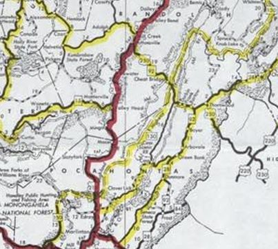
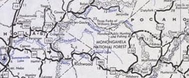
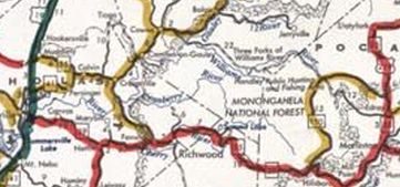
| Creation: WV 150 was partially open by 1973, from WV 39 north roughly 10 miles as new construction and was under construction to US 219. Dotted lines show WV 150 proposed to extend northeast all the way to US 50 near Mt. Storm. This is the only WV 150.
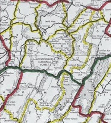
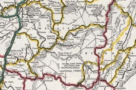
Adjustments: In 1974 or 1975, WV 150 was opened to the Williams River. Also, the proposed northern extension to US 50 was truncated to US 250/WV 92 near Cheat River. Between 1978-80, WV 150 was extended west with WV 39 to Fenwick, joined WV 20 to Craigsville, joined WV 41 to Calvin, then replaced WV 43 to end at US 19 Muddlety. In addition, the proposed extension to US 250/WV 92 was removed. In late 1981, WV 150 was completed from Williams River to US 219. About 1983, WV 150 west was truncated back to its original WV 39 endpoint. The extension to US 19 became part of WV 55.
Improvements: Upon designation, WV 150 was fully paved; no multilane segments. Comment: WV 150 is part of the Highland Scenic Parkway and gets to an elevation of 4500 feet. WV 150 is not maintained in the winter (may be why WV 55 isn't on this road) and commercial vehicles are banned. I drove this route in March 2022. Even with winter trees this was a spectacular drive! | ||||||||||
Previous: WV 140 |
Next: WV 151 |
Top | West Virginia Hwy Index
Home
Page last modified 1 April 2022