< WV 87 | Home | WV 89 >
|
|
|
| ROUTE LOG |
US 250: 0 - 0 WV 86: 4.0 - 4.0 Ohio-Marshall Line: 3.1 - 7.1 US 40 EB: 3.0 - 10.1 I-70 (exit 4): 0.6 - 10.7 US 40 WB: 2.7 - 13.4 Brooke-Ohio Line: 11.1 - 24.5 WV 67 WB: 2.6 - 27.1 WV 67 EB: 0.1 - 27.2 WV 27: 5.1 - 32.3
|
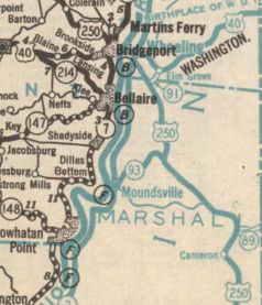
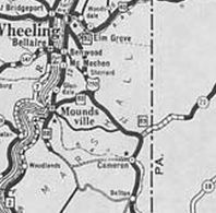
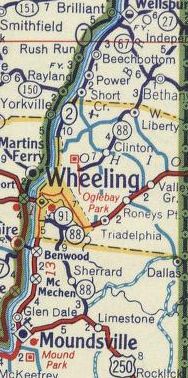
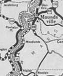
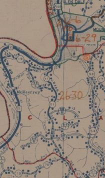
| Creation: WV 88 was designated by 1927, replacing WV 2 south several miles out of Moundsville. This is the only WV 88. By 1931, WV 88 was assigned to replace US 250 from Limestone to Moundsville. This was briefly WV 93 first. Adjustments: In 1933, WV 88 was extended north replacing US 250 to Bethlehem and west to end at US 250/WV 2 (now Jacob St) Wheeling. In 1936, WV 88 was extended north with US 250/WV 2 into downtown Wheeling, then east with US 40, then replaced Ohio CR 11, CR 13, CR 25 to Clinton, then replaced Ohio CR 7 and Brooke CR 11 and CR 24 to end at WV 27 at the Pennsylvania line. Between 1938-42, WV 88 was rerouted at Bethlehem to instead follow WV 91 east (WV 88 was co-sgned with WV 91 for several years) to US 40 then northwest with US 40 to where it split off as before towards Clinton. Old WV 88 to Wheeling became part of WV 91.
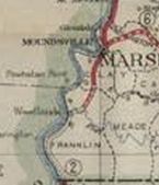
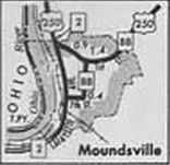
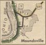
In 1948 (bridge date), WV 88 was put on its current bridge over Wheeling Creek to meet US 40 east of Bethlehem. The old routing used Evelyn Ave and Jr Ave. Between 1947-49, WV 88 was straightened out north of US 250 and removed from CR 88/15 McCombs Farm Rd; Old Fairmont Pike; CR 88/14 Fairmont Dr/Old Woodcret Dr; CR 88/13-CR 88/12 Old WV 88; Omar Dr Also between 1947-49, WV 88 south was truncated to Moundsville, leaving behind CR 21 and WV 2. In 1977, WV 88 south was truncated to its current end leaving behind US 250 and CR 250/88 (7th St and Jefferson Ave).
Improvements: Upon designation, WV 88 was fully paved except the last mile or so south of Moundsville which was never paved while part of WV 88; brief multilane segment west off US 40 since 1948 Comment: Minor state route running through the eastern edge of the northern tip of West Virginia. | |||||||||||||||


Previous: WV 87 | Next: WV 89 |
Top | West Virginia Hwy Index
Home
Page last modified 22 March 2019