< I-74 | Home | I-79 >
|
|
|
| ROUTE LOG |
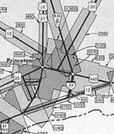
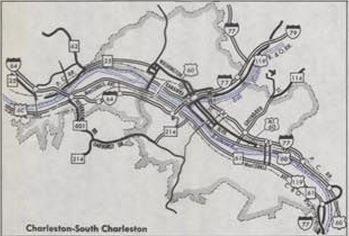
VA STATE LINE: 0 - 0 EXIT 1 - US 52 NB: 0.6 - 0.6 EXIT 5 (SB only) - WV 112: 4.4 - 5.0 EXIT 7 (NB only) - CR 27: 1.8 - 6.8 EXIT 9 (old exit 6) - US 460: 2.0 - 8.8 EXIT 14 - CR 7: 4.8 - 13.6 EXIT 20 - US 19: 6.0 - 19.6 Raleigh-Mercer Line: 7.5 - 27.1 EXIT 28 - CR 48: 1.6 - 28.7 EXIT 40 - I-64 EB (exit 121): 10.5 - 39.2 EXIT 42 - WV 16, WV 97: 2.8 - 42.0 EXIT 44 (old exit 5) - WV 3: 2.3 - 44.3 EXIT 45 - Vankirk Dr: 1.2 - 45.5 EXIT 48 - US 19 ALT: 1.8 - 47.3 Fayette-Raleigh Line: 5.1 - 52.4 EXIT 54 - CR 23/2: 2.1 - 54.5 EXIT 60 (old exit 4) - WV 612: 4.9 - 59.4 EXIT 66 - CR 15: 6.6 - 66.0 Kanawha-Fayette Line: 0.9 - 66.9 EXIT 74 - CR 83: 7.1 - 74.0 EXIT 79 - CR 79/3: 5.3 - 79.3 EXIT 85 (old exit 3) - WV 6: 5.2 - 84.5 EXIT 89 - WV 94: 4.8 - 89.3 EXIT 95 (old exit 2) - WV 61: 4.8 - 94.1 EXIT 96 (old exit 1) - US 60 EB: 1.4 - 95.5 EXIT 97 (NB only) - US 60 WB: 0.7 - 96.2 EXIT 98 (SB only) - CR 60/62, CR 60/63: 1.8 - 98.0 EXIT 99 - WV 114: 0.9 - 98.9 EXIT 100 - Leon Sullivan Way/Capitol St: 1.0 - 99.9 EXIT 101 - I-64 WB (exit 59): 0.8 - 100.7 EXIT 102 - Westmoreland Ave: 0.7 - 101.4 EXIT 104 - I-79: 1.2 - 102.6 EXIT 106 - CR 27: 3.6 - 106.2 EXIT 111 - CR 29: 4.0 - 110.2 EXIT 114 - WV 622: 3.4 - 113.6 EXIT 116 - CR 21/17: 2.6 - 116.2 Jackson-Kanawha Line: 1.4 - 117.6 EXIT 119 - CR 21: 2.4 - 120.0 EXIT 124 - WV 34: 5.0 - 125.0 EXIT 132 - CR 21: 7.5 - 132.5 EXIT 138 - US 33 EB, WV 62: 5.5 - 138.0 EXIT 146 - US 33 WB, WV 2 SB: 8.1 - 146.1 EXIT 154 - CR 1: 8.4 - 154.5 Wood-Jackson Line: 2.7 - 157.2 EXIT 161 (NB only) - CR 21: 4.6 - 161.8 EXIT 161 (SB only) - CR 21: 1.4 - 163.2 EXIT 170 - WV 14: 6.9 - 170.1 EXIT 173 - WV 95: 3.2 - 173.3 EXIT 174 - WV 47: 0.7 - 174.0 EXIT 176 - US 50: 2.5 - 176.5 EXIT 179 - WV 2 NB, WV 68: 3.6 - 180.1 EXIT 185 - WV 14: 5.8 - 185.9 OH STATE LINE: 1.3 - 187.2
|
Creation: I-77 was created June 1958 as a renumbering of I-79.
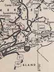
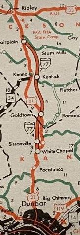
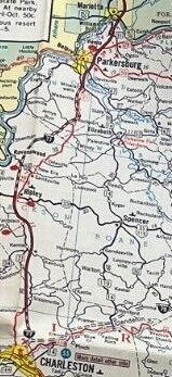
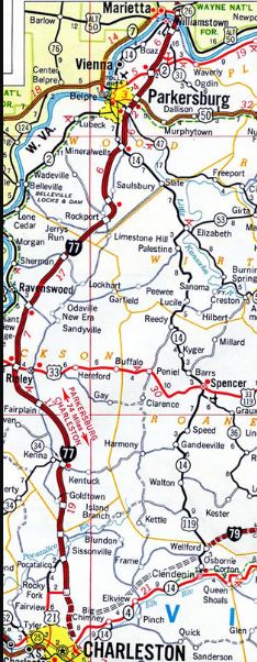
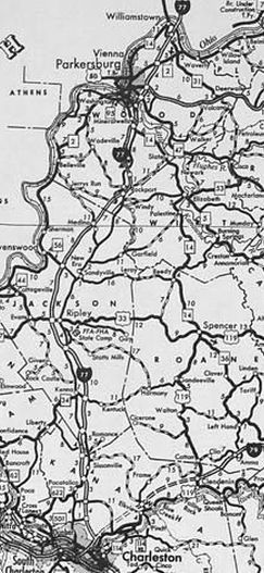
| Adjustments: The first portion of I-77 to be completed was from Sissonville to Fairplain, by 1961. It is unclear when I-77 was actually signed on the West Virginia Turnpike, which opened as an 88 mile super-2 road in 1954 with just 6 interchanges between Princeton and Charleston. Some commercial maps labeled the Turnpike as I-77 by 1961 and West Virginia Official maps by the late 1960s was doing the same. By 1965, I-77 was open from US 21 (now WV 14) Mineral Wells to US 50. In 1966, I-77 was open from Fairplain to Ripley and from US 50 to WV 14 Williamstown. In 1967, I-77 was open from WV 14 to Ohio. In 1969 or 1970, I-77 was opened from Ripley to Mineral Wells; also WV 12 (now WV 112) to US 460. In 1972 or 1973, I-77 was open from Sissonville south to Cedar Fork Rd. In 1974, I-77 was open from Virginia to WV 12.
In 1975, I-77 was opened from Cedar Fork Rd to I-64 in Charleston.
In 1976, I-64/77 was opened from the 64-77 split to the north end of the Turnpike.
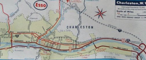
Improvements: Opened as 4 lanes everywhere except the West Virginia Turnpike (Exits 9-97) which was 2 lanes (except WV 3 to today's Tamarack was 4-lane) and within Charleston (Exits 98 to 104) which was 6-lanes. In 1979, I-77 on the Turnpike was 4-laned from the Princeton toll booth to a few miles short of today's I-64 interchange in Beckley. In 1980, I-77 on the Turnpike was 4-laned in the vicinity of the US 19 ALT exit north of Beckley In 1981, I-77 on the Turnpike was 4-laned from roughly the Pax Toll Plaza up to WV 612 In 1982, I-77 on the Turnpike was 4-laned from Willis Branch to Lively; WV 61 across the river to US 60 In 1983, I-77 on the Turnpike was 4-laned from Exit 66 Mahan to Exit 74 In 1984, I-77 on the Turnpike was 4-laned from 6 miles south of WV 94 Marmet to WV 61 In 1985, I-77 on the Turnpike was 4-laned from US 460 to the Princeton toll booth; WV 612 north 3 miles; I-64 interchange to WV 3; Exit 48 US 19 ALT to Pax Toll Plaza In 1986, I-77 on the Turnpike was 4-laned from the gap between the 1979 widening and I-64 In 1987, the last segment of I-77 on the Turnpike was 4-laned with the bypassing of the Bender Bridge and Memorial Tunnel near Exit 74. Between 2004-07, I-77 was 6-laned from WV 47 to US 50 in the Parkersburg area. In 2012, I-77 was widened to 8 lanes between WV 95 and WV 47 in the Parkersburg area. In 2021, I-77 was 6-laned from I-64 to US 19 ALT in the Beckley area. New Interchanges: EXIT 48 - US 19 ALT (about 1982) EXIT 14 - CR 7 (1987) EXIT 20 - US 19 (1987) EXIT 28 - CR 48 (1987) EXIT 42 - WV 16, WV 97 (1987) EXIT 54 - CR 23/2 (1987) EXIT 66 - CR 15 (1987) EXIT 74 - CR 83 (1987) EXIT 79 - CR 79/3 (1987) EXIT 89 - WV 94 (1987) EXIT 40 - I-64 EB (1988) EXIT 45 - Tamarack (1996) Comment: Apparently the 2-laned Turnpike was very dangerous with high accident rates. My only time on it during that period was summer 1982 and there was so much construction going on that the 2-lane portions were mostly bumper to bumper crawl fests. I also do not recall if I-77 was posted like a normal interstate at that time on the Turnpike. |
|||||||||||||