ROUTE LOG
I-75 (exit 4), US 74: 0 - 0
EXIT 1 - US 11, US 64, TN 2: 0.9 - 0.9
EXIT 1A - Shepherd Rd: 0.7 - 1.6
EXIT 2 - Shallowford Rd: 0.9 - 2.5
EXIT 3 - Jersey Pike: 0.8 - 3.3
EXIT 4 - TN 317: 0.7 - 4.0
EXIT 5 - TN 17, TN 58: 0.7 - 4.7
EXIT 6 - TN 319: 0.9 - 5.6
N. Access Rd: 1.5 - 7.1
TN 319 SB: 1.0 - 8.1
TN 319 NB: 0.8 - 8.9
US 27, TN 29: 3.6 - 12.5
|
Creation: Appeared in 1953 or 1954 defined as running from US 41-76 at the Georgia State Line to US 27 (now just Dayton Blvd), per the 1954 official route log.
Adjustments: The 1956 Gousha map of Tennessee shows this routing, but this was aspirational. In 1954 (bridge dates), TN 153 only existed from TN 2A (now TN 317) across the Chickamauga Dam north to US 27 (now Dayton Blvd).
In 1959 or so (bridge dates), TN 153 south was extended to I-75. Some I-75 bridges south of there are also dated 1959, so it is unclear if I-75 was assigned to the roadway yet or if TN 153 ever made it to US 41-76. Note that the last official route log (1962) still had TN 153's south end as US 41-76.
In 1987, TN 153 was extended north replacing US 27 to the modern US 27 alignment.
Posting: Posted as primary routing throughout
Secret US Route Overlay: None
Comment: Serves Chattanooga Airport and Chickamauga Dam
TN 153 provides a good alternative around the east of Chattanooga to reach US 27. It is a full freeway for 2/3 of its route.
TN 153's initially defined route
1956 Gousha
|
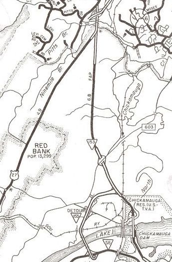
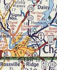
TN 153 original Red Bank end
Check out the TN 153 DETOUR route!
1983 Hamilton County
|
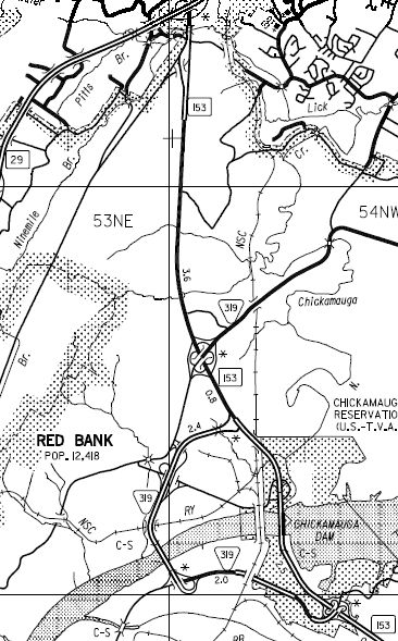
TN 153 extended north to modern US 27/TN 29
2007 Hamilton County
|
|