ROUTE LOG
US 64, US 641 BEGIN, TN 15: 0 - 0
TN 128 NB: 11.2 - 11.2
Hardin-Wayne Line: 0.7 - 11.9
TN 128 SB: 0.6 - 12.5
Decatur-Hardin Line: 2.9 - 15.4
US 641 NB, TN 69 NB: 2.2 - 17.6
TN 69 SB: 3.1 - 20.7
TN 202: 3.7 - 24.4
Henderson-Decatur Line: 6.5 - 30.9
TN 201 WB: 0.1 - 31.0
TN 100: 0.8 - 31.8
TN 201 EB: 5.6 - 37.4
US 412 EB, TN 20 EB: 4.0 - 41.4
US 412 WB, TN 20 WB, TN 104: 7.5 - 48.9
I-40 (exit 116): 16.0 - 64.9
Carroll-Henderson Line: 0 - 64.9
TN 424: 6.6 - 71.5
US 70 WB, TN 1 WB: 14.1 - 85.6
US 70 EB, TN 1 EB: 0.1 - 85.7
Henry-Carroll Line: 8.5 - 94.2
TN 77: 6.0 - 100.2
|
|
Creation: Appeared in 1929 or 1930 running from TN 15 (now US 64) Clifton Junction to TN 69 (now Three Way Rd) west of Bath Springs.
Adjustments: Between 1939-51, TN 114 was put on modern Old Ferry Rd from Russ Farm Rd south to the ferry landing. The old route was a winding road to the west that is completely erased by time at this point. Old Ferry Rd closer to TN 69 was also straightened out in a few places.
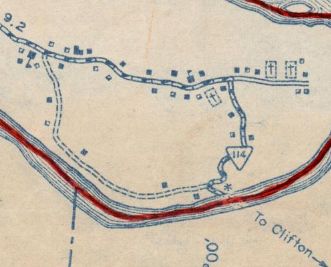
TN 114 original ferry approach
1939 Decatur County
|
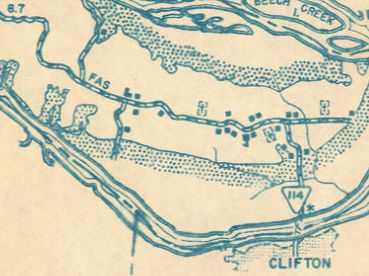
TN 114 modern ferry approach
1951 Decatur County
|
Between 1964-71, TN 114 north was extended west with TN 69 then northwest to end at TN 100 above Scotts Hill.
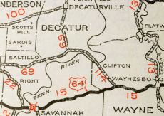
TN 114 from TN 15 to TN 69
1932 Official
|
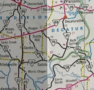
TN 114 extended to TN 100
1971 Official
|
Between 1953-73, TN 114 was removed from Lone Chestnut Cir north of the Clifton Ferry.
In 1983, TN 114 north was extended north to TN 20 (now US 412) Chesterfield, then west with TN 20 to Lexington, then north all the way to TN 77 south of Paris.
In 1999, TN 114 was rerouted to bypass Clifton on new alignment west into Hardin County then north across a new Tennessee River bridge back to the old TN 114 routing. The old route is now Main St into Clifton; abandoned ferry across the Tennessee River; Old Ferry Rd in Decatur County; part of Rivers Edge Dr; Glory Ln.
TN 114 extended to TN 77
1986 Official
|
TN 114 rerouted away from Clifton to new bridge
2001 Official
|
Between 1999-2006, TN 114 was straightended out between US 64 and Main St Clifton. The south end of TN 114 was shifted east 0.1 miles (old TN 114 stub still there but does not connect to 114 anymore); driveway access on the east side and abandoned loop on west side up to Lynch Rd; driveway access on the west side at Tom Holt Rd; Toll Gate Pike near Clifton
In 2015, US 641 was added to TN 114 from US 64 to TN 69.
Posting: The primary portion (TN 128 to TN 69) is unposted; The rest of the highway is secondary and is unposted with US 641.
The TN 69 and US 70 overlays are fully posted; the US 412 overlay is unposted
Secret US Route Overlay: US 641 (17.6 mi)
Comment: Passes through Natchez Trace State Park
A good route to get from US 64 to Decatur County
North of I-40 is an extremely convoluted and winding route.
|