< TN 16 | Home | TN 17 Spur | TN 18 >
|
|
|
| ROUTE LOG |
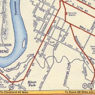
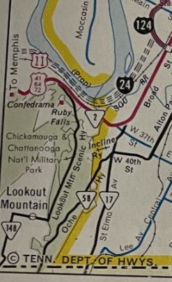
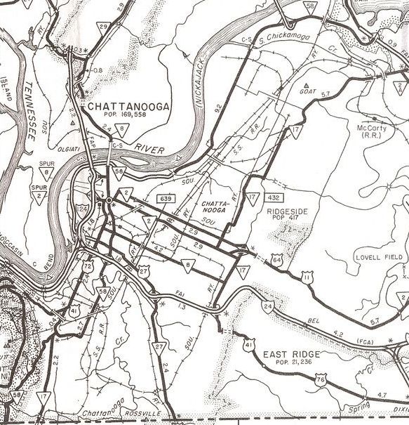
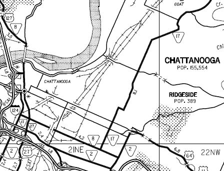
GA STATE LINE: 0 - 0 TN 58 SB: 1.7 - 1.7 TN 58 NB: 0.1 - 1.8 US 11 SB, US 41 NB, US 64 WB, US 72 WB, TN 2 SB: 0.4 - 2.2 I-24 (exit 178), US 27: 1.3 - 3.5 US 11 NB, US 64 EB, TN 2 NB: 0.2 - 3.7 US 72 EB, TN 8 NB: 0.3 - 4.0 US 76 WB, TN 27: 0.3 - 4.3 US 41 SB, US 76 EB, TN 8 SB: 1.9 - 6.2 TN 317: 6.2 - 12.4 TN 58, TN 153: 0.2 - 12.6
|
Creation: Appeared in 1963 or 1964 as new state highway, running from US 11-41-64-72 south to the Georgia line within Chattanooga. North of 40th St had been TN 58 before. This is the 2nd TN 17.
|
Adjustments: Between 1975-78, TN 17 was extended north with US 41 on Broad St, then east with US 41 on Main St to Dodds Ave. TN 17 then went north as new state highway on Dodds to then-US 11-64, then west on split routing - TN 17 NB used McCallie (replaced part of TN 2 Loop) while SB used Bailey. TN 17 then replaced TN 58 north along Willow St to its current endpoint at TN 58-153. In 2003, TN 17 was rerouted to leave Main St at Willow St. Main St to Dodds remained US 41. Dodds Ave became US 11-64/TN 2 and the McCallie/Bailey pair was removed from the state highway system. In 1935 or 1936, TN 18 north was truncated to its current endpoint south of central Jackson, leaving behind US 45 (now partly Royal St).
Posting: TN 17 is secondary throughout. It is not posted on its US 41 overlay except for a TN 17 South shield at the Willow St jct with Main saying to turn right. Secret US Route Overlay: US 41-72 (0.3 mi) Comment: TN 17 serves the Lookout Mtn Incline Railway Given the gap that exists in TN 58, I am puzzled why TN 17 north of US 41-76 is not part of TN 58 instead. | Previous TN 17's:
|
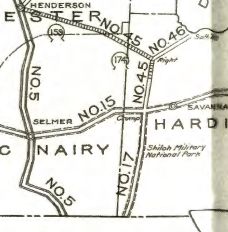
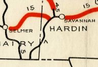
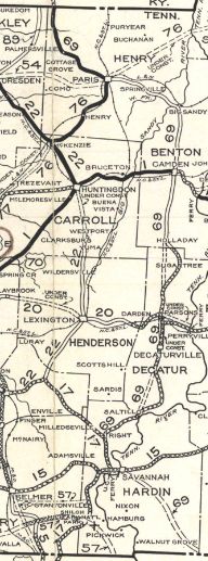
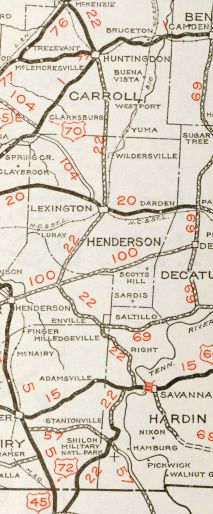
TN 17 #1: An original state highway that ran from TN 15 (now US 64) Crump south through the Shiloh Battlefield to the Mississippi line
By 1926, TN 17 was routed southwest into McNairy County to reach Mississippi. The 1923 Official suggests TN 17 originally stayed in Hardin County the whole time. The most likely route that did this: Hamburg-Purdy Rd; Federal Rd; Watkins Rd; current TN 142. In 1927 or 1928, TN 17 north was extended east with TN 15, then north and northwest replacng TN 45 through Right and Milledgeville to end at TN 22 (now Old Jacks Creek Rd) Jacks Creek. In 1931 or 1932, the entirety of TN 17 was renumbered as TN 22. Today this is TN 22 from Mississippi to Crump except: abandoned roadway into Shiloh, Corinth Rd, Confederate Rd; Hamburg-Savannah Rd; abandoned roadway south of Snake Creek; the eastern half of Snake Creek Loop, a bit of caney Branch Rd, Sheffield Rd; Angotti Rd in Crump. It is US 64 from Crump eastward a couple miles; Coffee Landing Rd through Right to Morris Chapel; TN 69 into McNairy County; abandoned roadway across White Oak Cr; Main St into Milledgeville; TN 22A to Jacks Creek except: Republican Cir and Moss Cir north of Enville; Rhodes Ln/Middle Fork Access Rd below Middle Fork. it is unclear if TN 17 ever used Cemetery Rd out of Enville.
| ||||||||||||||
Previous: TN 16 |
Next: TN 17 Spur | TN 18
Top | Tennessee Hwy Index
Home
Page last modified 15 May 2021