<US 377 | Home | US 380 >
US 378 at US Ends.com
Photo: US 380 leaving NM 172 (GMSV, August 2022)

|
|
|
| ROUTE LOG |
US 78, US 78 Bus: 0 - 0 SC STATE LINE: 23.2 - 23.2 US 221 SB: 7.0 - 30.2 US 221 NB: 0.6 - 30.8 US 25: 14.7 - 45.5 US 178: 17.4 - 62.9 US 1 SB: 31.7 - 94.6 US 1 NB: 0.7 - 95.3 I-20 (Exit 61): 6.1 - 101.4 I-26 (Exit 110): 2.3 - 103.7 US 1 SB: 3.3 - 107.0 US 21, US 176, US 321: 0.6 - 107.6 US 76 WB: 1.0 - 108.6 US 1 NB: 1.0 - 109.6 I-77 (Exit 9): 4.2 - 113.8 US 601: 16.6 - 130.4 US 76 Bus: 18.0 - 148.4 US 521: 0.2 - 148.6 US 15: 2.4 - 151.0 US 401: 1.5 - 152.5 US 76, US 76 Bus: 0.9 - 153.4 I-95 (Exit 135), US 77: 13.3 - 166.7 US 301 SB: 4.4 - 171.1 US 301 NB: 0.7 - 171.8 US 378 Bus Lake City: 12.8 - 184.6 US 52: 2.2 - 186.8 US 378 Bus: 1.1 - 189.9 US 501, US 701: 43.7 - 233.6 US 501 Bus: 0.9 - 234.5
|
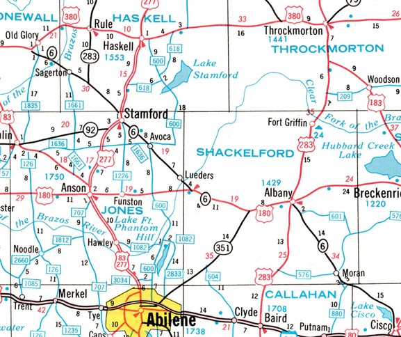
Creation: Appeared in July 1931 (AASHO) as the 2nd US 380, running from US 85 (now NM 1) San Antonio NM to US 283 (now TX 6) Albany TX. This was going to be US 280 but by the time this was finalized US 280 was assigned in Georgia. This was a replacement for US 566 from San Antonio to Hondo NM; replaced US 366 to Roswell NM, replaced NM 13 to Tatum NM;
|
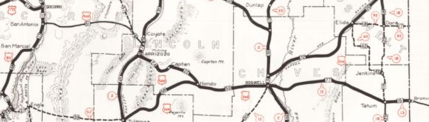
US 566, US 366, NM 13 San Antonio NM to Texas via Roswell 1929 Official
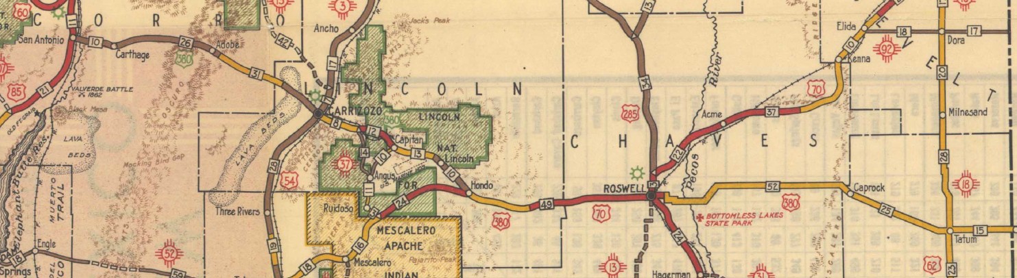
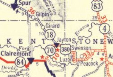
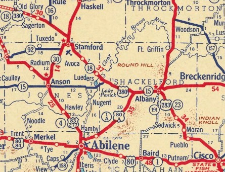
US 380 San Antonio NM to Texas via Roswell 1935 Official US 380 then followed then-US 62 to Brownfield TX, added to TX 84 to east of Clairemont, added to TX 70 to Jaytona, added to TX 18 to Acampo, and followed US 80 ALT to Albany TX.
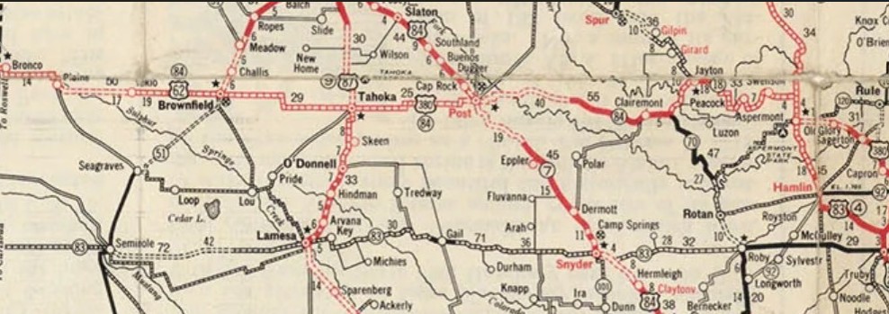
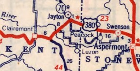
US 380 across central Texas to Albany 1934 RMcN Adjustments: About 1932 (bridge date), US 380 was placed on US 83's modern routing north of Aspermont TX to CR 301. The old route: abandoned alignment south from CR 301 starting about 0.15 miles west of US 83 and meeting US 83 about 0.5 miles south of CR 301; CR 202/CR 401; 1st St into Aspermont. About 1933, US 380 was given its direct routing from Carrizozo NM to Capitan NM. The old route: NM 37 through Nogal; CR C017 Cora Dutton Rd for 3.4 miles; abandoned routing for about a mile to about Aspen Dr; a bit of NM 48; Mt Capitan Rd, then NM 48 to Capitan In 1934, US 380 in Plains TX was removed from abandoned/10th St/abandoned arc/TX 214 down to 17th St/abandoned east Also about 1934, US 380 was given a modern routing from west of Old Glory to Sagerton TX. The old route: starting 1/3 mile west of Stonewall CR 16 - abandoned ENE about 0.3 mile; abandoned east 1 mile; abandoned north 0.2 miles; abandoned east then picking up CR 120; CR 122 into Old Glory; Loop 128; CR 134 out of Old Glory; CR 139; CR 141/CR 467, then 0.25 miles abandoned across the Dbl Mtn Fork Brazos River; curled in an upside down U shape; abandoned SSE about 0.25 mile; abandoned east about 0.1 mile; abandoned south then SSE about 0.8 miles; CR 463; Harrison Ave to Sagerton About 1936 (bridge date), US 380 was removed from abandoned starting 4 miles east of US 83, 1.6 miles southeast About 1937 (bridge date), US 380 was straightened out well east of Roswell NM. The old route: abandoned beginning at CR 51 Ponderosa Rd in a flat north loop for about 3 miles, then abandoned south of 380 for a little over 7 miles, then abandoned north of 380/Sand Ranch Rd which loops back to 380 about 8.5 miles later, then a south abandoned loop for about 1.8 miles. Also about 1937, US 380 was given a direct routing from Jayton TX to US 83 north of Aspermont TX. The old route: 4th St, Houston Ave, and 8th St out of Jayton; CR 150 for 3.2 miles; CR 152/CR 344; CR 340 south 0.8 miles; abandoned east about 0.5 mile; abandoned south 0.25 mile; abandoned east 2.1 miles with a southern bow about halfway across; abandoned south to US 380, continuing with CR 349 for 3.4 miles to Oriana; CR 437 (except used abandoned Oriana Bridge); CR 435 past Peacock; FM 2211; CR 411 for 4.5 miles; CR 409 to Swenson; CR 316; CR 302 south to US 380; abandoned south and east, then CR 301; US 83 back to US 380 About 1938, US 380 was straightened out immediately east out of Roswell NM. The old route: NM 254; Lovers Ln; Seminole Rd; Miami Rd to end; the area here, including the paths of natural waterways has been completely changed and the crossing of the Pecos River cannot be discern; east of the crossing, it picked up River Rd to Bottomless Lakes Rd, then continued across as abandoned bout 1.5 miles, then north abandoned 1.6 mi, then ENE abandoned 0.6 miles, then NNE abandoned 1 mile to Harral Rd, then east abandoned 5.2 miles, then abandoned NE about 1.2 miles to US 380. In the late 1930s it appears US 380 was rebuilt in eastern Lincoln and western Chaves Counties in NM. The old route: starting 7.5 miles east of the Picacho Post Office, abandoned south loop 0.5 miles, then 0.3 miles later, south abandonded loop 1 mile, then north abandoned loop for 0.9 miles, then south abandoned loop for 2.5 miles to meet 380 0.8 miles west of Borderhill Rd; abandoned south loop starting 0.5 miles east of the county line for 2 miles back to 380 at Mossman Rd; abandoned from the WB Weigh Station 3.3 miles to where it tied back in, now an abandoned alignment about 1.3 miles west of Larkspur Rd Between 1937-40, US 380 was removed from FM 769 and CR 180 at the NM/TX state line, and also from Whiskey Rd/Airport Rd, 1st St, and Avenue E north out of Plains TX. Between 1938-40, US 380 was given its current routing through Brownfield TX. The old route was CR 440/Powell St, then 11th St south to Main. Also between 1938-40, US 380 was removed from CR 440/22 and FM 179 at West Point TX. Also between 1938-40, US 380 was removed from FM 212 and CR 22/250 at the Lynn/Garza County line area. About 1940 (bridge date), US 380 was given its modern approach over the Rio Grande River into San Antoinio NM. The old route was Santa Fe RR St and 6th St leaving San Antonio; abandoned routing across the Rio Grande to connect with current US 380, 1.7 miles east of its current Rio Grande crossing; also a mix of US 380 and abandoned loops for the next 7.5 miles About 1941 (bridge date), US 380 was removed from Los Chozas Trail west of Hondo NM. Also about 1941 (TXDOT), US 380 was given a direct route from TX 70 east of Clairemont TX to TX 70 below Jayton. The old route: FM 1083 to near Jayton; 8th St, Goodall Ave, and 4th St into Jayton, then TX 70 south back to US 380.
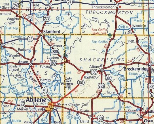
About 1947 (bridge date), US 380 was removed from 18 miles along San Pedro Arroyo and Wsmr P Rte 41 to the Mockingbird Archaelogical Site in the Bingham area, then CR 263 southeast for 3 miles In July 1953 (AASHO), US 380 was extended southeast to US 80 (now TX 206) Cisco TX, replacing part of US 283. In July 1957 (TXDOT), US 380 was given TX 6's current routing between west of Moran TX and Eastland County. The old route was: abandoned/Ground St into Moran; FM 880; Spur 880/abandoned east loop at TX 6. Also, abandoned south loop west of Bottle Creek. Also, abandoned double S loops east of CR 127. Also, abandoned/CR 562 In March 1961 (TXDOT), US 380 was rebuilt north out of Cisco TX. The old route: Armory Cir. Also, Country Club Rd/Lake Cisco Dam/abandoned/Country Club Rd About 1964, US 380 was extended west replacing US 85 out to I-25. In October 1969, AASHO turned down a request to reroute US 380 at Old Glory TX to instead replace TX 24 to Greenville TX. In November 1970 (AASHO), US 380 was rerouted at Old Glory TX, replacing TX 24 to Greenville TX and added to Loop 315 (now US 69) to end at I-30.

US 380 Old Glory to Jacksboro 1975 Official

US 380 Jacksboro to Greenville 1975 Official Old Glory to Cisco TX became TX 6 (Old Glory to current TX 6 is now TX 283. The rest remains TX 6 except: short abandoned loop north 5.2 miles west of Acampo; abandoned S loop both sides centered 3.2 miles west of Acampo; abandoned loop north 1.6 miles west of Acampo into Acampo; abandoned loop north at the TX 351 interchange; abandoned loop north that ends at the Picnic Area east of TX 351; Private Rd 2310 loop; abandoned north loop about a mile west of US 283).
In May 1974 (TXDOT), US 380 was given its northern bypass of Graham TX. The old route through town is TX 16 Elm St and 4th St. In the 1960s or 1970s, US 380 was removed from an S loop in the Blackwater Draw area west of Roswell NM. In April 1987 (TXDOT), US 380 was given its northern bypass of Decatur TX. The old route became Loop 369 (now US 380 Business). In October 1989 (TXDOT), US 380 was removed from Hardin Ln over the Brazos River southwest of Newcastle TX. Between 1987-96, US 380 was rebuilt between 1 mile east of NM 457 and 2.2 miles west of NM 206 Tatum NM. The old route is abandoned alignment immediately adjacent to the former railroad to the south. In June 2010 (TXDOT), US 380 was given its southern bypass of Floyd TX, leaving behing US 380 Business. In June 2011 (per TXDOT application to AASHTO), US 380 was removed from the disconnected Spur 137 and Spur 138 just west of US 69 in Greenville TX. Comments: US 380 is a pretty sparse route. Although it is 40 miles north of Fort Worth and Dallas, it is starting to be part of their suburban reach. Previous US 380's:
|
LAST ROUTE LOG (380 #1) US 80: 0 - 0 MEXICO: 69 - 69
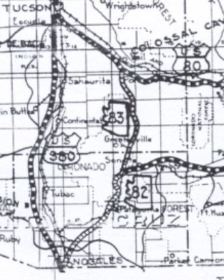
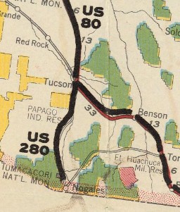
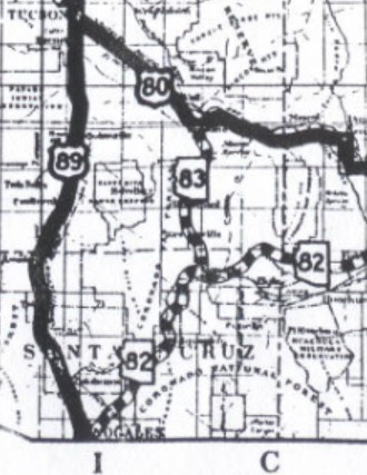
US 380 #1: Appeared on the 1925 plan for US Highways, running from US 80 Tucson down to Mexico at Nogales AZ.
| In August 1926 (AASHO), US 380 was redesignated as US 280, when the 1925 iteration of US 280 was replaced by US 89. When the system was announced in late 1926, this was also part of US 89. Today it is basically I-19 Bus out of Nogales; Old Tucson Hwy; I-19 corridor to Green Valley; Old Nogales Hwy/Continental Rd; I-19 Bus to Tucson. This US 380 does appear on the Arizona official and at least one commercial map (1927 RMcN)...
| ||||||||||||||






 Washington, GA
 Conway, SC
Previous: US 378 | Next: US 381
US 380 at US Ends.com
Page last modified 3 July 2026