< 640 to 649 | Home | 660 to 699 >
| SC 650 not currently assigned | |||||||||||||
| Previous SC 650's: |
SC 650: Appeared in 1941 or 1942 as new primary routing. Ran from SC 64-65 (current US 17 ALT-SC 61) The Forks to SC 61 (current SC 61-165 CONN) Cooks Cross Roads.
SC 650 was renumbered as part of SC 61 in 1951 or 1952. | 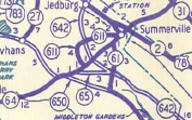 |
|||||||||||
|
|
|
| ROUTE LOG |
US 17 ALT: 0 - 0 SC 61: 8.3 - 8.3
|
Creation: Appeared in 1949 as a resurrected route. Ran just like it does now, only its endpoints were SC 64 and SC 65 respectively.
| Adjustments: SC 651 first appeared in 1940, running as it does today. In 1948, SC 651 was downgraded to secondary status. Improvements: Fully paved since 1949; no multilane sections. Comment: SC 651 doesn't serve much purpose for traffic flow, just a connector in eastern Colleton County. 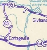 |
||||||
|
|
|
| ROUTE LOG |
US 601: 0 - 0 US 278: 10.5 - 10.5
|
Creation: Appeared in 1951 or 1952 as a resurrected route. Ran as it does today, except its eastern end was SC 128 at the time.
| Adjustments: SC 652 first appeared in 1941 or 1942 as new routing. It ran just like it does now. In 1948, SC 652 was downgraded to secondary status. Improvements: Fully paved at resurrection; no multilane sections. Comment: SC 652 is a sparse drive through the Great Swamp. 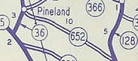 |
||||||
| SC 654 not currently assigned | |||
| Previous SC 654's: |
SC 654: Appeared in 1941 or 1942 as new primary routing. Ran as a stub 4 miles west off SC 631 (current SC 3) Lawtonville Crossroads (near Estill) to the Allendale County Line.
In 1948, SC 654 was downgraded to S-25-39. | 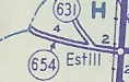 |
|
Last Update: 30 May 2005
Previous: SC 640 - 649 |
Next: SC 660 - 699
Top | South Carolina Hwy Index
Home